Earth
ID: 4153
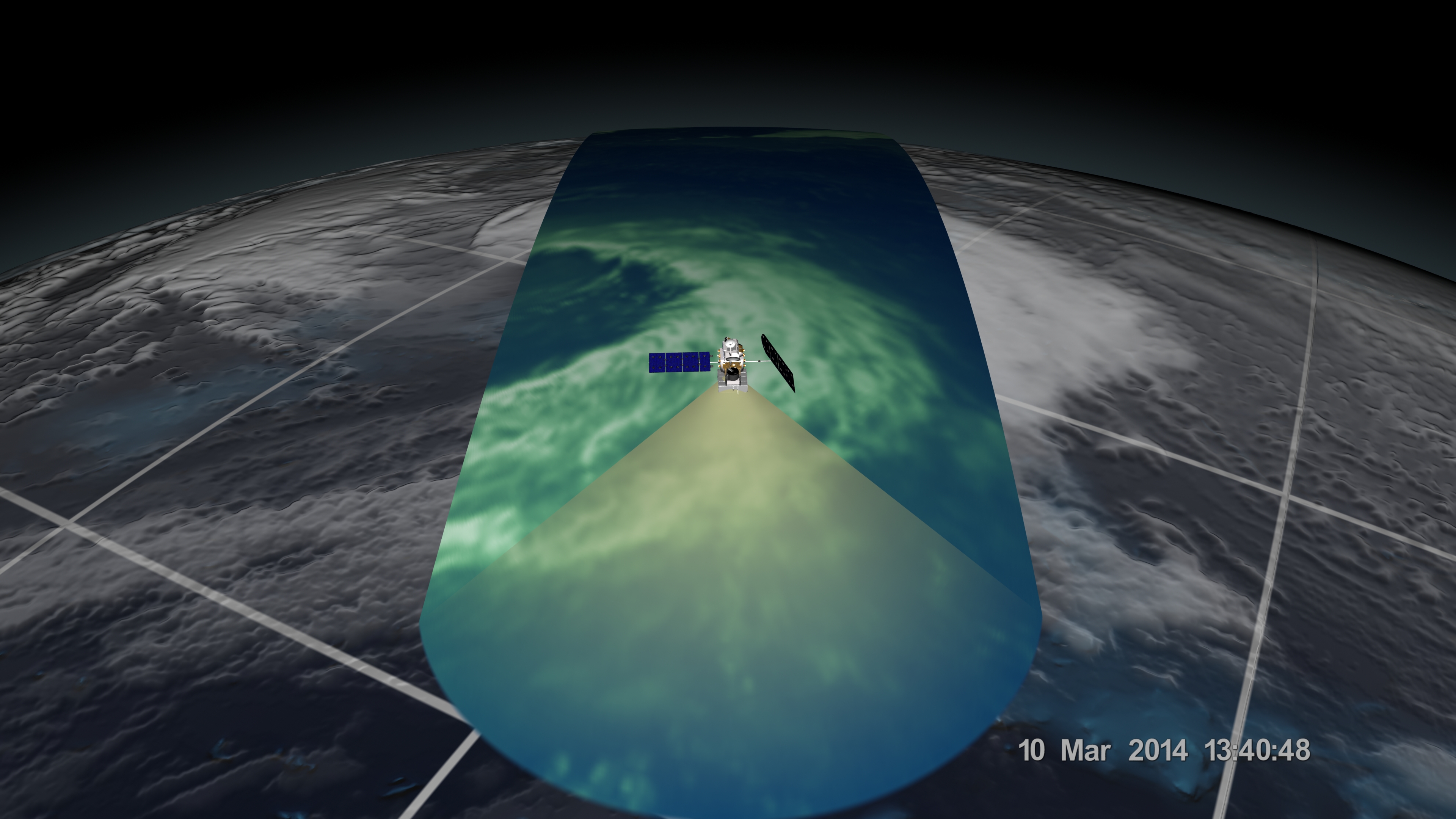
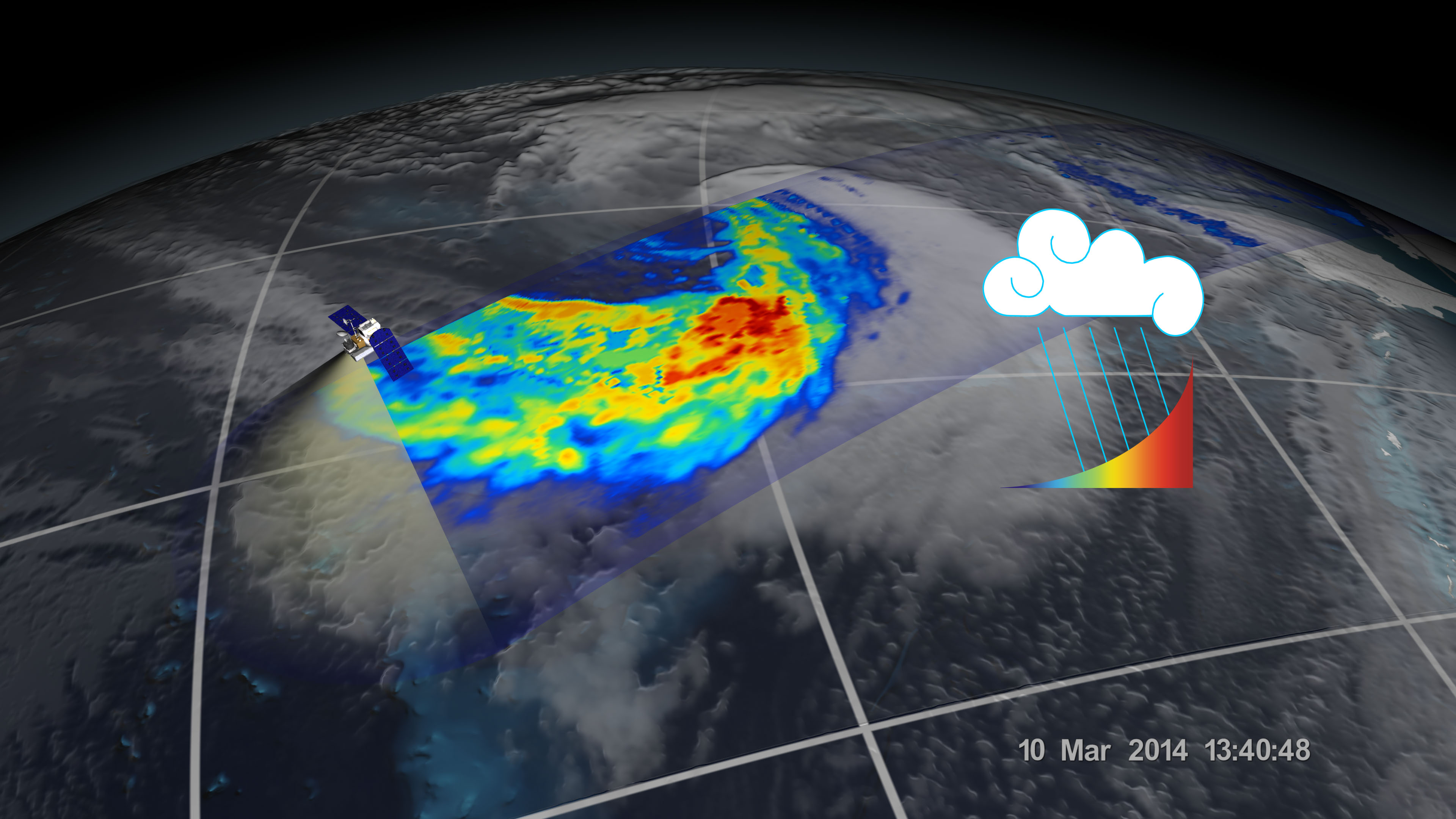
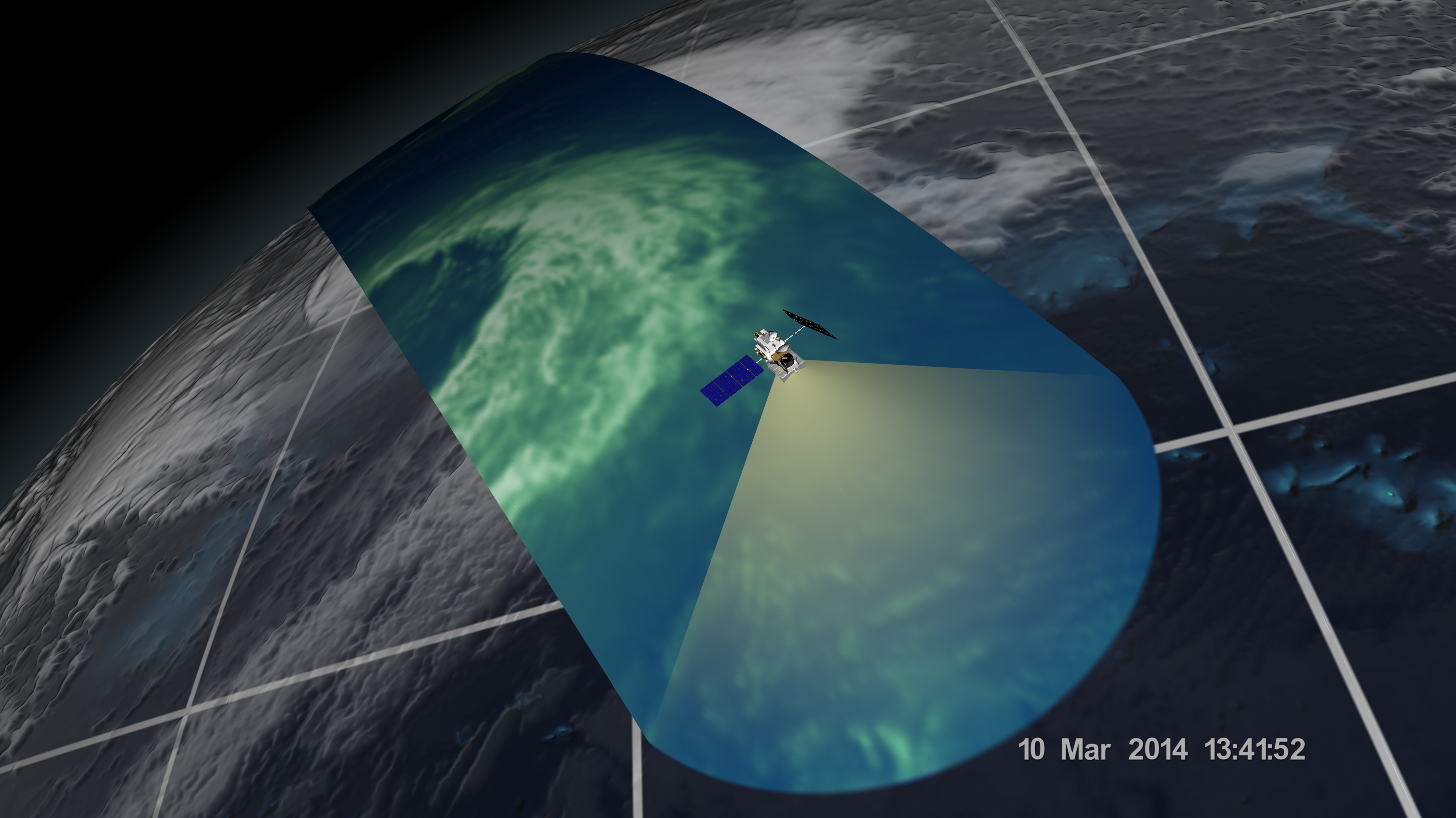
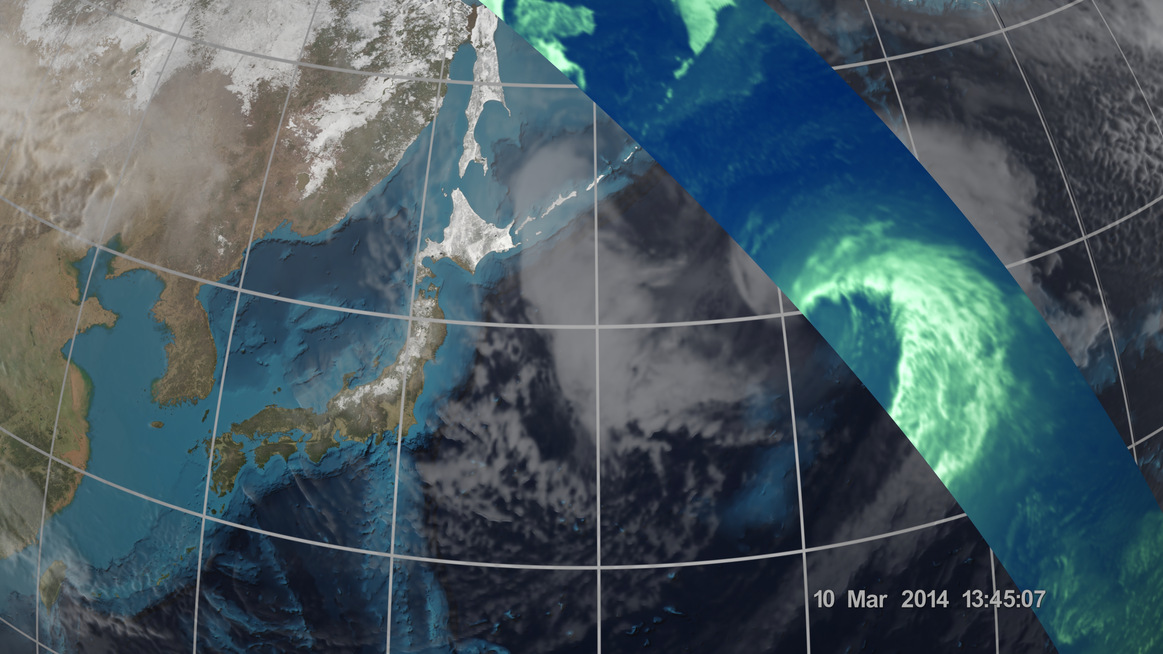
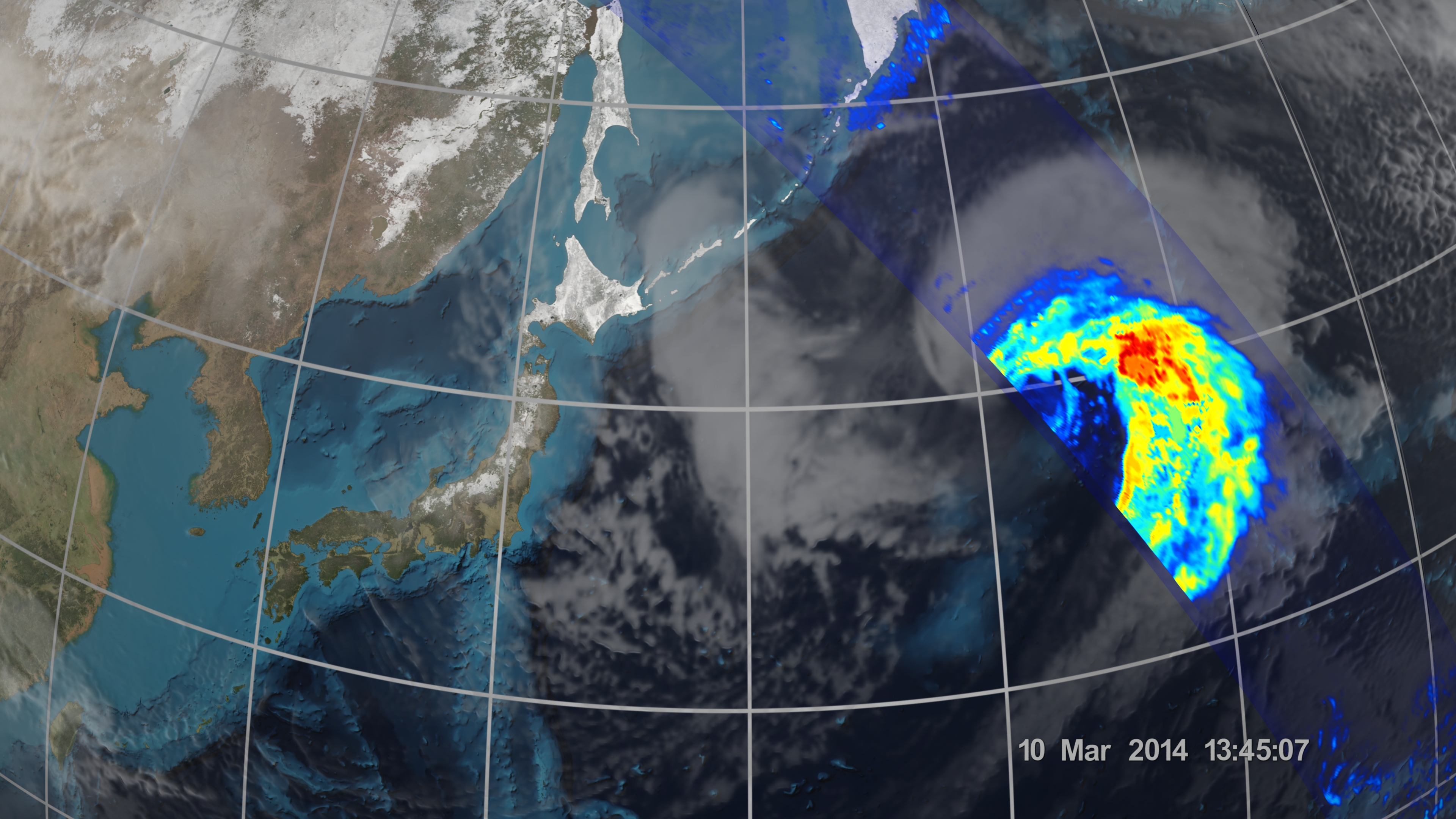
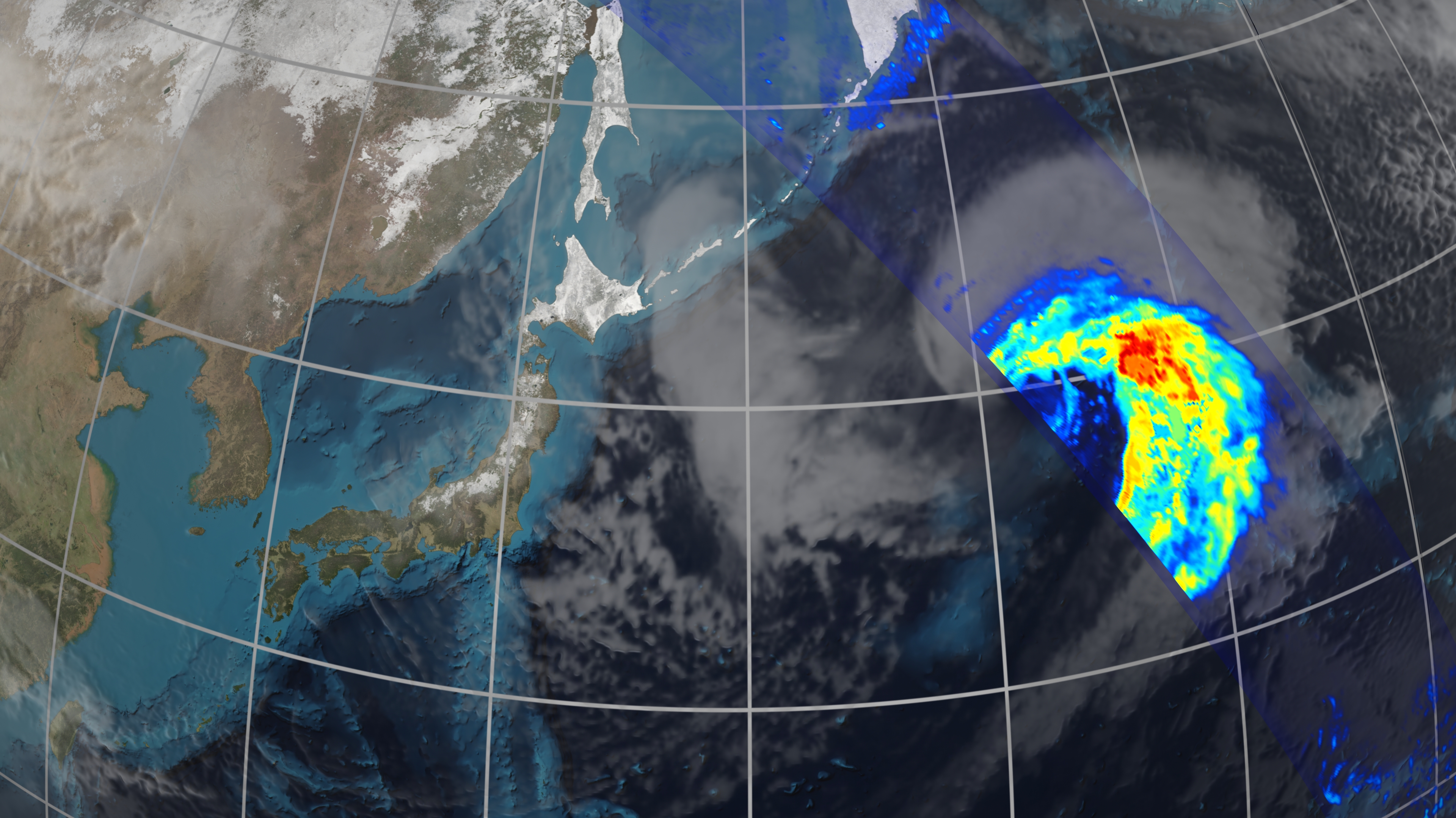
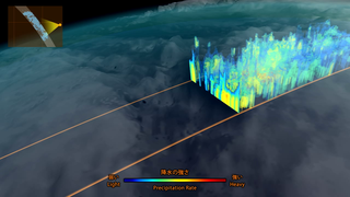
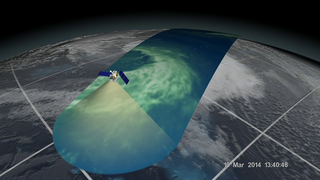
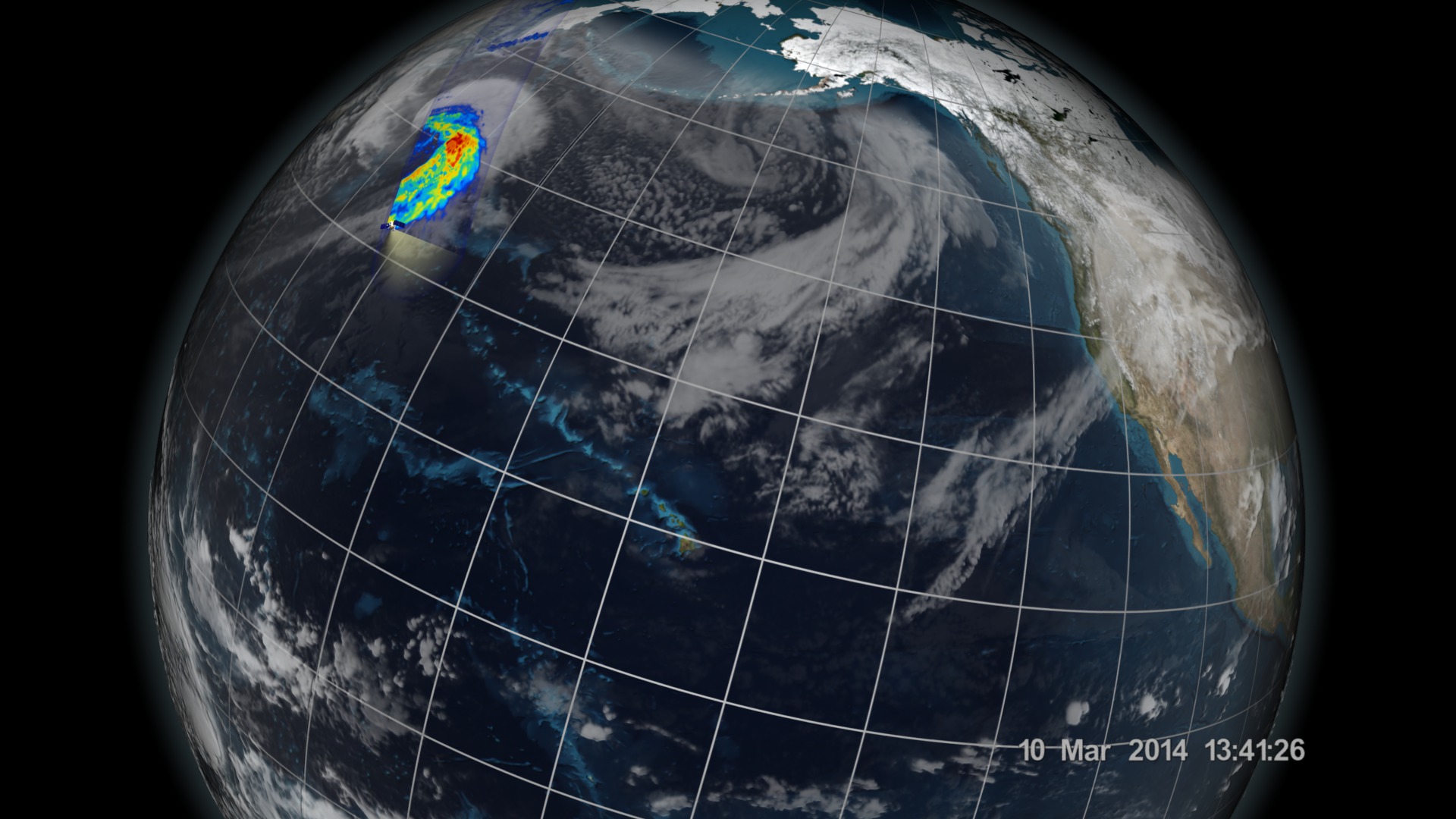
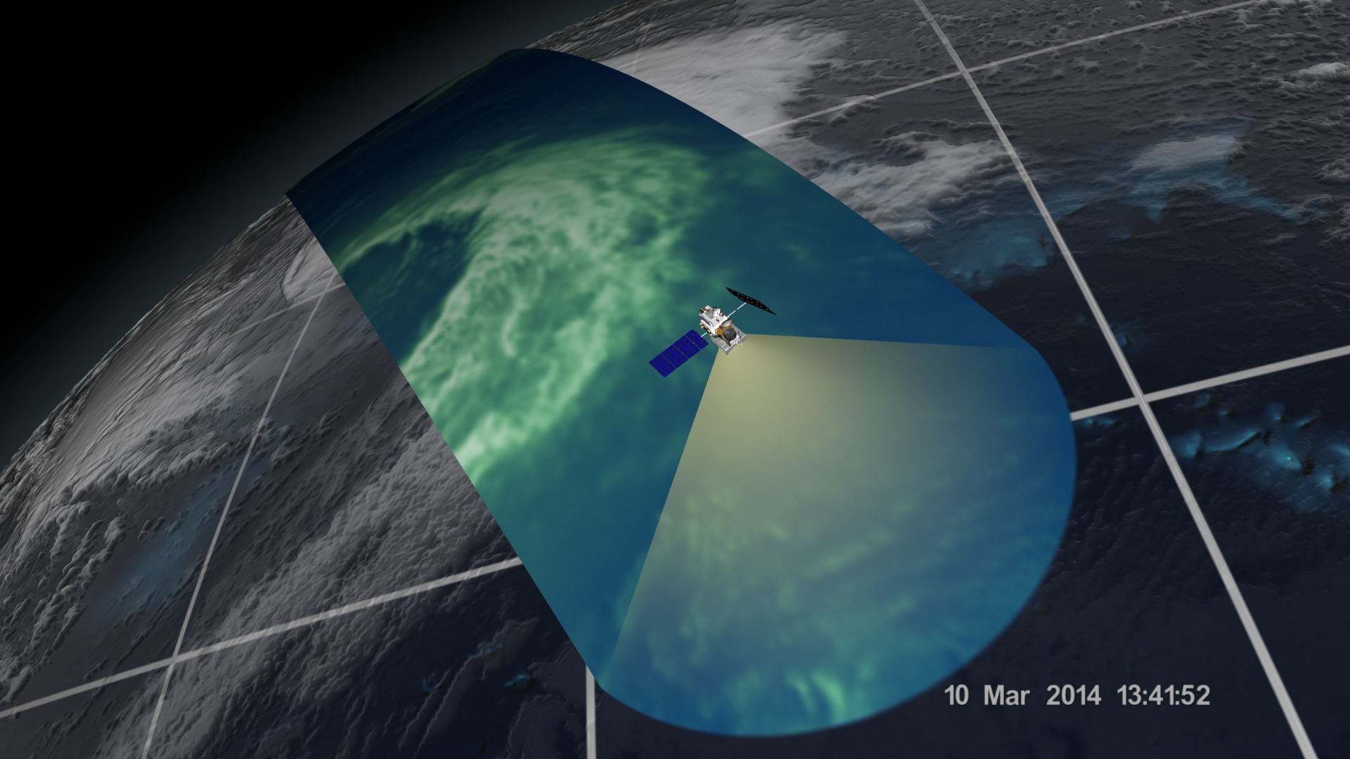
Eleven days after the Feb. 27 launch of the Global Precipitation Measurement (GPM) Core Observatory, the two instruments aboard took their first joint images of an interesting precipitation event. On March 10, the Core Observatory passed over an extra-tropical cyclone about 1055 miles (1700 kilometers) due east of Japan's Honshu Island. The storm formed from the collision of a cold front wrapping around a warm front, emerging over the ocean near Okinawa on March 8. It moved northeast over the ocean south of Japan, drawing cold air west-to-east over the land, a typical winter weather pattern that also brought heavy snow over Hokkaido, the northernmost of the four main islands. After the GPM images were taken, the storm continued to move eastward, slowly intensifying before weakening in the central North Pacific.
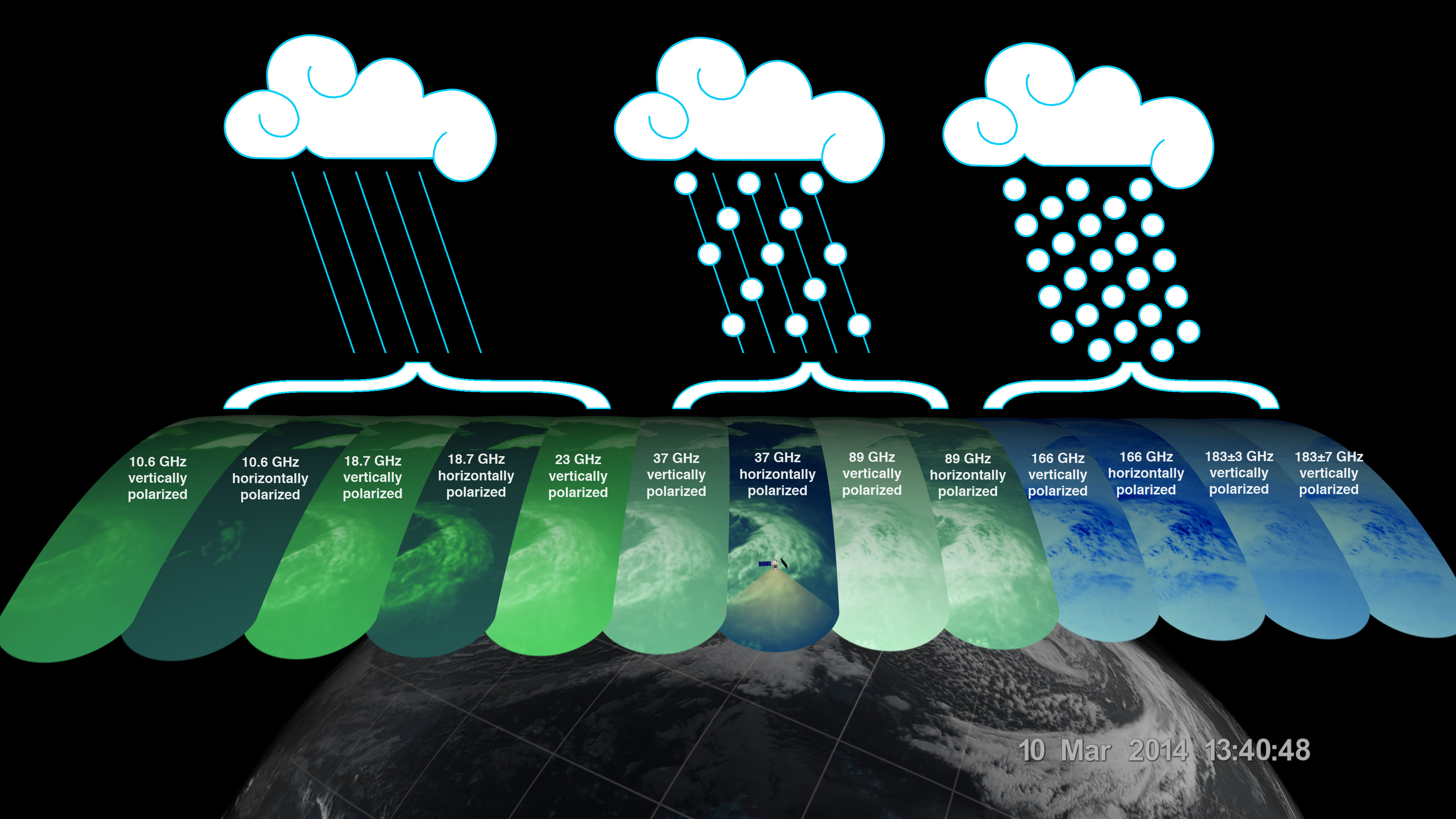
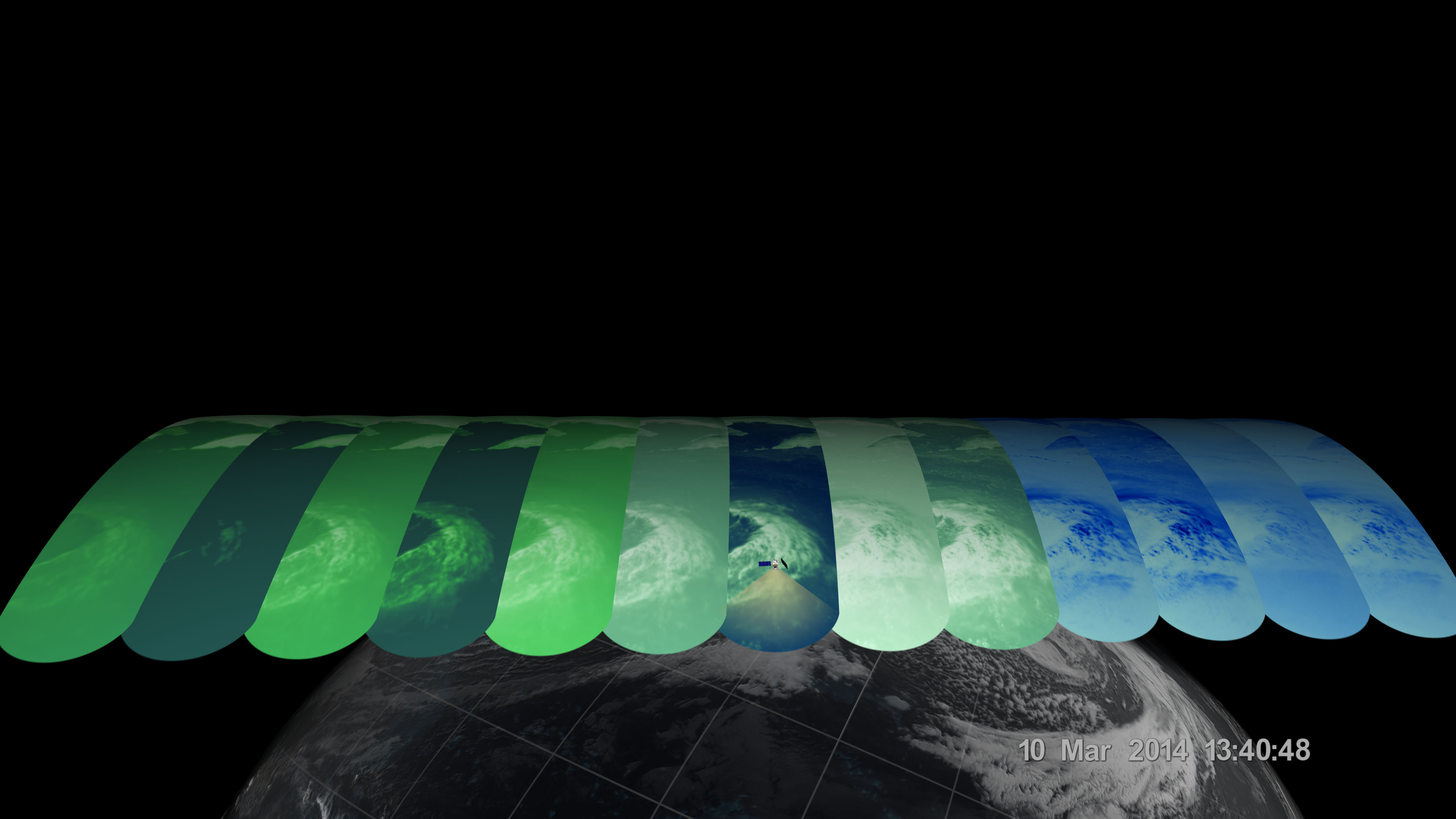
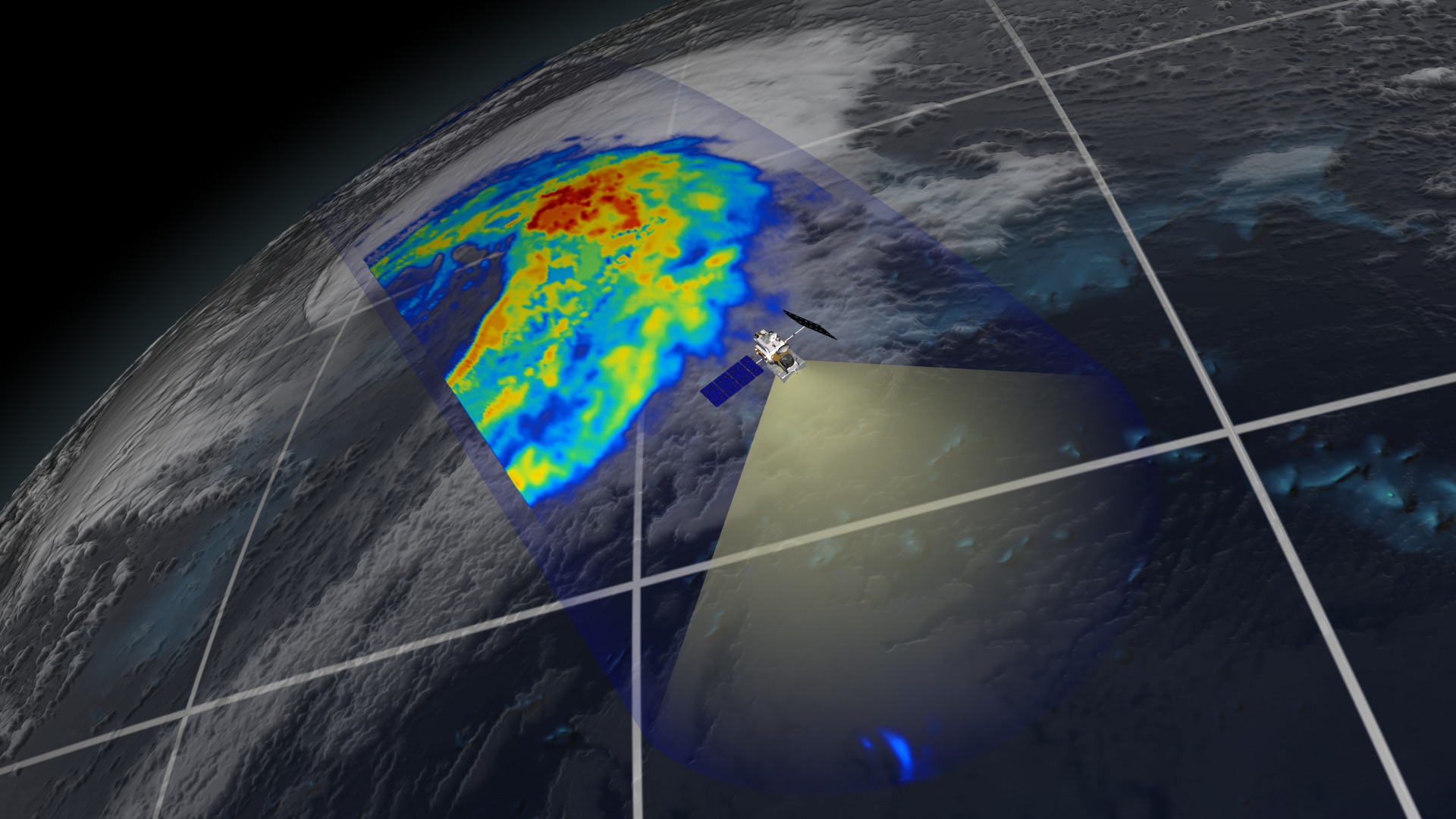
This visualization shows data from the GPM Microwave Imager, which observes different types of precipitation with 13 channels. Scientists analyze that data and then use it to calculate the light to heavy rain rates and falling snow within the storm.
For more information on this topic:
GPM web site
Other multimedia items related to this story:
GPM GMI First Light (#11508)
GPM DPR First Light (#11509)
All multimedia items from this point on are print stills.


GPM/GMI First Light
This visualization shows data from the GPM Microwave Imager, which observes different types of precipitation with 13 channels. Scientists analyze that data and then use it to calculate the light to heavy rain rates and falling snow within the storm.
For more information on this topic:
GPM web site
Other multimedia items related to this story:
GPM GMI First Light (#11508)
GPM DPR First Light (#11509)
All multimedia items from this point on are print stills.
Related

Visualization Credits
Alex Kekesi (Global Science and Technology, Inc.): Lead Animator
Greg Shirah (NASA/GSFC): Animator
Ernie Wright (USRA): Animator
Ryan Fitzgibbons (USRA): Producer
Rani Gran (NASA/GSFC): Producer
Gail Skofronick Jackson (NASA/GSFC): Scientist
Dalia B Kirschbaum (NASA/GSFC): Scientist
Chris Kidd (University of Maryland): Scientist
Laurence Schuler (ADNET Systems, Inc.): Project Support
Ian Jones (ADNET Systems, Inc.): Project Support
Robert Simmon (Sigma Space Corporation): Project Support
Jesse Allen (Sigma Space Corporation): Project Support
John M. Kwiatkowski (George Mason University): Project Support
Ellen T. Gray (ADNET Systems, Inc.): Writer
Please give credit for this item to:
NASA's Scientific Visualization Studio
NASA's Scientific Visualization Studio
Short URL to share this page:
https://svs.gsfc.nasa.gov/4153
Missions:
Global Precipitation Measurement (GPM)
Viking
Data Used:
Note: While we identify the data sets used in these visualizations, we do not store any further details nor the data sets themselves on our site.
This item is part of this series:
GPM Animations
Keywords:
DLESE >> Atmospheric science
SVS >> HDTV
DLESE >> Natural hazards
GCMD >> Earth Science >> Atmosphere >> Clouds
GCMD >> Earth Science >> Atmosphere >> Atmospheric Phenomena >> Storms
GCMD >> Earth Science >> Atmosphere >> Clouds >> Cloud Liquid Water/Ice
GCMD >> Earth Science >> Atmosphere >> Clouds >> Cloud Precipitable Water
GCMD >> Earth Science >> Atmosphere >> Precipitation >> Rain
GCMD >> Earth Science >> Spectral/Engineering >> Infrared Wavelengths >> Brightness Temperature
GCMD >> Earth Science >> Spectral/Engineering >> Microwave >> Brightness Temperature
NASA Science >> Earth
GCMD >> Earth Science >> Atmosphere >> Clouds >> Cloud Droplet Distribution
GCMD keywords can be found on the Internet with the following citation: Olsen, L.M., G. Major, K. Shein, J. Scialdone, S. Ritz, T. Stevens, M. Morahan, A. Aleman, R. Vogel, S. Leicester, H. Weir, M. Meaux, S. Grebas, C.Solomon, M. Holland, T. Northcutt, R. A. Restrepo, R. Bilodeau, 2013. NASA/Global Change Master Directory (GCMD) Earth Science Keywords. Version 8.0.0.0.0
Places you might have seen this:

President Obama Views Miraikan Exhibit with Japanese Astronaut. Photo courtesy of US State Department. Photographer: William Ng.
https://svs.gsfc.nasa.gov/4153
Missions:
Global Precipitation Measurement (GPM)
Viking
Data Used:
GPM/GMI/Surface Precipitation also referred to as: Rain Rates
3/10/2014:12:41:46 - 3/10/2014:14:13:55
Credit:
Data provided by the joint NASA/JAXA GPM mission.
Data provided by the joint NASA/JAXA GPM mission.
GPM/GMI/Brightness Temperature
Observed Data - 3/10/2014:12:41:46 - 3/10/2014:14:13:55
Credit:
Data provided by the joint NASA/JAXA GPM mission.
Data provided by the joint NASA/JAXA GPM mission.
EO-1/ALI
3/8/2014:12:30:00 - 3/10/2014:14:00:00This item is part of this series:
GPM Animations
Keywords:
DLESE >> Atmospheric science
SVS >> HDTV
DLESE >> Natural hazards
GCMD >> Earth Science >> Atmosphere >> Clouds
GCMD >> Earth Science >> Atmosphere >> Atmospheric Phenomena >> Storms
GCMD >> Earth Science >> Atmosphere >> Clouds >> Cloud Liquid Water/Ice
GCMD >> Earth Science >> Atmosphere >> Clouds >> Cloud Precipitable Water
GCMD >> Earth Science >> Atmosphere >> Precipitation >> Rain
GCMD >> Earth Science >> Spectral/Engineering >> Infrared Wavelengths >> Brightness Temperature
GCMD >> Earth Science >> Spectral/Engineering >> Microwave >> Brightness Temperature
NASA Science >> Earth
GCMD >> Earth Science >> Atmosphere >> Clouds >> Cloud Droplet Distribution
GCMD keywords can be found on the Internet with the following citation: Olsen, L.M., G. Major, K. Shein, J. Scialdone, S. Ritz, T. Stevens, M. Morahan, A. Aleman, R. Vogel, S. Leicester, H. Weir, M. Meaux, S. Grebas, C.Solomon, M. Holland, T. Northcutt, R. A. Restrepo, R. Bilodeau, 2013. NASA/Global Change Master Directory (GCMD) Earth Science Keywords. Version 8.0.0.0.0
Places you might have seen this:
President Obama Views Miraikan Exhibit with Japanese Astronaut. Photo courtesy of US State Department. Photographer: William Ng.

Marvel's Agents of S.H.I.E.L.D., Season 2, Episode 8, "The Things We Bury"


