Planets and Moons
ID: 4886
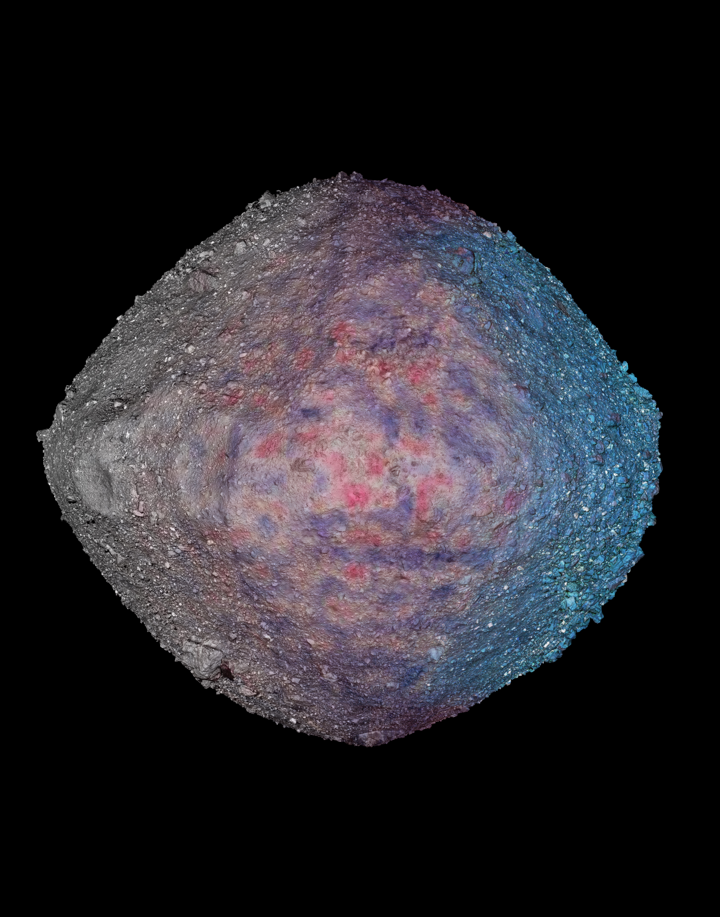
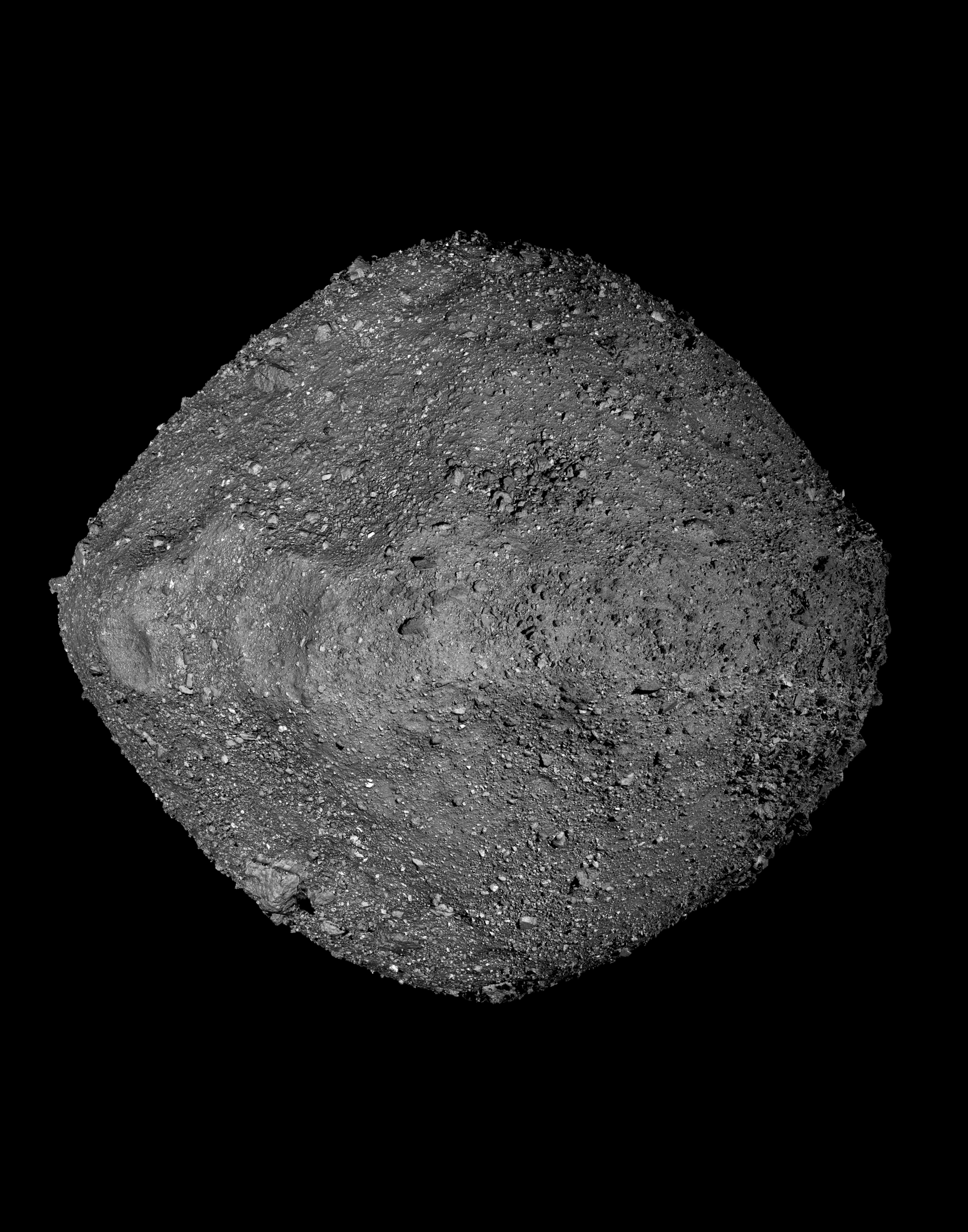
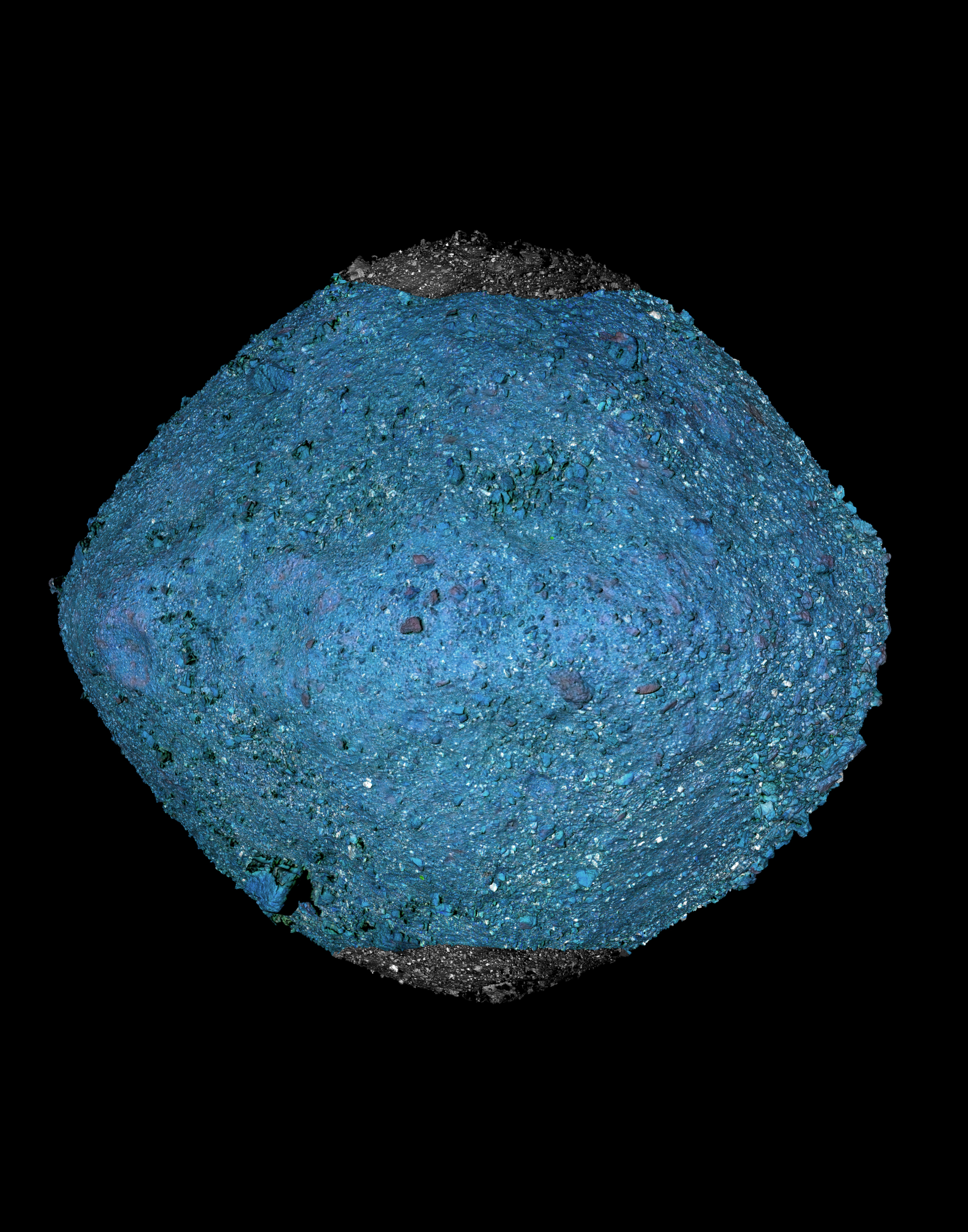
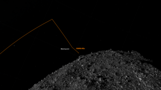
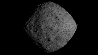
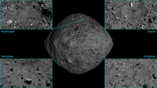
This visualization of Bennu was selected for the cover of the November 6th special issue of Science. The image was created using high-resolution imagery and laser altimetry data from the OSIRIS-REx spacecraft. Multiple data layers were wrapped to a detailed 3D model of the asteroid, representing just a few of the recent science results from the mission.
More information about this issue of Science (as well as the final cover image) can be found here: https://science.sciencemag.org/content/370/6517

Bennu visualization on the cover of Science
More information about this issue of Science (as well as the final cover image) can be found here: https://science.sciencemag.org/content/370/6517
Related
Visualization Credits
Kel Elkins (USRA): Lead Visualizer
Dathon Golish (The University of Arizona/LPL): Scientist
Daniella DellaGiustina (The University of Arizona/LPL): Scientist
Amy A. Simon (NASA/GSFC): Scientist
Dan Gallagher (USRA): Lead Producer
Cat Wolner (The University of Arizona/LPL): Producer
Erin Morton (The University of Arizona): Communications Lead
Nancy Neal-Jones (NASA/GSFC): Communications Lead
Please give credit for this item to:
NASA's Scientific Visualization Studio
Data provided by NASA/University of Arizona/CSA/York University/Open University/MDA.
NASA's Scientific Visualization Studio
Data provided by NASA/University of Arizona/CSA/York University/Open University/MDA.
Short URL to share this page:
https://svs.gsfc.nasa.gov/4886
Data Used:
Note: While we identify the data sets used in these visualizations, we do not store any further details nor the data sets themselves on our site.
Keywords:
SVS >> Asteroid
SVS >> Elevation data
SVS >> Imaging
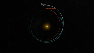
SVS >> Orbit
SVS >> OSIRIS-REx
NASA Science >> Planets and Moons
SVS >> Bennu
SVS >> Sample Return
https://svs.gsfc.nasa.gov/4886
Data Used:
OSIRIS-REx/OLA/LIDAR
The OSIRIS-REx Laser Altimeter (OLA) is a scanning LIDAR (Light Detection and Ranging). LIDAR is similar to RADAR, but it uses light instead of radio waves to measure distance. OLA emitted laser pulses at the surface of Bennu, which reflected back from the surface and returned a portion of the laser pulse to the LIDAR detector. By carefully measuring the time difference between the outgoing pulse and the incoming pulse, the distance from the spacecraft to the surface of Bennu was computed using the speed of light. This allowed OLA to provide high-resolution topographical information about Bennu during the mission.
OSIRIS-REx/OCAMS/Imagery
Observed Data
The OSIRIS-REx Camera Suite (OCAMS) consists of three cameras: PolyCam, MapCam, and SamCam. These cameras captured a wealth of imagery during OSIRIS-REx’s time at asteroid Bennu. To help mission planners select a site on Bennu for sample collection, OCAMS provided global image mapping of the asteroid’s surface and more detailed images of potential sample sites. OCAMS also recorded the sampling event during the touch-and-go (TAG) maneuver.
Credit:
NASA/University of Arizona/CSA/York University/MDA
NASA/University of Arizona/CSA/York University/MDA
Keywords:
SVS >> Asteroid
SVS >> Elevation data
SVS >> Imaging
SVS >> Orbit
SVS >> OSIRIS-REx
NASA Science >> Planets and Moons
SVS >> Bennu
SVS >> Sample Return


