Earth
ID: 5009
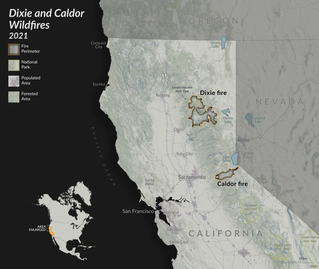
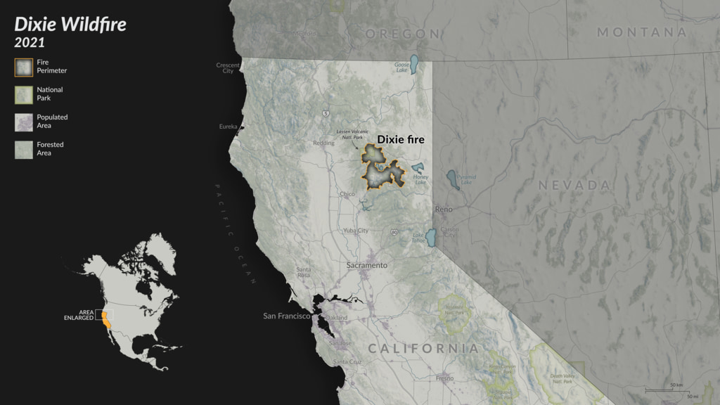
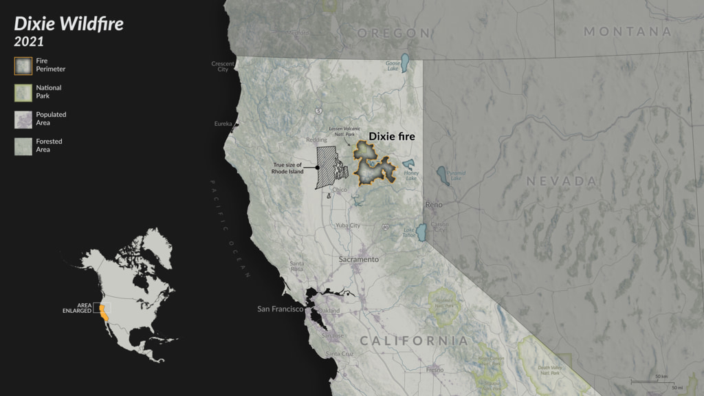
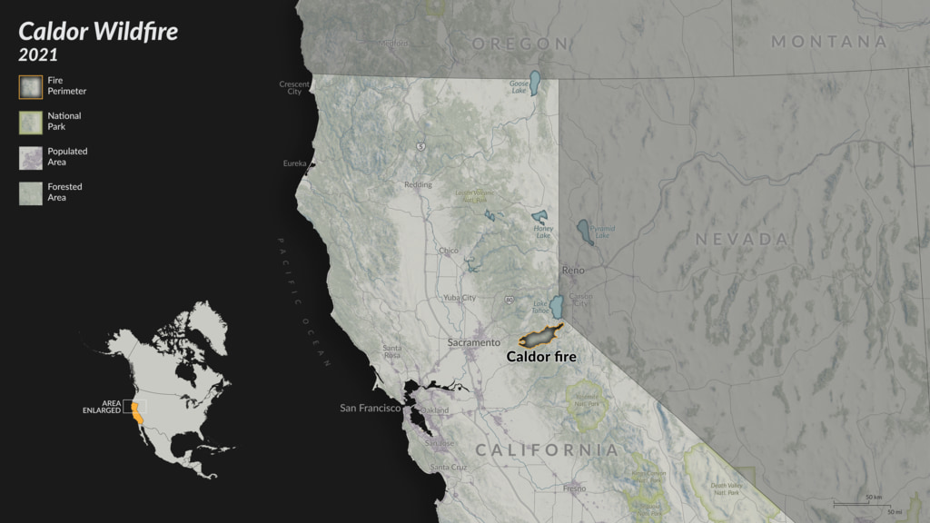
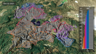
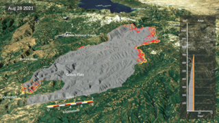
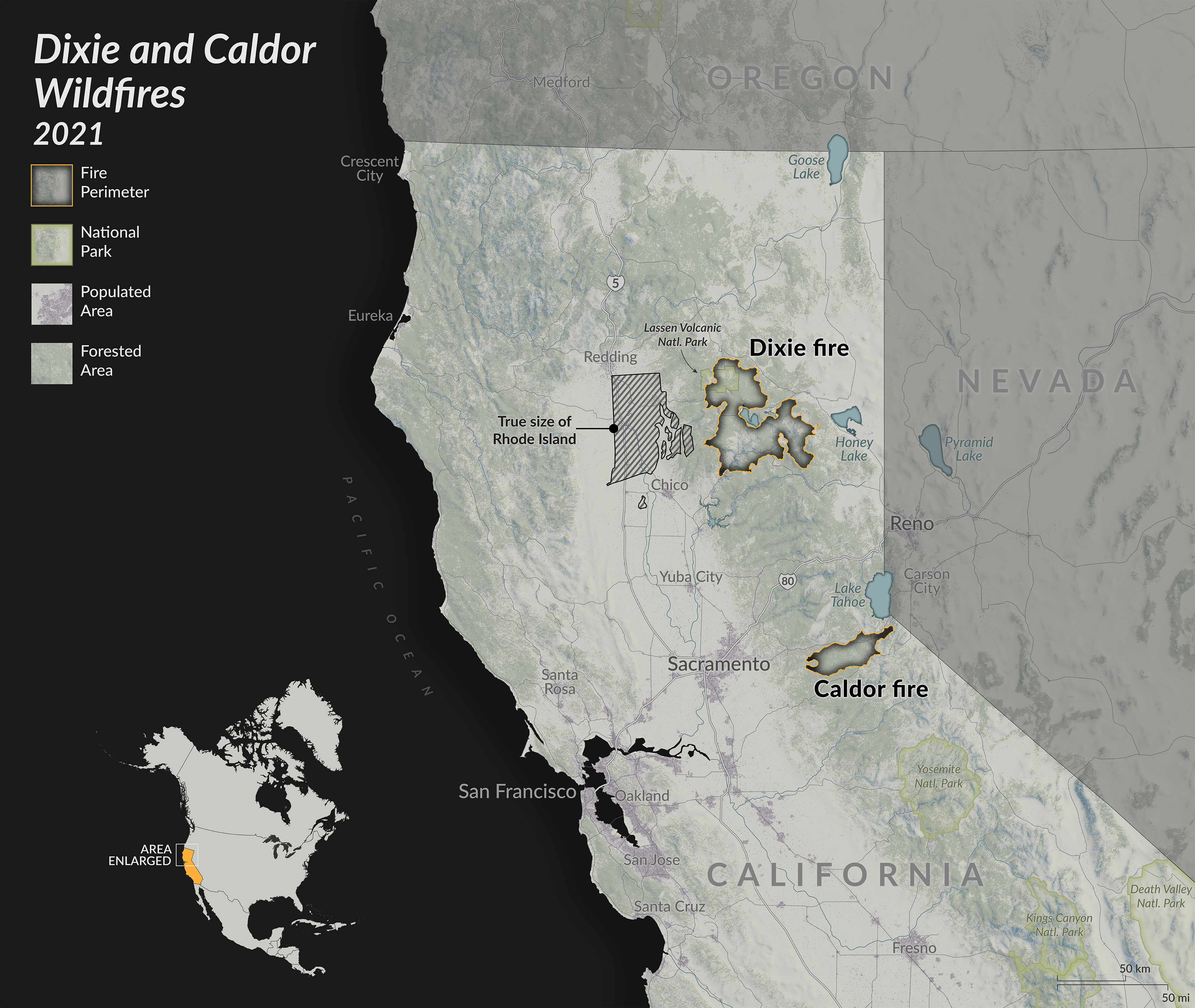
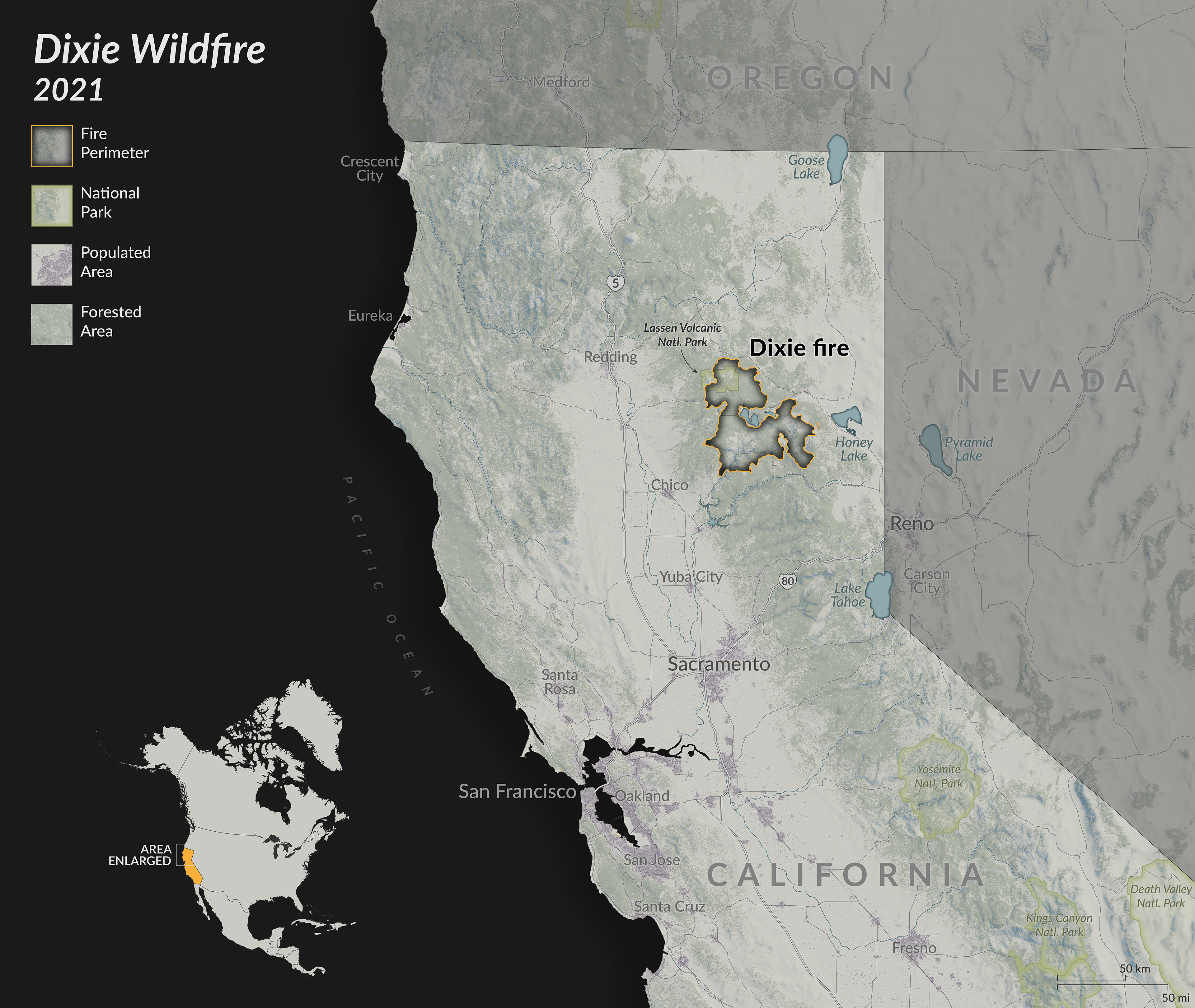
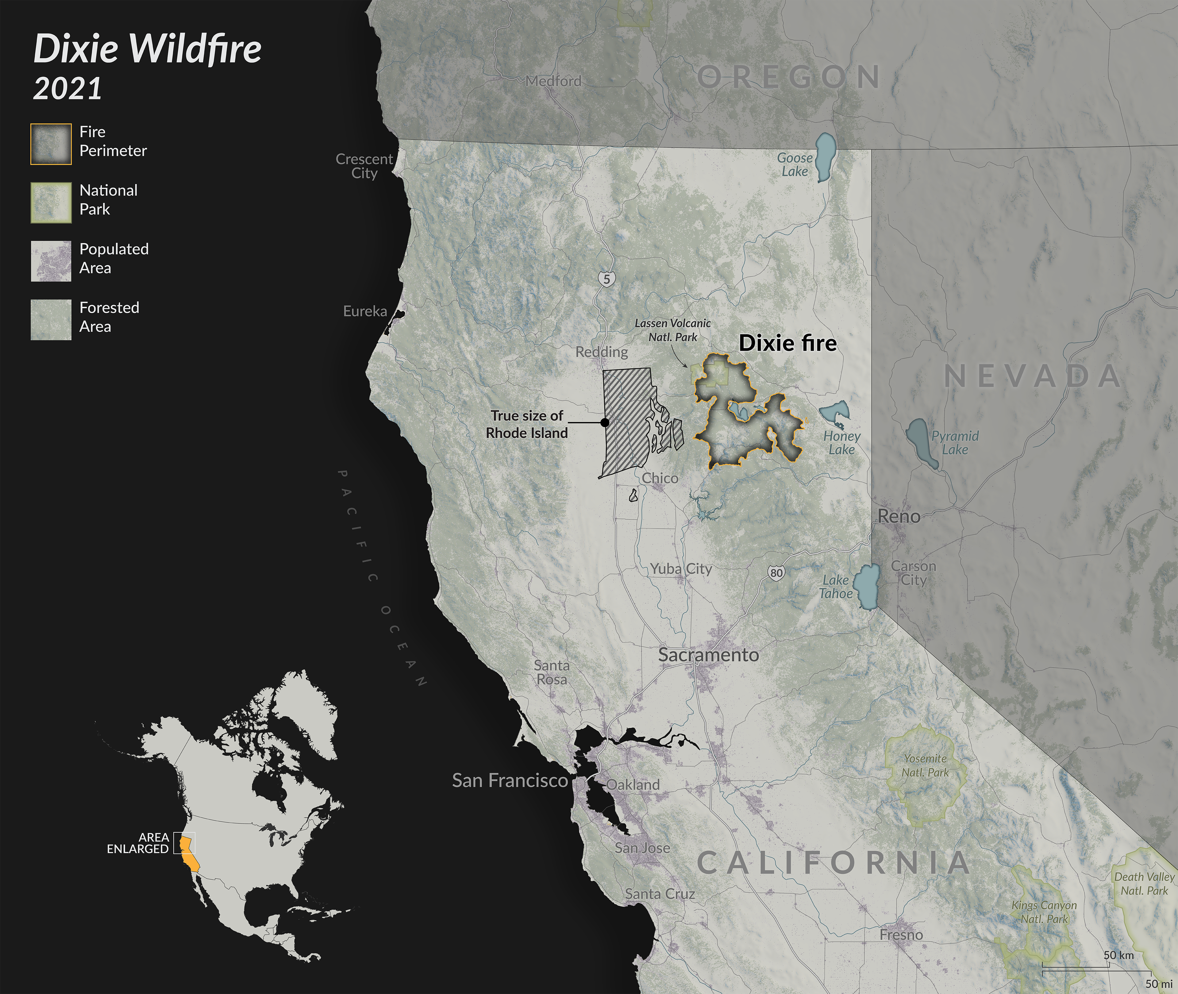
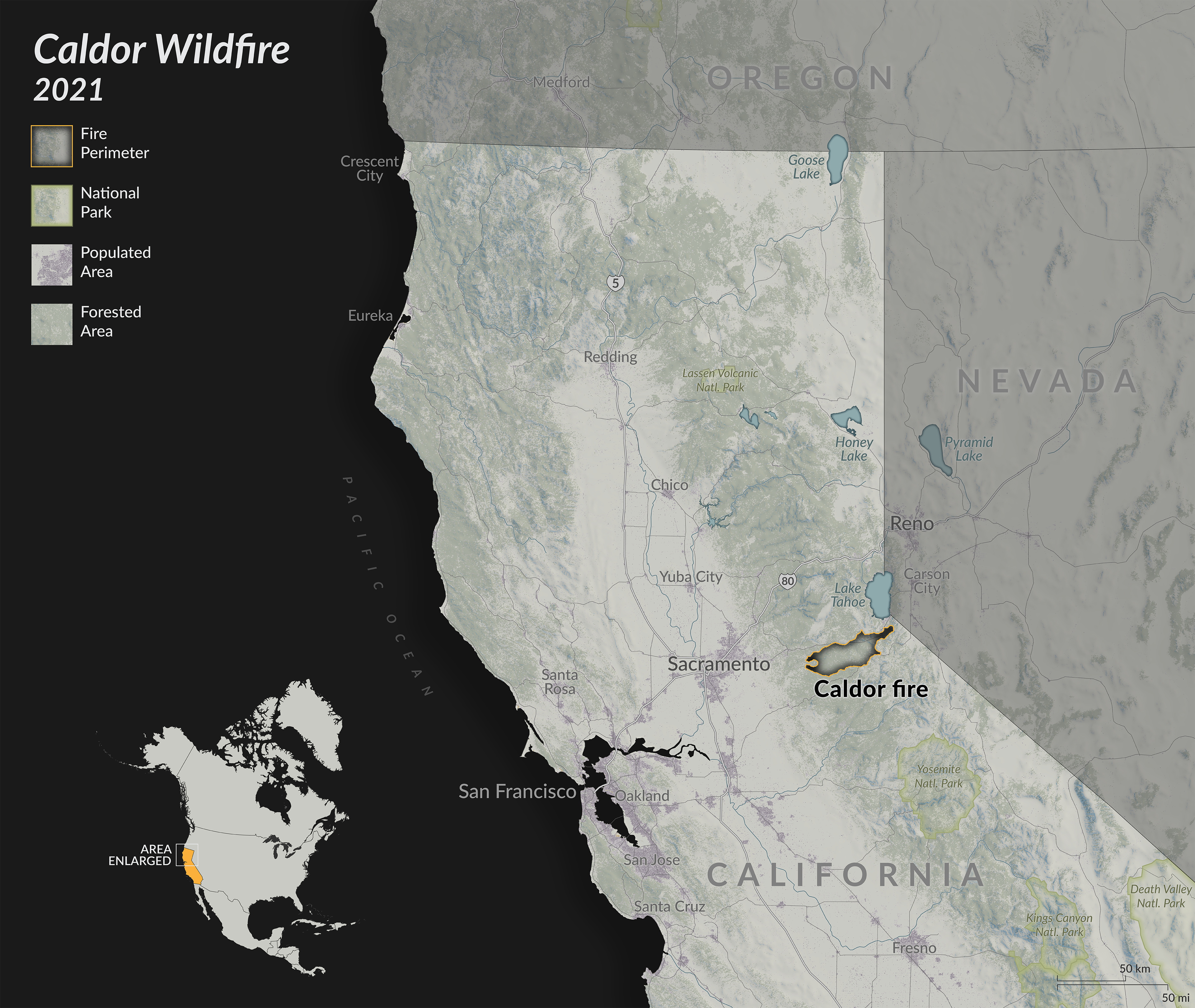
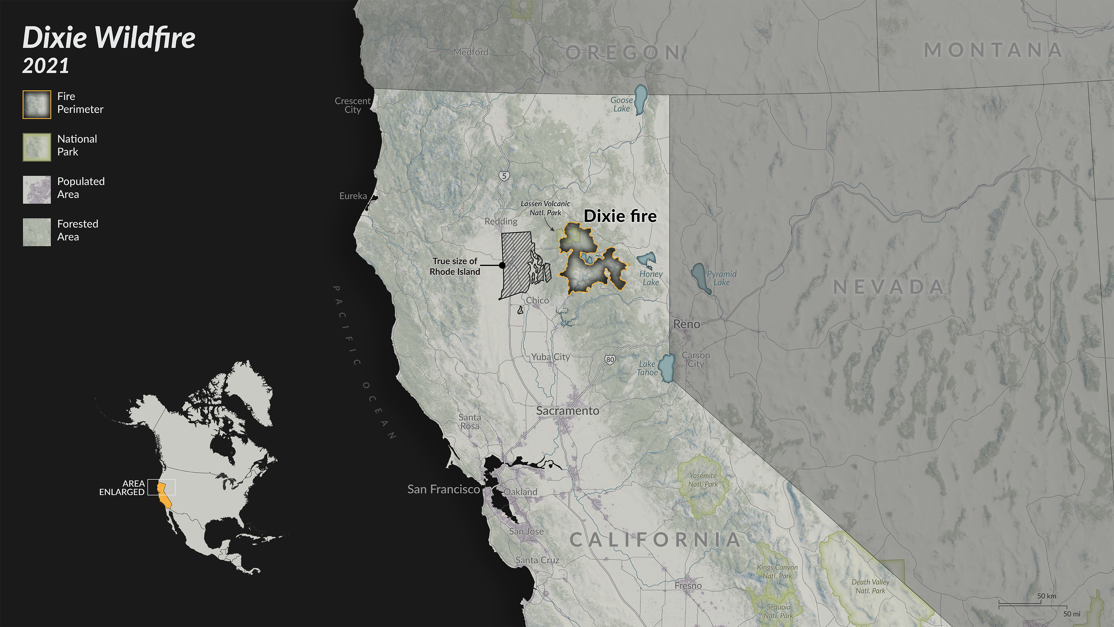
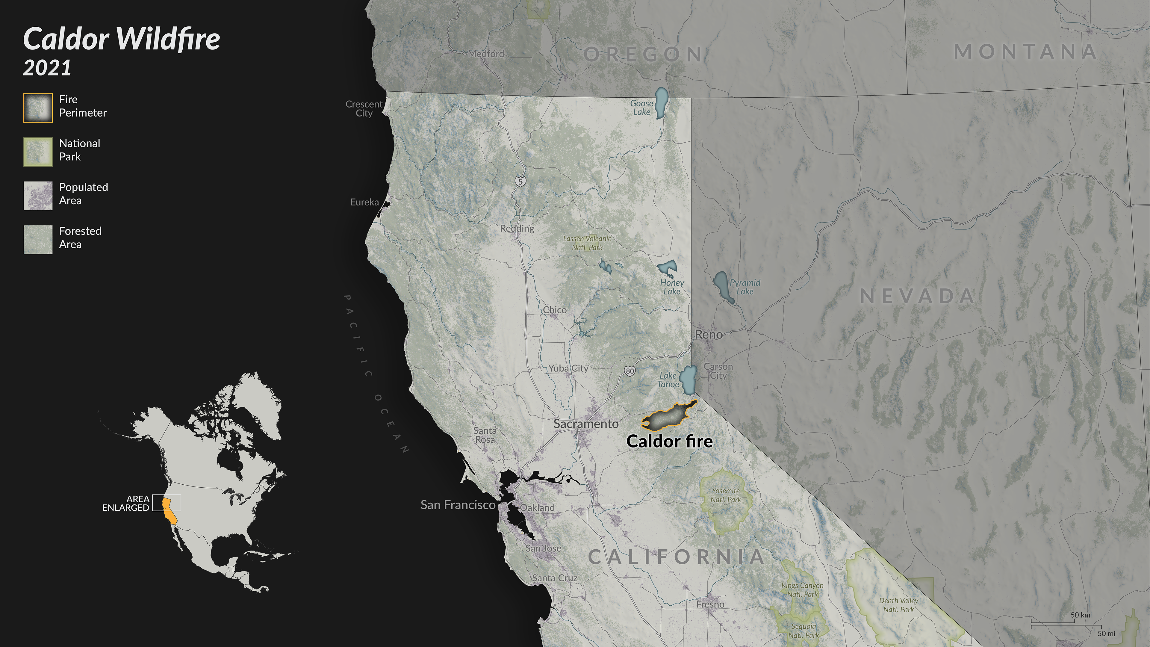
This map illustrates perimeter data for two California wildfires and allows for the comparison of their size and position. The data is derived from a new automatic fire detection and tracking approach (Chen et al., 2022) based on near-real time active fire detections from the VIIRS sensor on the Suomi-NPP satellite. The tracking system’s algorithm uses new active fire detections to update the total fire perimeter and estimate the position of active fire lines every 12 hours.
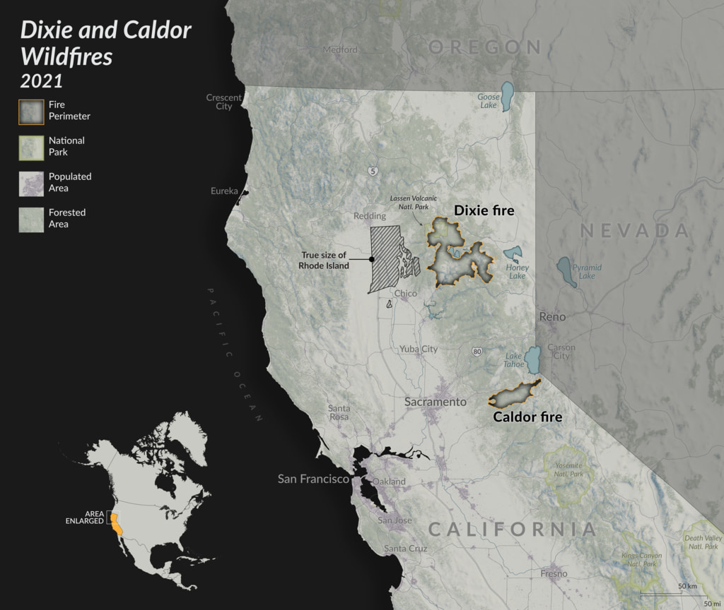
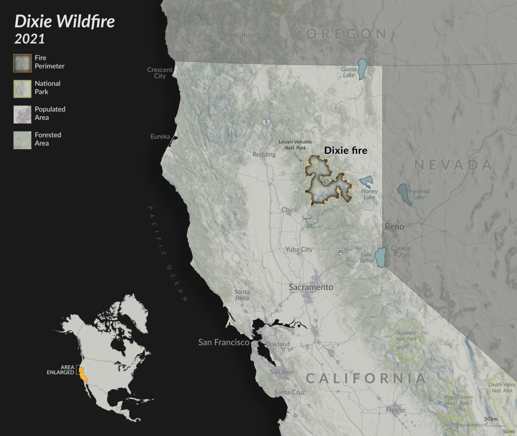

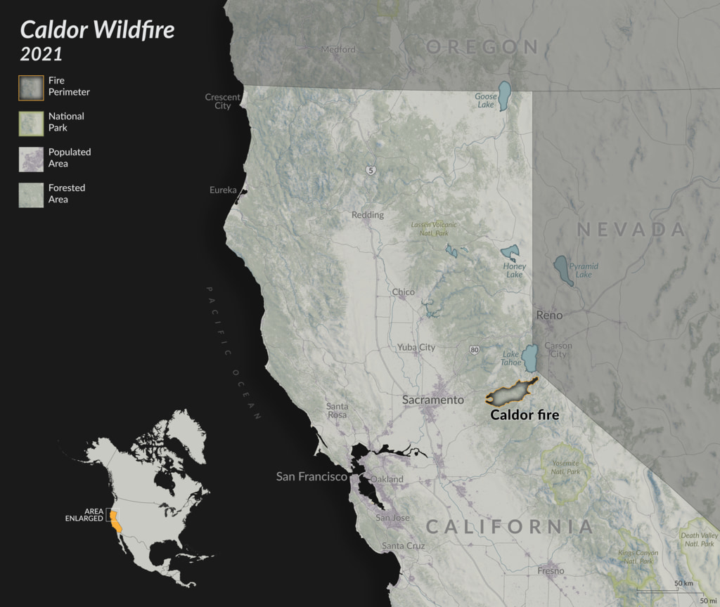
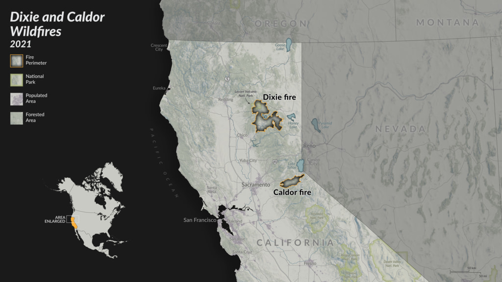

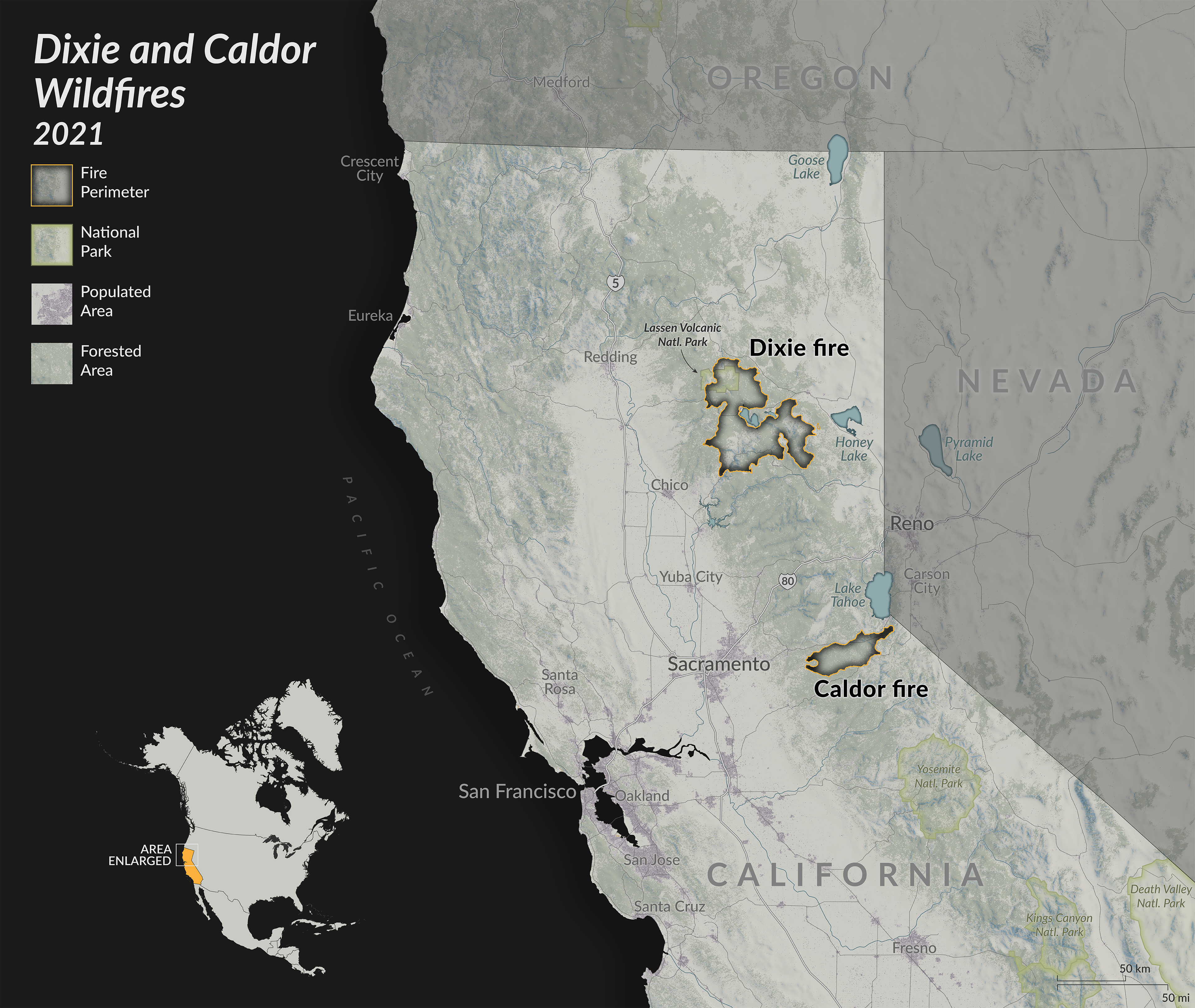
Dixie and Caldor Wildfires Locator Maps - 2021
The Dixie wildfire, the northern most of the two, was the largest fire in California history with a total area (1,505 sq. miles) just above the size of U.S. state Rhode Island (1,214 sq. miles). In total, the Dixie fire burned for more than 100 days and this map displays the total extent between July 14 and October 22, 2021. The Caldor wildfire, east of Sacramento, is the second fire in California history to cross the Sierra Nevada Mountains. In total, the Caldor fire burned for more than 80 days through the El Dorado National Forest, threatening the communities of Meyers and South Lake Tahoe.
For more details, see the paper here.
Related
Visualization Credits
Scientist:
Doug C. Morton (NASA/GSFC)
Lead Visualizer:
Michala Garrison (SSAI)
Visualizer:
Cindy Starr (Global Science and Technology, Inc.)
Technical Support:
Ian Jones (ADNET Systems, Inc.)
Laurence Schuler (ADNET Systems, Inc.)
Doug C. Morton (NASA/GSFC)
Lead Visualizer:
Michala Garrison (SSAI)
Visualizer:
Cindy Starr (Global Science and Technology, Inc.)
Technical Support:
Ian Jones (ADNET Systems, Inc.)
Laurence Schuler (ADNET Systems, Inc.)
Please give credit for this item to:
NASA's Scientific Visualization Studio
NASA's Scientific Visualization Studio
Science Paper:
Chen, Y., Hantson, S., Andela, N. et al. California wildfire spread derived using VIIRS satellite observations and an object-based tracking system. Sci Data 9, 249 (2022). https://doi.org/10.1038/s41597-022-01343-0
Short URL to share this page:
https://svs.gsfc.nasa.gov/5009
Data Used:
Note: While we identify the data sets used in these visualizations, we do not store any further details nor the data sets themselves on our site.
Keywords:
SVS >> Fire Management
DLESE >> Human geography
DLESE >> Natural hazards
GCMD >> Earth Science >> Human Dimensions >> Natural Hazards >> Fires
SVS >> Biosphere >> Ecological Dynamics >> Fire Occurrence
NASA Science >> Earth
GCMD >> Earth Science >> Human Dimensions >> Environmental Governance/management >> Fire Management
GCMD keywords can be found on the Internet with the following citation: Olsen, L.M., G. Major, K. Shein, J. Scialdone, S. Ritz, T. Stevens, M. Morahan, A. Aleman, R. Vogel, S. Leicester, H. Weir, M. Meaux, S. Grebas, C.Solomon, M. Holland, T. Northcutt, R. A. Restrepo, R. Bilodeau, 2013. NASA/Global Change Master Directory (GCMD) Earth Science Keywords. Version 8.0.0.0.0
Chen, Y., Hantson, S., Andela, N. et al. California wildfire spread derived using VIIRS satellite observations and an object-based tracking system. Sci Data 9, 249 (2022). https://doi.org/10.1038/s41597-022-01343-0
Short URL to share this page:
https://svs.gsfc.nasa.gov/5009
Data Used:
SRTM/SIR-C/DEM
Natural Earth: North America Roads also referred to as: North America Roads
Database - Natural Earth
The 1:1,000,000 scale roads database for North America from Natural Earth: http://www.naturalearthdata.com/downloads/10m-cultural-vectors/roads/. This data is in the public domain. Terms of use: http://www.naturalearthdata.com/about/terms-of-use/.
Natural Earth: 1:10m Cultural Vectors - Populated Places
Database - Natural EarthSuomi-NPP/VIIRS/Fire Events Data Suite (FEDS) GeoPackage also referred to as: Fire Events Data Suite (FEDS) GeoPackage
NASA
The authors used the Suomi-NPP VIIRS I-band fire location data product (VNP14IMGML, Collection 1 Version 4), the U.S. National Land Cover Database (NLCD 2016) and gridMET product27 dead fuel moisture to develop an automatic system to dynamically track the growth of all fire events at a regional scale.
Credit:
Yang Chen, Stijn Hantson, Niels Andela, Shane R. Coffield, Casey A. Graff, Douglas C. Morton, Lesley E. Ott, Efi Foufoula-Georgiou, Padhraic Smyth,
Yang Chen, Stijn Hantson, Niels Andela, Shane R. Coffield, Casey A. Graff, Douglas C. Morton, Lesley E. Ott, Efi Foufoula-Georgiou, Padhraic Smyth,
Multi-Resolution Land Characteristics (MRLC) consortium National Land Cover Database (NLCD) also referred to as: MRLC NLCD
Mosaic - United States Geoogical Survey (USGS)
The National Land Cover Database (NLCD) provides nationwide data on land cover and land cover change at a 30m resolution with a 16-class legend based on a modified Anderson Level II classification system.
Natural Earth also referred to as: Natural Earth
Natural Earth is a public domain map dataset available at 1:10m, 1:50m, and 1:110 million scales. Featuring tightly integrated vector and raster data, with Natural Earth you can make a variety of visually pleasing, well-crafted maps with cartography or GIS software.
Keywords:
SVS >> Fire Management
DLESE >> Human geography
DLESE >> Natural hazards
GCMD >> Earth Science >> Human Dimensions >> Natural Hazards >> Fires
SVS >> Biosphere >> Ecological Dynamics >> Fire Occurrence
NASA Science >> Earth
GCMD >> Earth Science >> Human Dimensions >> Environmental Governance/management >> Fire Management
GCMD keywords can be found on the Internet with the following citation: Olsen, L.M., G. Major, K. Shein, J. Scialdone, S. Ritz, T. Stevens, M. Morahan, A. Aleman, R. Vogel, S. Leicester, H. Weir, M. Meaux, S. Grebas, C.Solomon, M. Holland, T. Northcutt, R. A. Restrepo, R. Bilodeau, 2013. NASA/Global Change Master Directory (GCMD) Earth Science Keywords. Version 8.0.0.0.0


