Earth
ID: 13129
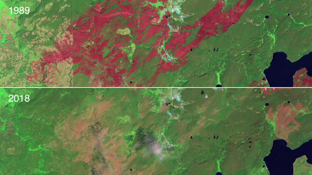
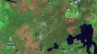
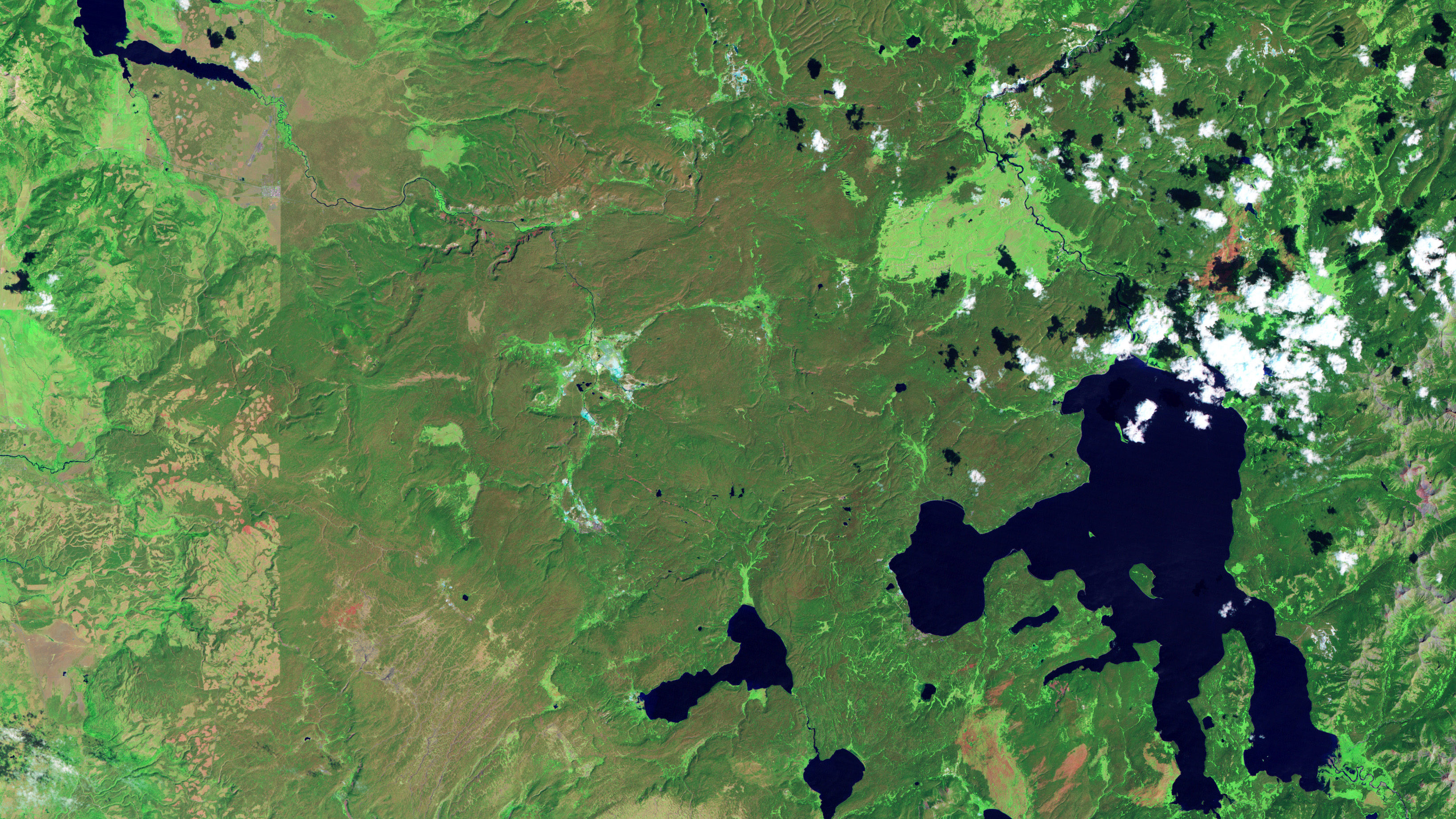
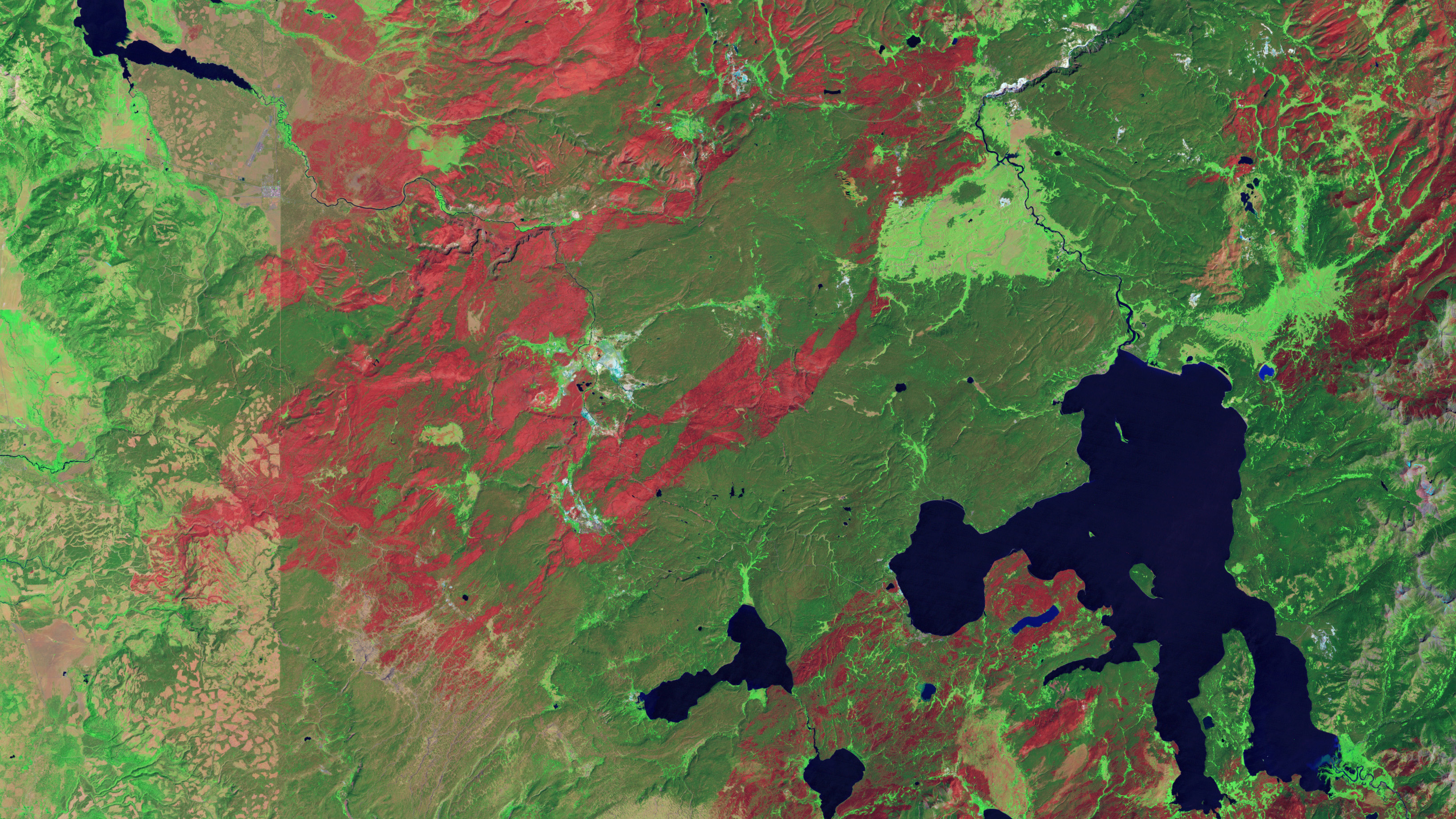
In the summer of 1988, a third of Yellowstone National Park’s verdant landscape was wiped out in a devastating wildfire. Images collected by USGS-NASA Landsat satellites have been able to follow the remarkable recovery of the land since then. Landsat instruments use visible and infrared light to differentiate between burned and healthy areas. Images taken right after the fire use false color to show freshly burned land as dark red. The dark red areas are patchy, indicating that the fire did not totally burn everything in its path. The shades of red span from dark red to light red to mark the varying severity of certain areas. In 2018, the burn scars were a pale, pinkish tan indicating that the forest vegetation is recovering. The light green edges are young trees, which use and reflect sunlight differently than mature trees that appear dark green. Fire scientists and researchers have used these false colored images to understand the long-term effects of wildfire upon a landscape and the progression of recovery over the 1988-2018 period. Watch the videos to learn more.


Yellowstone Fire: Then and Now
Related Story
Story Credits
Lead Producer:
Matthew R. Radcliff (USRA)
Lead Scientist:
Jeffrey Masek (NASA/GSFC)
Lead Writer:
Ellen T. Gray (ADNET Systems, Inc.)
Writer:
Michelle Tu (Experiential Learning Program, UMD)
Matthew R. Radcliff (USRA)
Lead Scientist:
Jeffrey Masek (NASA/GSFC)
Lead Writer:
Ellen T. Gray (ADNET Systems, Inc.)
Writer:
Michelle Tu (Experiential Learning Program, UMD)
Please give credit for this item to:
NASA's Scientific Visualization Studio
Images courtesy of Jim Peaco, National Park Service and the United States Geological Survey and NASA's Earth Observatory
Images used from NASA's Earth Observatory:
https://eoimages.gsfc.nasa.gov/images/imagerecords/76000/76837/Yellowstone_20110924_lrg.jpg
https://eoimages.gsfc.nasa.gov/images/imagerecords/39000/39125/yellowstone_tm5_1987236_lrg.jpg
https://eoimages.gsfc.nasa.gov/images/imagerecords/76000/76837/Yellowstone_20110924_lrg.jpg
Short URL to share this page:
https://svs.gsfc.nasa.gov/13129
Keywords:
SVS >> HDTV
SVS >> App
NASA Science >> Earth
https://svs.gsfc.nasa.gov/13129
Keywords:
SVS >> HDTV
SVS >> App
NASA Science >> Earth


