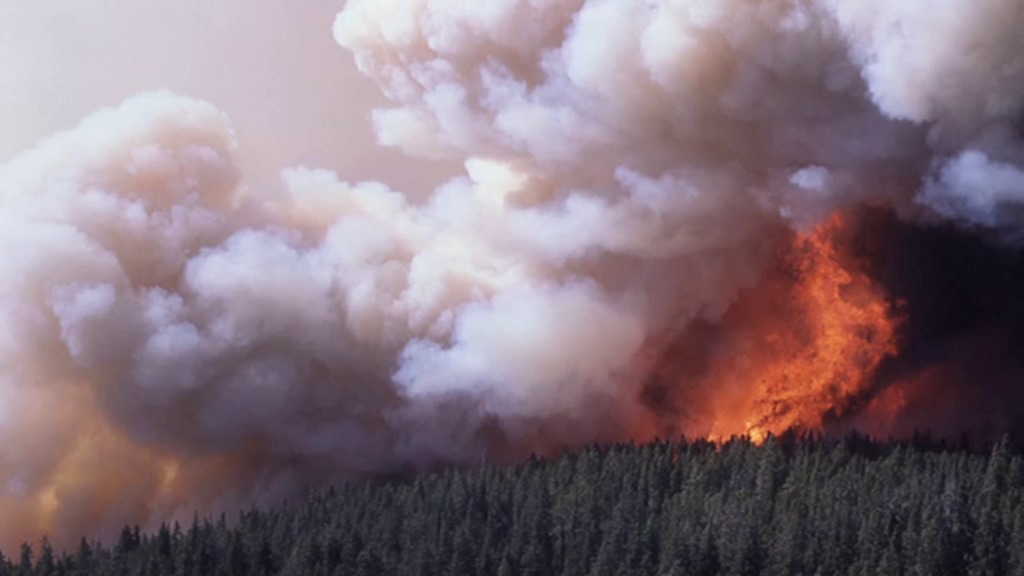
Yellowstone Burn Recovery
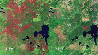
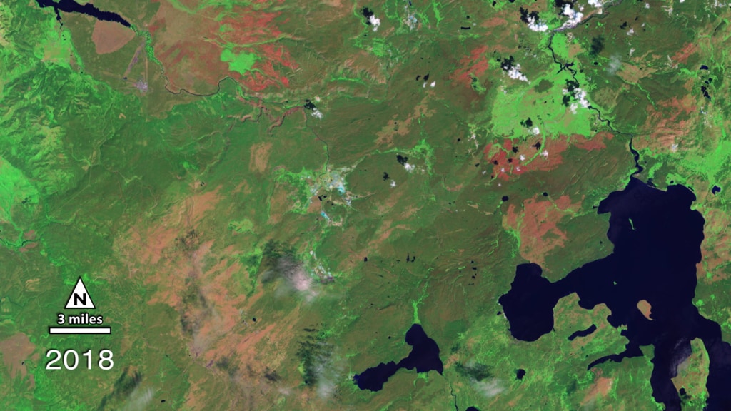
In the time-lapse video below, a series of false-color images collected by USGS-NASA Landsat satellites from 1987 to 2018 show the burning and gradual regeneration of Yellowstone's forests following the 1988 fire season. Watch as burn scars (dark red) quickly replace large expanses of healthy green vegetation (dark green) by 1989. Notice how the scars slowly fade over time as new vegetation begins to grow and heal the landscape.
Landsat Project Scientist Jeff Masek has been studying the recovery of the forest after the 1988 Yellowstone fires. In the video below, he talks about how Landsat satellites detect the burn scars from space and distinguish them from healthy, un-burned forest and from new growth.
Older Version
Related

Credits
Jeffrey Masek (NASA/GSFC): Interviewee
Matthew R. Radcliff (USRA): Producer
Jeffrey Masek (NASA/GSFC): Scientist
Matthew R. Radcliff (USRA): Videographer
NASA/Goddard Space Flight Center
Images used from NASA's Earth Observatory:
http://earthobservatory.nasa.gov/Features/WorldOfChange/yellowstone.php
Landsat is a joint program of NASA and USGS:
http://landsat.usgs.gov
http://www.nasa.gov/landsat
https://svs.gsfc.nasa.gov/11029
Mission:
Landsat
This item is part of these series:
Geophysical Changes Over Time
Narrated Movies
Landsat
Goddard TV Tape:
G2011-117 -- Yellowstone Burn Recovery
Keywords:
SVS >> HDTV
SVS >> Landsat
GCMD >> Earth Science >> Biosphere >> Terrestrial Ecosystems >> Forests
GCMD >> Earth Science >> Human Dimensions >> Natural Hazards >> Fires
SVS >> Hyperwall
DLESE >> Narrated
SVS >> Forest Fires
NASA Science >> Earth
GCMD keywords can be found on the Internet with the following citation: Olsen, L.M., G. Major, K. Shein, J. Scialdone, S. Ritz, T. Stevens, M. Morahan, A. Aleman, R. Vogel, S. Leicester, H. Weir, M. Meaux, S. Grebas, C.Solomon, M. Holland, T. Northcutt, R. A. Restrepo, R. Bilodeau, 2013. NASA/Global Change Master Directory (GCMD) Earth Science Keywords. Version 8.0.0.0.0


