Earth
ID: 12733
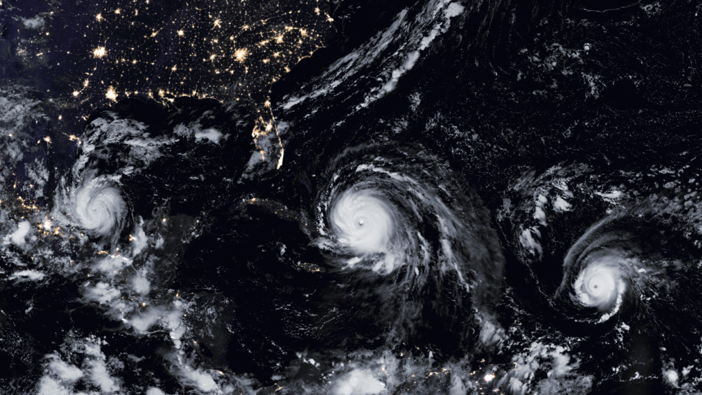
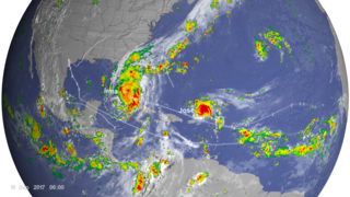
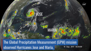
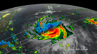
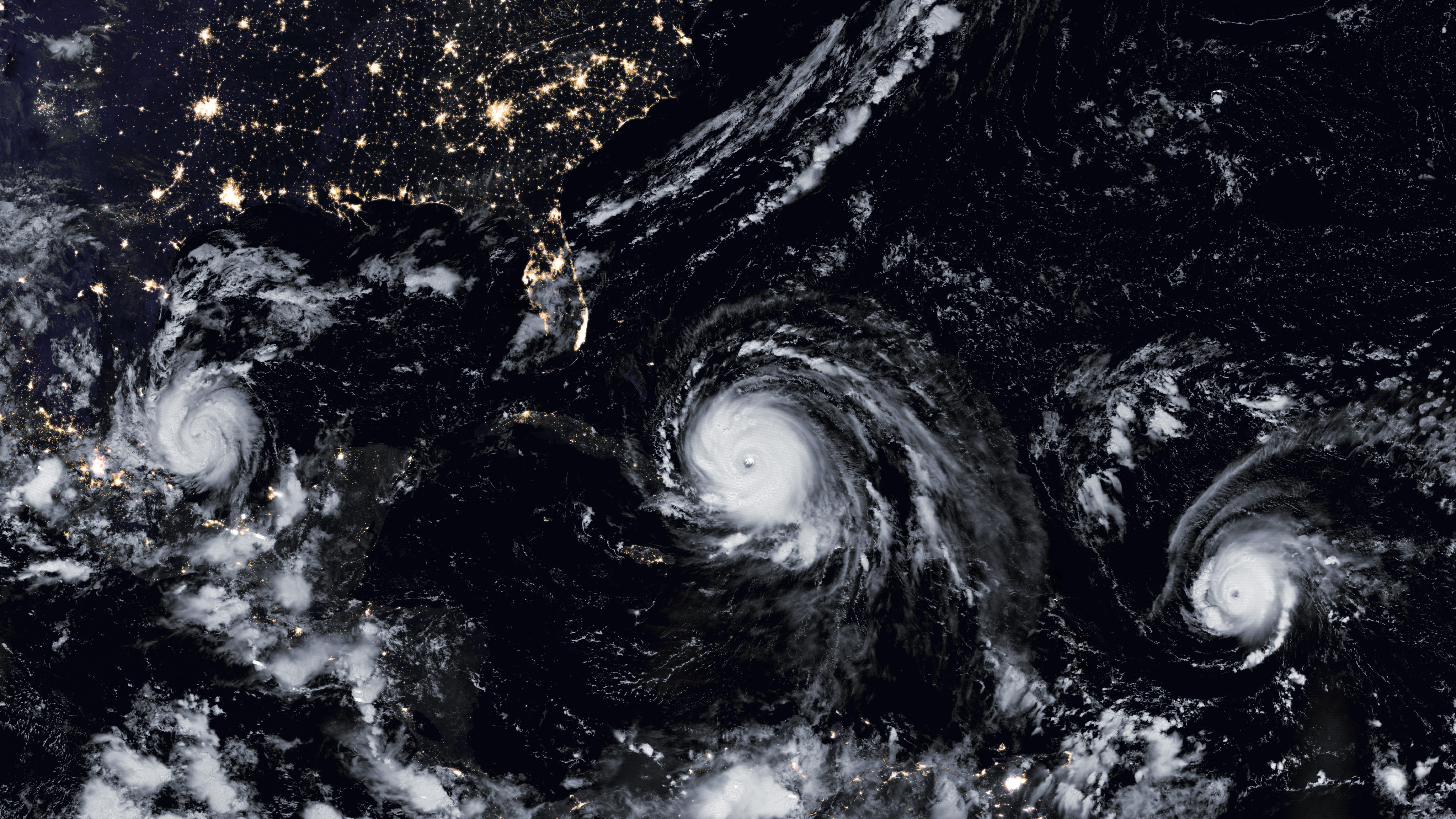
As Hurricane Harvey was dissipating over the southeast United States, four more major hurricanes were barreling across the Atlantic Ocean. Hurricane Katia, a category 2 storm, formed in the Gulf of Mexico and struck Mexico on September 8. At the same time, Hurricane Irma was passing over the Caribbean Islands. Irma set a new record for longest time spent as a category 5 hurricane with winds reaching 183 miles per hour. It caused devastation across the Caribbean and continued with its Sept. 10 landfall on Florida. Also active was Hurricane Jose, which was a category 4 storm at its maximum strength. Mercifully, Jose traveled north of the Caribbean islands and decreased in strength as it curved back to sea without making landfall. While Jose went north, Hurricane Maria, a category 5 storm, began its run through the Caribbean, directly striking Puerto Rico on Sept. 20th, as well as other islands, and causing massive damage. NASA's Global Precipitation Measurement satellite captured images of the storms' and their rainfaill. Watch the videos to learn more.
Hurricane Train: Katia, Irma, and Jose
Source Material
Story Credits
Lead Visualizers/Animators:
Kel Elkins (USRA)
Alex Kekesi (Global Science and Technology, Inc.)
Greg Shirah (NASA/GSFC)
Lead Producer:
Ryan Fitzgibbons (USRA)
Lead Scientists:
George Huffman (NASA/GSFC)
Dalia B Kirschbaum (NASA/GSFC)
Lead Writer:
Ellen T. Gray (ADNET Systems, Inc.)
Kel Elkins (USRA)
Alex Kekesi (Global Science and Technology, Inc.)
Greg Shirah (NASA/GSFC)
Lead Producer:
Ryan Fitzgibbons (USRA)
Lead Scientists:
George Huffman (NASA/GSFC)
Dalia B Kirschbaum (NASA/GSFC)
Lead Writer:
Ellen T. Gray (ADNET Systems, Inc.)
Please give credit for this item to:
NASA's Scientific Visualization Studio
NASA's Scientific Visualization Studio
Short URL to share this page:
https://svs.gsfc.nasa.gov/12733
Keywords:
SVS >> HDTV
SVS >> App
NASA Science >> Earth
NASA Earth Science Focus Areas >> Weather and Atmospheric Dynamics
https://svs.gsfc.nasa.gov/12733
Keywords:
SVS >> HDTV
SVS >> App
NASA Science >> Earth
NASA Earth Science Focus Areas >> Weather and Atmospheric Dynamics


