Earth
ID: 12579
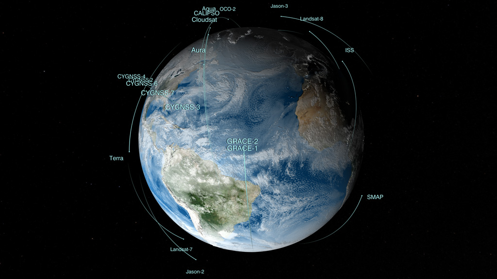
No planet is better studied than the one we actually live on. NASA's fleet of 18 Earth science missions in space, supported by aircraft, ships and ground observations, measure aspects of the environment that touch the lives of every person around the world. They study everything from the air we breathe, to rain and snow that provide water for agriculture and communities, to natural disasters such as droughts and floods, to the oceans, which cover 70 percent of Earth’s surface and provide food for many people around the world. Satellites and instruments on the International Space Station circle the whole globe, seeing both where people live and those remote parts of deserts, mountains and the vast oceans that are difficult if not impossible to visit. With instruments in space, scientists can get data for the whole globe in detail that they can't get anywhere else. This visualization shows the NASA fleet in 2017, from low Earth orbit all the way out to the DSCOVR satellite taking in the million-mile view.

Satellite Sentinels
Source Material

Related Story
Story Credits
Please give credit for this item to:
NASA's Scientific Visualization Studio
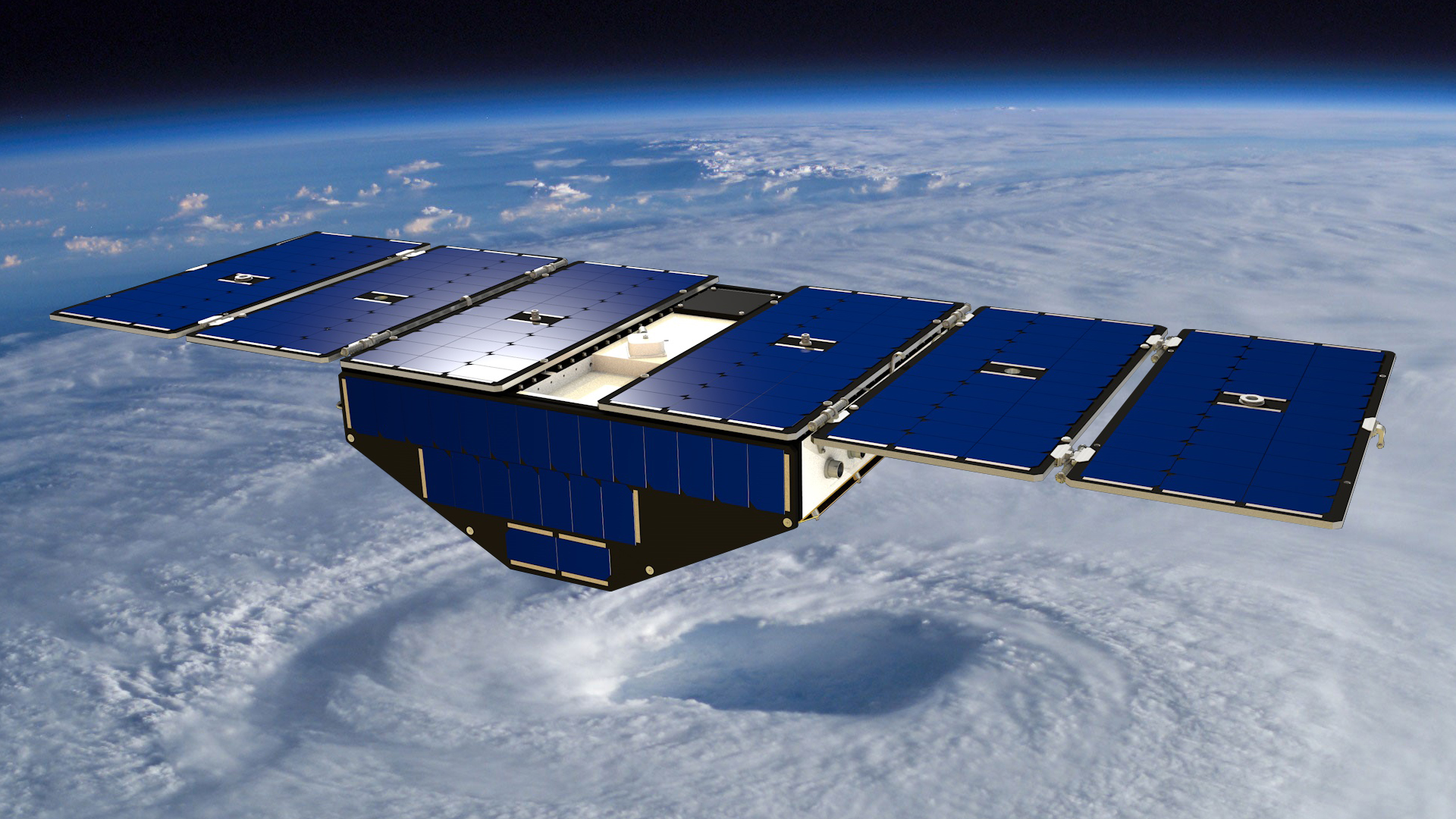
Illustration of CYGNNS courtesy of University of Michigan.
NASA's Scientific Visualization Studio
Illustration of CYGNNS courtesy of University of Michigan.
Short URL to share this page:
https://svs.gsfc.nasa.gov/12579
Keywords:
SVS >> HDTV
SVS >> App
NASA Science >> Earth
https://svs.gsfc.nasa.gov/12579
Keywords:
SVS >> HDTV
SVS >> App
NASA Science >> Earth


