NASA's Vantage Point to View Earth
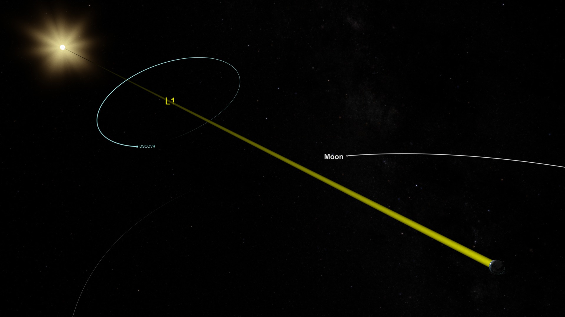
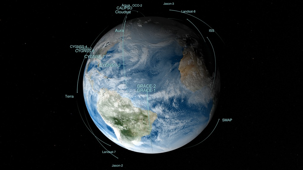
NASA's fleet of Earth science satellites, along with Earth science instruments on the International Space Station, surveys the whole globe, even the most remote parts that are difficult if not impossible to visit. With instruments in space, scientists can get data for the whole globe in detail that they can't get anywhere else. This visualization shows the NASA fleet in 2017, from low Earth orbit all the way out to the DSCOVR satellite taking in the million-mile view.
Music: The Glide, by Zubin Thakkar [SOCAN]
Watch this video on the NASA Goddard YouTube channel.
No planet is better studied than the one we actually live on. NASA's fleet of 26 Earth science spacecraft, supported by aircraft, ships and ground observations, measure aspects of the environment that touch the lives of every person around the world. They study everything from the air we breathe, to rain and snow that provide water for agriculture and communities, to natural disasters such as droughts and floods, to the oceans, which cover 70 percent of Earth’s surface and provide food for many people around the world. Satellites and instruments on the International Space Station circle the whole globe, seeing both where people live and those remote parts of deserts, mountains and the vast oceans that are difficult if not impossible to visit. With instruments in space, scientists can get data for the whole globe in detail that they can't get anywhere else. This visualization shows the NASA fleet in 2017, from low Earth orbit all the way out to the DSCOVR satellite taking in the million-mile view.
Credits
Please give credit for this item to:
NASA's Goddard Space Flight Center
-
Producer
- Matthew R. Radcliff (USRA)
-
Technical support
- Aaron E. Lepsch (ADNET Systems, Inc.)
-
Animators
- Greg Shirah (NASA/GSFC)
- Ernie Wright (USRA)
Release date
This page was originally published on Wednesday, April 19, 2017.
This page was last updated on Wednesday, May 3, 2023 at 1:47 PM EDT.
Series
This visualization can be found in the following series:Related
- ID: 12824
- ID: 12579
 Produced Video
Sources
- ID: 4558
 Visualization