NASA Captures Isaias Twice Along the East Coast
Music: "Seven Wonders," Universal Production Music
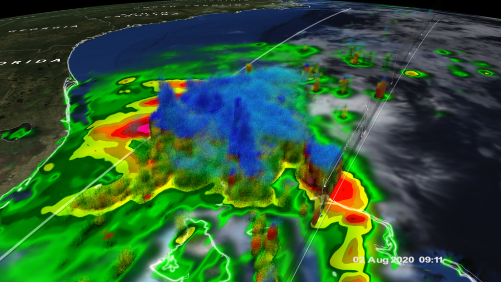
After forming into a tropical storm in the eastern Caribbean, Isaias crossed over Hispaniola and back into the western Atlantic heading northwest towards the Bahamas. During this time, Isaias strengthened into a Category 1 hurricane before then passing through the southern and central Bahamas. As it crossed Andros Island in the central Bahamas, Isaias also came under the effects of southwesterly wind shear, which together with the land interaction caused Isais to weaken back to a strong tropical storm.
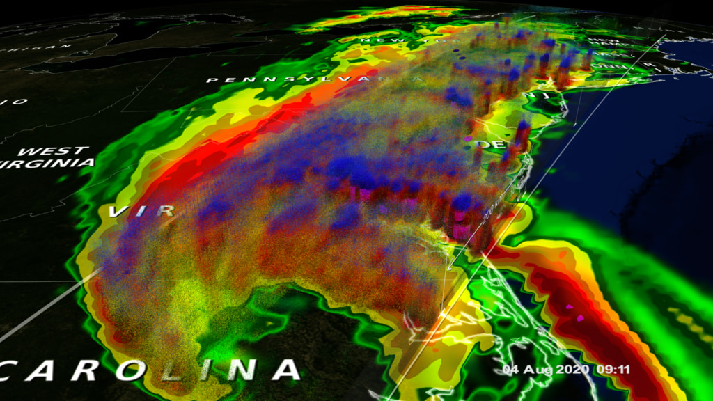
After regaining hurricane intensity over the Gulf Stream, Hurricane Isaias made landfall on the south coast of North Carolina on Monday August 3rd at 11:10 pm EDT near Ocean Isle Beach. This animation shows Isaias as is makes its way northward from the Bahamas to the coast of North Carolina using NASA’s IMERG rainfall product. With IMERG, precipitation estimates from the GPM core satellite are used to calibrate precipitation estimates from microwave and IR sensors on other satellites to produce half-hourly precipitation maps at 0.1-degree horizontal resolution. After making landfall, Isaias continued tracking northward over eastern North Carolina in response to a large upper-level trough located over the eastern half of the US.
For More Information
See NASA.gov
Credits
Please give credit for this item to:
NASA's Goddard Space Flight Center
-
Producer
- Ryan Fitzgibbons (USRA)
-
Technical support
- Aaron E. Lepsch (ADNET Systems, Inc.)
-
Writer
- Stephen Lang (NASA/GSFC)
-
Scientists
- George Huffman (NASA/GSFC)
- Scott Braun (NASA/GSFC)
- B. Jason West (ADNET Systems, Inc.)
-
Visualizer
- Alex Kekesi (Global Science and Technology, Inc.)
Release date
This page was originally published on Wednesday, August 5, 2020.
This page was last updated on Wednesday, May 3, 2023 at 1:44 PM EDT.
Sources
- ID: 4847
 Visualization
 - ID: 4846