Planets and Moons
ID: 4883
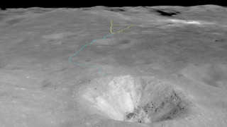
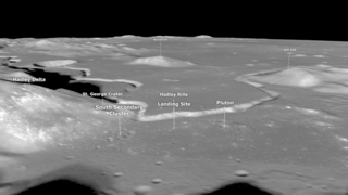
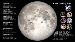
Apollo 14 landed on the Moon a little after 3:00 a.m. Houston time on February 5, 1971. The landing site in the Fra Mauro highlands had originally been the destination of Apollo 13 ten months earlier. The site is on the edge of a debris field created by the impact that formed Cone crater, 330 meters in diameter and about 1.5 kilometers away.
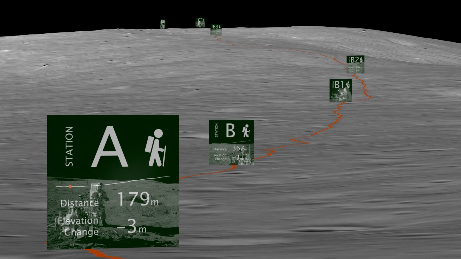
On their second moonwalk, astronauts Alan Shepard and Edgar Mitchell hiked toward the crater, collecting samples of crater ejecta along the way. In theory, rocks blasted from the impact that lay closer to the crater were from deeper beneath the surface, creating a sequence that sampled the lunar crust down to the depth of the crater. But navigating to the crater was difficult. It was on the far side of a fairly steep incline and was never visible to the astronauts as they walked toward it, and they struggled to match features on their map with what they saw on the ground.
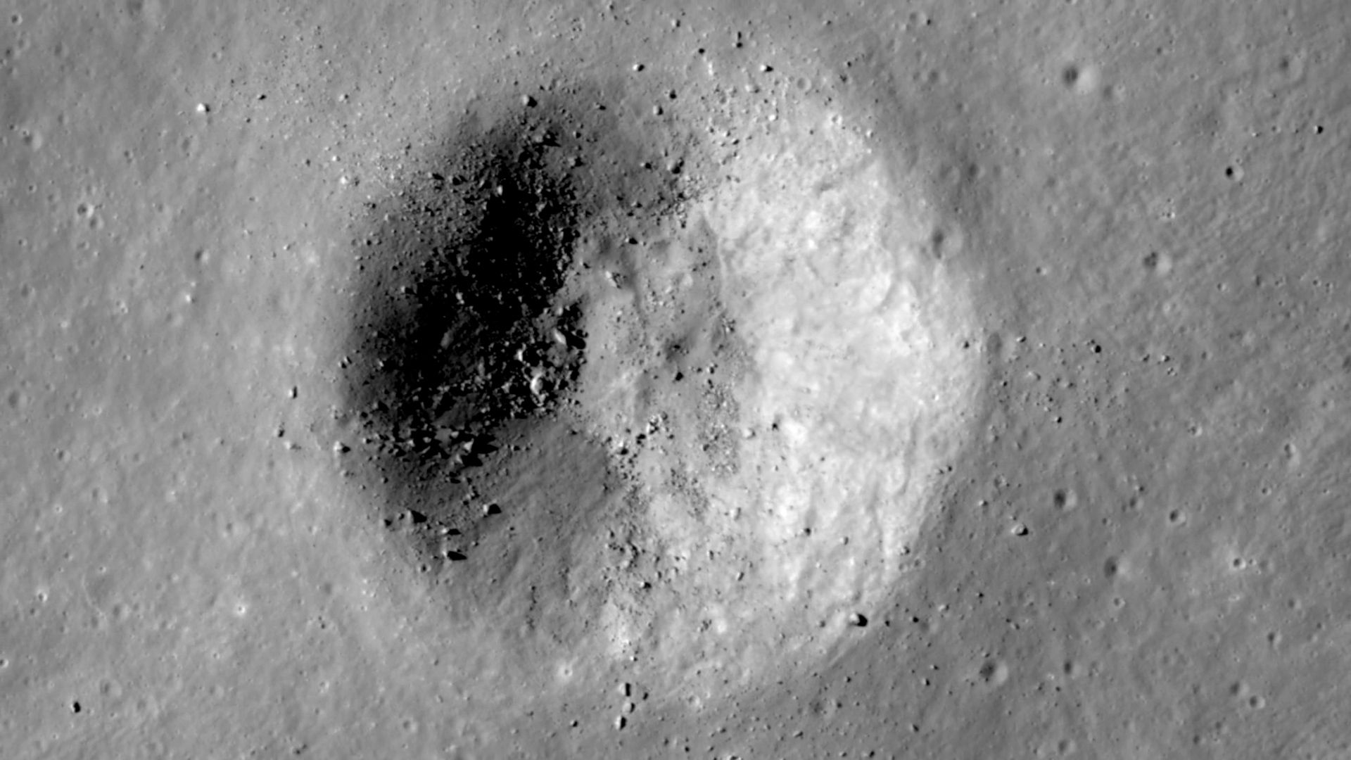
Images of the site from the Narrow Angle Camera on Lunar Reconnaissance Orbiter record the path of the astronauts as a clearly visible trail of darker, disturbed regolith. Although they didn't know it at the time, Shepard and Mitchell came within 40 meters (135 feet) of the rim of Cone crater, close enough to collect some of the deepest ejecta, but not close enough to actually see the crater itself.
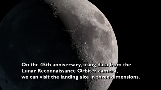
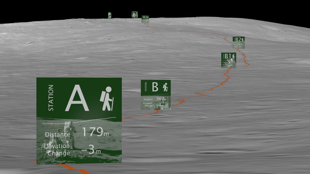
This visualization uses LRO images and elevation data to recreate EVA 2, the hike to Cone crater. The camera flies near the ground, along the outbound path taken by the astronauts. Stops along the way are labeled with distance and elevation information. The journey ends by showing how close the astronauts came to a spectacular view of the crater.
Apollo 14 Hike To Cone Crater
On their second moonwalk, astronauts Alan Shepard and Edgar Mitchell hiked toward the crater, collecting samples of crater ejecta along the way. In theory, rocks blasted from the impact that lay closer to the crater were from deeper beneath the surface, creating a sequence that sampled the lunar crust down to the depth of the crater. But navigating to the crater was difficult. It was on the far side of a fairly steep incline and was never visible to the astronauts as they walked toward it, and they struggled to match features on their map with what they saw on the ground.
Images of the site from the Narrow Angle Camera on Lunar Reconnaissance Orbiter record the path of the astronauts as a clearly visible trail of darker, disturbed regolith. Although they didn't know it at the time, Shepard and Mitchell came within 40 meters (135 feet) of the rim of Cone crater, close enough to collect some of the deepest ejecta, but not close enough to actually see the crater itself.
This visualization uses LRO images and elevation data to recreate EVA 2, the hike to Cone crater. The camera flies near the ground, along the outbound path taken by the astronauts. Stops along the way are labeled with distance and elevation information. The journey ends by showing how close the astronauts came to a spectacular view of the crater.
Related
Visualization Credits
Ernie Wright (USRA):
Lead Visualizer
David Ladd (USRA):
Lead Producer
Lead Video Editor
Lead Narration
Noah Petro (NASA/GSFC):
Lead Scientist
Laurence Schuler (ADNET Systems, Inc.):
Technical Support
Ian Jones (ADNET Systems, Inc.):
Technical Support
Lead Visualizer
David Ladd (USRA):
Lead Producer
Lead Video Editor
Lead Narration
Noah Petro (NASA/GSFC):
Lead Scientist
Laurence Schuler (ADNET Systems, Inc.):
Technical Support
Ian Jones (ADNET Systems, Inc.):
Technical Support
Please give credit for this item to:
NASA's Scientific Visualization Studio
NASA's Scientific Visualization Studio
Short URL to share this page:
https://svs.gsfc.nasa.gov/4883
Missions:
Apollo
LRO (Lunar Reconnaissance Orbiter)
Data Used:
Note: While we identify the data sets used in these visualizations, we do not store any further details nor the data sets themselves on our site.
This item is part of this series:
The Moon
Keywords:
SVS >> HDTV
SVS >> Landing Site
SVS >> Lunar
SVS >> Moon
SVS >> LRO
SVS >> Lunar Reconnaissance Orbiter
SVS >> LROC
SVS >> Apollo Missions
SVS >> Lunar Surface
SVS >> Lunar Topography
SVS >> Lunar Elevation Map
SVS >> Apollo 14
NASA Science >> Planets and Moons
https://svs.gsfc.nasa.gov/4883
Missions:
Apollo
LRO (Lunar Reconnaissance Orbiter)
Data Used:
LRO/LROC/Narrow Angle Camera also referred to as: NAC
2011-01-25LRO/LROC NAC/Stereo DEM
Model - 2013-09-05This item is part of this series:
The Moon
Keywords:
SVS >> HDTV
SVS >> Landing Site
SVS >> Lunar
SVS >> Moon
SVS >> LRO
SVS >> Lunar Reconnaissance Orbiter
SVS >> LROC
SVS >> Apollo Missions
SVS >> Lunar Surface
SVS >> Lunar Topography
SVS >> Lunar Elevation Map
SVS >> Apollo 14
NASA Science >> Planets and Moons


