Earth
ID: 4478
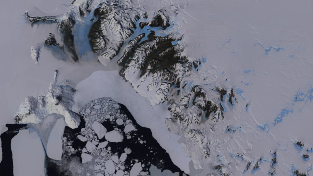
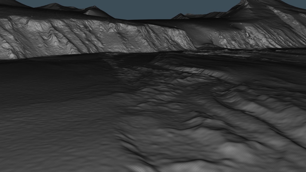
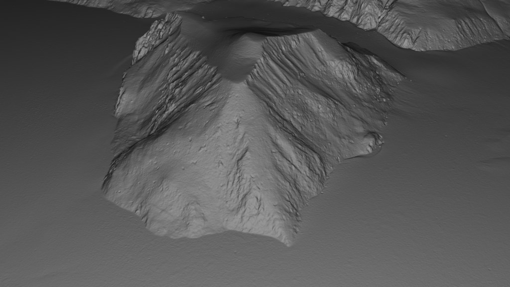
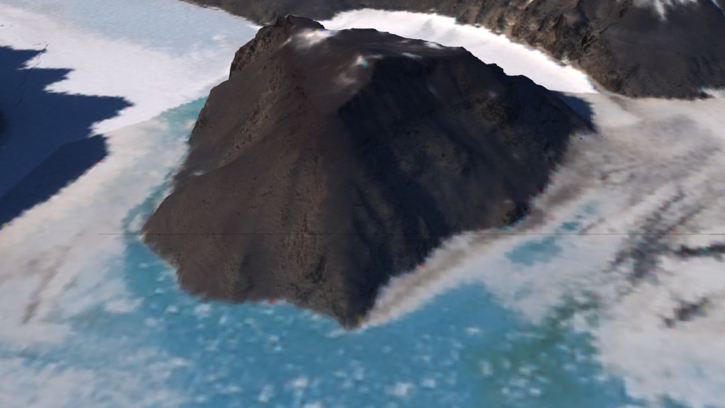
The Reference Elevation Model of Antarctica (REMA) provides the first, high resolution (8-meter) terrain map of nearly the entire continent.
REMA is constructed from hundreds of thousands of individual stereoscopic Digital Elevation Models (DEM) extracted from pairs of submeter (0.32 to 0.5 m) resolution DigitalGlobe satellite imagery, including data from WorldView-1, WorldView-2, and WorldView-3, and a small number from GeoEye-1, acquired between 2009 and 2017, with most collected in 2015 and 2016, over the austral summer seasons (mostly December to March).
Each individual DEM was vertically registered to satellite altimetry measurements from Cryosat-2 and ICESat, resulting in absolute uncertainties of less than 1 m over most of its area, and relative uncertainties of decimeters.
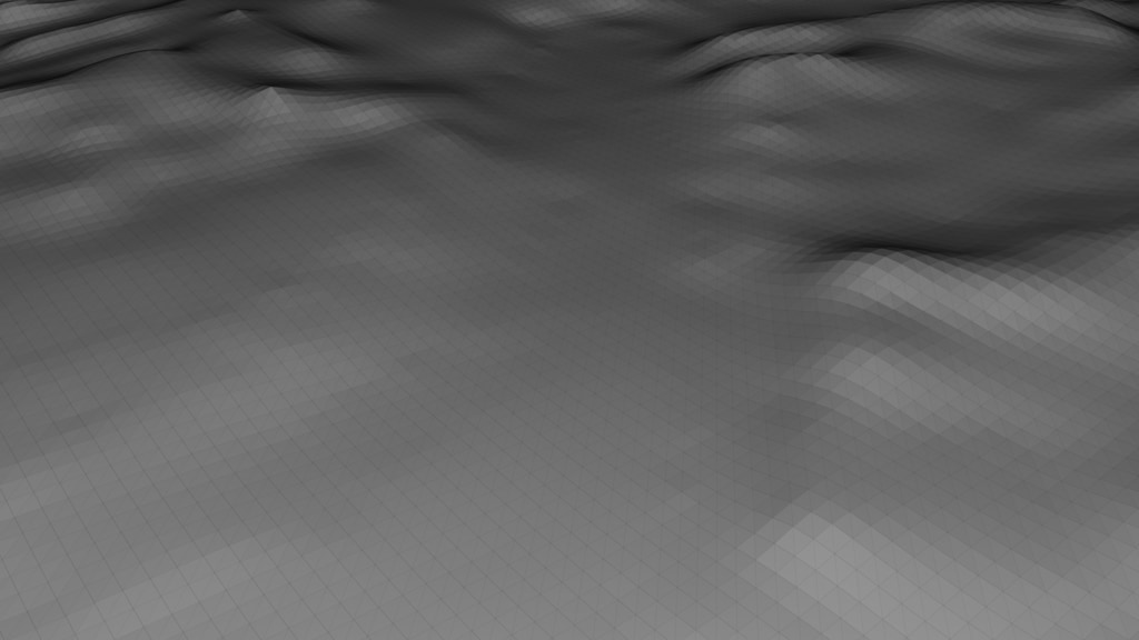
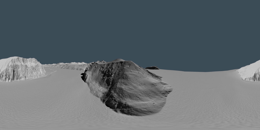
This visualization compares the spatial resolution of REMA with DEM data from RADARSAT.

The Reference Elevation Model of Antarctica (REMA)
REMA is constructed from hundreds of thousands of individual stereoscopic Digital Elevation Models (DEM) extracted from pairs of submeter (0.32 to 0.5 m) resolution DigitalGlobe satellite imagery, including data from WorldView-1, WorldView-2, and WorldView-3, and a small number from GeoEye-1, acquired between 2009 and 2017, with most collected in 2015 and 2016, over the austral summer seasons (mostly December to March).
Each individual DEM was vertically registered to satellite altimetry measurements from Cryosat-2 and ICESat, resulting in absolute uncertainties of less than 1 m over most of its area, and relative uncertainties of decimeters.
This visualization compares the spatial resolution of REMA with DEM data from RADARSAT.
Used Elsewhere In
Visualization Credits
Kel Elkins (USRA): Lead Visualizer
Greg Shirah (NASA/GSFC): Visualizer
Lori Perkins (NASA/GSFC): Visualizer
Paul Morin (University of Minnesota): Scientist
Greg Shirah (NASA/GSFC): Visualizer
Lori Perkins (NASA/GSFC): Visualizer
Paul Morin (University of Minnesota): Scientist
Please give credit for this item to:
NASA's Scientific Visualization Studio
NASA's Scientific Visualization Studio
Short URL to share this page:
https://svs.gsfc.nasa.gov/4478
Data Used:
Note: While we identify the data sets used in these visualizations, we do not store any further details nor the data sets themselves on our site.
Keywords:
SVS >> Antarctic
GCMD >> Earth Science >> Land Surface >> Topography >> Terrain Elevation
SVS >> Hyperwall
NASA Science >> Earth
SVS >> 360
GCMD keywords can be found on the Internet with the following citation: Olsen, L.M., G. Major, K. Shein, J. Scialdone, S. Ritz, T. Stevens, M. Morahan, A. Aleman, R. Vogel, S. Leicester, H. Weir, M. Meaux, S. Grebas, C.Solomon, M. Holland, T. Northcutt, R. A. Restrepo, R. Bilodeau, 2013. NASA/Global Change Master Directory (GCMD) Earth Science Keywords. Version 8.0.0.0.0
https://svs.gsfc.nasa.gov/4478
Data Used:
Reference Elevation Model of Antarctica - 8m also referred to as: REMA
Data Compilation - The Polar Geospatial Center (PGC)
High resolution, time-stamped Digital Surface Model (DSM) of Antarctica at 8-meter spatial resolution
Credit:
DEMs provided by the Byrd Polar and Climate Research Center and the Polar Geospatial. Computer time provided through a Blue Waters Innovation Initiative. DEMs produced using data from DigitalGlobe, Inc.
DEMs provided by the Byrd Polar and Climate Research Center and the Polar Geospatial. Computer time provided through a Blue Waters Innovation Initiative. DEMs produced using data from DigitalGlobe, Inc.
Keywords:
SVS >> Antarctic
GCMD >> Earth Science >> Land Surface >> Topography >> Terrain Elevation
SVS >> Hyperwall
NASA Science >> Earth
SVS >> 360
GCMD keywords can be found on the Internet with the following citation: Olsen, L.M., G. Major, K. Shein, J. Scialdone, S. Ritz, T. Stevens, M. Morahan, A. Aleman, R. Vogel, S. Leicester, H. Weir, M. Meaux, S. Grebas, C.Solomon, M. Holland, T. Northcutt, R. A. Restrepo, R. Bilodeau, 2013. NASA/Global Change Master Directory (GCMD) Earth Science Keywords. Version 8.0.0.0.0


