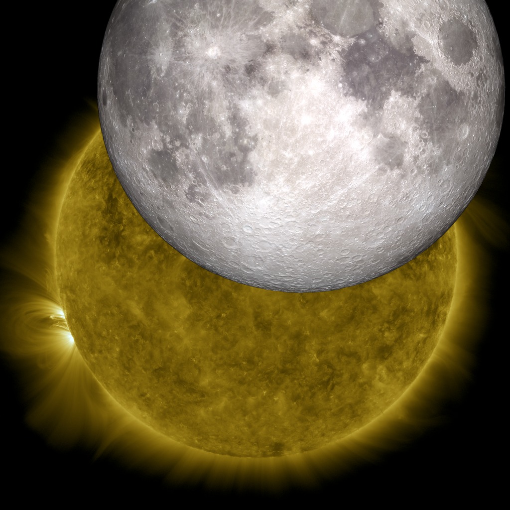
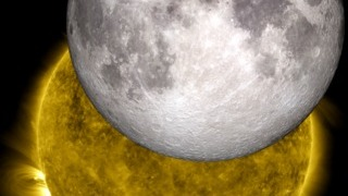
Lunar Transit from Solar Dynamics Observatory (2010)
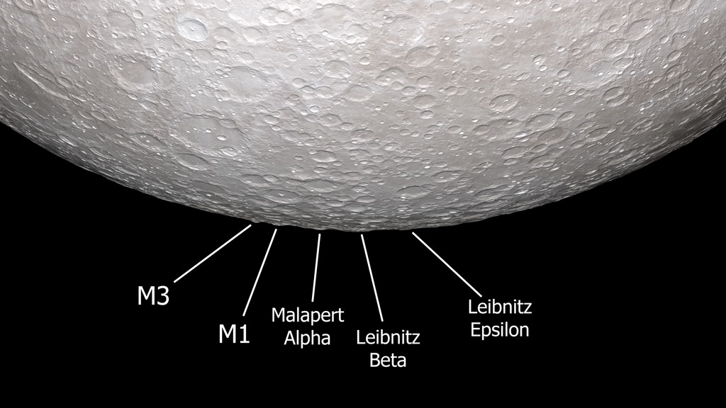
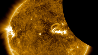
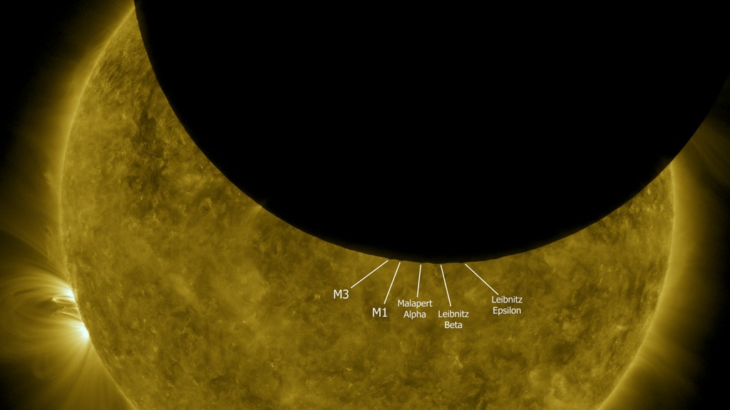
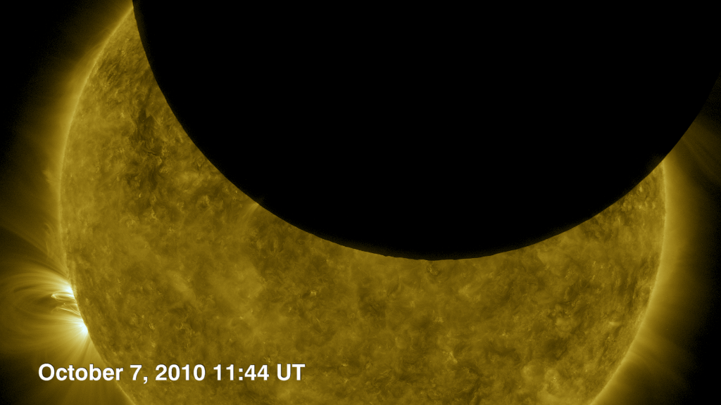
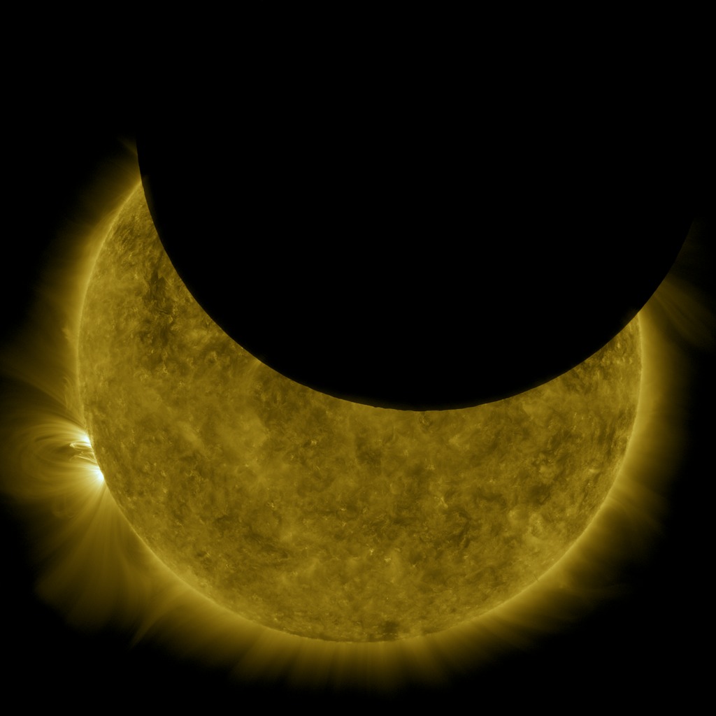
Just as we do on Earth, the Solar Dynamics Observatory satellite periodically crosses the Moon's shadow and experiences a solar eclipse. During the eclipse witnessed by SDO on October 7, 2010, the southern hemisphere of the Moon was silhouetted against the solar disk, revealing some especially prominent mountain peaks near the Moon's south pole. By using elevation data from Lunar Reconnaissance Orbiter to visualize the Moon from SDO's point of view, it's possible to identify these peaks. Although all of these are well-known features, all but one of them have no official names. The following list corresponds to the labels in the animation, from left to right.
- In his 1954 sketch of the lunar south pole, astronomer Ewen Whitaker labeled this feature "M3." It's a mountain about halfway between the craters Cabeus and Drygalski, at 83.2°S 68°W.
- Whitaker's "M1," a mountain on the northern rim of Cabeus, 83.4°S 33°W.
- A mountain on the southern rim of Malapert crater, about halfway between the centers of Malapert and Haworth. Whitaker labels this Malapert Alpha. It's also known as Mons Malapert or Malapert Peak. 85.8°S 0°E.
- Labeled Leibnitz Beta by Whitaker and now officially named Mons Mouton, this is part of the highlands adjacent to the northern rim of Nobile crater. 84°S 37°E. Part of the Leibnitz mountain range first identified by Johann Schröter in the late 1700s, unrelated to Leibnitz Crater on the lunar far side.
- A mountain near Amundsen crater, on the western (Earthward) rim of Hédervári crater, 82.2°S 75°E. Whitaker tentatively labels this Leibnitz Epsilon in his sketch.
The Moon visualization uses the latest albedo and elevation maps from Lunar Reconnaissance Orbiter (LRO).
Related
For More Information
Visualization Credits
Tom Bridgman (Global Science and Technology, Inc.): Animator
Scott Wiessinger (USRA): Producer
NASA's Goddard Space Flight Center Scientific Visualization Studio
https://svs.gsfc.nasa.gov/4075
Missions:
LRO (Lunar Reconnaissance Orbiter)
SDO
Data Used:
JPL DE421 also referred to as: DE421
Ephemeris - NASA/JPLLRO/LOLA/Digital Elevation Map also referred to as: DEM
SDO/AIA/171 Filter also referred to as: AIA 171
JOINT SCIENCE OPERATIONS CENTER - 2010-10-07T11:40 to 2010-10-07T11:50Keywords:
SVS >> HDTV
SVS >> Laser Altimeter
SVS >> Lunar
SVS >> Moon
SVS >> Transit
GCMD >> Earth Science >> Sun-earth Interactions >> Solar Activity >> Solar Ultraviolet
SVS >> Hyperwall
SVS >> SDO
SVS >> Solar Dynamics Observatory
SVS >> LRO
SVS >> Lunar Reconnaissance Orbiter
SVS >> LOLA
SVS >> LROC
SVS >> Lunar Surface
SVS >> Corona
SVS >> Lunar Topography
SVS >> Lunar Elevation Map
NASA Science >> Sun
NASA Science >> Planets and Moons
SVS >> Extreme Ultraviolet Imaging
SVS >> EUV Imaging
GCMD keywords can be found on the Internet with the following citation: Olsen, L.M., G. Major, K. Shein, J. Scialdone, S. Ritz, T. Stevens, M. Morahan, A. Aleman, R. Vogel, S. Leicester, H. Weir, M. Meaux, S. Grebas, C.Solomon, M. Holland, T. Northcutt, R. A. Restrepo, R. Bilodeau, 2013. NASA/Global Change Master Directory (GCMD) Earth Science Keywords. Version 8.0.0.0.0


