Global Hawk Takes High Altitude Imaging Wind and Rain Airborne Profiler (HIWRAP) Data
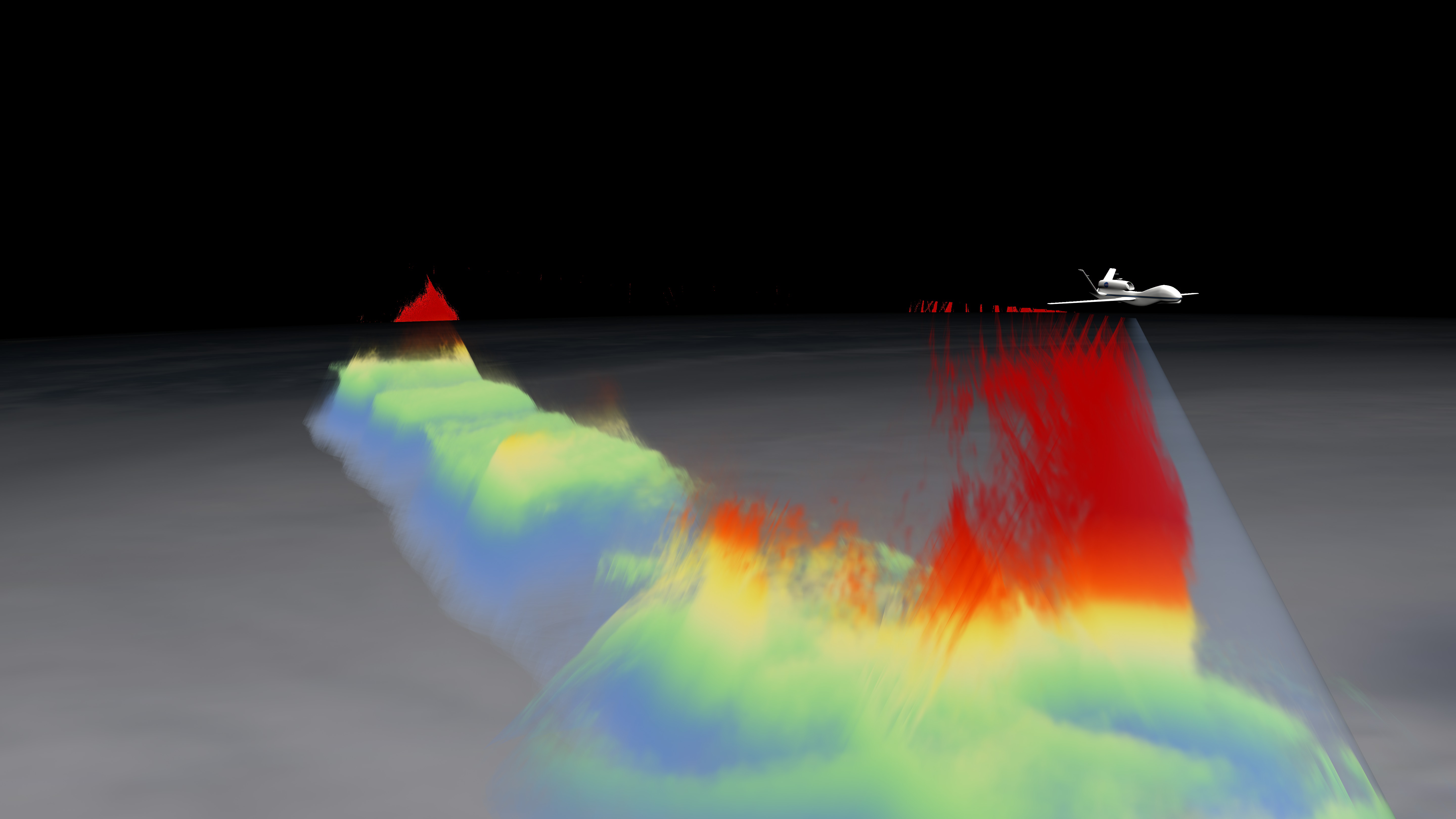
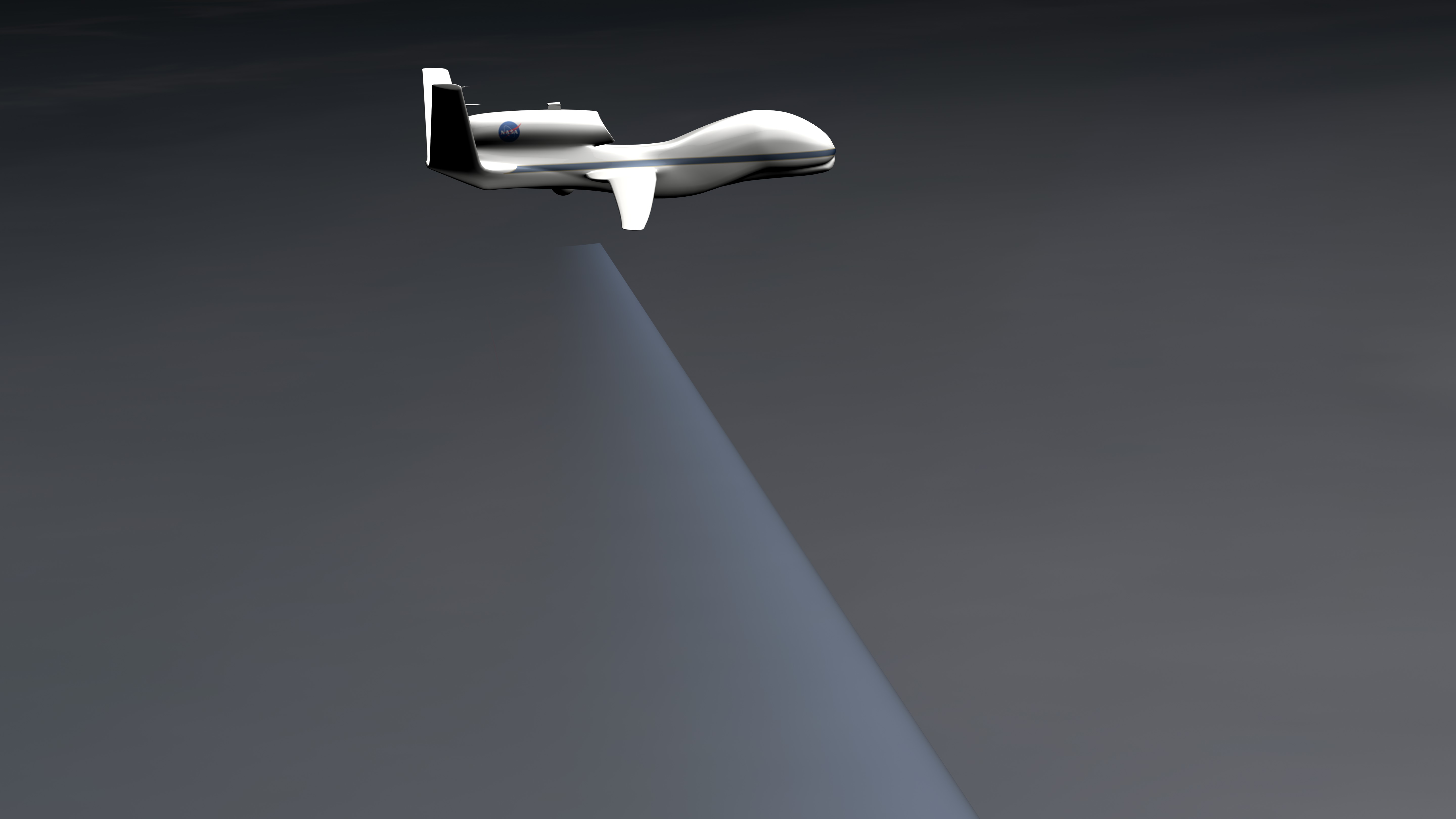
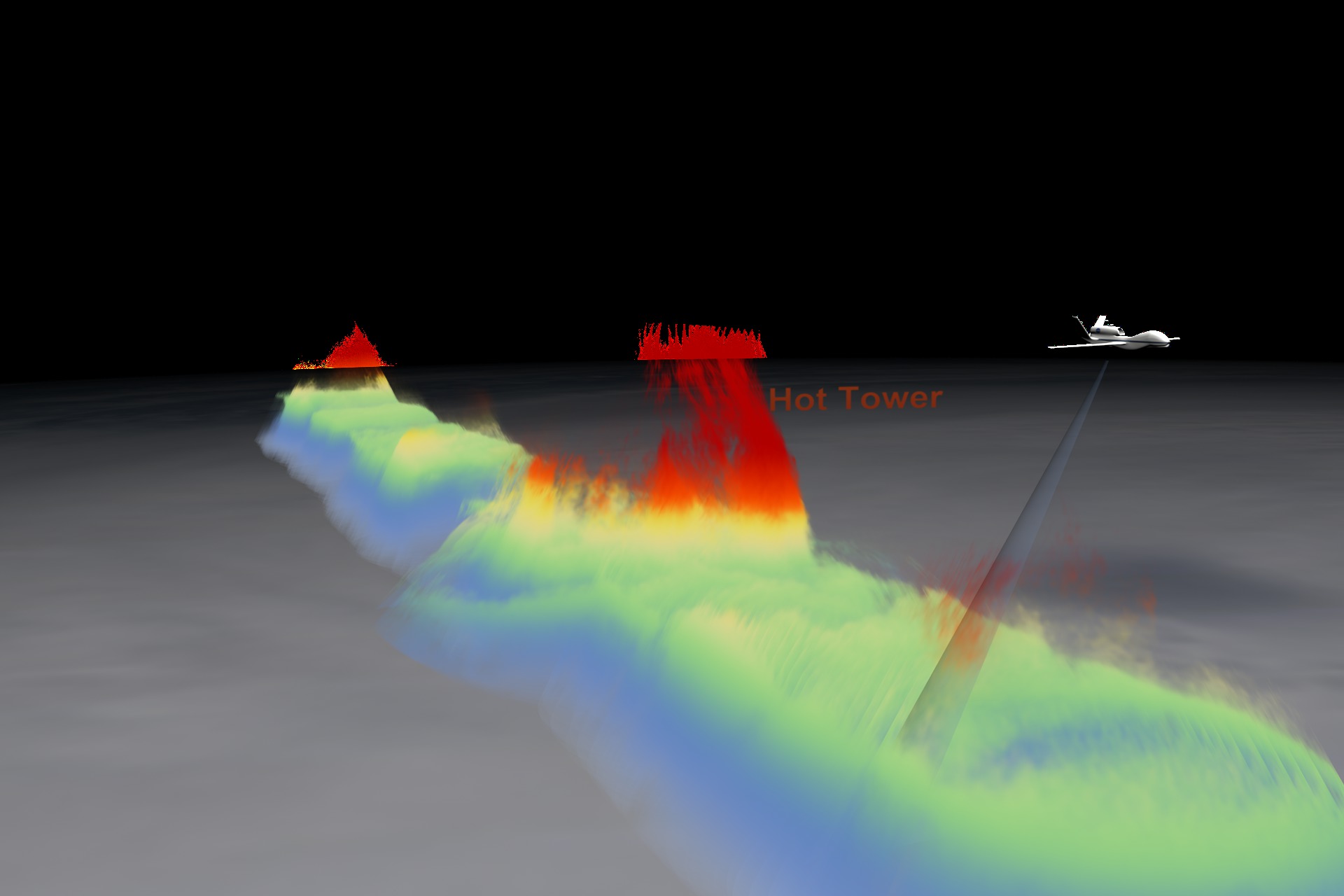
The dimensions of the Global Hawk were exaggerated by a factor of 10 so the viewer could see the UAV. The Global Hawk actual dimensions are 44.4 ft (13.5 m) length by 116.2 ft. (35.4 m) wingspan by 15.2 ft (4.6 m) height. The movie starts as the Global Hawk flies over Hurricane Karl to reveal a hot tower. Hot towers are important to understanding hurricane intensification because they can carry hot moist air through the high layer of cirrus clouds above a hurricane. Hot towers are hard to study because they go so high and they do not last very long. The structure of this storm is seen through reflectivity data where dbz is between 25 and 40. The HIWRAP data is colored based on the height from the surface. Red shows 12 km above sea level, orange is 10 km, yellow is 7.5 km, green is 6 km, and blue is under 6 km.
For more information on GRIP and other elements of NASA's Hurricane and Severe Storm Sentinel project, visit http://www.nasa.gov/HS3.
Related


Visualization Credits
Horace Mitchell (NASA/GSFC): Animator
Greg Shirah (NASA/GSFC): Animator
Jefferson Beck (USRA): Producer
Gerald Heymsfield (NASA/GSFC): Scientist
Stephen R. Guimond (University of Maryland): Scientist
Scott Braun (NASA/GSFC): Scientist
Matthew McLinden (NASA/GSFC): Project Support
Scott Hanger: Project Support
NASA/Goddard Space Flight Center
Scientific Visualization Studio
https://svs.gsfc.nasa.gov/4036
Data Used:
Global Hawk UAV/HIWRAP/GRIP High Altitude Imaging Wind and Rain Airborne Profiler (HIWRAP)
Observed Data - KU band Sep16 hour 18:53:10 through Sep 17 hour 06:29:01This item is part of this series:
GRIP Airborne Field Campaign
Keywords:
DLESE >> Atmospheric science
DLESE >> Natural hazards
GCMD >> Earth Science >> Atmosphere >> Atmospheric Phenomena >> Hurricanes
SVS >> Hyperwall
SVS >> Hurricane Intensity
NASA Science >> Earth
GCMD keywords can be found on the Internet with the following citation: Olsen, L.M., G. Major, K. Shein, J. Scialdone, S. Ritz, T. Stevens, M. Morahan, A. Aleman, R. Vogel, S. Leicester, H. Weir, M. Meaux, S. Grebas, C.Solomon, M. Holland, T. Northcutt, R. A. Restrepo, R. Bilodeau, 2013. NASA/Global Change Master Directory (GCMD) Earth Science Keywords. Version 8.0.0.0.0


