Earth
ID: 13417
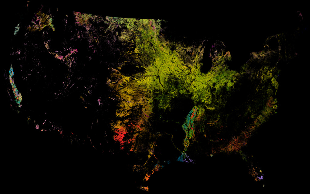
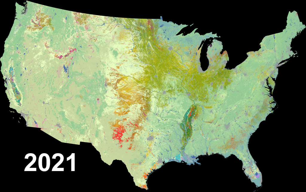
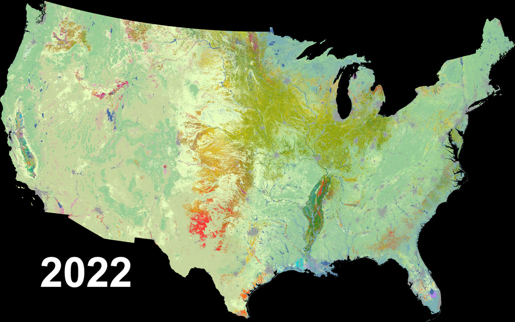
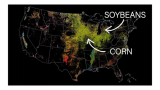
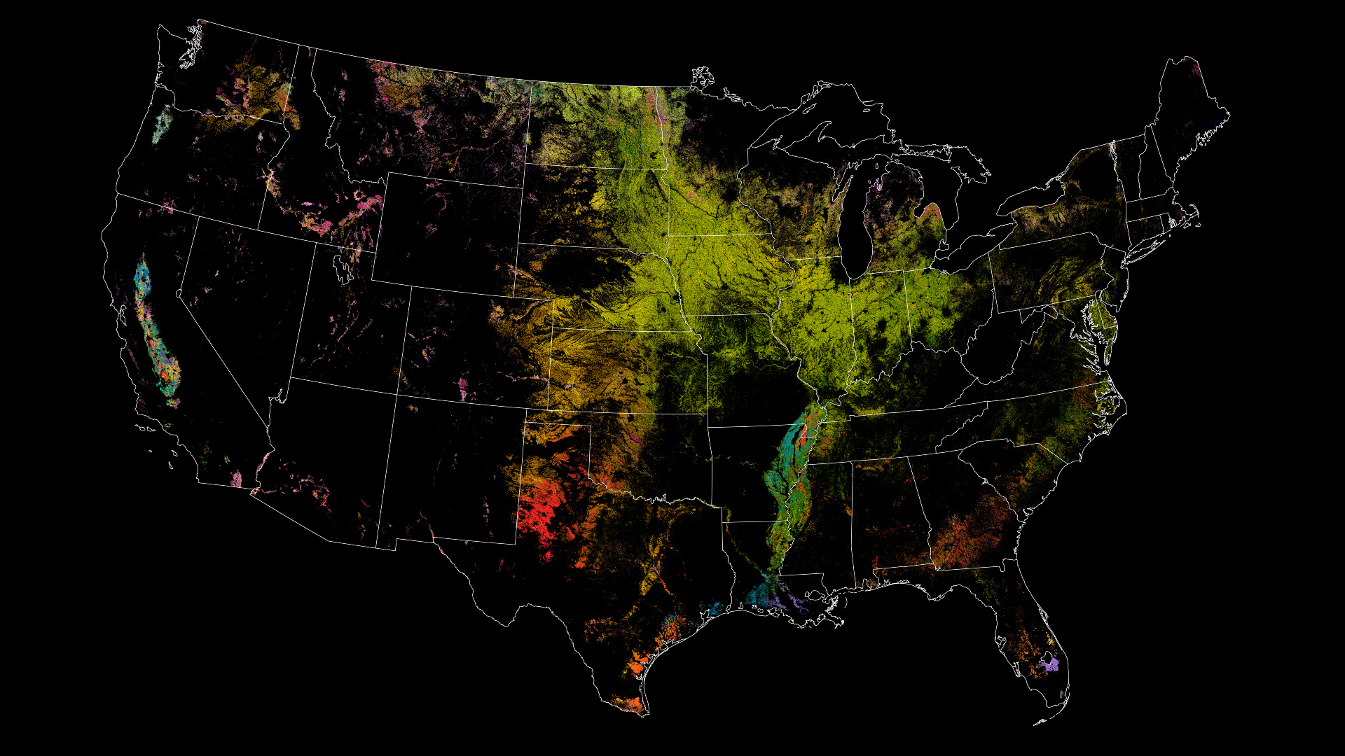
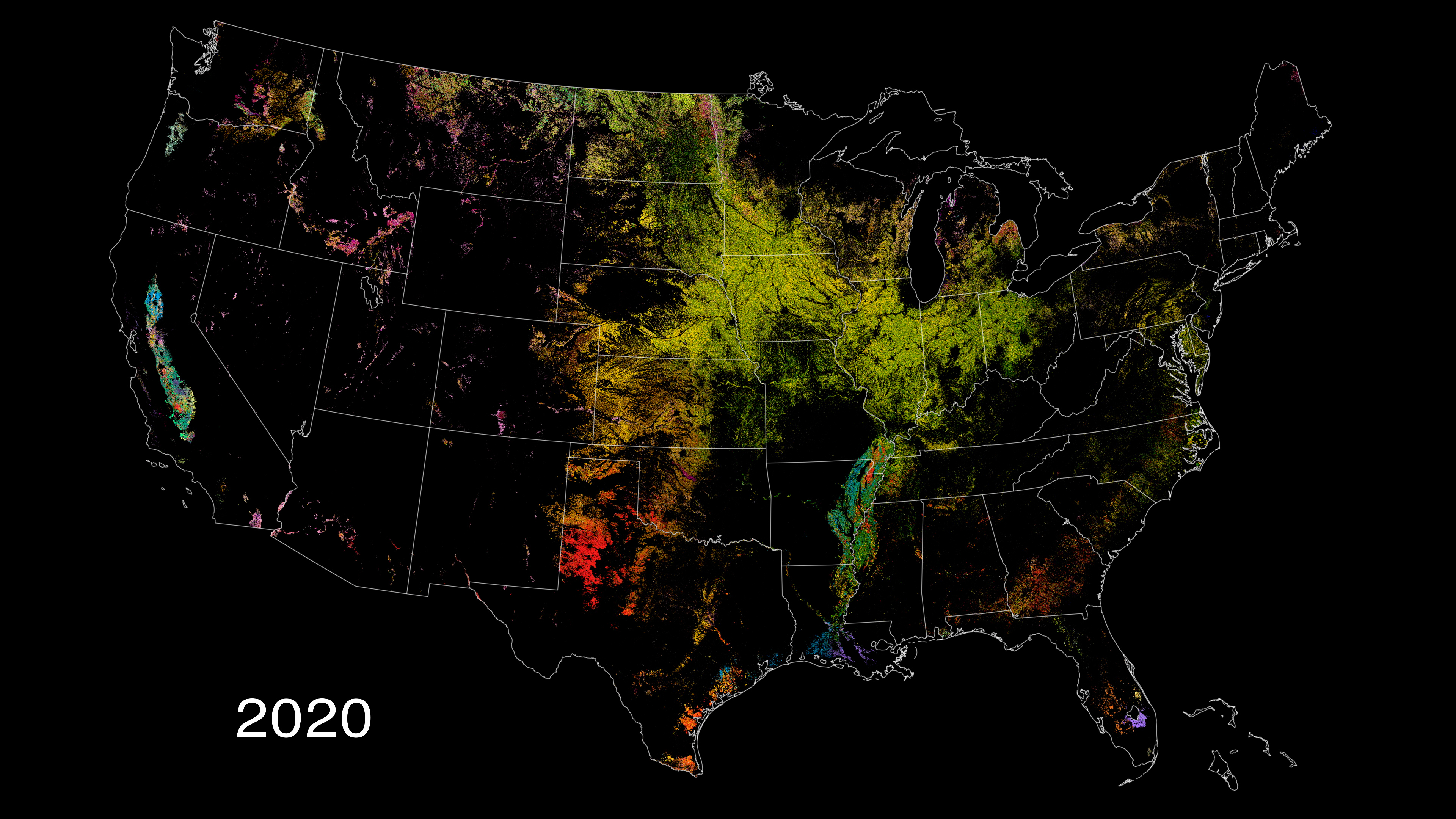
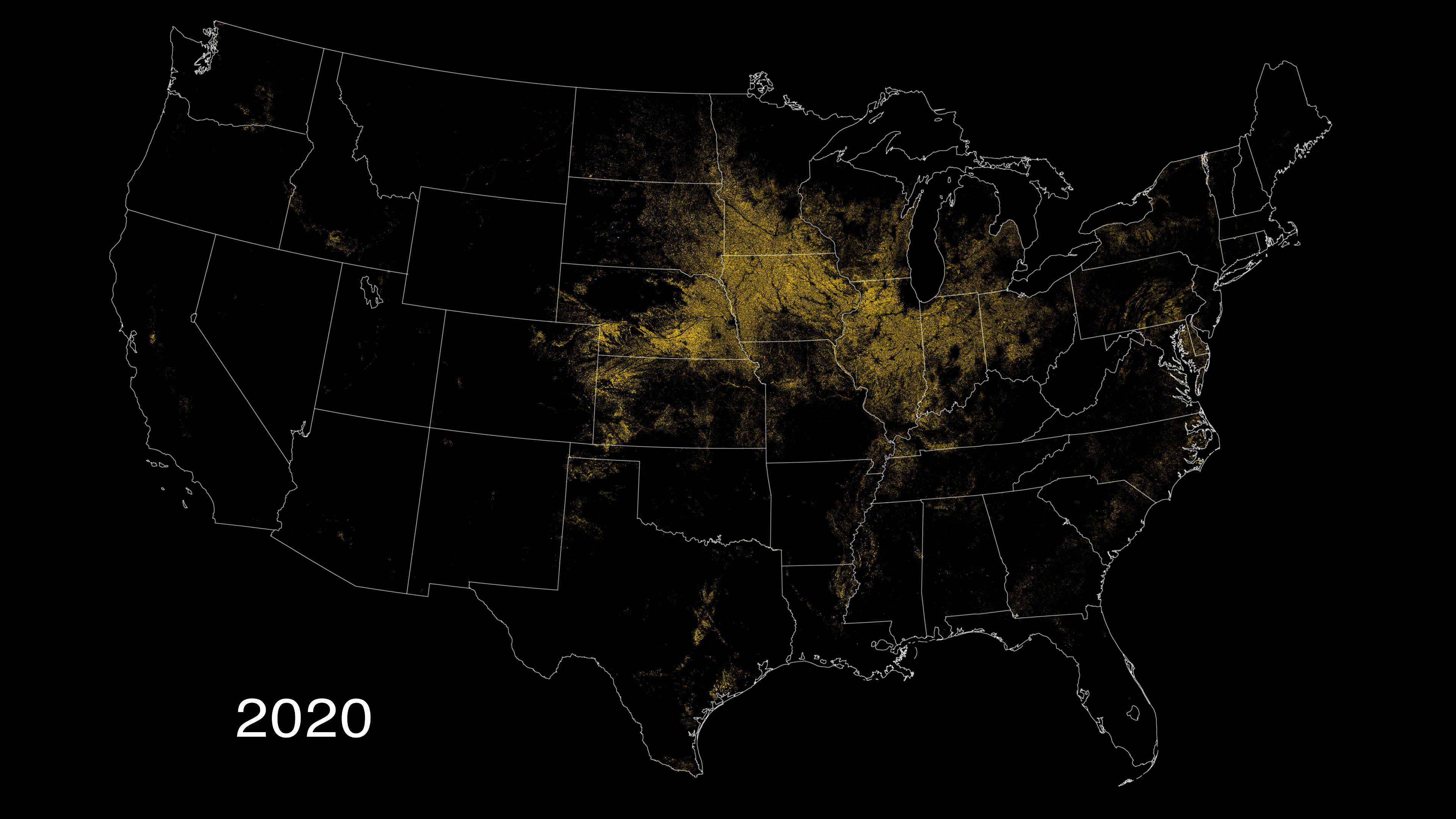
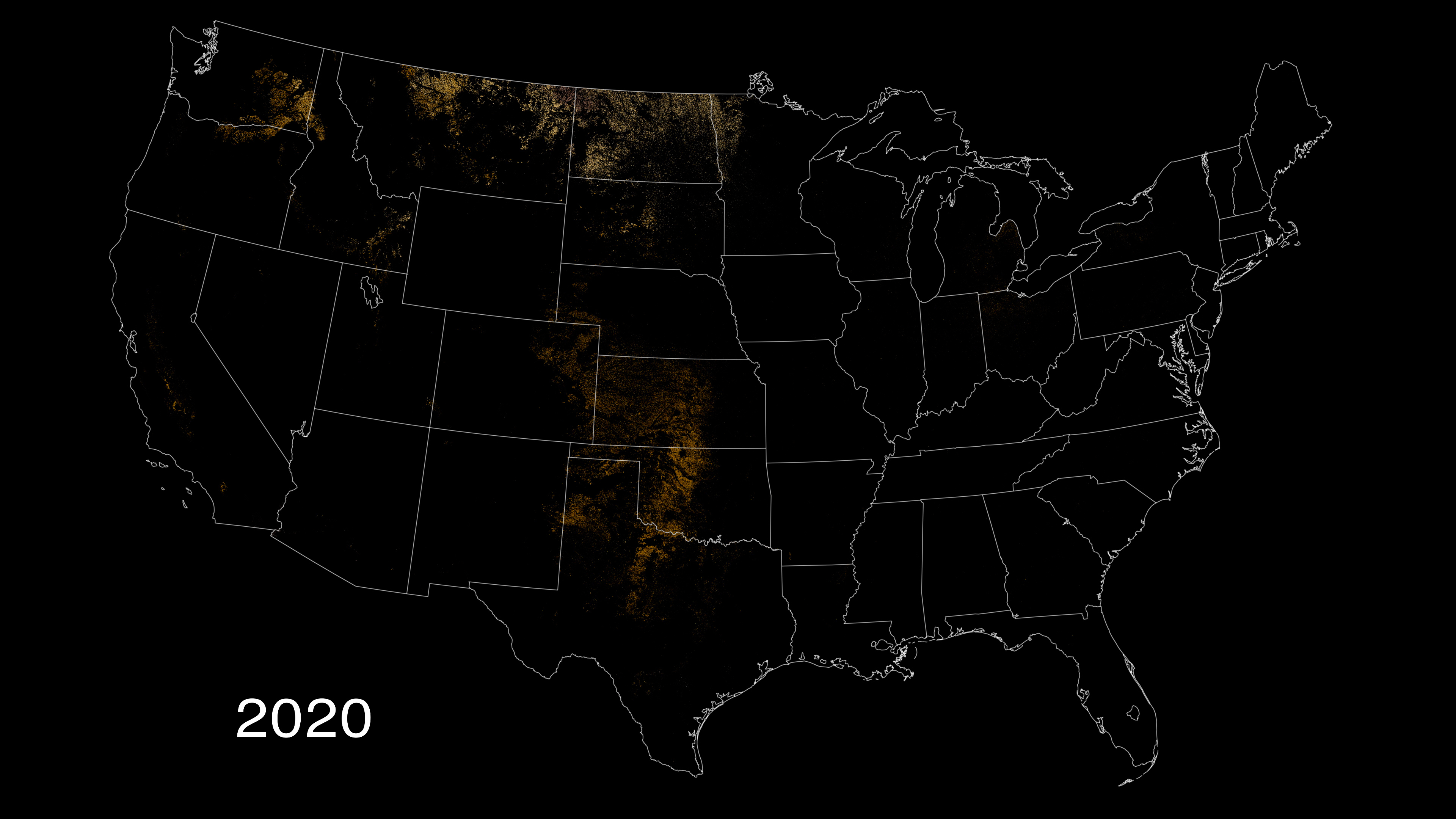
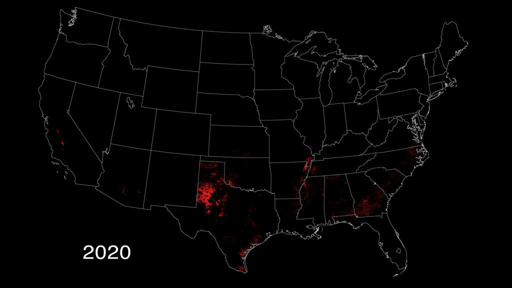
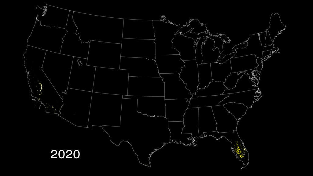
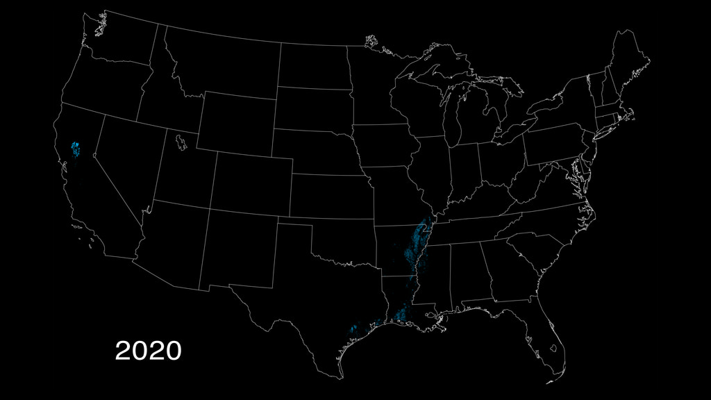
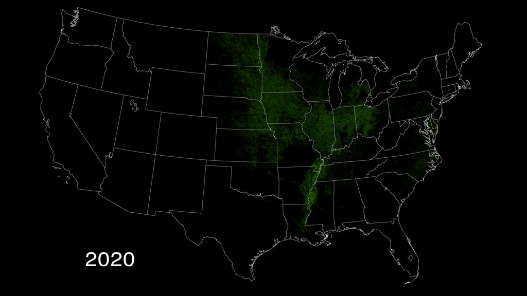
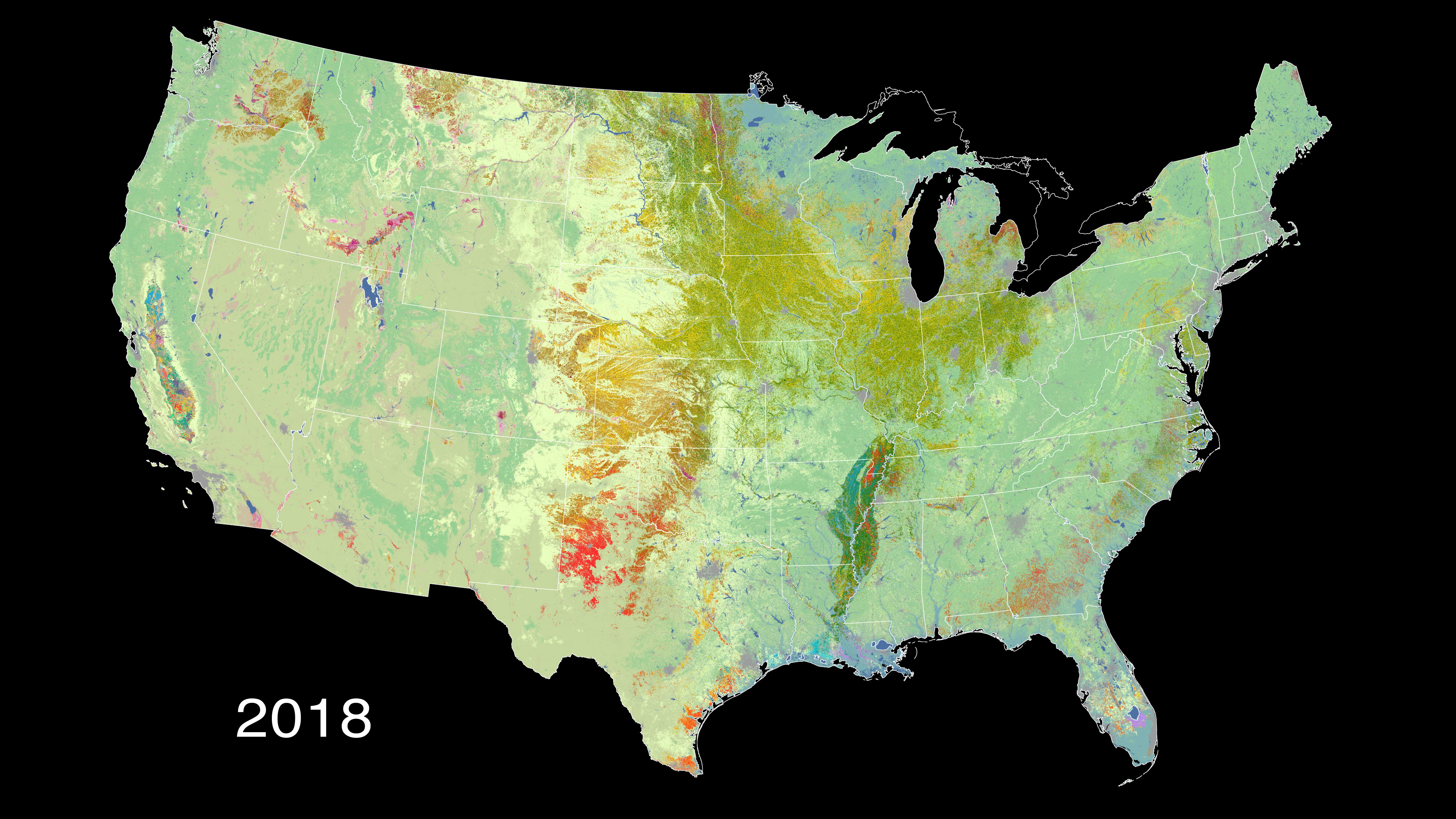
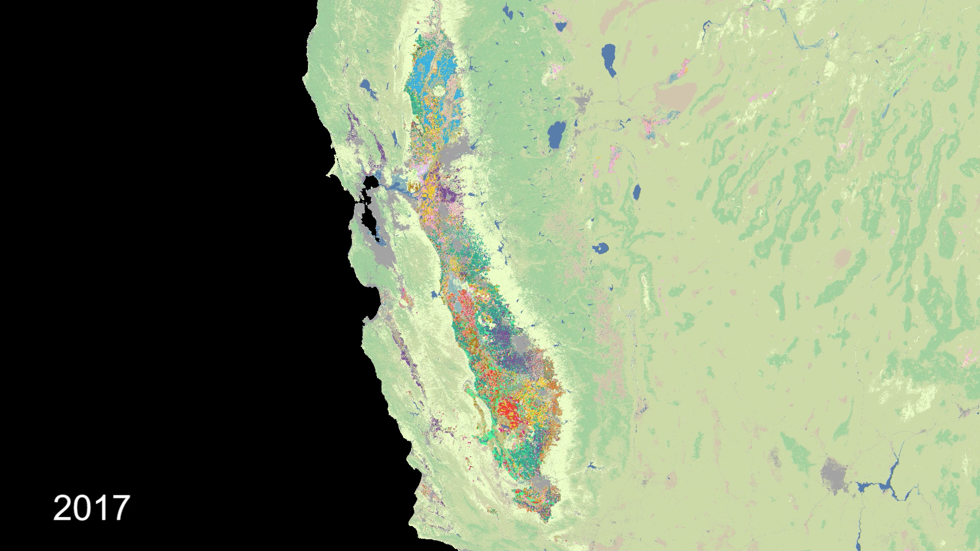
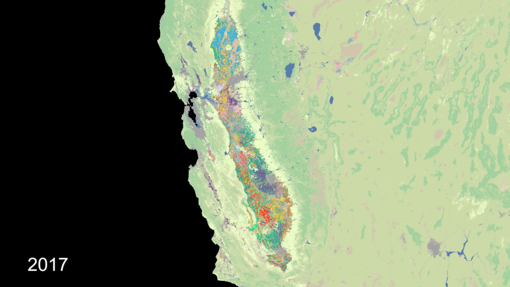
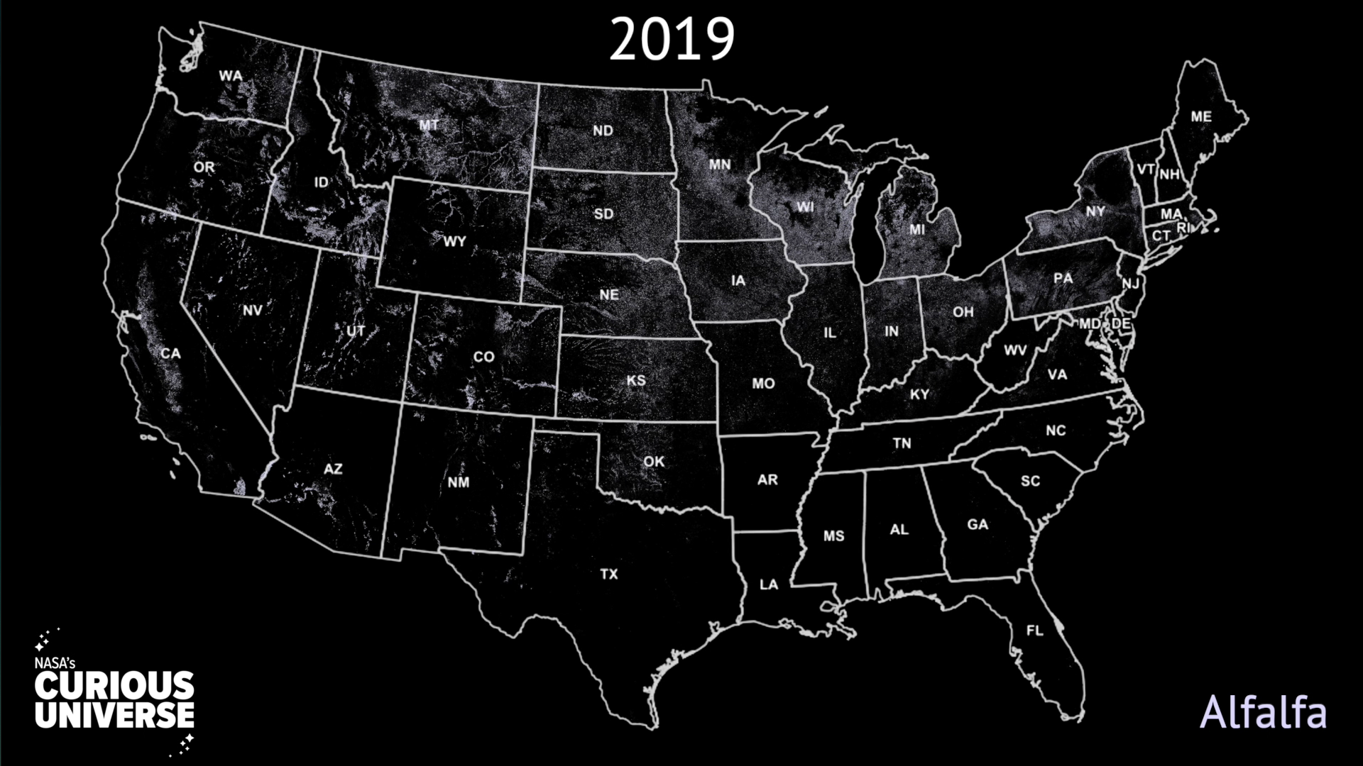
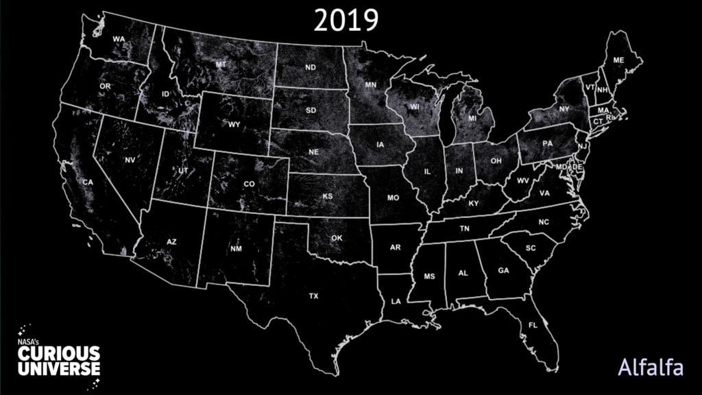
Since 2009, the USDA's National Agricultural Statistics Service, or NASS, has drawn on Landsat data to monitor dozens of crops in the lower 48 states as part of NASS's Cropland Data Layer program. The Cropland Data layer uses Landsat and similar sensors to identify what crop is growing where in the country. Separately, NASS uses NASA's Moderate Resolution Imaging Spectroradiometer (MODIS) instruments aboard the Aqua and Terra satellites to monitor daily vegetation health and growth stage, all indicators of crop yield.
“Landsat has been one of the only ways we can directly measure the global food supply,” said Brad Doorn, program manager for NASA's Applied Sciences Water Resources and Agriculture Research at NASA Headquarters in Washington, D.C. However, “It's not all satellites,” Mueller said.
During a typical farming year, NASS relies heavily on their ground observations and surveys data. Across the country, NASS field officials visit farms, and measure acreage and condition of planted fields throughout the growing season. NASS also receives crop acreage data from the Farm Service Agency (FSA). Farmers are required to self-report crop acreage and land use information to FSA annually. FSA uses the data to determine payment for federal programs such as crop loss due to natural disaster or financial loss from changes in market prices.
NASS will publish the final Cropland Data layer in January of the following year and makes the data available to everyone through the CropScape website. Disaster managers use the sites historic data to evaluate crop damage from this year's floods and other natural disasters. Resource managers use historic data to direct crop rotation, study land-use change, and monitor water use.

Landsat Croplands Data Overview
“Landsat has been one of the only ways we can directly measure the global food supply,” said Brad Doorn, program manager for NASA's Applied Sciences Water Resources and Agriculture Research at NASA Headquarters in Washington, D.C. However, “It's not all satellites,” Mueller said.
During a typical farming year, NASS relies heavily on their ground observations and surveys data. Across the country, NASS field officials visit farms, and measure acreage and condition of planted fields throughout the growing season. NASS also receives crop acreage data from the Farm Service Agency (FSA). Farmers are required to self-report crop acreage and land use information to FSA annually. FSA uses the data to determine payment for federal programs such as crop loss due to natural disaster or financial loss from changes in market prices.
NASS will publish the final Cropland Data layer in January of the following year and makes the data available to everyone through the CropScape website. Disaster managers use the sites historic data to evaluate crop damage from this year's floods and other natural disasters. Resource managers use historic data to direct crop rotation, study land-use change, and monitor water use.
Used Elsewhere In

For More Information
Credits
Matthew R. Radcliff (USRA): Lead Producer
Kel Elkins (USRA): Data Visualizer
Horace Mitchell (NASA/GSFC): Data Visualizer
Lori Perkins (NASA/GSFC): Lead Data Visualizer
Jessica Merzdorf (Telophase): Writer
Rani Gran (NASA/GSFC): Writer
Jefferson Beck (USRA): Narrator
David M. Johnson (USDA/NASS): Scientist
Kel Elkins (USRA): Data Visualizer
Horace Mitchell (NASA/GSFC): Data Visualizer
Lori Perkins (NASA/GSFC): Lead Data Visualizer
Jessica Merzdorf (Telophase): Writer
Rani Gran (NASA/GSFC): Writer
Jefferson Beck (USRA): Narrator
David M. Johnson (USDA/NASS): Scientist
Please give credit for this item to:
NASA's Goddard Space Flight Center.
Data from the USDA National Agricultural Statistics Service Cropland Data Layer. Available at https://nassgeodata.gmu.edu/CropScape/ (accessed Oct. 28, 2019 and January 21, 2022) USDA-NASS, Washington, DC.
NASA's Goddard Space Flight Center.
Data from the USDA National Agricultural Statistics Service Cropland Data Layer. Available at https://nassgeodata.gmu.edu/CropScape/ (accessed Oct. 28, 2019 and January 21, 2022) USDA-NASS, Washington, DC.
Short URL to share this page:
https://svs.gsfc.nasa.gov/13417
Missions:
Landsat
Landsat 7
Landsat 8
Landsat 9
This item is part of these series:
Geophysical Changes Over Time
Narrated Movies
Landsat
Keywords:
DLESE >> Agricultural science
SVS >> Croplands
GCMD >> Earth Science >> Agriculture
GCMD >> Earth Science >> Agriculture >> Agricultural Plant Science >> Crop/Plant Yields
SVS >> Biosphere >> Agriculture
NASA Science >> Earth
GCMD keywords can be found on the Internet with the following citation: Olsen, L.M., G. Major, K. Shein, J. Scialdone, S. Ritz, T. Stevens, M. Morahan, A. Aleman, R. Vogel, S. Leicester, H. Weir, M. Meaux, S. Grebas, C.Solomon, M. Holland, T. Northcutt, R. A. Restrepo, R. Bilodeau, 2013. NASA/Global Change Master Directory (GCMD) Earth Science Keywords. Version 8.0.0.0.0


