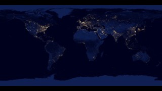
Earth
ID: 31180
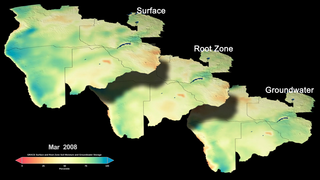
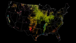
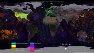
NASA satellites, data, missions, and programs have been put to use for decades to strengthen food security, track droughts and flooding, determine plant and soil health and otherwise support agriculture decision making. With observations from space and aircraft, combined with high-end computer modeling, NASA works with partner agencies, organizations, farmers, ranchers, and decision makers to share our understanding of the relationship between the Earth system and the environments that provide us food. Working with local communities and decision makers to determine their needs and how they can best use Earth observation data, NASA supports those who address issues like water management for irrigation, crop-type identification and land use, coastal and lake water quality monitoring, drought preparedness, and famine early warnings.
NASA and Agriculture: From Seeds to Satellites
NASA satellites, data, missions, and programs have been put to use for decades to strengthen food security, track droughts and flooding, determine plant and soil health and otherwise support agriculture decision making. With observations from space and aircraft, combined with high-end computer modeling, NASA works with partner agencies, organizations, farmers, ranchers, and decision makers to share our understanding of the relationship between the Earth system and the environments that provide us food. Working with local communities and decision makers to determine their needs and how they can best use Earth observation data, NASA supports those who address issues like water management for irrigation, crop-type identification and land use, coastal and lake water quality monitoring, drought preparedness, and famine early warnings.
Source Material

Credits
Kathleen Gaeta (Advocates in Manpower Management, Inc.): Lead Lead Producer
Aries Keck (ADNET Systems, Inc.): Writer
Christopher Thorne (ADNET): Writer
Aries Keck (ADNET Systems, Inc.): Writer
Christopher Thorne (ADNET): Writer
Please give credit for this item to:
NASA's Scientific Visualization Studio
NASA's Scientific Visualization Studio
Short URL to share this page:
https://svs.gsfc.nasa.gov/31180
This item is part of these series:
Narrated Movies
Agriculture Animations - Global Agricultural Monitoring
Keywords:
DLESE >> Agricultural science
SVS >> Drought
GCMD >> Earth Science >> Agriculture
NASA Science >> Earth
GCMD >> Earth Science >> Human Dimensions >> Natural Hazards >> Floods
SVS >> Applied Science
GCMD keywords can be found on the Internet with the following citation: Olsen, L.M., G. Major, K. Shein, J. Scialdone, S. Ritz, T. Stevens, M. Morahan, A. Aleman, R. Vogel, S. Leicester, H. Weir, M. Meaux, S. Grebas, C.Solomon, M. Holland, T. Northcutt, R. A. Restrepo, R. Bilodeau, 2013. NASA/Global Change Master Directory (GCMD) Earth Science Keywords. Version 8.0.0.0.0


