NASA Catches Super Typhoon Yutu Making Landfall
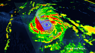
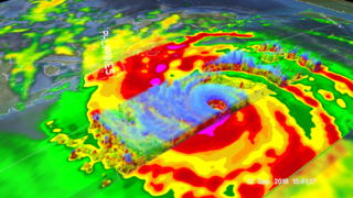
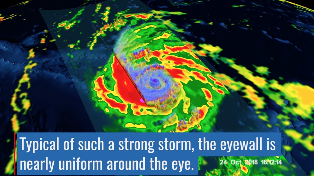
Early Thursday, Oct. 25 local time, Super Typhoon Yutu crossed over the U.S. Commonwealth of the Northern Mariana Islands. It was the equivalent of a Category 5 hurricane. The National Weather Service in Guam said it was the strongest storm to hit any part of the U.S. this year.
The Global Precipitation Measurement mission or GPM core satellite, which is managed by both NASA and the Japan Aerospace Exploration Agency, JAXA analyzed Yutu on Oct. 24 at 11:07 a.m. EDT (1507 UTC)/ 1:07 a.m. Guam Time, Oct. 25. GPM estimated rain rates within Super Typhoon Yutu fusing data from two instruments aboard: the GPM Dual-frequency Precipitation Radar or DPR, which covered the inner part of the storm, and the GPM Microwave Imager or GMI that analyzed the outer swath, just as the center was passing over the Island of Tinian.
Source Material
Credits
Ryan Fitzgibbons (USRA): Lead Producer
George Huffman (NASA/GSFC): Lead Scientist
Stephen J. Munchak (University of Maryland): Lead Scientist
Scott Braun (NASA/GSFC): Lead Scientist
George Huffman (NASA/GSFC): Lead Writer
Stephen J. Munchak (University of Maryland): Writer
Ryan Fitzgibbons (USRA): Lead Editor
NASA's Goddard Space Flight Center
https://svs.gsfc.nasa.gov/13101
Mission:
Global Precipitation Measurement (GPM)
This item is part of this series:
Narrated Movies
Keywords:
SVS >> HDTV
SVS >> Tropical Storm
SVS >> Typhoon Yutu
NASA Science >> Earth


