GEDI: Mapping Carbon in 3-D
The Global Ecosystem Dynamics Investigation (GEDI) instrument will measure forest structure and canopy height, from a perch on the International Space Station. By sending laser pulses down to Earth, GEDI will generate a three-dimensional map of forest structure that will allow scientists to better understand where carbon is being stored around the world.
Music: "Hard Thinking" by Leonard-Morgen and "Hidden Files" by Sam Dodson [PRS]
Complete transcript available.
Watch this video on the NASA Goddard YouTube channel.
NASA's new laser instrument, the Global Ecosystem Dynamics Investigation, or GEDI, has advanced laser technology that will reveal the makeup of remote forest ecosystems around the globe. GEDI will soar above Earth at 17,150 miles per hour onboard the International Space Station. Its measurements of the height of leaves, branches, trees, and shrubs below its path will help scientists map the structure of forests and better understand how ecosystems are storing or releasing carbon.
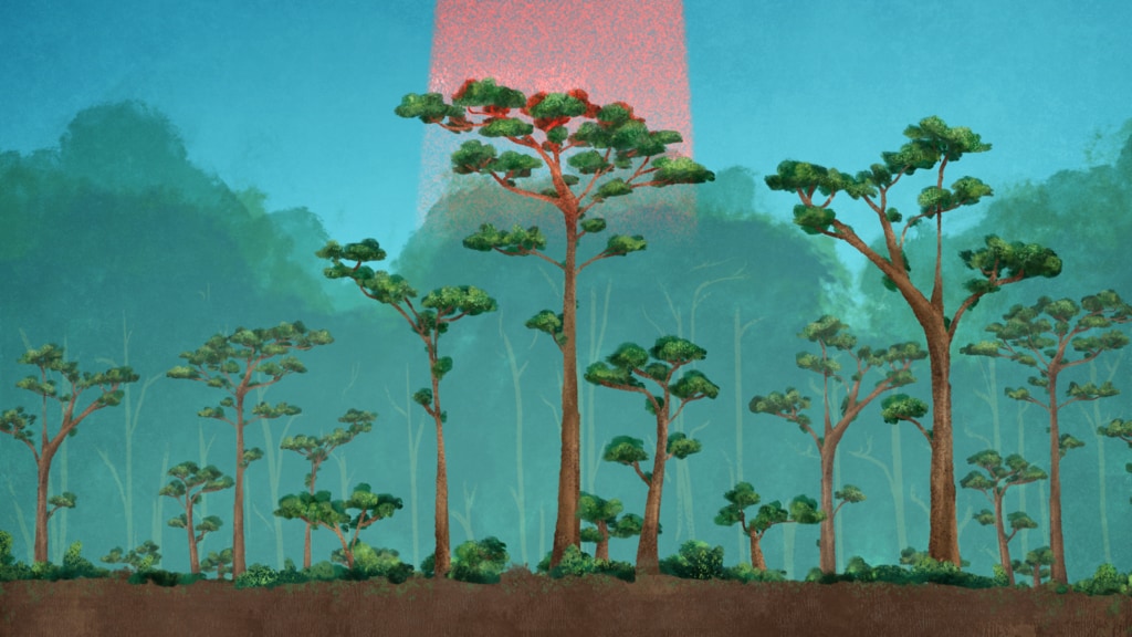
GEDI's lidar instrument sends laser pulses down to Earth, where they penetrate the globe’s temperate and tropical forests. The laser beams ricochet off the first thing they hit, which can be a leaf atop a dense canopy, a protruding branch, or the ground from which the forest emerges. The energy returned to the GEDI telescope on the International Space Station will provide an intricate three-dimensional map of forest canopies and carbon storage.
Led by the University of Maryland in collaboration with NASA's Goddard Space Flight Center, GEDI has the highest resolution and densest sampling of any lidar every put in orbit.
For More Information
See NASA.gov
Credits
Please give credit for this item to:
NASA's Goddard Space Flight Center
-
Producer
- Matthew R. Radcliff (USRA)
-
Animator
- Lisa Poje (Freelance)
-
Scientists
- Bryan Blair (NASA/GSFC)
- Ralph Dubayah (University of Maryland)
Release date
This page was originally published on Wednesday, November 7, 2018.
This page was last updated on Wednesday, May 3, 2023 at 1:46 PM EDT.
Series
This visualization can be found in the following series:Related
- ID: 13114
![The GEDI instrument was built at NASA's Goddard Space Flight Center, and has the highest resolution and densest sampling of any lidar every put in orbit. The mission is led by the University of Maryland and is designed to help researchers understand how ecosystems are storing carbon.Complete transcript available.Music: Secret Science, by Lee Groves [PRS], Peter George Marett [PRS]; Team Effort, by Alexandre Prodhomme [SACEM], Eddy Pradelles [SACEM]Watch this video on the NASA Goddard YouTube channel.](/vis/a010000/a013100/a013114/GEDI_on_ISS_print.jpg) Produced Video
Produced Video - ID: 13090
 Produced Video