A newer version of this visualization is available.
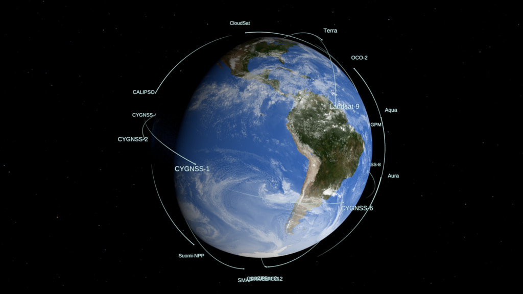
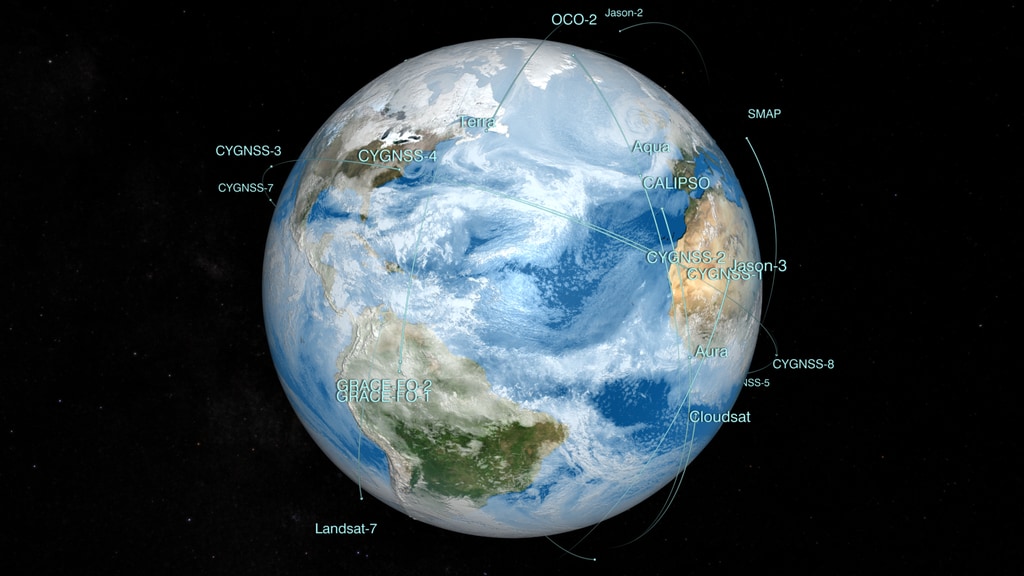
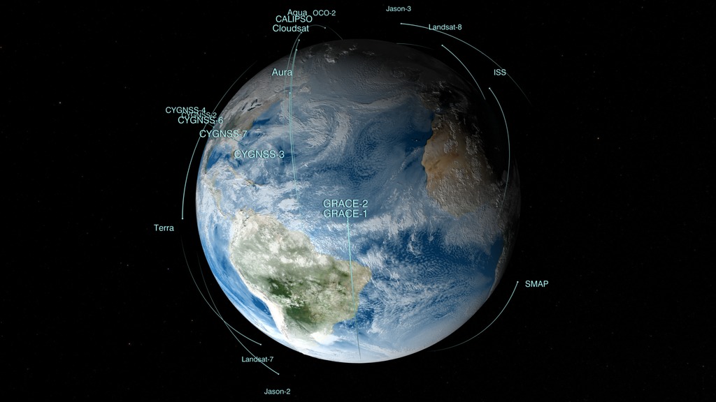
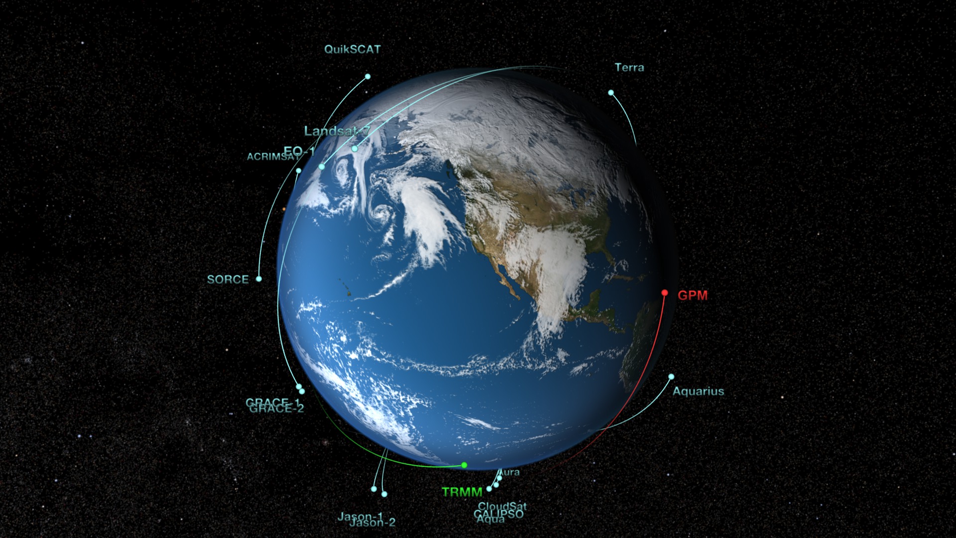
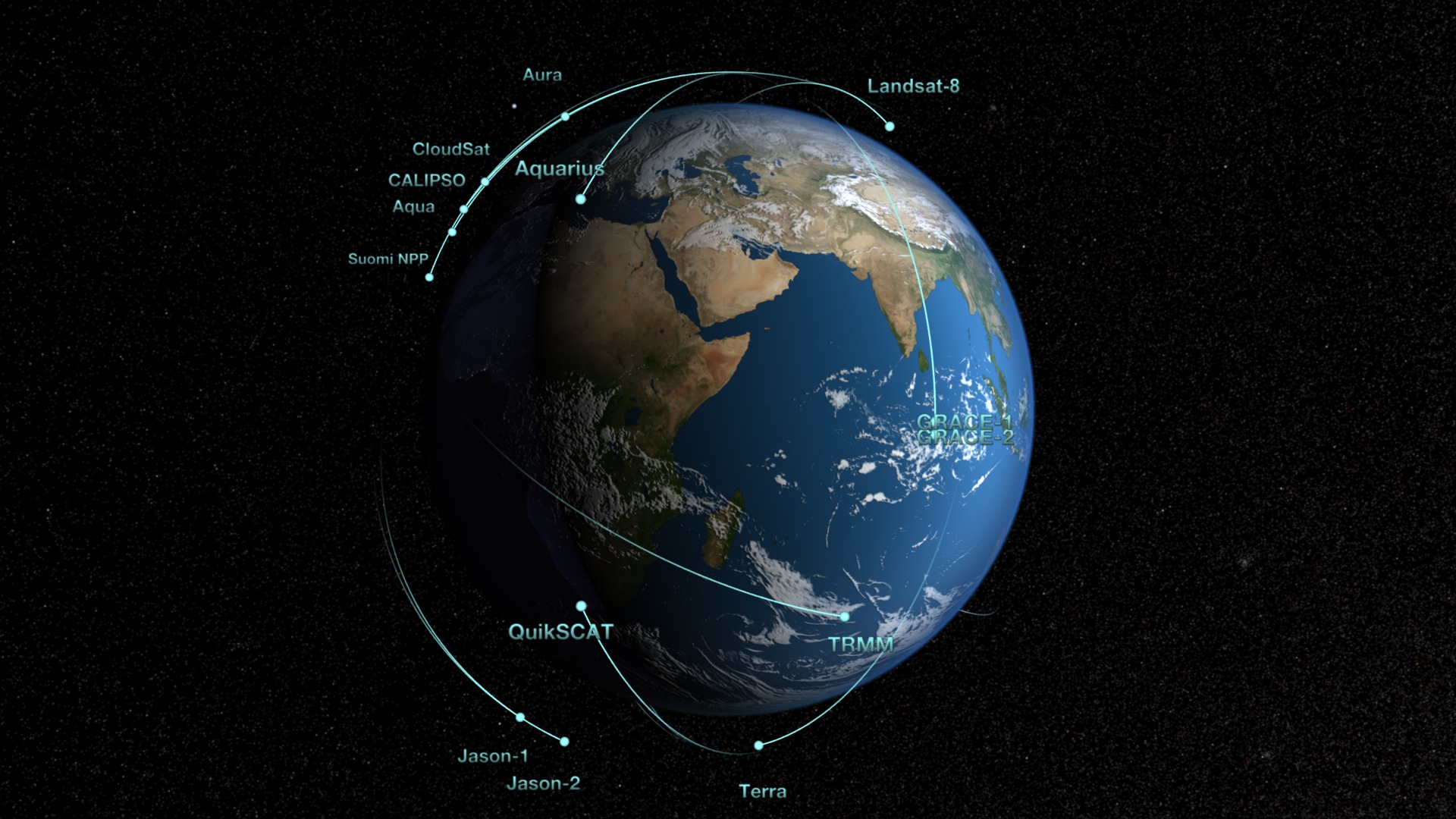
Earth Observing Fleet (August 2021)
Earth observing fleet for August 2021 - this version labels the "Sentinel-6 Michael Freilich" spacecraft: Sentinel-6
This animation shows the orbits of NASA's fleet of Earth observing spacecraft that are considered operational as of August 2021. The clouds used in this version are from a high resolution GEOS model run at 10 minute time steps interpolated down to the per-frame level.
Changes to this version include: removal of SORCE and the addition of Sentinel-6 Michael Freilich.
Spacecraft included:
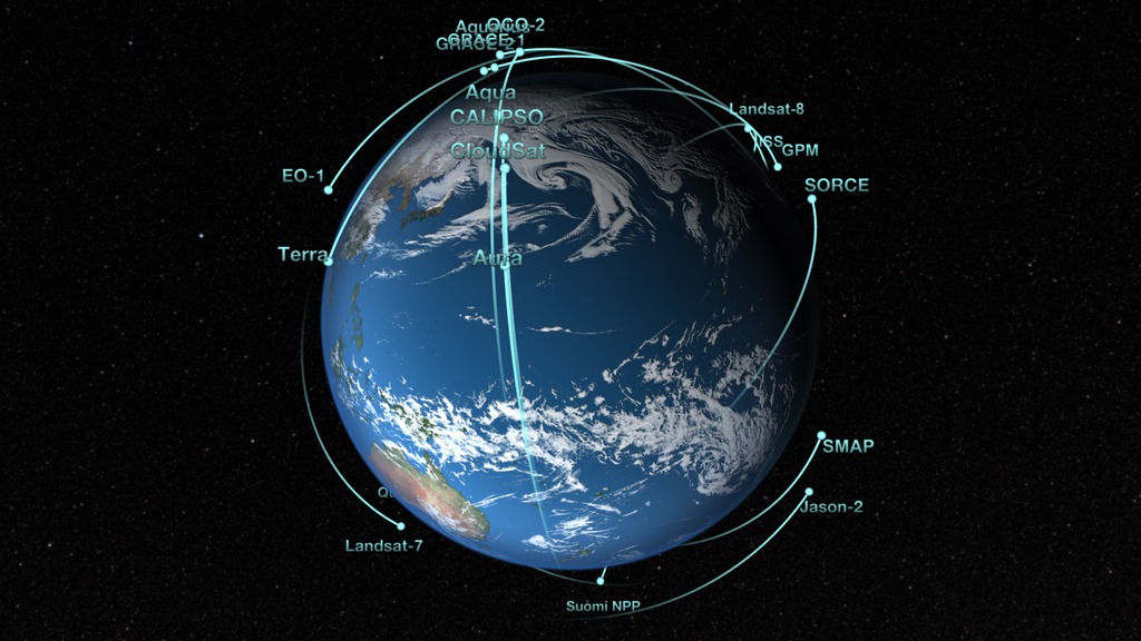
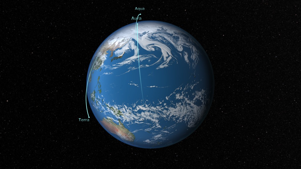
Aqua
Aura
CALIPSO: Cloud-Aerosol Lidar and Infrared Pathfinder Satellite Observation
CYGNSS-1: Cyclone Global Navigation Satellite System 1
CYGNSS-2: Cyclone Global Navigation Satellite System 2
CYGNSS-3: Cyclone Global Navigation Satellite System 3
CYGNSS-4: Cyclone Global Navigation Satellite System 4
CYNGSS-5: Cyclone Global Navigation Satellite System 5
CYGNSS-6: Cyclone Global Navigation Satellite System 6
CYGNSS-7: Cyclone Global Navigation Satellite System 7
CYGNSS-8: Cyclone Global Navigation Satellite System 8
Cloudsat
GPM: Global Precipitation Measurement
GRACE-FO-1: Gravity Recovery and Climate Experiment Follow On-1
GRACE-FO-2: Gravity Recovery and Climate Experiment Follow On-2
ICESat-2
ISS: International Space Station
Landsat 7
Landsat 8
OCO-2: Orbiting Carbon Observatory-2
SMAP: Soil Moisture Passive Active
Suomi NPP: Suomi National Polar-orbiting Partnership
Sentinel-6 Micael Freilich
Terra
Earth observing fleet from August 2021 - this version labels the "Sentinel-6 Michael Freilich" spacecraft: Sentinel-6 Michael Freilich
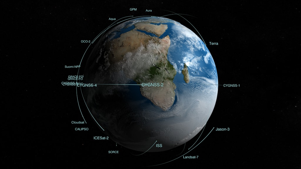
Earth observing fleet without satellite labels
Credits
Please give credit for this item to:
NASA's Scientific Visualization Studio
-
Visualizers
- Greg Shirah (NASA/GSFC)
- Ernie Wright (USRA)
- Kel Elkins (USRA)
Release date
This page was originally published on Thursday, August 26, 2021.
This page was last updated on Sunday, May 5, 2024 at 12:13 AM EDT.
Datasets used in this visualization
-
CelesTrak Spacecraft Orbit Ephemeris
ID: 454This dataset can be found at: http://celestrak.com
See all pages that use this dataset -
BMNG (Blue Marble: Next Generation) [Terra and Aqua: MODIS]
ID: 508Credit: The Blue Marble data is courtesy of Reto Stockli (NASA/GSFC).
This dataset can be found at: http://earthobservatory.nasa.gov/Newsroom/BlueMarble/
See all pages that use this dataset -
GEOS Atmospheric Model
ID: 665
Note: While we identify the data sets used in these visualizations, we do not store any further details, nor the data sets themselves on our site.
Related
- ID: 4880
 Visualization
 - ID: 13746

Newer Versions
- ID: 5061
 Visualization
 - ID: 4928
 Visualization
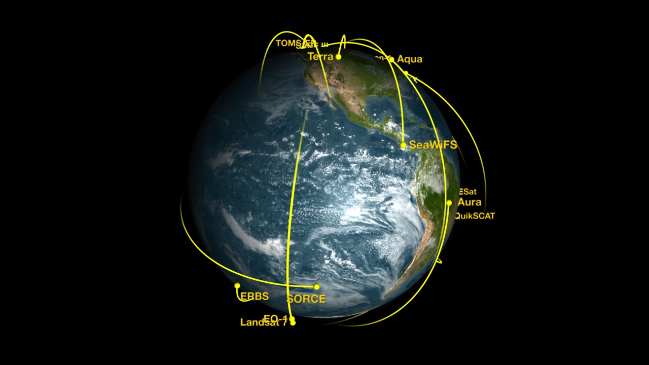
Older Versions
- ID: 4772
 Visualization
 - ID: 4698
 Visualization
 - ID: 4662
 Visualization
 - ID: 4558
 Visualization
 - ID: 4274
 Visualization
 - ID: 4208
 Visualization
 - ID: 3996
 Visualization
 - ID: 4070
 Visualization
 - ID: 3227
Used as a Source In
- ID: 14043
 Produced Video