NASA Catches Super Typhoon Yutu Making Landfall
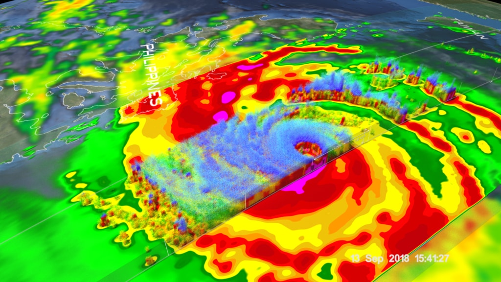
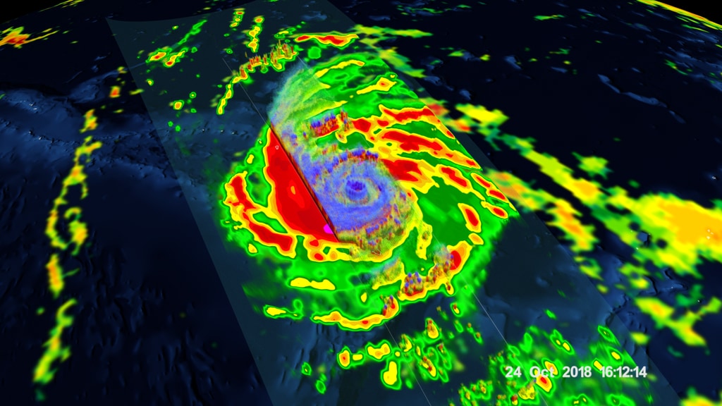
NASA's GPM Core Observatory satellite captured an image of Super Typhoon Yutu when it flew over the powerful storm just as the center was striking the central Northern Mariana Islands north of Guam.
Early Thursday, Oct. 25 local time, Super Typhoon Yutu crossed over the U.S. Commonwealth of the Northern Mariana Islands. It was the equivalent of a Category 5 hurricane. The National Weather Service in Guam said it was the strongest storm to hit any part of the U.S. this year.
The Global Precipitation Measurement mission or GPM core satellite, which is managed by both NASA and the Japan Aerospace Exploration Agency, JAXA analyzed Yutu on Oct. 24 at 11:07 a.m. EDT (1507 UTC)/ 1:07 a.m. Guam Time, Oct. 25. GPM estimated rain rates within Super Typhoon Yutu fusing data from two instruments aboard: the GPM Dual-frequency Precipitation Radar or DPR, which covered the inner part of the storm, and the GPM Microwave Imager or GMI that analyzed the outer swath, just as the center was passing over the Island of Tinian.
Credits
Please give credit for this item to:
NASA's Goddard Space Flight Center
-
Visualizer
- Kel Elkins (USRA)
-
Producer
- Ryan Fitzgibbons (USRA)
-
Scientists
- George Huffman (NASA/GSFC)
- Stephen J. Munchak (University of Maryland)
- Scott Braun (NASA/GSFC)
-
Writers
- George Huffman (NASA/GSFC)
- Stephen J. Munchak (University of Maryland)
-
Editor
- Ryan Fitzgibbons (USRA)
Release date
This page was originally published on Friday, October 26, 2018.
This page was last updated on Wednesday, May 3, 2023 at 1:46 PM EDT.
Missions
This visualization is related to the following missions:Series
This visualization can be found in the following series:Sources
- ID: 4694
- ID: 4682