Intense String of Hurricanes Seen From Space
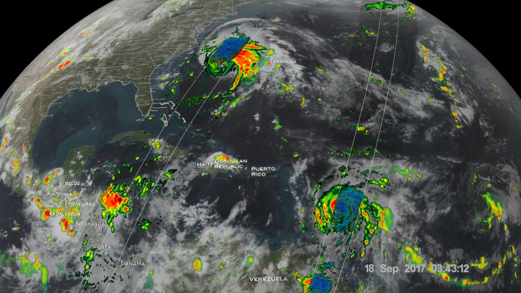
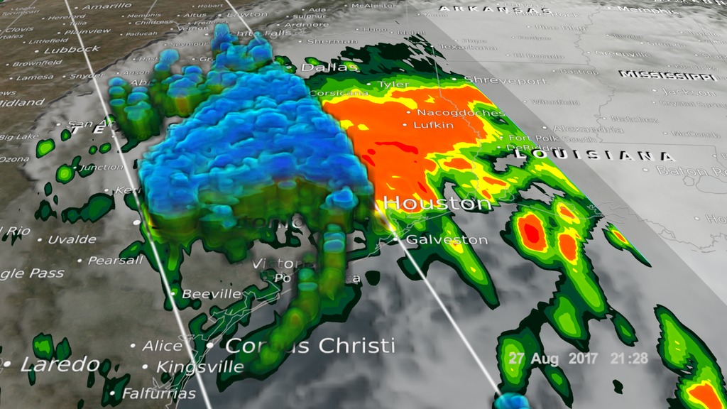
In 2017, we have seen four Atlantic storms rapidly intensify with three of those storms - Hurricane Harvey, Irma and Maria - making landfall.
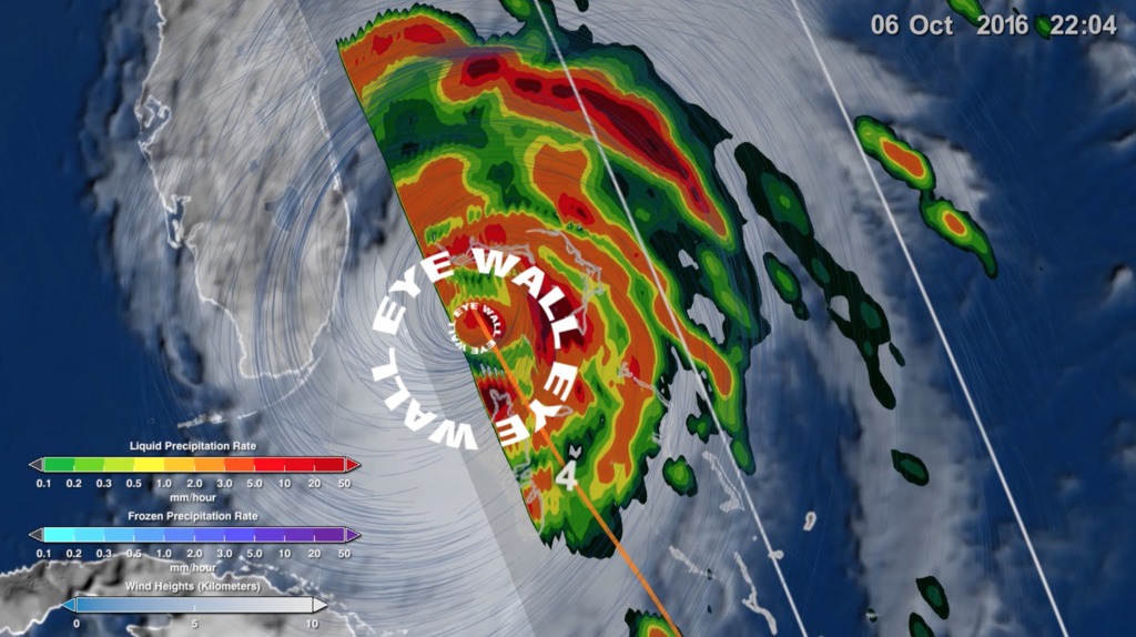
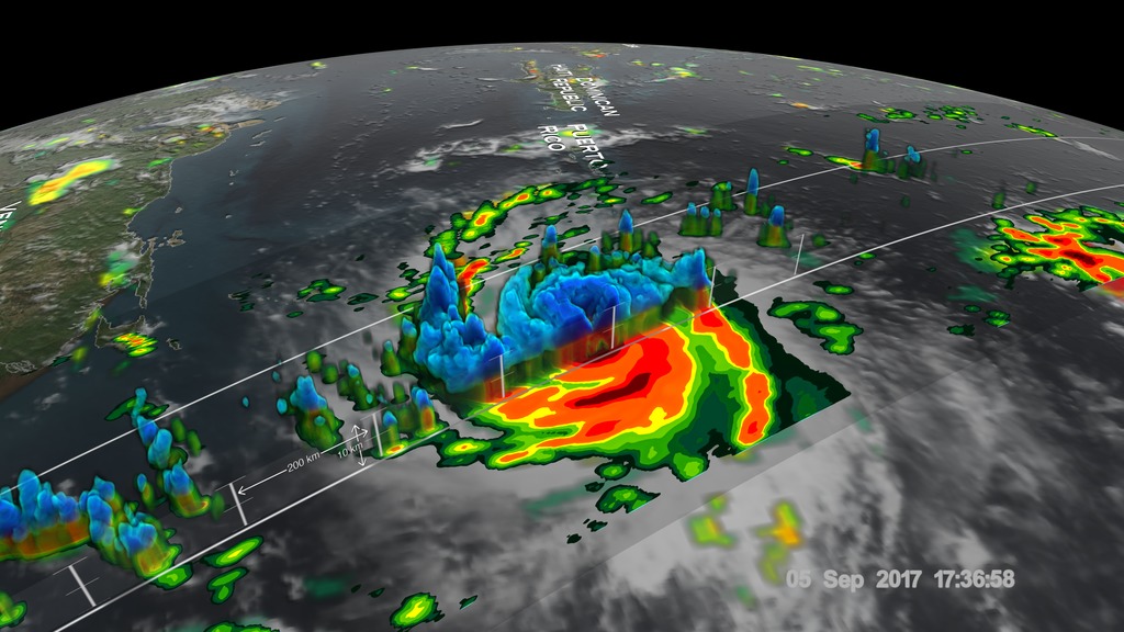
When hurricanes intensify a large amount in a short period, scientists call this process rapid intensification. This is the hardest aspect of a storm to forecast and it can be most critical to people’s lives.
While any hurricane can threaten lives and cause damage with storm surges, floods, and extreme winds, a rapidly intensifying hurricane can greatly increase these risks while giving populations limited time to prepare and evacuate.
Watch this video on the NASA Goddard YouTube channel.
Complete transcript available.
Music credits: 'Micro Currents' by Jean-Patrick Voindrot [SACEM], 'Sink Deep' by Andrew Michael Britton [PRS], David Stephen Goldsmith [PRS], Mikey Rowe [PRS] from Killer Tracks.
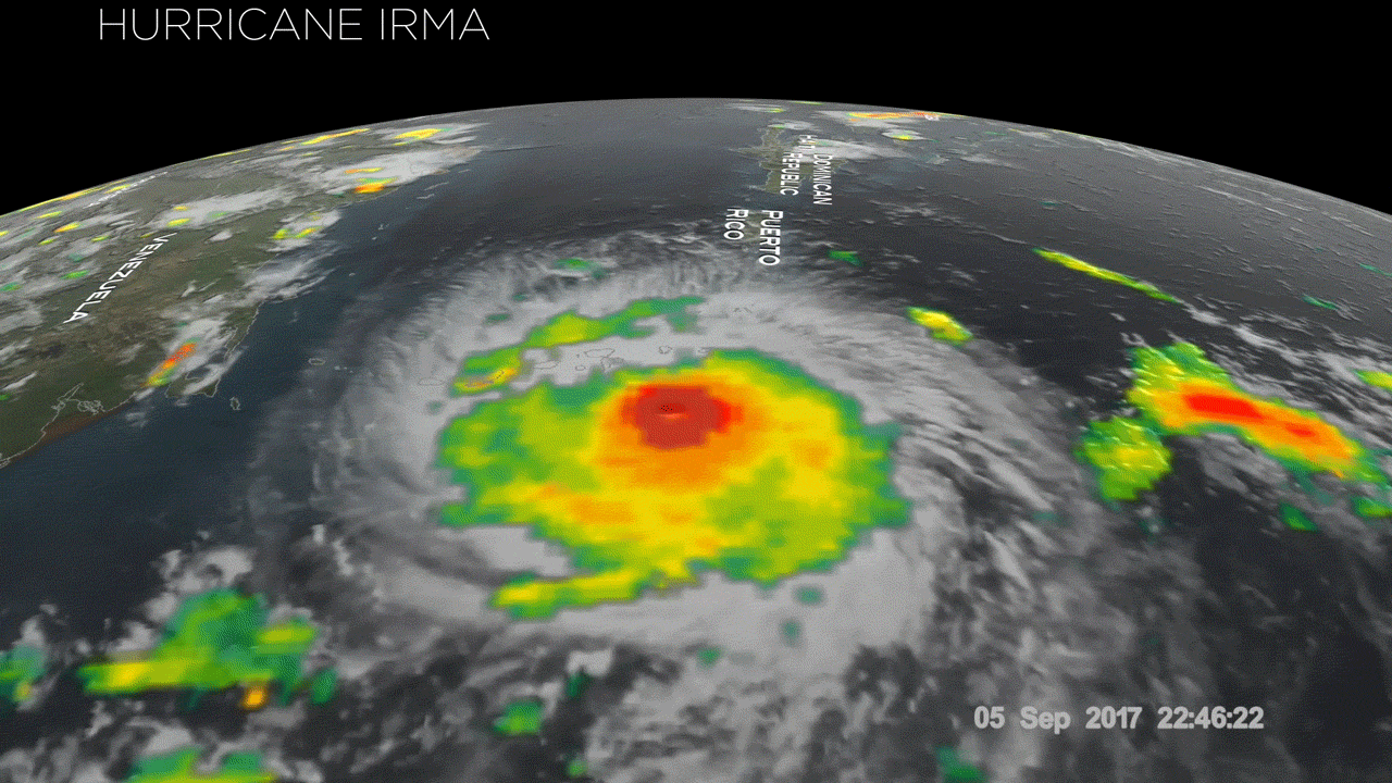
Rapid intensification is the hardest aspect of a storm to forecast and it can be most critical to people's lives. This GIF is optimized for posting on Twitter.
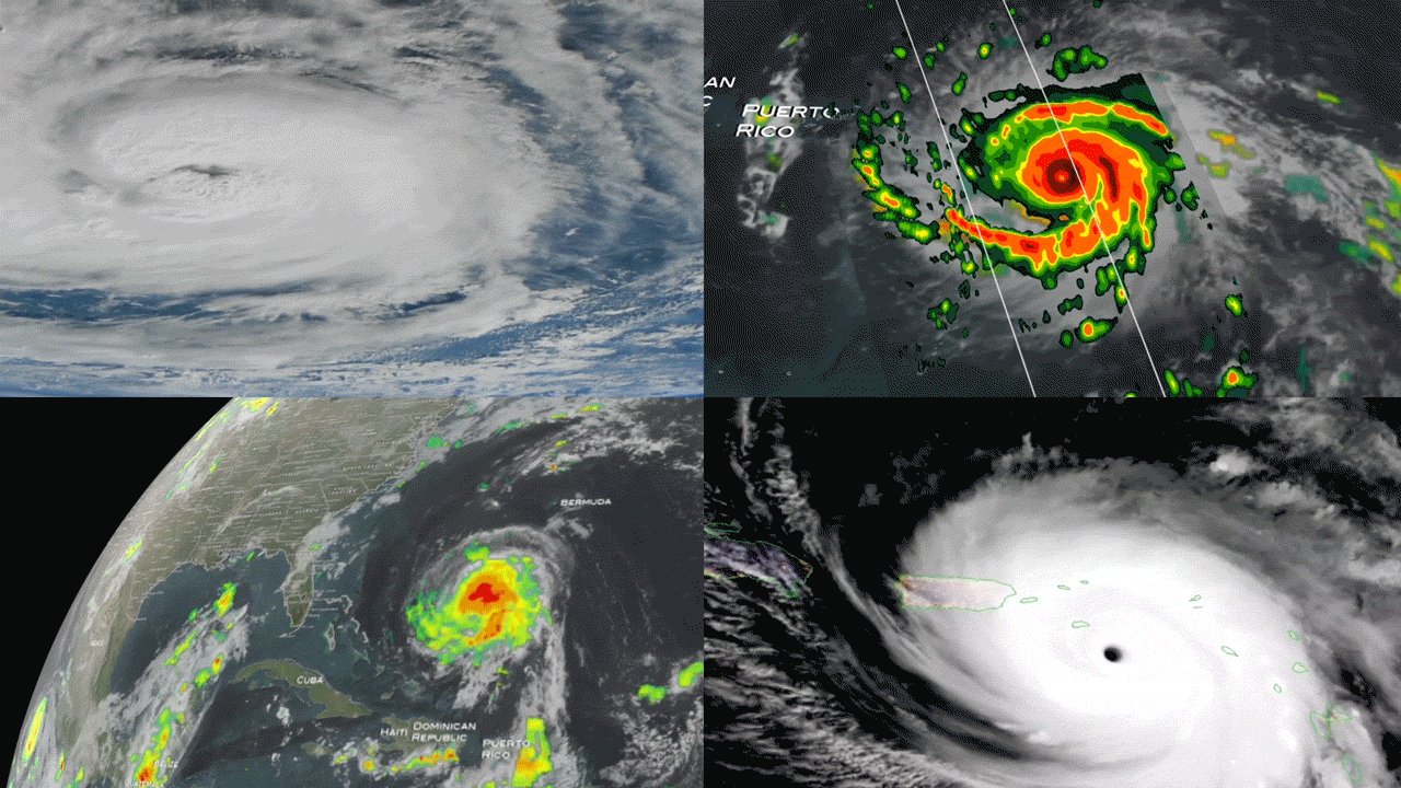
Rapidly intensifying storms typically occur up to twice in a hurricane season. But in 2017, we have seen four storms rapidly intensify and scientists attribute this to warmer ocean waters and favorable winds. This GIF is optimized for posting on Twitter.
For More Information
Credits
Please give credit for this item to:
NASA's Goddard Space Flight Center
-
Scientists
- Scott Braun (NASA/GSFC)
- Amber Emory (NASA/GSFC)
- Dalia B Kirschbaum (NASA/GSFC)
- Stephen J. Munchak (University of Maryland)
-
Producer
- Joy Ng (USRA)
-
Support
- Patrick Lynch (NASA/GSFC)
- Rob Gutro (NASA/GSFC)
- Ryan Fitzgibbons (USRA)
- Aries Keck (ADNET Systems, Inc.)
Release date
This page was originally published on Wednesday, October 4, 2017.
This page was last updated on Wednesday, May 3, 2023 at 1:47 PM EDT.
Missions
This visualization is related to the following missions:Series
This visualization can be found in the following series:Related
- ID: 12723
 Produced Video
 - ID: 30898
 Hyperwall Visual
 - ID: 12697
 Produced Video
 - ID: 12195
![Music credit: 'Cellular Signals' by Laurent Levesque [SACEM] from Killer TracksComplete transcript available.Watch this video on the NASA Goddard YouTube channel.](/vis/a010000/a012100/a012195/LARGE_MP4-12195_EPOCH_Hurricanes2_large.00151_print.jpg) Produced Video
Produced Video - ID: 12628
![Music: Eternal Sunset by Alexandre Prodhomme [SACEM]Complete transcript available.](/vis/a010000/a012600/a012628/LARGE_MP4-Hurricane_NoTitle_large.00001_print.jpg) Produced Video
Produced Video - ID: 12635
 Produced Video
Alternate Versions
- ID: 13216
![Complete transcript available.Music credits: “Northern Breeze” by Denis Levaillant [SACEM], “Stunning Horizon” by Maxime Lebidois [SACEM], Ronan Maillard [SACEM], “Magnetic Force” by JC Lemay [SACEM] from Killer TracksWatch this video on the NASA Goddard YouTube channel.This video can be freely shared and downloaded. While the video in its entirety can be shared without permission, some individual imagery provided by pond5.com is obtained through permission and may not be excised or remixed in other products. Specific details on stock footage may be found here. For more information on NASA’s media guidelines, visit https://www.nasa.gov/multimedia/guidelines/index.html.Notes on footage:• 0:03 - 0:17 provided by Pond5• 1:38 - 1.43 provided by Pond5• 1:49 - 1:52 provided by Pond5• 2:21 - 1:27 provided by Pond5](/vis/a010000/a013200/a013216/13216_NASA_Has_Eyes_On_The_Atlantic_Hurricane_Season_YouTube.00050_print.jpg) Produced Video
Produced Video
Sources
- ID: 4585
- ID: 4584
 Visualization
 - ID: 4458
- ID: 11392
 Produced Video
 - ID: 3912
 Visualization