Seeing Precipitation From Space
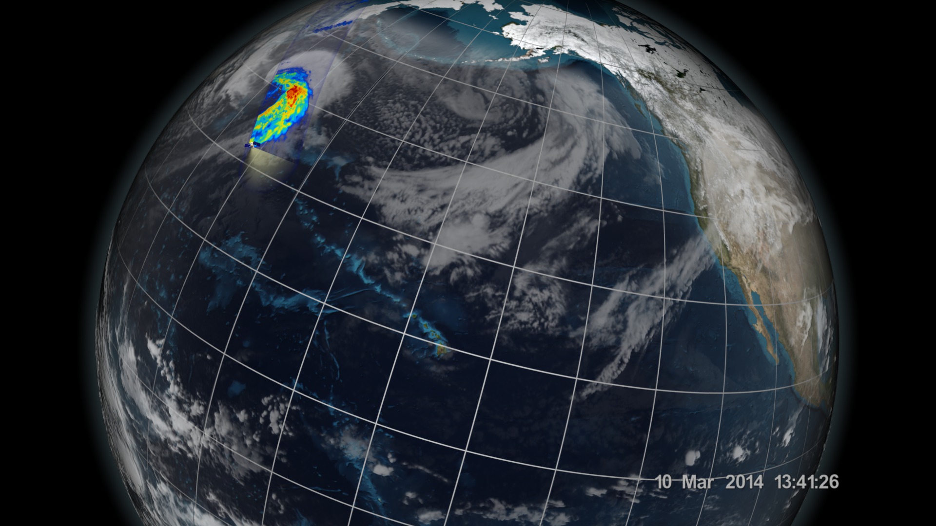
An extratropical cyclone spun across the North Pacific near Japan on March 10, 2014. The cyclone became the first storm imaged by NASA’s Global Precipitation Measurement (GPM) Core Observatory, launched eleven days earlier. The two instruments aboard the satellite are tuned in to different types of precipitation—rain, snow, and any mixture of the two, letting scientists see exactly where each is falling inside a storm. This kind of detail is important for understanding how storms behave and how the water essential to life moves around the planet. Watch the video to learn more about the satellite and how it observes our watery world.

Go inside an extratropical cyclone with NASA's newest rain and snow satellite.
Explore how NASA's GPM satellite monitors storms in this video.
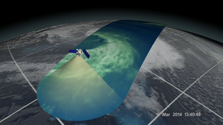
The satellite scans Earth's atmosphere and senses precipitation from storms.
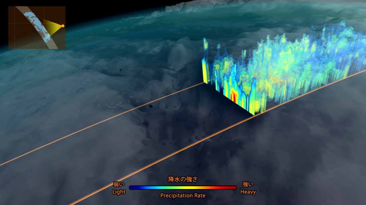
The satellite can detect all types of precipitation, including mixtures of rain and snow (center).
Measurements collected by the satellite can be used to calculate rain rates and snowfall for storms observed around the world.
For More Information
See NASA.gov
Credits
Please give credit for this item to:
NASA's Scientific Visualization Studio
-
Animators
- Alex Kekesi (Global Science and Technology, Inc.)
- Greg Shirah (NASA/GSFC)
- Ernie Wright (USRA)
-
Video editor
- Ryan Fitzgibbons (USRA)
-
Narration
- Ryan Fitzgibbons (USRA)
-
Narrator
- Dan Gallagher (USRA)
-
Producers
- Ryan Fitzgibbons (USRA)
- Rani Gran (NASA/GSFC)
-
Scientists
- Gail Skofronick Jackson (NASA/GSFC)
- Dalia B Kirschbaum (NASA/GSFC)
- Chris Kidd (University of Maryland)
-
Project support
- Laurence Schuler (ADNET Systems, Inc.)
- Ian Jones (ADNET Systems, Inc.)
- Robert Simmon (Sigma Space Corporation)
- Jesse Allen (Sigma Space Corporation)
- John M. Kwiatkowski (George Mason University)
-
Writer
- Ellen T. Gray (ADNET Systems, Inc.)
Release date
This page was originally published on Tuesday, April 1, 2014.
This page was last updated on Wednesday, May 3, 2023 at 1:51 PM EDT.
Related
- ID: 4153
 Visualization
 - ID: 11508
 Produced Video
 - ID: 11509
 Produced Video