Chopping Wood
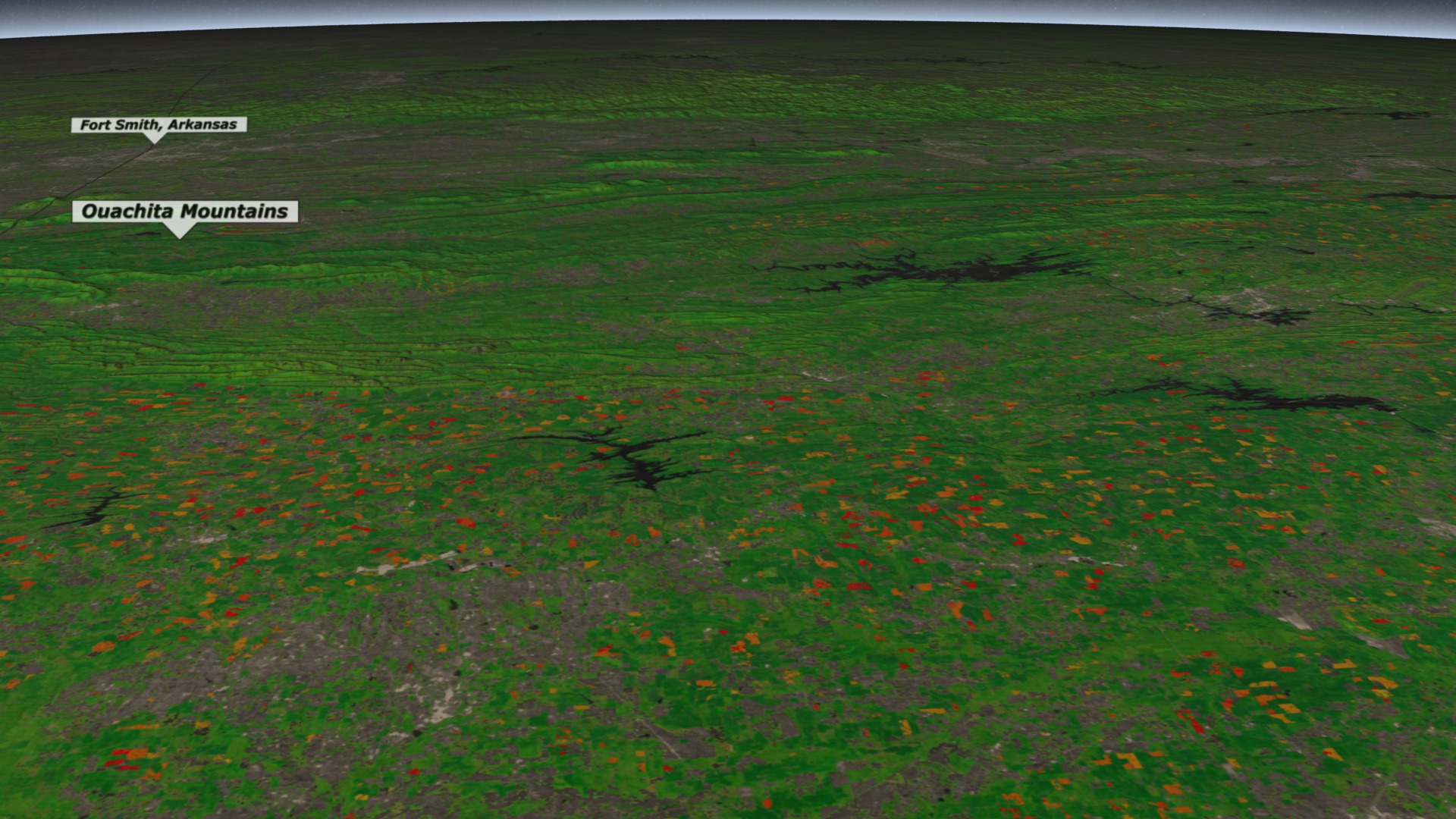
The southeastern United States is a hotspot for forestry activity. The cyclical harvest and planting of trees on lands dedicated to timber and pulp production result in some of the highest rates of forest change observed in the country. Over the past 40 years scientists have used USGS-NASA Landsat satellite data to detect changes in U.S. forest cover and monitor the impact of clearings on biodiversity and water resources. The color-coded visualization highlights vegetation change from 2006 to 2010 on land located south of the Ouachita Mountains, a mountain range that runs from central Arkansas to southeastern Oklahoma. Red areas represent forests cleared in 2010; orange areas represent clearings that took place around 2006. Land that had more than 25 percent tree cover prior to 2006 is colored green, while areas with less than 25 percent appear gray.

Logging operations in the southeastern U.S. leave a footprint that's visible from space.
Learn more about forestry activity in the southeastern United States by watching this narrated video.
Changing forest cover peppers the landscape south of Little Rock, Arkansas.
Patches of cleared forest form a ring around the protected forested area that surrounds Broken Bow Lake (left of center).
Data collected by the USGS-NASA Landsat 7 satellite (above) was used to create the visualization.
Credits
Please give credit for this item to:
NASA's Goddard Space Flight Center
-
Animators
- Alex Kekesi (Global Science and Technology, Inc.)
- Greg Shirah (NASA/GSFC)
-
Narrator
- Alison Schuyler Ogden (NASA/GSFC)
-
Producers
- Matthew R. Radcliff (USRA)
- Alison Schuyler Ogden (NASA/GSFC)
-
Scientist
- Matt C. Hansen (University of Maryland)
-
Writer
- Alison Schuyler Ogden (NASA/GSFC)
Release date
This page was originally published on Thursday, January 17, 2013.
This page was last updated on Wednesday, May 3, 2023 at 1:52 PM EDT.
Related
- ID: 3964