A Virtual Eros -- Take a 3-D Spin Around 433 Eros

Near's EROS false color Edge 5 Near's EROS false color Edge 6
View Eros Images and Animations

Read the Official Press Release


Introduction

Scientists are releasing new highly detailed 3-D views of the near-Earth asteroid 433 Eros. The images were not captured by a camera, but are the product of over 8 million observations from the NEAR Laser Rangefinder (NLR). Scientists use the data from the NLR to build detailed models of Eros's shape. NEAR team members use this information to help them understand the asteroid's evolution and internal structure. The model can then be used to generate a virtual tour of the asteroid 433 Eros.
Take asteroid 433 Eros Tour

433 EROS - IN 3-D

Near's EROS true color Edge 0 Near's EROS true color Edge 1 Near's EROS true color Edge 2
Near's EROS true color Edge 3 Near's EROS true color Edge 4 Near's EROS true color Edge 7

View Images and Animations

Scientists are releasing highly detailed 3-D views of the near-Earth asteroid 433 Eros. The images were not captured by a camera, but are the product of over 8 million observations from the NEAR Laser Rangefinder (NLR). The NLR measures heights on Eros' surface by determining the time short pulses of laser light take to travel from the spacecraft to the asteroid and back. NEAR team members use this information to build detailed models of Eros' shape, which in turn help them understand the asteroid's collisional evolution and internal structure. The shape of Eros also provides a context for interpreting images and compositional information.

A VIRTUAL EROS

Near's EROS false color Edge 0 Near's EROS false color Edge 1 Near's EROS false color Edge 2
Near's EROS false color Edge 3 Near's EROS false color Edge 4 Near's EROS false color Edge 7

View Images and Animations

This sequence combines the topographic model of Eros generated by the NEAR Laser Rangefinder (NLR) with colors sampled from other Eros images. Scientists can examine the asteroid from any angle to help them understand the asteroid's collisional evolution and internal structure. The shape of Eros also provides a context for interpreting images and compositional information.

BEST SKI SLOPES ON EROS

The asteroid's shape, density and spin combine to create a bizarre pattern of what is "uphill" and "downhill". In this view, a map of "gravity slope" has been painted onto the topographic model generated by the NEAR Laser Rangefinder (NLR). A ball would tend to roll fastest in the red regions and would tend to stay put in the blue regions.

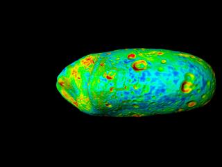
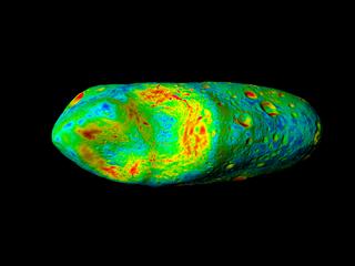
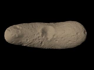
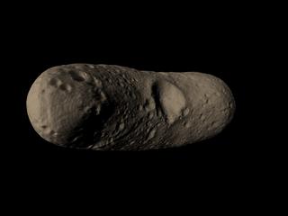
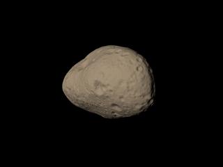
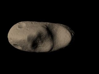
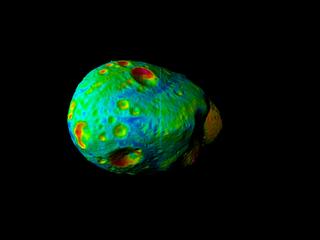
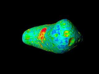
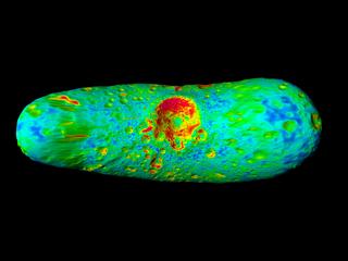
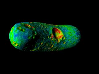
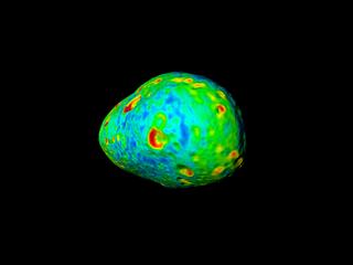
NEAR LASER RANGEFINDER ANIMATION

Animation of the NEAR Laser Rangefinder (NLR). The NLR measures heights on Eros' surface by determining the time short pulses of laser light take to travel from the spacecraft to the asteroid and back. The elevations of points on the surface of Eros are determined by subtracting the laser-derived distance between the spacecraft and the surface from the distance between the spacecraft and Eros' center of mass, as determined from radio tracking.
This multimedia project is the work of a dedicated team of researchers, animators, and media specialists. A companion video to this web site is available from NASA-TV. Below are a list of agencies, departments, and researchers who provided expertise and data for this production:

Please give credit for these images to:
NASA - Goddard Space Flight Center
Johns Hopkins University Applied Physics Laboratory (JHUAPL)
NEAR Laser Rangefinder (NLR)

Last Revised: February 4, 2019 at 06:02 PM EST