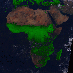
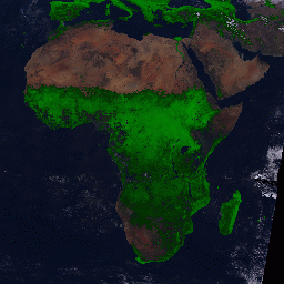
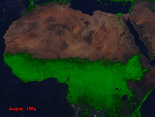
Normalized
Difference Vegetation Index of Africa
|
|||||
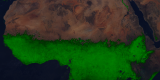 August 1984 |
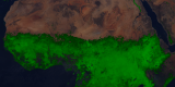 August 1994 |
 August 1984 |
 August 1994 |
For many years, scientists have believed that the southern expansion of the Sahara has been due to human activity. However, results from the AVHRR instrument and its measurements of vegetation suggest a different explanation: rainfall patterns. In drier years (1984 was one of the driest summers in recorded history in Northern Africa), the Sahara expands south, but in wetter years (such as 1994), vegetation moves back and there is no net expansion of the Sahara as had been previously suggested.
Technical notes:
Rendered: November, 1998.
Investigators: Dr. Compton Tucker (NASA GSFC) and Dr. Sharon Nicholson (Florida State University)
Data source: AVHRR instrument on NOAO series satellites. The background image of Africa is SeaWiFS true color data (courtesy of SeaWiFS Project and ORBImage)
Data date: August 1984 and August 1994
For: Laboratory for Terrestrial Physics and Goddard Public Affairs Office