Paris
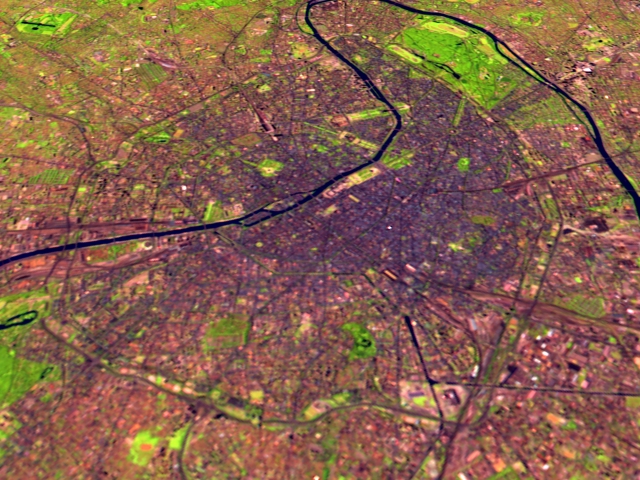
The Landsat scene above shows Paris from above, facing (roughly) south looking across the city and the Seine River which snakes through the center of Paris. The Landsat data is shown with shortwave infrared (TM Band 5) displayed as red, near infrared (TM Band 4) as green, and visible green (TM Band 2) as blue. This wide spectral range results in urban features such as concrete buildings and roads to appear as dark grey/black, water as dark blue, while green spaces are vegetation coverage such as grass and trees.
Technical notes:
|
