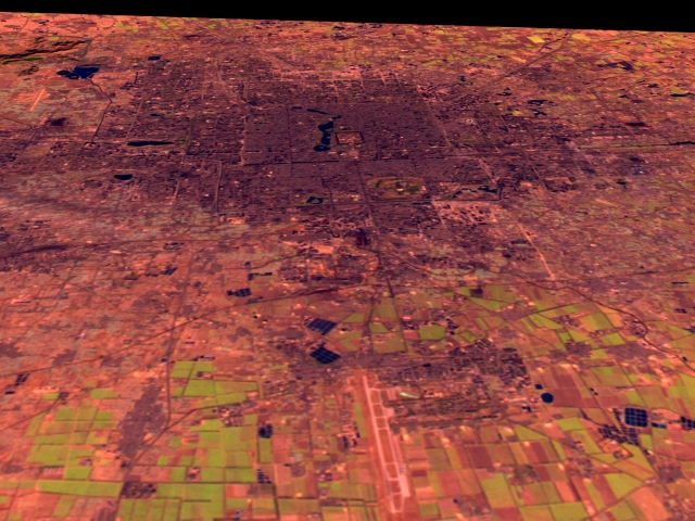
Beijing
This Landsat scene shows the city of Beijing, looking northward. The main city airport is visible in the foreground. The Landsat data is shown with shortwave infrared (TM Band 5) displayed as red, near infrared (TM Band 4) as green, and visible green (TM Band 2) as blue. Reddish tone shows bare soil or recently cultivated land, greens shows vegetation, while dark grey tones correspond to concrete and asphalt. The overall dark pink/red tone of the city in this image is due to the data coming from the early winter when there is much less vegetation coverage. Images: GIF (40 k)JPEG (215 k) Medium resolution TIFF (2.8 M) High resolution TIFF (10.4 M) Technical notes:
|
