Earth
ID: 4897
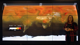
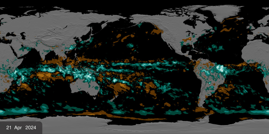
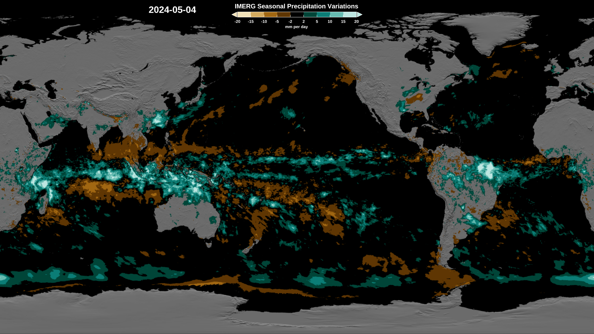
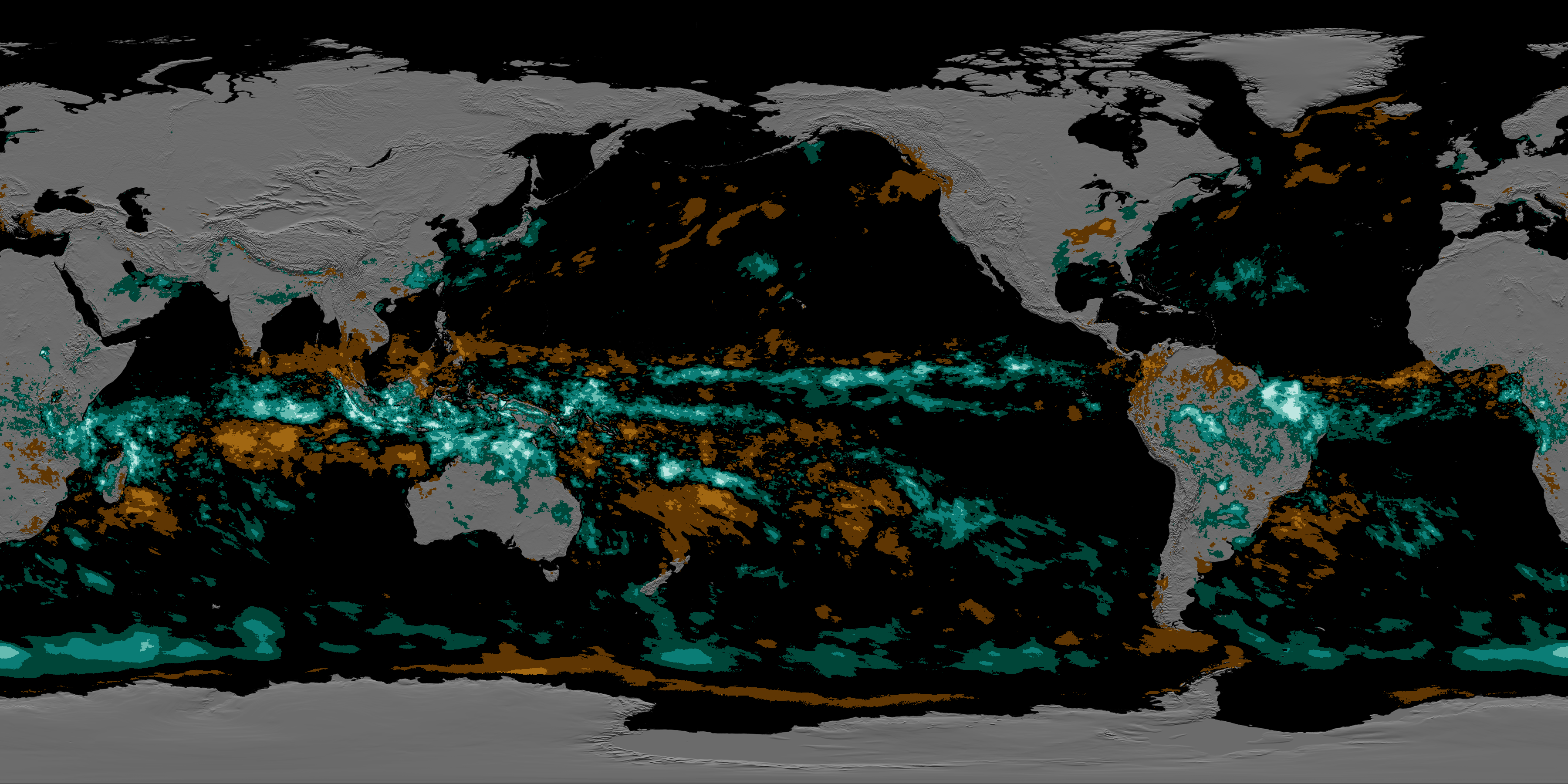
The Global Precipitation Meaurement (GPM) mission produces NASA's most comprehensive estimate of global rain and snowfall, the Integrated Multi-satellite Retrievals for GPM, or IMERG. IMERG is largely based on data from the GPM constellation - a group of satellites independently operated by many agencies that pool their data for global precipitation estimates. These satellites currently include the GPM Core Observatory, other U.S. civilian satellites (Aqua, NOAA-19, NOAA-20, Suomi NPP), U.S. defense satellites (DMSP F-16, DMSP F-17, DMSP- F18), and international agency satellites (GCOM-W1, Metop-B, Metop-C, and MeghaTropiques). The IMERG dataset starts in June 2000, providing a sufficiently long record that seasonal/regional averages, or climatology, can be computed with reasonable confidence. By comparing the progression of the observed precipitation with climatology, we can generate maps of showing how much observations depart from normal. In the animation, each day's variation from the average precipitation is added to the map, then allowed to gradually fade away over three months so that time changes in the larger-scale patterns are easier to see. Researchers sometimes refer to these deviations from the climatology as "precipitation anomalies".

Seasonal Global Precipitation Variation from the Global Precipitation Measurement Constellation
Used Elsewhere In
Visualization Credits
Horace Mitchell (NASA/GSFC): Lead Animator
Alex Kekesi (Global Science and Technology, Inc.): Data Visualizer
George Huffman (NASA/GSFC): Lead Scientist
Gail Skofronick Jackson (NASA/GSFC): Lead Scientist
Dalia B Kirschbaum (NASA/GSFC): Lead Scientist
Ryan Fitzgibbons (USRA): Producer
Alex Kekesi (Global Science and Technology, Inc.): Data Visualizer
George Huffman (NASA/GSFC): Lead Scientist
Gail Skofronick Jackson (NASA/GSFC): Lead Scientist
Dalia B Kirschbaum (NASA/GSFC): Lead Scientist
Ryan Fitzgibbons (USRA): Producer
Please give credit for this item to:
NASA's Scientific Visualization Studio
Huffman, G.J., E.F. Stocker, D.T. Bolvin, E.J. Nelkin, Jackson Tan (2019), GPM IMERG Late Precipitation L3 1 day 0.1 degree x 0.1 degree V06, Edited by Andrey Asvtchenko, Greenbelt, MD, Goddard Earth Sciences Data and Information Services Center (GES DISC), Accessed: 2021, 10.5067/GPM/IMERGDL/DAY/06
Short URL to share this page:
https://svs.gsfc.nasa.gov/4897
Data Used:
Note: While we identify the data sets used in these visualizations, we do not store any further details nor the data sets themselves on our site.
Keywords:
DLESE >> Atmospheric science
SVS >> Global Precipitation Measurement
GCMD >> Earth Science >> Atmosphere >> Precipitation >> Precipitation Rate
GCMD >> Earth Science >> Atmosphere >> Precipitation >> Rain
SVS >> Hyperwall
SVS >> SOS
NASA Science >> Earth
NASA Earth Science Focus Areas >> Weather and Atmospheric Dynamics
SVS >> Real-time
SVS >> Realtime
SVS >> Updated
SVS >> Up-to-date
GCMD keywords can be found on the Internet with the following citation: Olsen, L.M., G. Major, K. Shein, J. Scialdone, S. Ritz, T. Stevens, M. Morahan, A. Aleman, R. Vogel, S. Leicester, H. Weir, M. Meaux, S. Grebas, C.Solomon, M. Holland, T. Northcutt, R. A. Restrepo, R. Bilodeau, 2013. NASA/Global Change Master Directory (GCMD) Earth Science Keywords. Version 8.0.0.0.0
https://svs.gsfc.nasa.gov/4897
Data Used:
also referred to as: IMERG
Data Compilation - NASA/GSFCKeywords:
DLESE >> Atmospheric science
SVS >> Global Precipitation Measurement
GCMD >> Earth Science >> Atmosphere >> Precipitation >> Precipitation Rate
GCMD >> Earth Science >> Atmosphere >> Precipitation >> Rain
SVS >> Hyperwall
SVS >> SOS
NASA Science >> Earth
NASA Earth Science Focus Areas >> Weather and Atmospheric Dynamics
SVS >> Real-time
SVS >> Realtime
SVS >> Updated
SVS >> Up-to-date
GCMD keywords can be found on the Internet with the following citation: Olsen, L.M., G. Major, K. Shein, J. Scialdone, S. Ritz, T. Stevens, M. Morahan, A. Aleman, R. Vogel, S. Leicester, H. Weir, M. Meaux, S. Grebas, C.Solomon, M. Holland, T. Northcutt, R. A. Restrepo, R. Bilodeau, 2013. NASA/Global Change Master Directory (GCMD) Earth Science Keywords. Version 8.0.0.0.0


