Planets and Moons
ID: 4803
Seventy-eight hours into the flight of Apollo 13, Capcom Vance Brand in Mission Control informed the astronauts that the third stage of their Saturn V rocket had hit the Moon. Commander Jim Lovell replied,
One day earlier, a catastrophic failure of an oxygen tank in the Service Module left the crew without power, air, and water in their Command Module, forcing them to use their Lunar Module as a lifeboat. The Moon landing, and all of the science they would do on the lunar surface, was lost. The only major science objective that yielded results was the intentional impact of their booster.
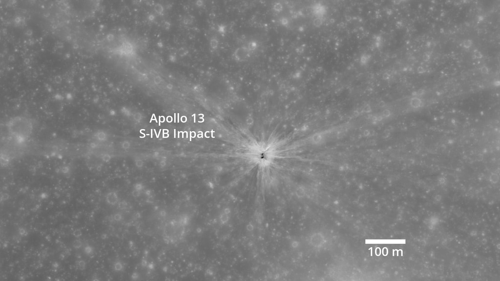
After sending the astronauts out of Earth orbit on a path to the Moon, the detached upper stage of the Saturn V rocket, called the S-IVB (“ess four bee”), was aimed squarely at the Moon. Its impact at 77:56:39.7 mission elapsed time was detected by several scientific instruments left on the surface by Apollo 12. A seismometer (a moonquake detector) recorded the tremor, and particle detectors sensed molecules from both the impact itself and the resulting deflection of the solar wind.
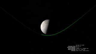
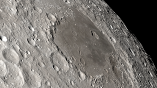
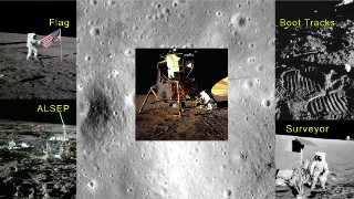
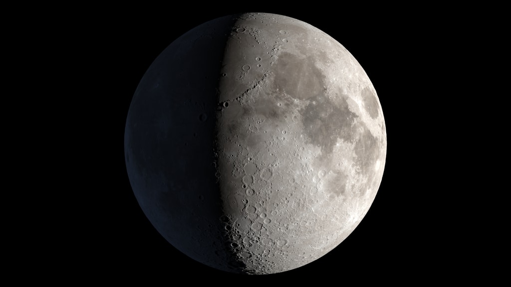
More than four decades later, the Lunar Reconnaissance Orbiter (LRO) mission located and photographed the Apollo 13 S-IVB impact site about 135 kilometers west of the Apollo 12 landing. In this visualization, we first see the location of the impact on the night side of the waxing gibbous Moon. (It isn’t certain whether the impact could have been seen from Earth in this way, but the energy of the impact was roughly twice that of the bright flash recorded on March 17, 2013.) The view then zooms rapidly to the LRO image of the impact crater before pulling back to show its location relative to the Apollo 12 landing site.
The close-up NAC (Narrow Angle Camera) view is a detail from image M140087684L and has a resolution of 50 centimeters per pixel. The wider view, at 100 meters per pixel, is a detail from the LROC WAC global morphological map.
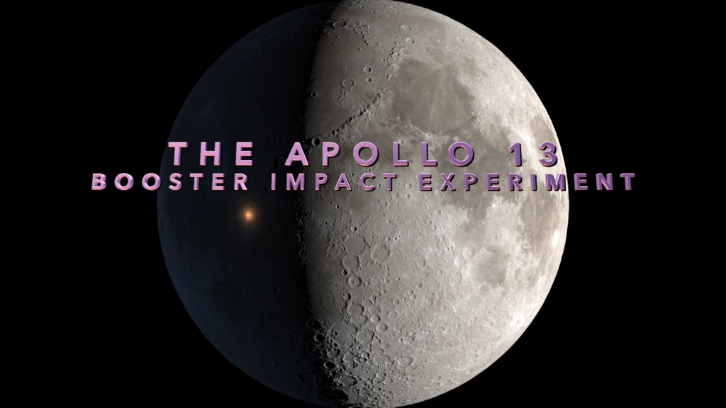
Apollo 13 S-IVB Impact Site
Well, at least something worked on this flight.
One day earlier, a catastrophic failure of an oxygen tank in the Service Module left the crew without power, air, and water in their Command Module, forcing them to use their Lunar Module as a lifeboat. The Moon landing, and all of the science they would do on the lunar surface, was lost. The only major science objective that yielded results was the intentional impact of their booster.
After sending the astronauts out of Earth orbit on a path to the Moon, the detached upper stage of the Saturn V rocket, called the S-IVB (“ess four bee”), was aimed squarely at the Moon. Its impact at 77:56:39.7 mission elapsed time was detected by several scientific instruments left on the surface by Apollo 12. A seismometer (a moonquake detector) recorded the tremor, and particle detectors sensed molecules from both the impact itself and the resulting deflection of the solar wind.
More than four decades later, the Lunar Reconnaissance Orbiter (LRO) mission located and photographed the Apollo 13 S-IVB impact site about 135 kilometers west of the Apollo 12 landing. In this visualization, we first see the location of the impact on the night side of the waxing gibbous Moon. (It isn’t certain whether the impact could have been seen from Earth in this way, but the energy of the impact was roughly twice that of the bright flash recorded on March 17, 2013.) The view then zooms rapidly to the LRO image of the impact crater before pulling back to show its location relative to the Apollo 12 landing site.
The close-up NAC (Narrow Angle Camera) view is a detail from image M140087684L and has a resolution of 50 centimeters per pixel. The wider view, at 100 meters per pixel, is a detail from the LROC WAC global morphological map.
Related
Visualization Credits
Ernie Wright (USRA): Lead Visualizer
David Ladd (USRA): Lead Producer
David Ladd (USRA): Lead Video Editor
Noah Petro (NASA/GSFC): Scientist
Laurence Schuler (ADNET Systems, Inc.): Technical Support
Ian Jones (ADNET Systems, Inc.): Technical Support
David Ladd (USRA): Lead Producer
David Ladd (USRA): Lead Video Editor
Noah Petro (NASA/GSFC): Scientist
Laurence Schuler (ADNET Systems, Inc.): Technical Support
Ian Jones (ADNET Systems, Inc.): Technical Support
Please give credit for this item to:
NASA's Scientific Visualization Studio
NASA's Scientific Visualization Studio
Short URL to share this page:
https://svs.gsfc.nasa.gov/4803
Missions:
Apollo
LRO (Lunar Reconnaissance Orbiter)
Data Used:
Note: While we identify the data sets used in these visualizations, we do not store any further details nor the data sets themselves on our site.
Keywords:
SVS >> HDTV
SVS >> Moon
SVS >> Hyperwall
SVS >> LRO
SVS >> Lunar Reconnaissance Orbiter
SVS >> LROC
SVS >> Apollo Missions
SVS >> Lunar Surface
NASA Science >> Planets and Moons
https://svs.gsfc.nasa.gov/4803
Missions:
Apollo
LRO (Lunar Reconnaissance Orbiter)
Data Used:
LRO/LROC/Narrow Angle Camera also referred to as: NAC
2010 Sep 25 21:00LRO/LOLA/Digital Elevation Map also referred to as: DEM
Lunar Reconnaissance Orbiter/Wide-Angle Camera/Global Morphological Map also referred to as: LROC WAC Global Morphological Map
MosaicKeywords:
SVS >> HDTV
SVS >> Moon
SVS >> Hyperwall
SVS >> LRO
SVS >> Lunar Reconnaissance Orbiter
SVS >> LROC
SVS >> Apollo Missions
SVS >> Lunar Surface
NASA Science >> Planets and Moons


