Earth
ID: 11926

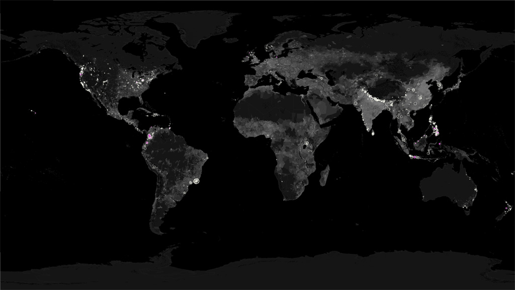
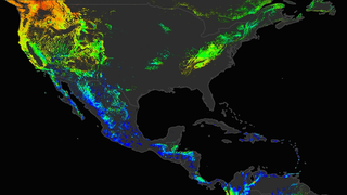
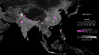
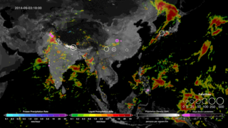
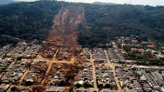
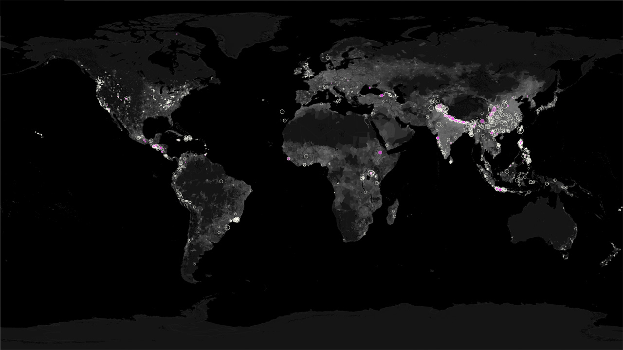
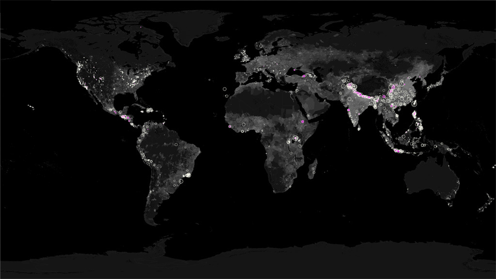
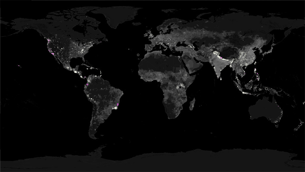
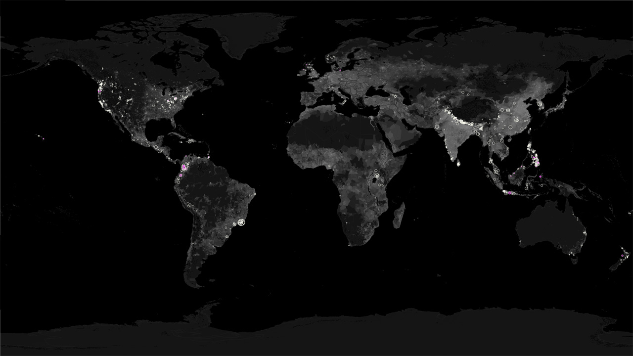
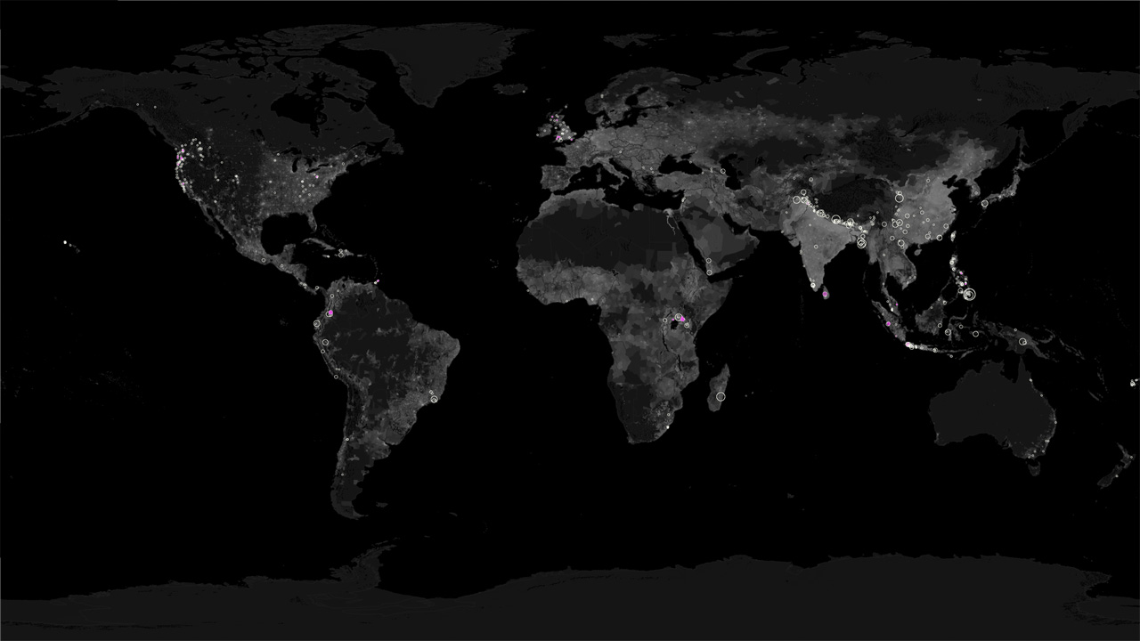
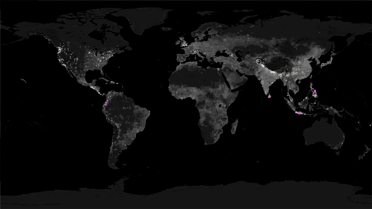
Landslides are one of the most dangerous natural hazards on the planet. Between 2007 and 2015, there were more than 25,000 reported deaths due to rainfall-triggered landslides around the world. Heavy rains set off landslides by forming fast-moving flows of rock, mud and debris that pour down hillsides, causing destruction to life, property and homes. Most landslides occur during the Northern Hemisphere summer, coinciding with tropical cyclone and East Asian monsoon seasons. In 2010, NASA scientists released the first publicly available catalog of rainfall-triggered landslides using information collected from online databases and media reports that date back to 2007. Recently, the catalog has been updated to include landslide events from the last five years. Scientists have begun to compare events with satellite rainfall measurements to determine where and when landslides are likely to occur. Watch the video to see the distribution of rainfall-triggered landslides that took place from 2007 to 2015.


Visualizing Landslides
Related Stories
Story Credits
Lead Visualizer/Animator:
Lori Perkins (NASA/GSFC)
Lead Producer:
Joy Ng (USRA)
Lead Scientist:
Dalia B Kirschbaum (NASA/GSFC)
Lead Project Support:
Thomas A. Stanley (USRA)
Lead Writer:
Kayvon Sharghi (USRA)
Lori Perkins (NASA/GSFC)
Lead Producer:
Joy Ng (USRA)
Lead Scientist:
Dalia B Kirschbaum (NASA/GSFC)
Lead Project Support:
Thomas A. Stanley (USRA)
Lead Writer:
Kayvon Sharghi (USRA)
Please give credit for this item to:
NASA's Scientific Visualization Studio
NASA's Scientific Visualization Studio
Short URL to share this page:
https://svs.gsfc.nasa.gov/11926
Keywords:
SVS >> App
NASA Science >> Earth
https://svs.gsfc.nasa.gov/11926
Keywords:
SVS >> App
NASA Science >> Earth


