Planets and Moons
ID: 5092
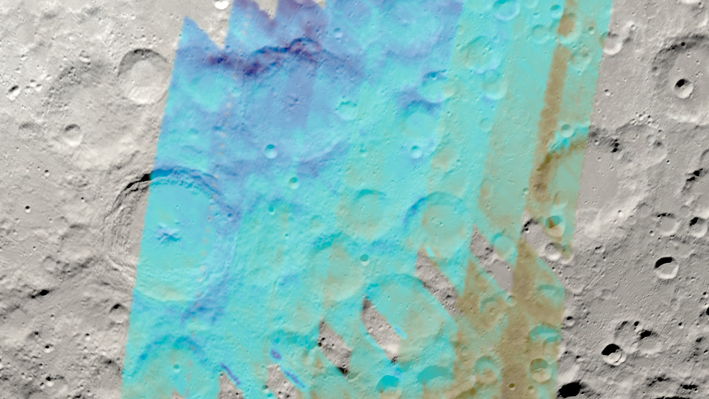
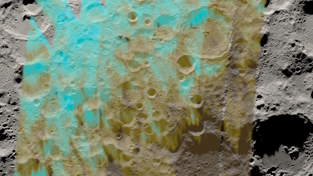
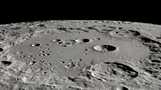
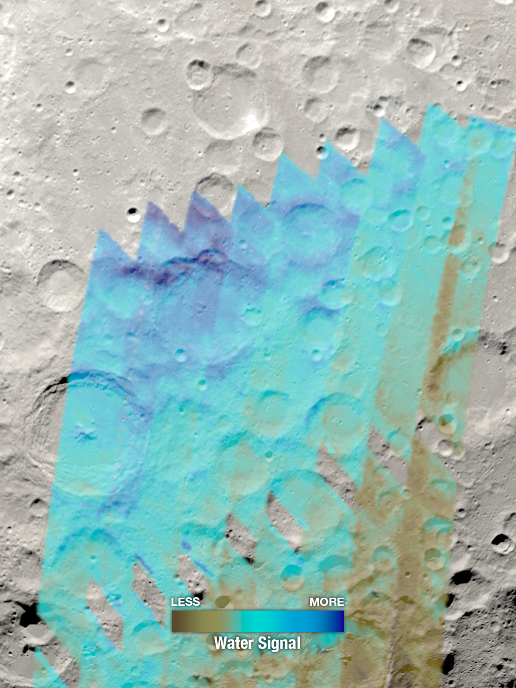
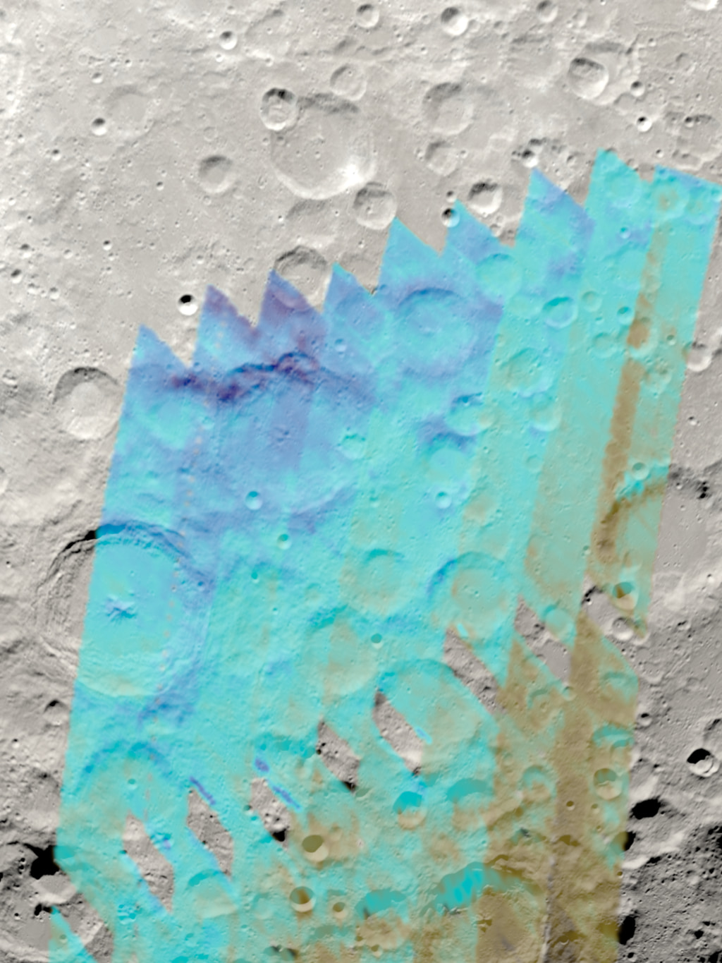
A study using the Stratospheric Observatory for Infrared Astronomy (SOFIA) has assembled the first detailed, wide-area map of water distribution on the Moon. The map covers a region on the eastern side of the Earth-facing hemisphere of the Moon from about 60°S latitude to the South Pole. The map shows higher concentrations of water on the shady poleward sides of craters and peaks far from the South Pole.
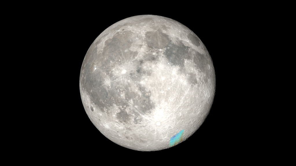
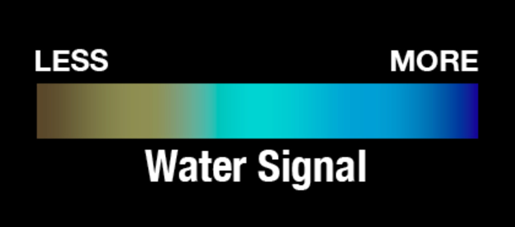
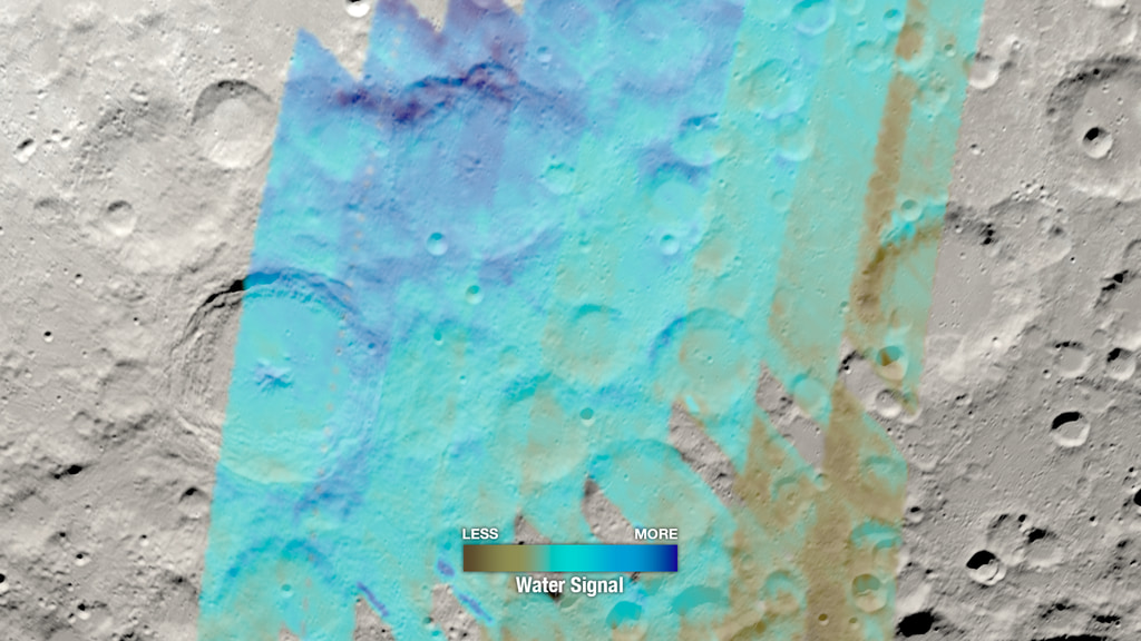
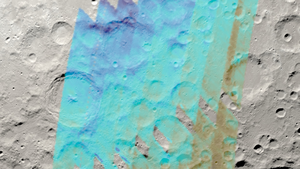
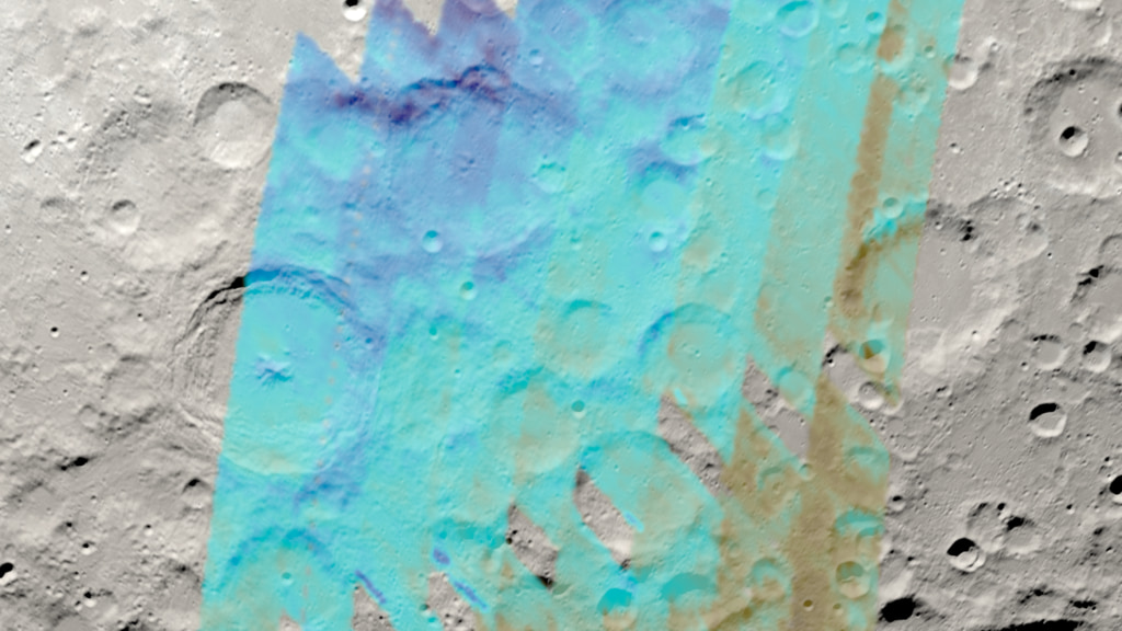
The media on this page show a visualization of the Moon as it appeared on the date of the SOFIA observations (February 17, 2022), overlaid with the water concentration map. Combining the map with an accurately illuminated model of the lunar terrain clearly shows the correspondence between the water concentration and the shadowed areas of the surface. Blue areas on the map indicate places that returned a stronger water signature in the 6.1μm band as detected by SOFIA's FORCAST short-wavelength infrared camera. The movies are provided in both landscape and portrait aspect ratios, with and without the color key, along with the rendered animation frames, stills, and the color key as a separate element.
SOFIA Map of Water Near the Moon's South Pole
The media on this page show a visualization of the Moon as it appeared on the date of the SOFIA observations (February 17, 2022), overlaid with the water concentration map. Combining the map with an accurately illuminated model of the lunar terrain clearly shows the correspondence between the water concentration and the shadowed areas of the surface. Blue areas on the map indicate places that returned a stronger water signature in the 6.1μm band as detected by SOFIA's FORCAST short-wavelength infrared camera. The movies are provided in both landscape and portrait aspect ratios, with and without the color key, along with the rendered animation frames, stills, and the color key as a separate element.
Related
For More Information
Visualization Credits
Ernie Wright (USRA): Lead Visualizer
Kayvon E. Sharghi (ARC-DO): Lead Producer
Abby Tabor (Wyle Labs): Producer
William Reach (Universites Space Research Association (USRA)): Lead Scientist
Casey Honniball (USRA): Scientist
Anashe Bandari (Universities Space Research Association (USRA)): Lead Writer
Laurence Schuler (ADNET Systems, Inc.): Technical Support
Ian Jones (ADNET Systems, Inc.): Technical Support
Please give credit for this item to:
NASA's Scientific Visualization Studio
NASA's Scientific Visualization Studio
Science Paper:
The Distribution of Molecular Water in the Lunar South Polar Region based upon 6-micron Spectroscopic Imaging
Short URL to share this page:
https://svs.gsfc.nasa.gov/5092
Data Used:
Note: While we identify the data sets used in these visualizations, we do not store any further details nor the data sets themselves on our site.
Keywords:
SVS >> HDTV
SVS >> Moon
SVS >> Water
SVS >> Hyperwall
NASA Science >> Planets and Moons
The Distribution of Molecular Water in the Lunar South Polar Region based upon 6-micron Spectroscopic Imaging
Short URL to share this page:
https://svs.gsfc.nasa.gov/5092
Data Used:
LRO/LOLA/Digital Elevation Map also referred to as: DEM
Lunar Reconnaissance Orbiter/LRO Camera/Natural Color Hapke Normalized WAC Mosaic also referred to as: LROC WAC Color Mosaic
Mosaic - Arizona State University
This natural-color global mosaic is based on the 'Hapke normalized' mosaic from LRO's wide-angle camera. The data has been gamma corrected, white balanced, and range adjusted to more closely match human vision.
Keywords:
SVS >> HDTV
SVS >> Moon
SVS >> Water
SVS >> Hyperwall
NASA Science >> Planets and Moons


