Planets and Moons
ID: 4893
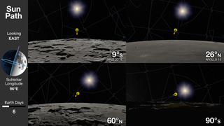
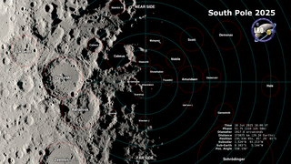
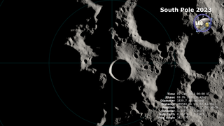
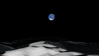
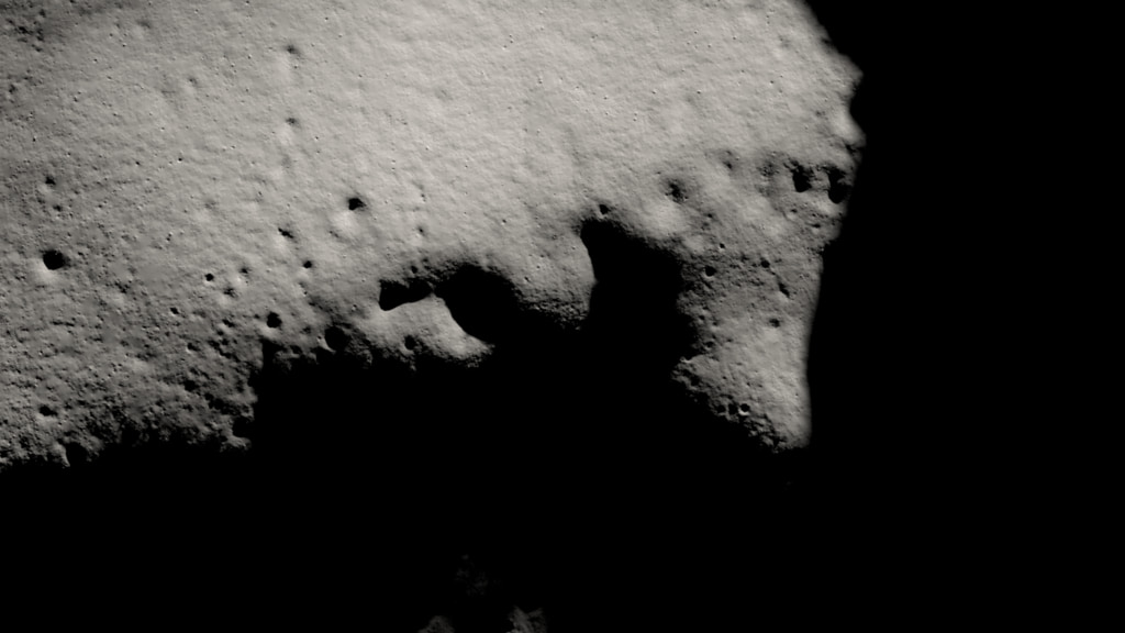
At the Moon's North and South Poles, the Sun is never more than 1.5° above or below the horizon. The resulting pattern of daylight and shadows is unlike anywhere else on the Moon — or the Earth. After zooming in on a small lunar highland area near the South Pole, this visualization recreates the illumination conditions there over a period of two lunar days, equal to two months on Earth.
This close to the pole, the Sun doesn't rise and set. Instead, as the Moon rotates on its axis, the Sun skims the horizon, traveling a full 360 degrees around the terrain. Mountains as far as 75 miles (120 kilometers) away cast shadows across the landscape. With the Sun at such a low angle, it can never reach the floors of some deep craters. Places the Sun never reaches are known as permanently shadowed regions. They are the locations of some of the coldest spots in the solar system, and because of that, they trap volatile chemicals, including water ice, that would immediately sublimate (transform directly from a solid to a gas) in the harsh, airless sunshine that falls in most other places on the Moon.
The Sun appears to travel in a circle at the Earth's poles, too, but it also travels through a range of altitudes. From spring equinox to summer solstice, for example, the Sun is climbing higher in the sky, reaching an altitude of 23.4°. It only hugs the horizon for a few days around the equinoxes. At the Moon's poles, the Sun is always near the horizon, and the shadows are perpetually long, sweeping across the surface with the changing solar azimuth.
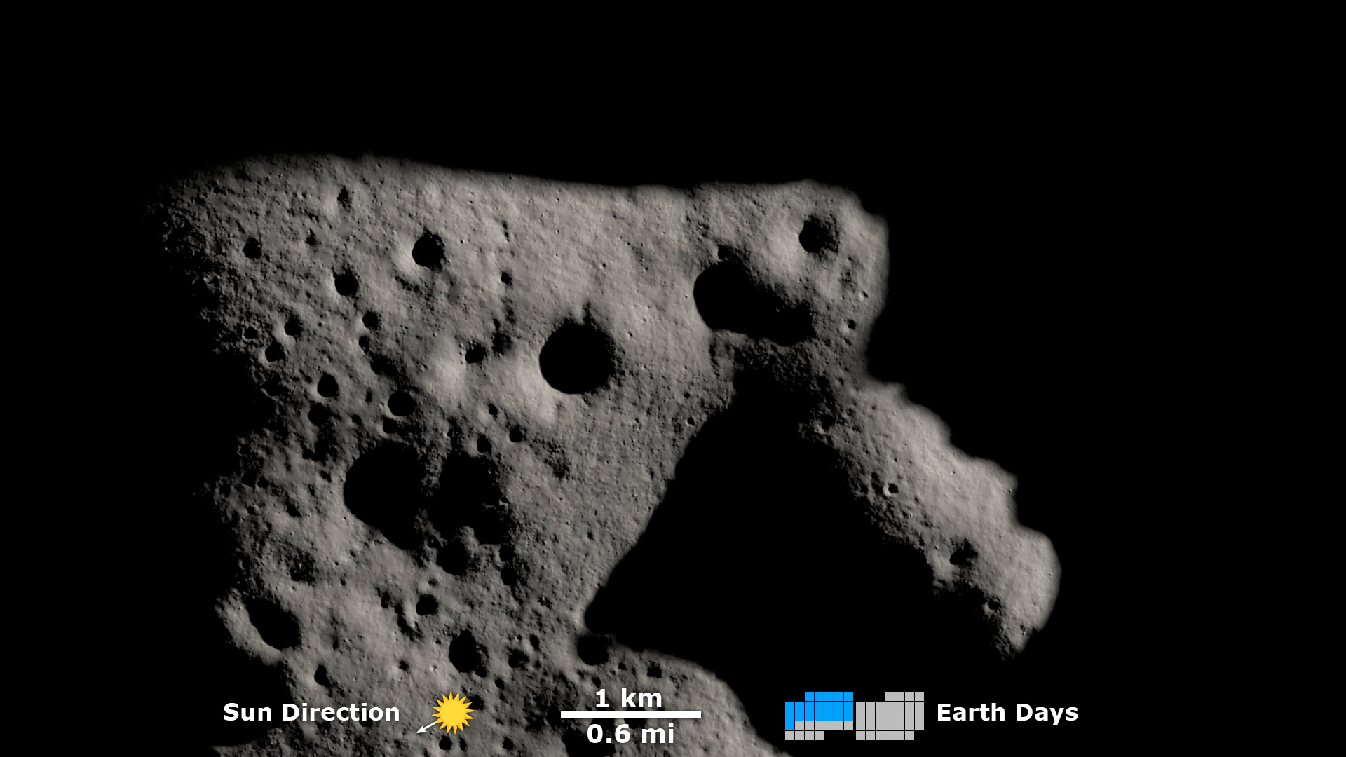
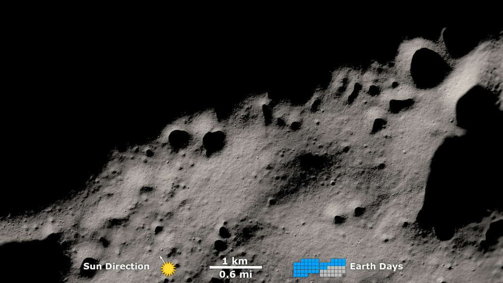
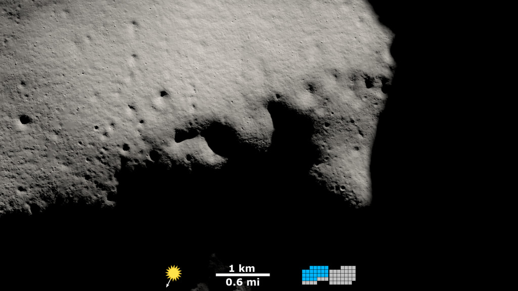
Shadows near the Moon's South Pole
This close to the pole, the Sun doesn't rise and set. Instead, as the Moon rotates on its axis, the Sun skims the horizon, traveling a full 360 degrees around the terrain. Mountains as far as 75 miles (120 kilometers) away cast shadows across the landscape. With the Sun at such a low angle, it can never reach the floors of some deep craters. Places the Sun never reaches are known as permanently shadowed regions. They are the locations of some of the coldest spots in the solar system, and because of that, they trap volatile chemicals, including water ice, that would immediately sublimate (transform directly from a solid to a gas) in the harsh, airless sunshine that falls in most other places on the Moon.
The Sun appears to travel in a circle at the Earth's poles, too, but it also travels through a range of altitudes. From spring equinox to summer solstice, for example, the Sun is climbing higher in the sky, reaching an altitude of 23.4°. It only hugs the horizon for a few days around the equinoxes. At the Moon's poles, the Sun is always near the horizon, and the shadows are perpetually long, sweeping across the surface with the changing solar azimuth.
Used Elsewhere In
Related
Visualization Credits
Ernie Wright (USRA): Lead Visualizer
David Ladd (USRA): Lead Producer
David Ladd (USRA): Lead Video Editor
David Ladd (USRA): Narrator
Noah Petro (NASA/GSFC): Lead Scientist
Laurence Schuler (ADNET Systems, Inc.): Technical Support
Ian Jones (ADNET Systems, Inc.): Technical Support
David Ladd (USRA): Lead Producer
David Ladd (USRA): Lead Video Editor
David Ladd (USRA): Narrator
Noah Petro (NASA/GSFC): Lead Scientist
Laurence Schuler (ADNET Systems, Inc.): Technical Support
Ian Jones (ADNET Systems, Inc.): Technical Support
Please give credit for this item to:
NASA's Scientific Visualization Studio
Music Provided by Universal Production Music: "Two Horizons" – Anthony d’Amario
Short URL to share this page:
https://svs.gsfc.nasa.gov/4893
Mission:
LRO (Lunar Reconnaissance Orbiter)
Data Used:
Note: While we identify the data sets used in these visualizations, we do not store any further details nor the data sets themselves on our site.
Keywords:
SVS >> HDTV
SVS >> Moon
SVS >> Hyperwall
SVS >> LRO
SVS >> Lunar Reconnaissance Orbiter
SVS >> Moon >> South Pole
NASA Science >> Planets and Moons
SVS >> Permanently Shadowed Regions
https://svs.gsfc.nasa.gov/4893
Mission:
LRO (Lunar Reconnaissance Orbiter)
Data Used:
LRO/LOLA/Digital Elevation Map also referred to as: DEM
Lunar Reconnaissance Orbiter/LRO Camera/Natural Color Hapke Normalized WAC Mosaic also referred to as: LROC WAC Color Mosaic
Mosaic - Arizona State University
This natural-color global mosaic is based on the 'Hapke normalized' mosaic from LRO's wide-angle camera. The data has been gamma corrected, white balanced, and range adjusted to more closely match human vision.
Keywords:
SVS >> HDTV
SVS >> Moon
SVS >> Hyperwall
SVS >> LRO
SVS >> Lunar Reconnaissance Orbiter
SVS >> Moon >> South Pole
NASA Science >> Planets and Moons
SVS >> Permanently Shadowed Regions


