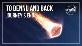
Planets and Moons
ID: 4862
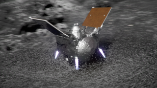
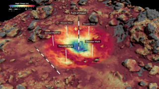
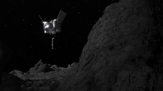
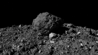
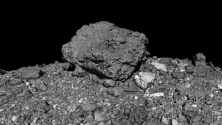
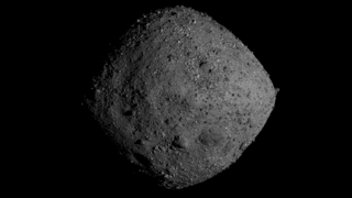
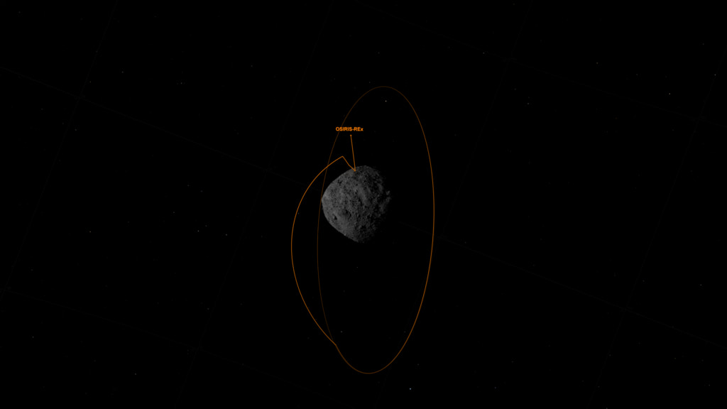
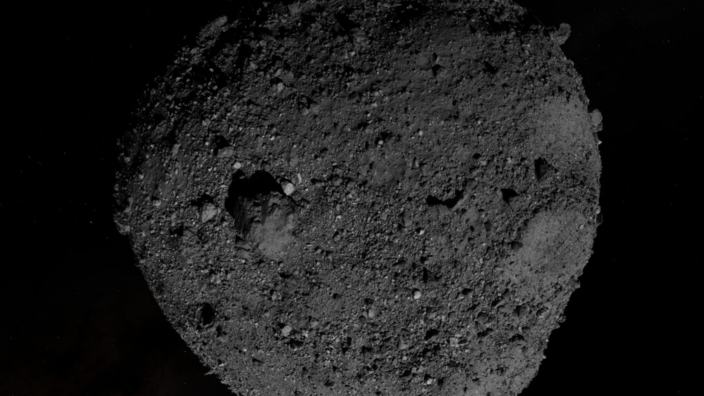
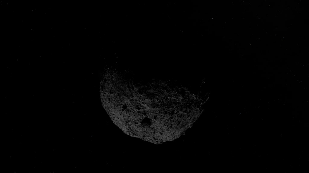
On Oct. 20, the OSIRIS-REx spacecraft will perform the first attempt of its Touch-And-Go (TAG) sample collection event. This series of maneuvers will bring the spacecraft down to site Nightingale, a rocky area 52 ft (16 m) in diameter in Bennu’s northern hemisphere, where the spacecraft’s robotic sampling arm will attempt to collect a sample. Site Nightingale was selected as the mission’s primary sample site because it holds the greatest amount of unobstructed fine-grained material, but the region is surrounded by building-sized boulders. During the sampling event, the spacecraft, which is the size of a large van, will attempt to touch down in an area that is only the size of a few parking spaces, and just a few steps away from some of these large boulders.
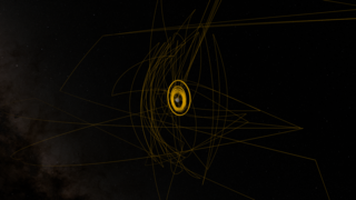
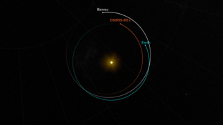
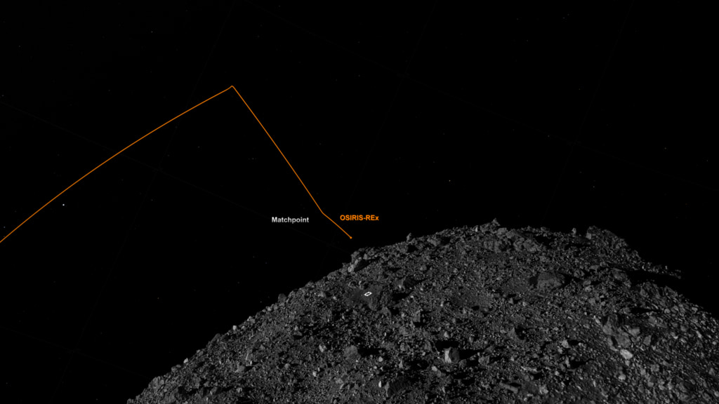
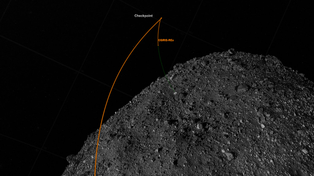
During the 4.5-hour sample collection event, the spacecraft will perform three separate maneuvers to reach the asteroid’s surface. The descent sequence begins with OSIRIS-REx firing its thrusters for an orbit departure maneuver to leave its safe-home orbit approximately 2,500 feet (770 meters) from Bennu's surface. After traveling four hours on this downward trajectory, the spacecraft performs the “Checkpoint” maneuver at an approximate altitude of 410 ft (125 m). This thruster burn adjusts OSIRIS-REx’s position and speed to descend steeply toward the surface. About 11 minutes later, the spacecraft performs the “Matchpoint” burn at an approximate altitude of 177 ft (54 m), slowing its descent and targeting a path to match the asteroid's rotation at the time of contact. The spacecraft then descends to the surface, touches down for less than sixteen seconds and fires one of its three pressurized nitrogen bottles. The gas agitates and lifts Bennu’s surface material, which is then caught in the spacecraft’s collector head. After this brief touch, OSIRIS-REx fires its thrusters to back away from Bennu’s surface and navigates to a safe distance from the asteroid.
TAG Event – Visualizations
During the 4.5-hour sample collection event, the spacecraft will perform three separate maneuvers to reach the asteroid’s surface. The descent sequence begins with OSIRIS-REx firing its thrusters for an orbit departure maneuver to leave its safe-home orbit approximately 2,500 feet (770 meters) from Bennu's surface. After traveling four hours on this downward trajectory, the spacecraft performs the “Checkpoint” maneuver at an approximate altitude of 410 ft (125 m). This thruster burn adjusts OSIRIS-REx’s position and speed to descend steeply toward the surface. About 11 minutes later, the spacecraft performs the “Matchpoint” burn at an approximate altitude of 177 ft (54 m), slowing its descent and targeting a path to match the asteroid's rotation at the time of contact. The spacecraft then descends to the surface, touches down for less than sixteen seconds and fires one of its three pressurized nitrogen bottles. The gas agitates and lifts Bennu’s surface material, which is then caught in the spacecraft’s collector head. After this brief touch, OSIRIS-REx fires its thrusters to back away from Bennu’s surface and navigates to a safe distance from the asteroid.
Used Elsewhere In

Related

Visualization Credits
Kel Elkins (USRA): Lead Visualizer
Dan Gallagher (USRA): Producer
Brittany Enos (The University of Arizona): Writer
Dan Gallagher (USRA): Producer
Brittany Enos (The University of Arizona): Writer
Please give credit for this item to:
NASA's Goddard Space Flight Center
Data provided by NASA/University of Arizona/CSA/York University/MDA.
NASA's Goddard Space Flight Center
Data provided by NASA/University of Arizona/CSA/York University/MDA.
Short URL to share this page:
https://svs.gsfc.nasa.gov/4862
Data Used:
Note: While we identify the data sets used in these visualizations, we do not store any further details nor the data sets themselves on our site.
Keywords:
SVS >> Asteroid
SVS >> Elevation data
SVS >> HDTV
SVS >> Imaging
SVS >> Orbit
SVS >> Hyperwall
SVS >> OSIRIS-REx
NASA Science >> Planets and Moons
SVS >> Bennu
SVS >> Sample Return
https://svs.gsfc.nasa.gov/4862
Data Used:
OSIRIS-REx/OLA/LIDAR
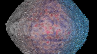
The OSIRIS-REx Laser Altimeter (OLA) is a scanning LIDAR (Light Detection and Ranging). LIDAR is similar to RADAR, but it uses light instead of radio waves to measure distance. OLA emitted laser pulses at the surface of Bennu, which reflected back from the surface and returned a portion of the laser pulse to the LIDAR detector. By carefully measuring the time difference between the outgoing pulse and the incoming pulse, the distance from the spacecraft to the surface of Bennu was computed using the speed of light. This allowed OLA to provide high-resolution topographical information about Bennu during the mission.
OSIRIS-REx/OCAMS/Imagery
Observed Data
The OSIRIS-REx Camera Suite (OCAMS) consists of three cameras: PolyCam, MapCam, and SamCam. These cameras captured a wealth of imagery during OSIRIS-REx’s time at asteroid Bennu. To help mission planners select a site on Bennu for sample collection, OCAMS provided global image mapping of the asteroid’s surface and more detailed images of potential sample sites. OCAMS also recorded the sampling event during the touch-and-go (TAG) maneuver.
Credit:
NASA/University of Arizona/CSA/York University/MDA
NASA/University of Arizona/CSA/York University/MDA
Keywords:
SVS >> Asteroid
SVS >> Elevation data
SVS >> HDTV
SVS >> Imaging
SVS >> Orbit
SVS >> Hyperwall
SVS >> OSIRIS-REx
NASA Science >> Planets and Moons
SVS >> Bennu
SVS >> Sample Return


