Earth
ID: 4802
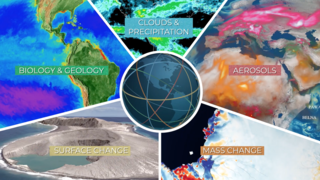
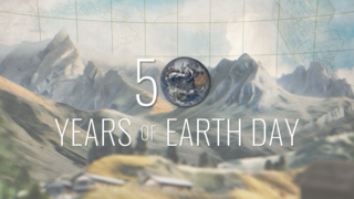
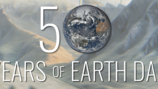
This visualization was created to be one of the final shots of a video celebrating the 50th anniversary of Earth Day. The camera starts under water off the coast of the Eastern United States showing layers of ocean currents from a computational model called ECCO-2. The camera slowly pulls back revealing the Gulf Stream, one of the most powerful ocean currents on Earth. The camera continues to pull back revealing NASA's Earth observing fleet.
Earth Day 2020: Gulf Stream ocean current pull out to Earth observing fleet
Used Elsewhere In
Related
Visualization Credits
Greg Shirah (NASA/GSFC): Lead Visualizer
Horace Mitchell (NASA/GSFC): Visualizer
Ryan Fitzgibbons (USRA): Producer
Horace Mitchell (NASA/GSFC): Visualizer
Ryan Fitzgibbons (USRA): Producer
Please give credit for this item to:
NASA's Scientific Visualization Studio
NASA's Scientific Visualization Studio
Short URL to share this page:
https://svs.gsfc.nasa.gov/4802
Data Used:
Note: While we identify the data sets used in these visualizations, we do not store any further details nor the data sets themselves on our site.
This item is part of these series:
Earth Observing Fleet
Earth Day 2020
Keywords:
DLESE >> Physical oceanography
GCMD >> Earth Science >> Oceans >> Ocean Circulation >> Ocean Currents
SVS >> Orbit
SVS >> Hyperwall
NASA Science >> Earth
GCMD keywords can be found on the Internet with the following citation: Olsen, L.M., G. Major, K. Shein, J. Scialdone, S. Ritz, T. Stevens, M. Morahan, A. Aleman, R. Vogel, S. Leicester, H. Weir, M. Meaux, S. Grebas, C.Solomon, M. Holland, T. Northcutt, R. A. Restrepo, R. Bilodeau, 2013. NASA/Global Change Master Directory (GCMD) Earth Science Keywords. Version 8.0.0.0.0
https://svs.gsfc.nasa.gov/4802
Data Used:
GTOPO30 Topography and Bathymetry
Data Compilation - USGSCelesTrak Spacecraft Orbit Ephemeris
EphemerisECCO2 High Resolution Ocean and Sea Ice Model also referred to as: ECCO2
Model - NASA/JPLThis item is part of these series:
Earth Observing Fleet
Earth Day 2020
Keywords:
DLESE >> Physical oceanography
GCMD >> Earth Science >> Oceans >> Ocean Circulation >> Ocean Currents
SVS >> Orbit
SVS >> Hyperwall
NASA Science >> Earth
GCMD keywords can be found on the Internet with the following citation: Olsen, L.M., G. Major, K. Shein, J. Scialdone, S. Ritz, T. Stevens, M. Morahan, A. Aleman, R. Vogel, S. Leicester, H. Weir, M. Meaux, S. Grebas, C.Solomon, M. Holland, T. Northcutt, R. A. Restrepo, R. Bilodeau, 2013. NASA/Global Change Master Directory (GCMD) Earth Science Keywords. Version 8.0.0.0.0


