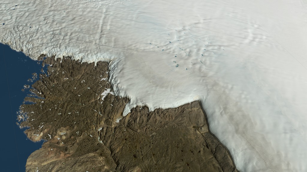
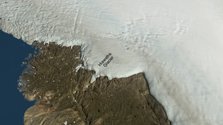
Greenland's Hiawatha Crater
Ice-penetrating radar sends radio waves downward into the ice sheet and measures the energy reflected back from within the ice sheet and the ground beneath. The radar data detects layers in the ice generated by climate events in the past. The radar data ("radargrams") is then displayed on curtains in the location where it was observed showing the layers in the ice.
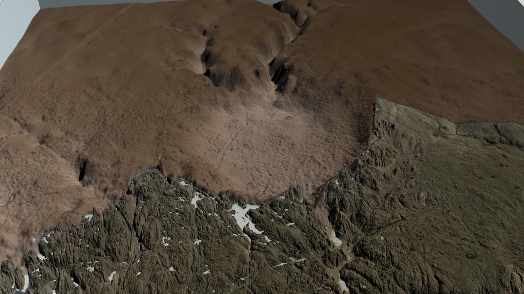
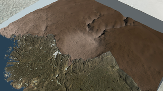
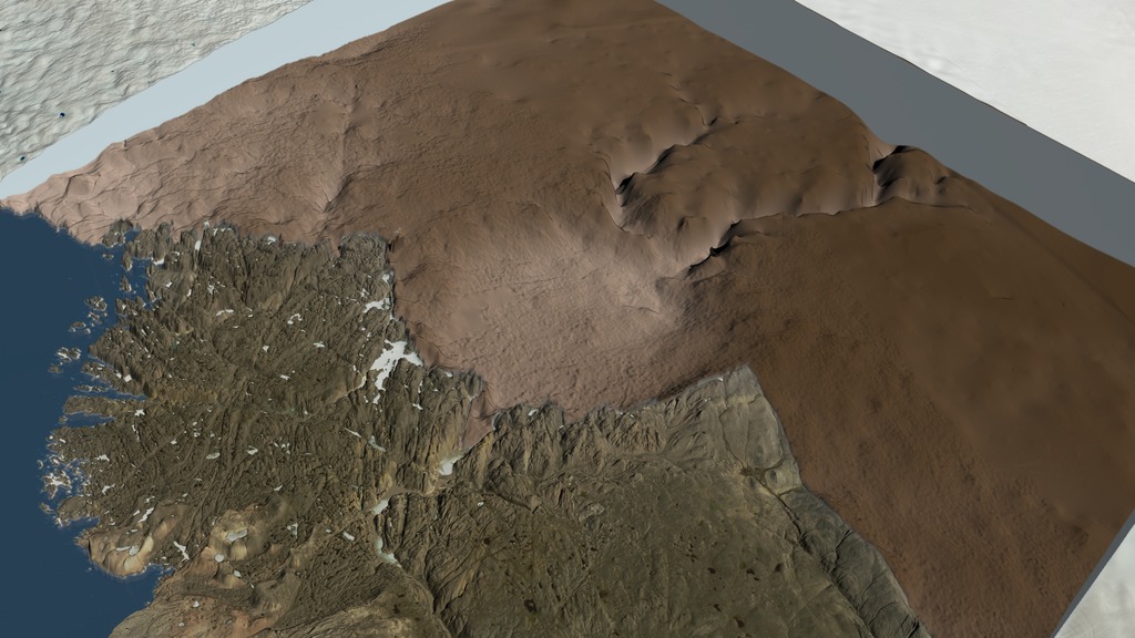
As the visualization shows the plane flying inland over Hiawatha Glacier, the ice sheet is cut away, leaving the radargram on the interior cutting plane. At this point, half of the depression of the Hiawatha impact crater is visible. A green grid fades in over the surface of the ice sheet showing the location of the flights that collected the radar data in spring 2016. The entire ice-sheet surface fades away and the full crater is visible as arrows point out the locations of the peaks in the central uplift and a red cylinder shows the best-fit rim of the impact crater. Radargram "curtains" fade on and are subsequently removed two at a time to allow examination of the structure of the ice that fills the crater. Note that the lower layers of ice near the crater floor appear disturbed, while the upper layers appear smooth and undisturbed.
Subsequent helicopter visits to the deglaciated terrain in front of Hiawatha Glacier by scientists from the Natural History Museum in Denmark recovered sediment samples from the main river that discharges water from beneath Hiawatha Glacier, through the northwestern rim breach. Laboratory examination revealed that these sediment samples contained shocked quartz and elevated platinum-group-element concentrations, both signs that the sediment records evidence of the impact of an iron asteroid more than one kilometer wide. The Hiawatha impact crater is potentially one of the youngest large impact craters on Earth.
Used Elsewhere In
Alternate Version
Visualization Credits
Cindy Starr (Global Science and Technology, Inc.)
Visualizers:
Greg Shirah (NASA/GSFC)
Lori Perkins (NASA/GSFC)
Ernie Wright (USRA)
Scientists:
Joe MacGregor (NASA/GSFC)
Mark Fahnestock (University of Alaska)
Kurt Kjær (University of Copenhagen)
Producer:
Jefferson Beck (USRA)
Narrator:
LK Ward (USRA)
Editor:
Stuart A. Snodgrass (KBR Wyle Services, LLC)
Project Support:
Joycelyn Thomson Jones (NASA/GSFC)
Leann Johnson (Global Science and Technology, Inc.)
Eric Sokolowsky (Global Science and Technology, Inc.)
Technical Support:
Ian Jones (ADNET Systems, Inc.)
Laurence Schuler (ADNET Systems, Inc.)
NASA's Scientific Visualization Studio
https://svs.gsfc.nasa.gov/4706
Data Used:
Terra and Aqua/MODIS/Blue Marble: Next Generation also referred to as: BMNG
2004The Blue Marble data is courtesy of Reto Stockli (NASA/GSFC).
Terra and Aqua/MODIS/Land Surface Temperature
2005-08-13 to 2005-08-14Landsat-8/OLI/Band Combination 2,3,4 also referred to as: True Color
Observed DataSHIZUKU (GCOM-W1)/AMSR2/10 km Daily Sea Ice Concentration
Observed Data - Japan Aerospace Exploration Agency - 02/07/2016 - 08/14/2016AMSR2 data courtesy of the Japan Aerospace Exploration Agency (JAXA).
SHIZUKU (GCOM-W1)/AMSR2/10 km Daily 89 GHz Brightness Temperature
Observed Data - Japan Aerospace Exploration Agency - 02/07/2016 - 08/14/2016AMSR2 data courtesy of the Japan Aerospace Exploration Agency (JAXA).
Greenland Mass Conservation Dataset - Surface Elevation
Data Compilation - Ice Sheet Modeling Group, UC, Irvine - 1993 - 2013Greenland Mass Conservation Dataset - Bed Topography
Data Compilation - Ice Sheet Modeling Group, UC, Irvine - 1993 - 2013TERRA/MODIS/MODIS Mosaic of Greenland (MOG) Image Map
Mosaic - 2005WorldView-1, WorldView-2, and WorldView-3, GeoEye-1/ArcticDEM 5-meter Digital Surface Model Release 4 also referred to as: ArcticDEM 5-meter Digital Surface Model Release 4
Data Compilation - National Geospatial-Intelligence Agency/National Science FoundationCanadian Digital Elevation Data
Data Compilation - Government of Canada; Natural Resources Canada; Earth Sciences Sector; Canada Centre for Mapping and Earth ObservationHiawatha Glacier Gridded Bed Topography
Data CompilationHiawatha Glacier Gridded Bed Topography data is courtesy of Mathieu Morlighem (UCI).
Alfred Wegener Institute (AWI) Airborne Radar Survey of Hiawatha Glacier
Alfred Wegener Institute (AWI)Keywords:
DLESE >> Geology
SVS >> Greenbelt
SVS >> HDTV
SVS >> Ice Sheets
GCMD >> Earth Science >> Cryosphere >> Glaciers/Ice Sheets >> Ice Sheets
GCMD >> Earth Science >> Hydrosphere >> Glaciers/Ice Sheets >> Ice Sheets
GCMD >> Location >> Greenland
SVS >> Hyperwall
SVS >> Geology
SVS >> Craters
NASA Science >> Earth
GCMD >> Earth Science >> Terrestrial Hydrosphere >> Glaciers/Ice Sheets >> Ice Sheets
GCMD keywords can be found on the Internet with the following citation: Olsen, L.M., G. Major, K. Shein, J. Scialdone, S. Ritz, T. Stevens, M. Morahan, A. Aleman, R. Vogel, S. Leicester, H. Weir, M. Meaux, S. Grebas, C.Solomon, M. Holland, T. Northcutt, R. A. Restrepo, R. Bilodeau, 2013. NASA/Global Change Master Directory (GCMD) Earth Science Keywords. Version 8.0.0.0.0


