Earth
ID: 4613
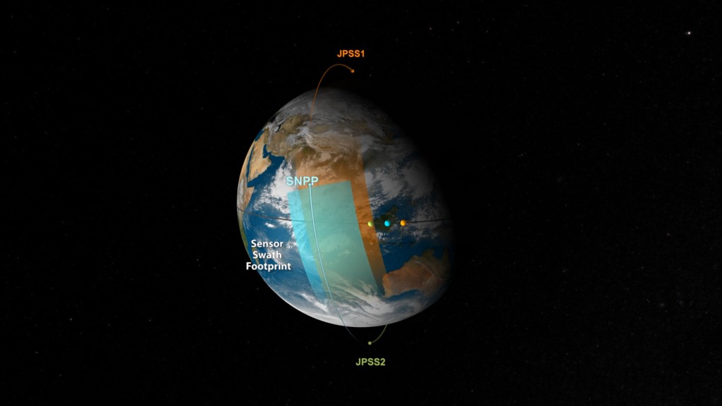
NOAA and NASA partnered to implement the Joint Polar Satellite System (JPSS). The JPSS Program constitutes the next series of U.S. civilian polar orbiting environmental remote sensing satellites and sensors that have been flown historically on polar satellites. These satellites will implement NOAA’s requirements for collection of global multi-spectral radiometry and other specialized meteorological and oceanographic data, via remote sensing of land, sea, and the atmosphere. These data will support NOAA’s mission for continuous observations of the Earth’s environment necessary to understand and predict changes in weather, climate, oceans and coasts, which support the Nation’s economy, and protect lives and property.
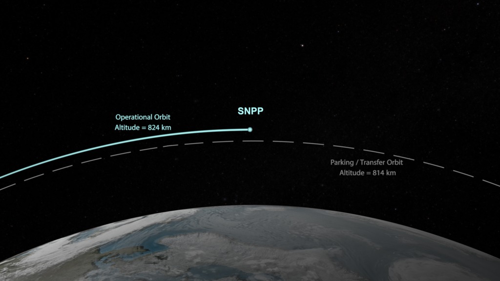
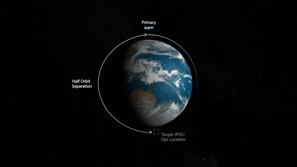
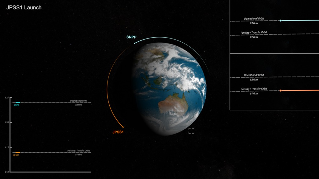
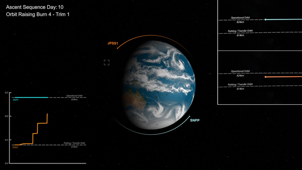
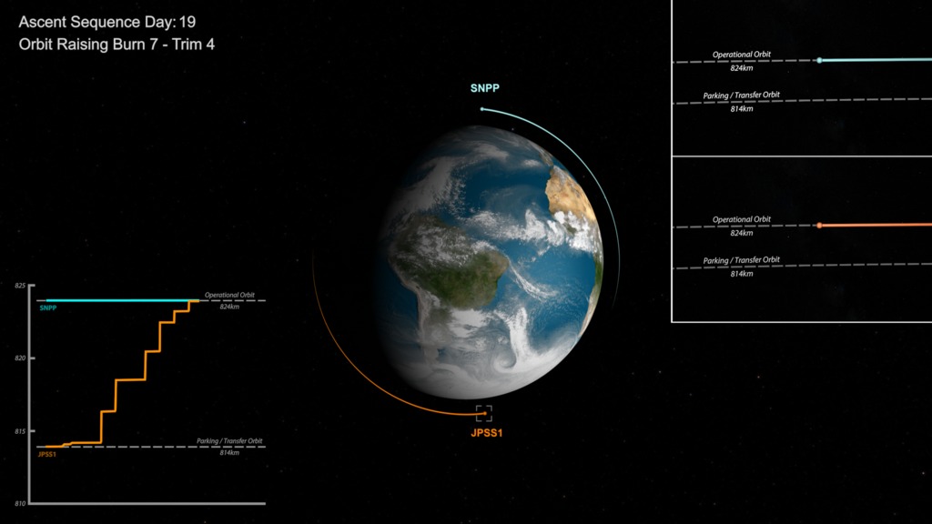
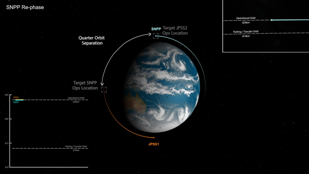
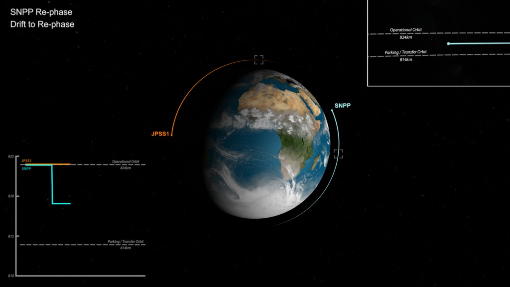
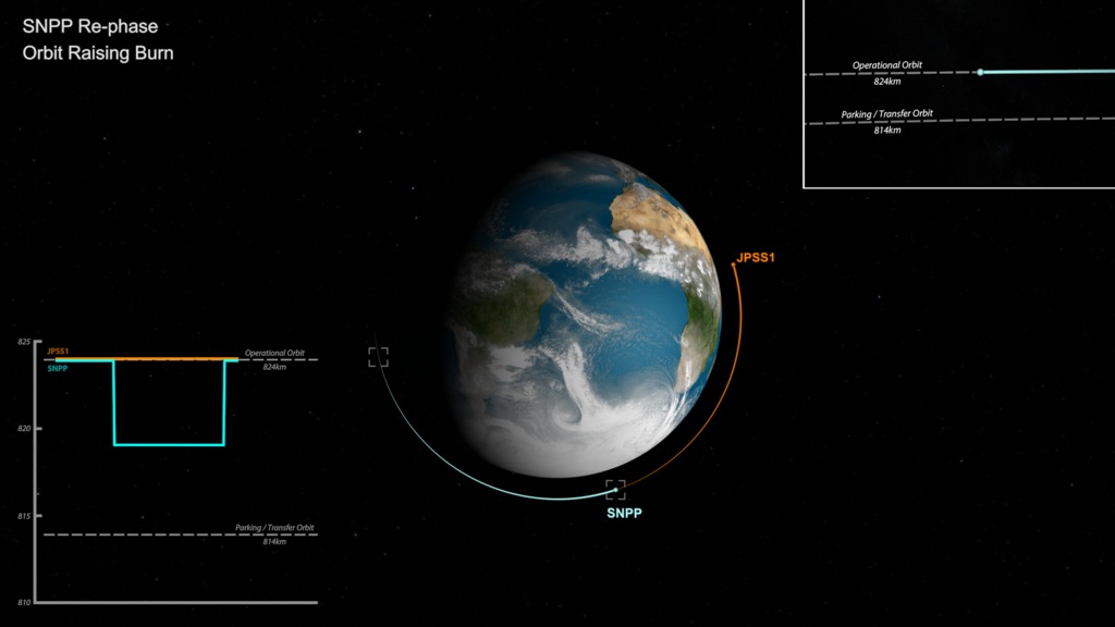
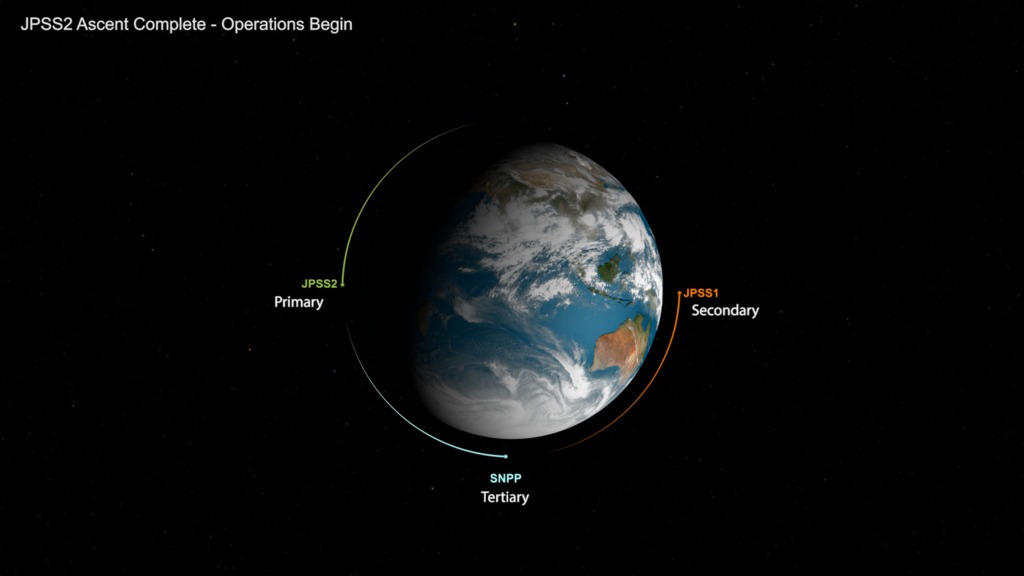
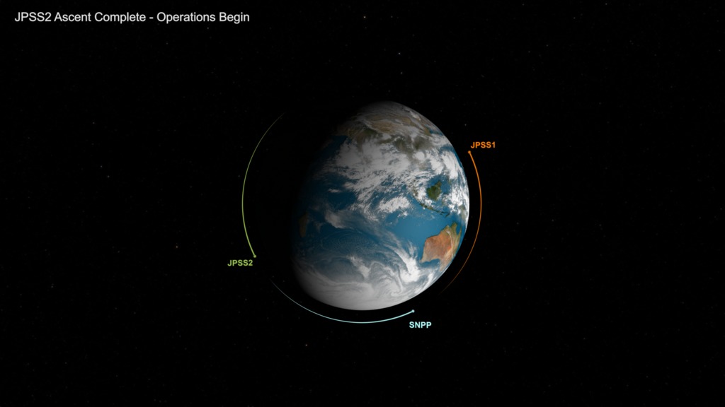
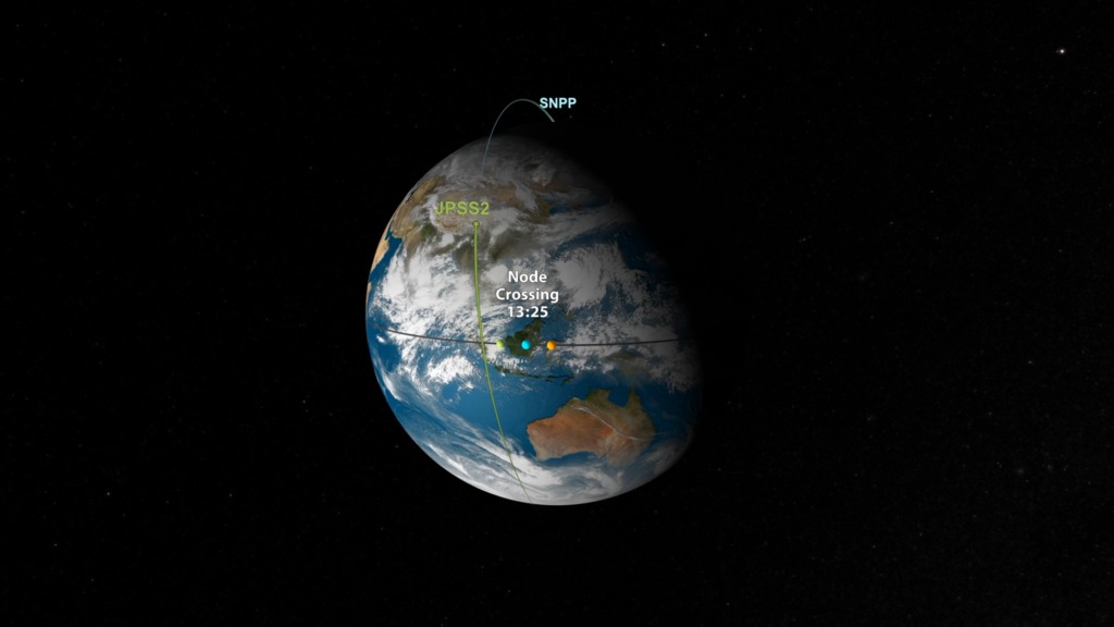
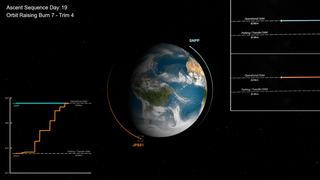
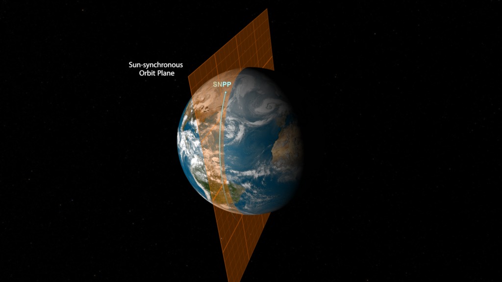
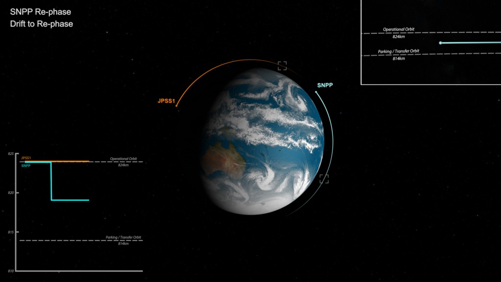
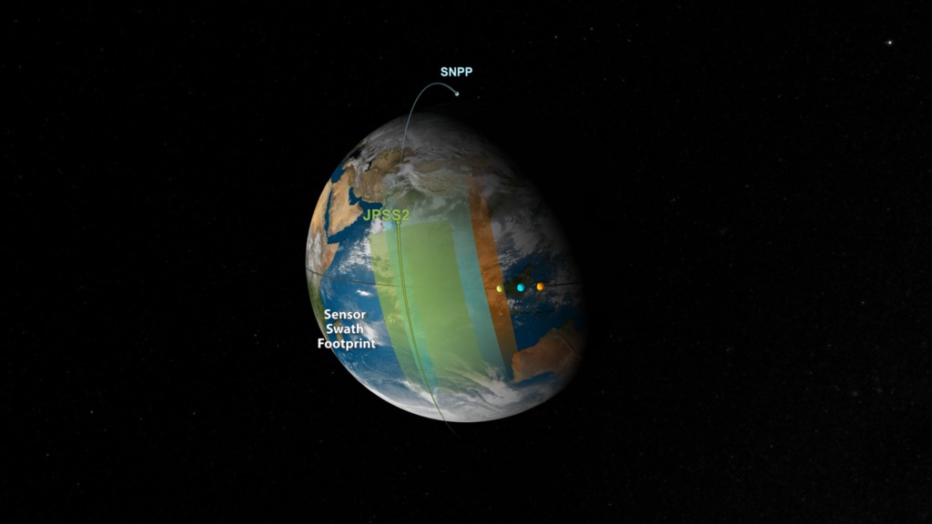
The JPSS constellation of satellites starts with JPSS-1 (now designated NOAA-20) sharing the polar orbit occupied by the currently primary operating Suomi National Polar-orbiting Partnership (S-NPP) satellite. JPSS constellation management consists of planning each mission such that a newly launched satellite (i.e. NOAA-20) is phased to reach an initial parking orbit for raising to its required operational orbit altitude in a half-orbit position relative to the existing (i.e. S-NPP) satellite. A planned sequence of orbit-raising maneuvers are executed to achieve this constellation configuration. When the satellite orbit raising and commissioning nominally completes the new satellite assumes a primary designation and S-NPP, in this case, assumes a secondary satellite designation. When the next JPSS satellite is to be launched (i.e. JPPS-2 ~2021) plans are to maneuver the secondary satellite beforehand to a different position so the next satellite can be phased and raised into a half-orbit separation from the current primary satellite. The resulting three-satellite constellation maintains primary and secondary operating satellites ~ 50 minutes apart and the now tertiary satellite approximately a quarter-orbit separation between the other two – all generating remote sensing data of the earth.
To learn more about JPSS, visit http://www.jpss.noaa.gov/

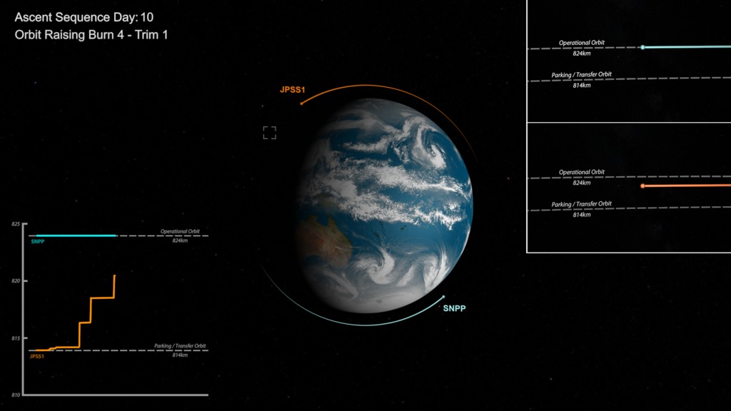
JPSS Concept of Operations: Constellation Management
The JPSS constellation of satellites starts with JPSS-1 (now designated NOAA-20) sharing the polar orbit occupied by the currently primary operating Suomi National Polar-orbiting Partnership (S-NPP) satellite. JPSS constellation management consists of planning each mission such that a newly launched satellite (i.e. NOAA-20) is phased to reach an initial parking orbit for raising to its required operational orbit altitude in a half-orbit position relative to the existing (i.e. S-NPP) satellite. A planned sequence of orbit-raising maneuvers are executed to achieve this constellation configuration. When the satellite orbit raising and commissioning nominally completes the new satellite assumes a primary designation and S-NPP, in this case, assumes a secondary satellite designation. When the next JPSS satellite is to be launched (i.e. JPPS-2 ~2021) plans are to maneuver the secondary satellite beforehand to a different position so the next satellite can be phased and raised into a half-orbit separation from the current primary satellite. The resulting three-satellite constellation maintains primary and secondary operating satellites ~ 50 minutes apart and the now tertiary satellite approximately a quarter-orbit separation between the other two – all generating remote sensing data of the earth.
To learn more about JPSS, visit http://www.jpss.noaa.gov/
Related

Visualization Credits
Kel Elkins (USRA): Lead Visualizer
Ernie Wright (USRA): Visualizer
Robert L. Harberts (NOAA-JPSS): Systems Engineer
Ernie Wright (USRA): Visualizer
Robert L. Harberts (NOAA-JPSS): Systems Engineer
Please give credit for this item to:
NASA's Scientific Visualization Studio
NASA's Scientific Visualization Studio
Short URL to share this page:
https://svs.gsfc.nasa.gov/4613
Data Used:
Note: While we identify the data sets used in these visualizations, we do not store any further details nor the data sets themselves on our site.
Keywords:
SVS >> Orbit
SVS >> Hyperwall
SVS >> Polar-orbiting
NASA Science >> Earth
SVS >> JPSS
https://svs.gsfc.nasa.gov/4613
Data Used:
Satellite ToolKit Ephemeris also referred to as: STK Ephemeris
Ephemeris - STK
Satellite ephemerides
Keywords:
SVS >> Orbit
SVS >> Hyperwall
SVS >> Polar-orbiting
NASA Science >> Earth
SVS >> JPSS


