Earth
ID: 4587
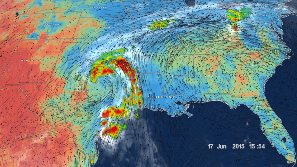
In several regions of the world, tropical cyclones have been known to maintain or increase strength after landfall without transitioning to extratropical systems. It is hypothesized that these inland areas help sustain tropical cyclones when there has been plentiful rainfall, leading to unusually wet soil and strong latent heat release. Additionally, given the symmetric structure of warm-core cyclones, the atmosphere should tend toward barotropic conditions that mimic an ocean environment. Observational and modeling studies support this "brown ocean" concept, providing a global climatology of inland tropical cyclones, pinpointing regions that are more favorable for re-intensification, and analyzing individual cyclones to better understand the associated land-atmosphere feedbacks.
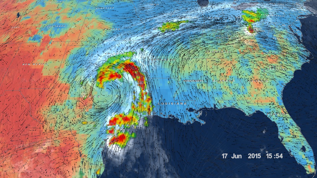
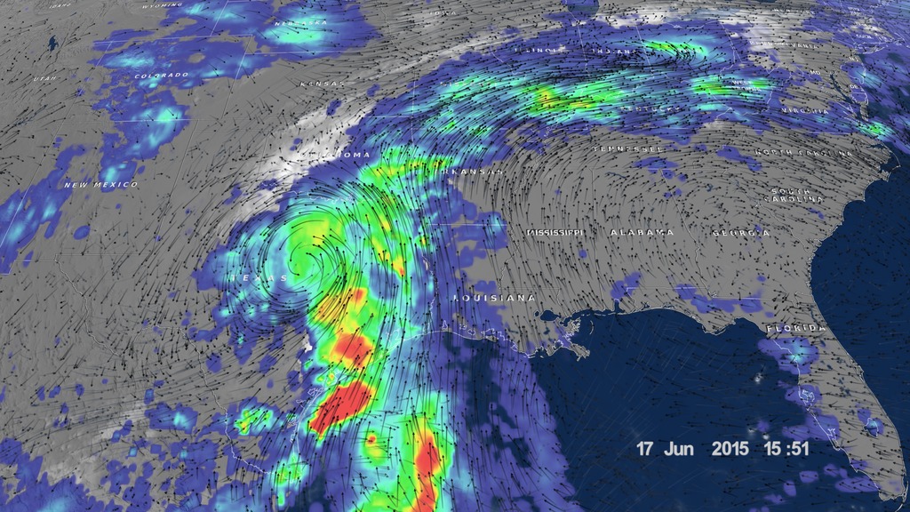
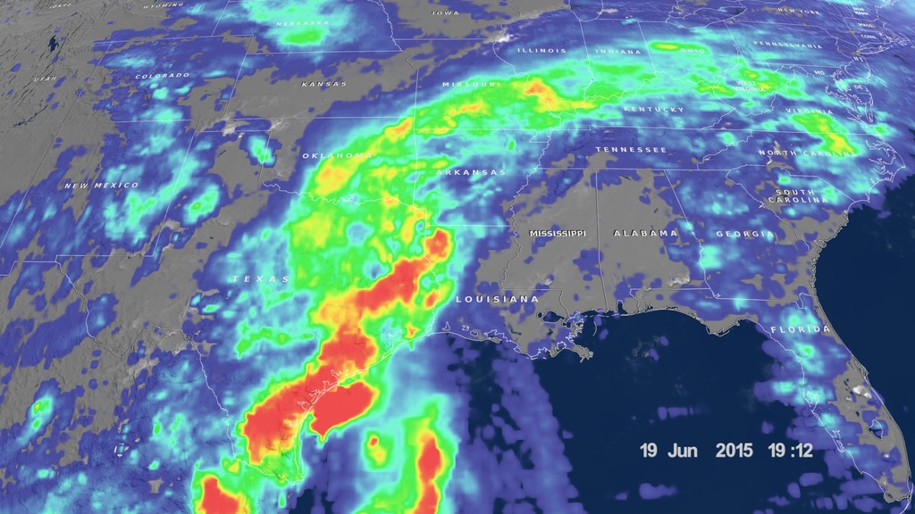
The Brown Ocean Effect
Related
Visualization Credits
Alex Kekesi (Global Science and Technology, Inc.): Lead Data Visualizer
Horace Mitchell (NASA/GSFC): Data Visualizer
Trent L. Schindler (USRA): Data Visualizer
Greg Shirah (NASA/GSFC): Data Visualizer
Matthew R. Radcliff (USRA): Lead Producer
Marshall Shepherd: Lead Scientist
Theresa Andersen (University of Georgia): Researcher
Laurence Schuler (ADNET Systems, Inc.): Technical Support
Ian Jones (ADNET Systems, Inc.): Technical Support
Please give credit for this item to:
NASA's Scientific Visualization Studio
NASA's Scientific Visualization Studio
Short URL to share this page:
https://svs.gsfc.nasa.gov/4587
Data Used:
Note: While we identify the data sets used in these visualizations, we do not store any further details nor the data sets themselves on our site.
This item is part of this series:
NASM2017
Keywords:
DLESE >> Atmospheric science
DLESE >> Hydrology
DLESE >> Natural hazards
SVS >> Rainfall
DLESE >> Soil science
SVS >> Tropical Storm
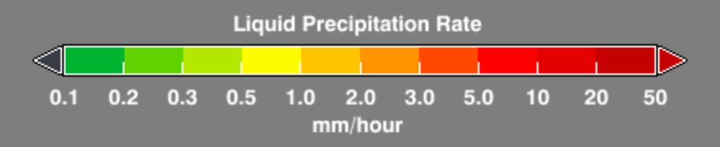
GCMD >> Earth Science >> Atmosphere >> Precipitation >> Rain
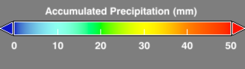
GCMD >> Earth Science >> Hydrosphere >> Surface Water >> Floods
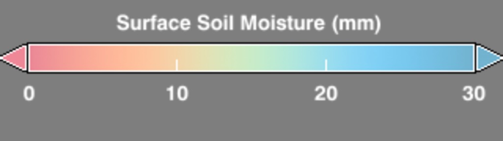
GCMD >> Earth Science >> Land Surface >> Soils >> Soil Moisture/Water Content
SVS >> Hyperwall
NASA Science >> Earth
GCMD >> Earth Science >> Climate Indicators >> Land Surface/agriculture Indicators >> Soil Moisture
GCMD >> Earth Science >> Human Dimensions >> Natural Hazards >> Floods
GCMD >> Earth Science >> Terrestrial Hydrosphere >> Surface Water >> Floods
SVS >> IMERG
GCMD keywords can be found on the Internet with the following citation: Olsen, L.M., G. Major, K. Shein, J. Scialdone, S. Ritz, T. Stevens, M. Morahan, A. Aleman, R. Vogel, S. Leicester, H. Weir, M. Meaux, S. Grebas, C.Solomon, M. Holland, T. Northcutt, R. A. Restrepo, R. Bilodeau, 2013. NASA/Global Change Master Directory (GCMD) Earth Science Keywords. Version 8.0.0.0.0
https://svs.gsfc.nasa.gov/4587
Data Used:
CPC (Climate Prediction Center) Cloud Composite
Data Compilation - Climate Prediction Center (CPC) - 6/10/2015 - 6/19/2015
Global cloud cover from multiple satellites
also referred to as: IMERG
Data Compilation - NASA/GSFC - 6/10/2015 - 6/19/2015Surface Soil Moisture corrected with SMOS imagery and assimilated by the Ensemble Kalman Filter also referred to as: NASA-USDA-FAS Soil Moisture
Data Compilation - NASA and USDA - 6/10/2015 - 6/19/2015
The surface soil moisture product is corrected by integrating satellite-derived Soil Moisture Ocean Salinity (SMOS) mission surface soil moisture retrievals into the modified Palmer two-layer soil moisture model. The SMOS imagery helps to correct the modified Pal
MERRA-2/Winds
Model - 6/10/2015 - 6/19/2015This item is part of this series:
NASM2017
Keywords:
DLESE >> Atmospheric science
DLESE >> Hydrology
DLESE >> Natural hazards
SVS >> Rainfall
DLESE >> Soil science
SVS >> Tropical Storm
GCMD >> Earth Science >> Atmosphere >> Precipitation >> Rain
GCMD >> Earth Science >> Hydrosphere >> Surface Water >> Floods
GCMD >> Earth Science >> Land Surface >> Soils >> Soil Moisture/Water Content
SVS >> Hyperwall
NASA Science >> Earth
GCMD >> Earth Science >> Climate Indicators >> Land Surface/agriculture Indicators >> Soil Moisture
GCMD >> Earth Science >> Human Dimensions >> Natural Hazards >> Floods
GCMD >> Earth Science >> Terrestrial Hydrosphere >> Surface Water >> Floods
SVS >> IMERG
GCMD keywords can be found on the Internet with the following citation: Olsen, L.M., G. Major, K. Shein, J. Scialdone, S. Ritz, T. Stevens, M. Morahan, A. Aleman, R. Vogel, S. Leicester, H. Weir, M. Meaux, S. Grebas, C.Solomon, M. Holland, T. Northcutt, R. A. Restrepo, R. Bilodeau, 2013. NASA/Global Change Master Directory (GCMD) Earth Science Keywords. Version 8.0.0.0.0


