Earthrise
There is a newer version of this story located here: https://svs.gsfc.nasa.gov/4129
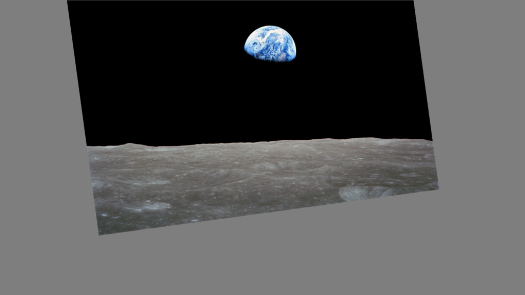
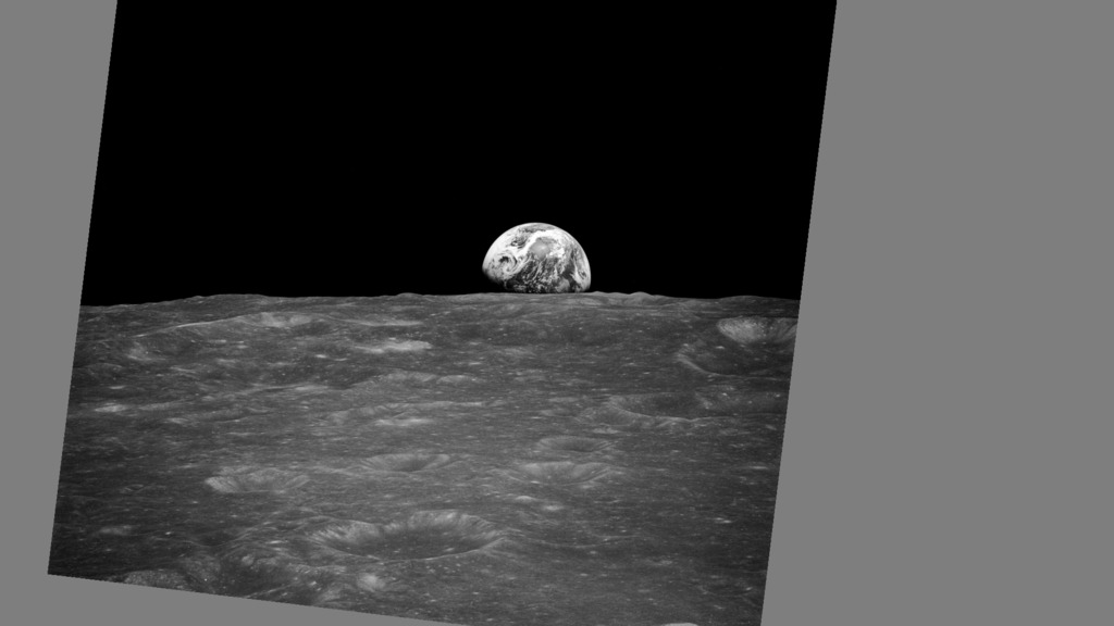
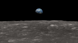
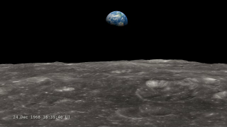
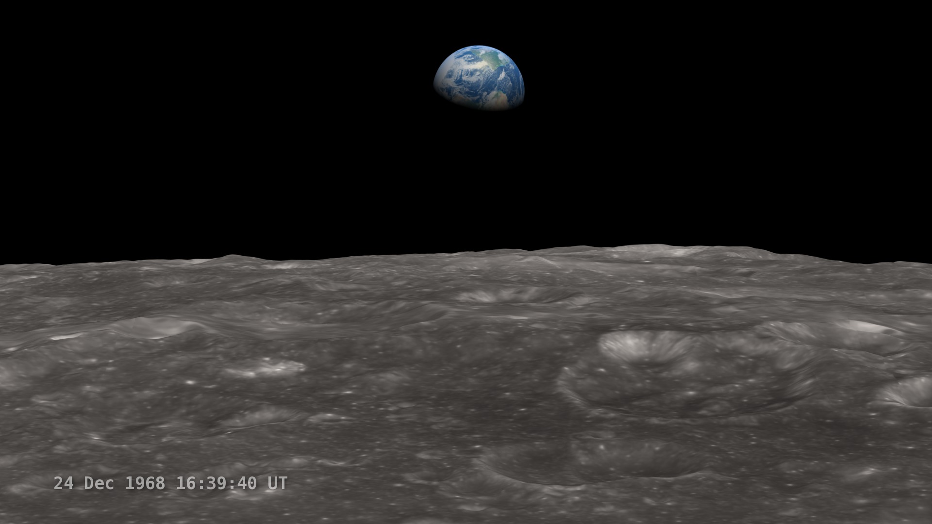
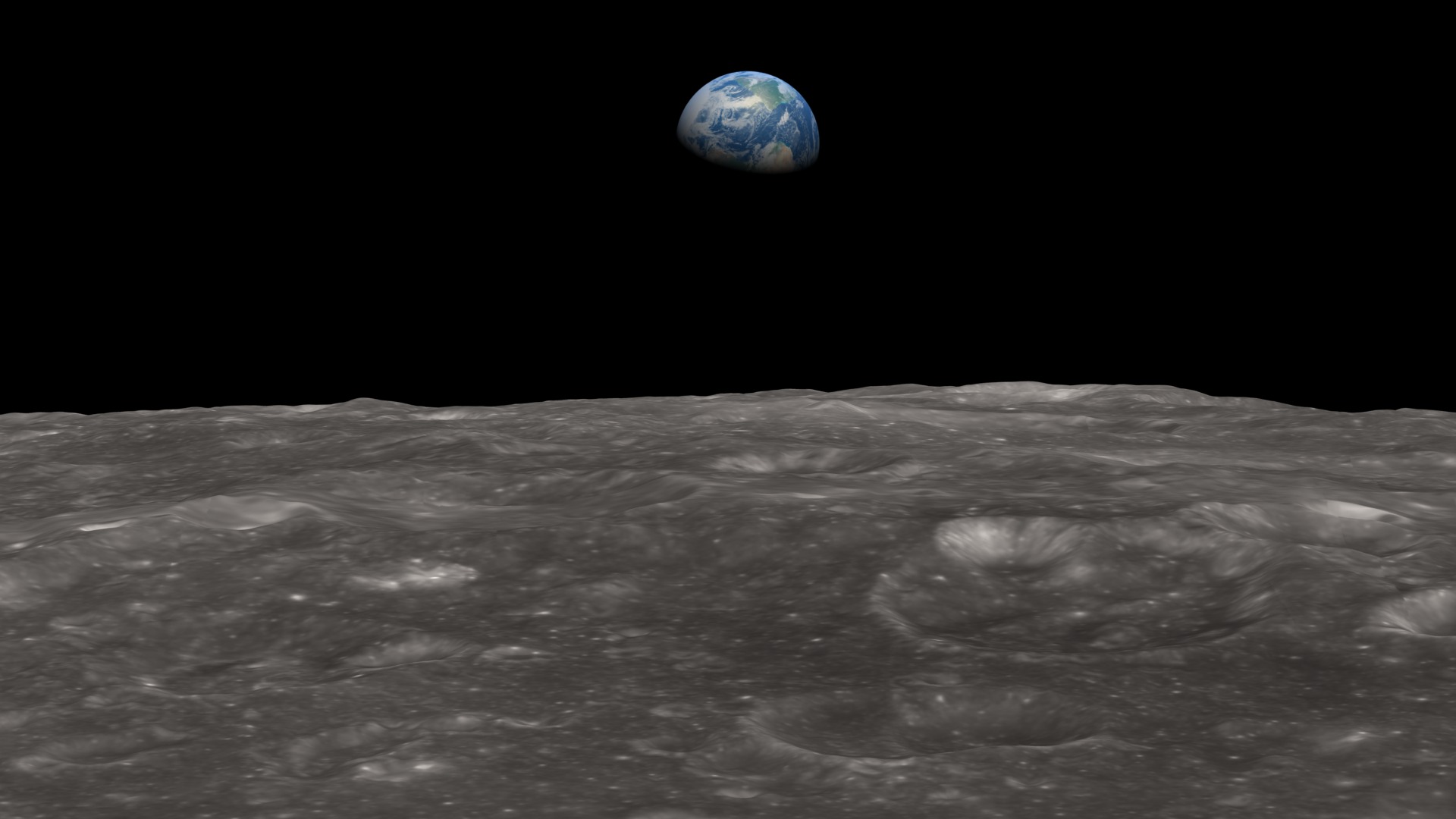
The sight of a small, intensely blue Earth rising above the barren, gray horizon of the Moon was one of the few things that NASA and the crew of Apollo 8 had not thoroughly planned and rehearsed beforehand. As historian Robert Poole noted, this lack of preparation meant that the sight of Earth came with the force of a revelation,
not just for the astronauts but for everyone on the ground. We came all this way to explore the Moon,
Apollo 8 astronaut Bill Anders said, and the most important thing is that we discovered the Earth.
Using the latest elevation data from Lunar Reconnaissance Orbiter, this visualization attempts to recreate what the astronauts saw. The virtual camera of the rendering software is put in the position of the Apollo 8 spacecraft at the time of the photographs, as the spacecraft emerged from its fourth pass behind the Moon. It shows a two-minute interval centered on 16:39:06 UT (10:39 a.m. Houston time) on December 24, 1968. This is around the time of AOS (acquisition of signal), the moment when radio contact is re-established after being lost on the far side of the Moon.
The position and motion of the spacecraft are based on a state vector, a set of (x, y, z) position and (vx, vy, vz) velocity values, published in NASA's Apollo 8 Mission Report about a year after the flight. The animator translated these values, given in Moon-centered inertial coordinates for Besselian year 1969.0, into a modern coordinate system, then calculated an orbit. The spacecraft was 110 km (68 miles, 60 nautical miles) above the surface of the Moon at 11.2°S 113.8°E when the Earthrise photograph was taken.
Used Elsewhere In
Newer Version

Visualization Credits
Chris Smith (HTSI): Producer
Richard Vondrak (NASA/GSFC): Scientist
NASA/Goddard Space Flight Center Scientific Visualization Studio
https://svs.gsfc.nasa.gov/3936
Missions:
Apollo
Clementine
LRO (Lunar Reconnaissance Orbiter)
Terra
Data Used:
Apollo 8 Trajectory Reconstruction
Ephemeris - NASA - Dec 1968 to Nov 1969LRO/LOLA/Digital Elevation Map also referred to as: DEM
Aug 2009 to Sep 2011Clementine/UVVIS Camera/750-nm Basemap
Mosaic - Feb 26 to Apr 21 1994Terra/MODIS/Blue Marble
Jun to Sep 2001The Blue Marble data is courtesy of Reto Stockli (NASA/GSFC).
This item is part of these series:
The Moon
LRO - Animations
Keywords:
SVS >> Earth
SVS >> Earth Day
SVS >> Elevation data
SVS >> Flyover
SVS >> HDTV
SVS >> Laser Altimeter
SVS >> Lunar
SVS >> Moon
SVS >> Hyperwall
SVS >> Lunar Reconnaissance Orbiter
SVS >> Lunar Surface
SVS >> Lunar Topography
SVS >> Lunar Elevation Map
SVS >> Solar System >> Moon >> Lunar Surface
NASA Science >> Planets and Moons
SVS >> Apollo 8


