Earth
ID: 3665
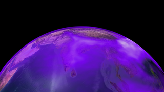
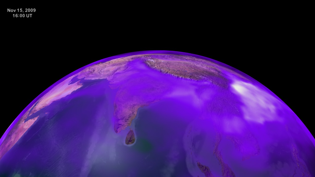
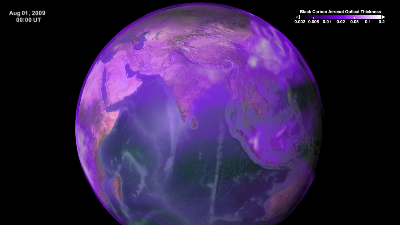
Tiny air pollution particles commonly called soot, but also known as black carbon, are in the air and on the move throughout our planet. Black carbon enters the air when fossil fuels and biofuels, such as coal, wood, and diesel are burned. Since black carbon readily absorbs heat from sunlight, the particles can affect Earth's climate, especially on a regional scale. Though global distribution of soot remains difficult to measure, NASA researchers use satellite data and computer models to better understand how these short-lived particles influence Earth's climate, cryosphere, and clouds. This scientific data visualization uses data from the GEOS5 GOCART climate model to show black carbon's atmospheric concentration from August to November in 2009.
A flat map version of this animation is available.
This visualziation was created in support of a presentation at the Fall 2009 American Geophysical Union (AGU) conference in San Fransisco, CA.
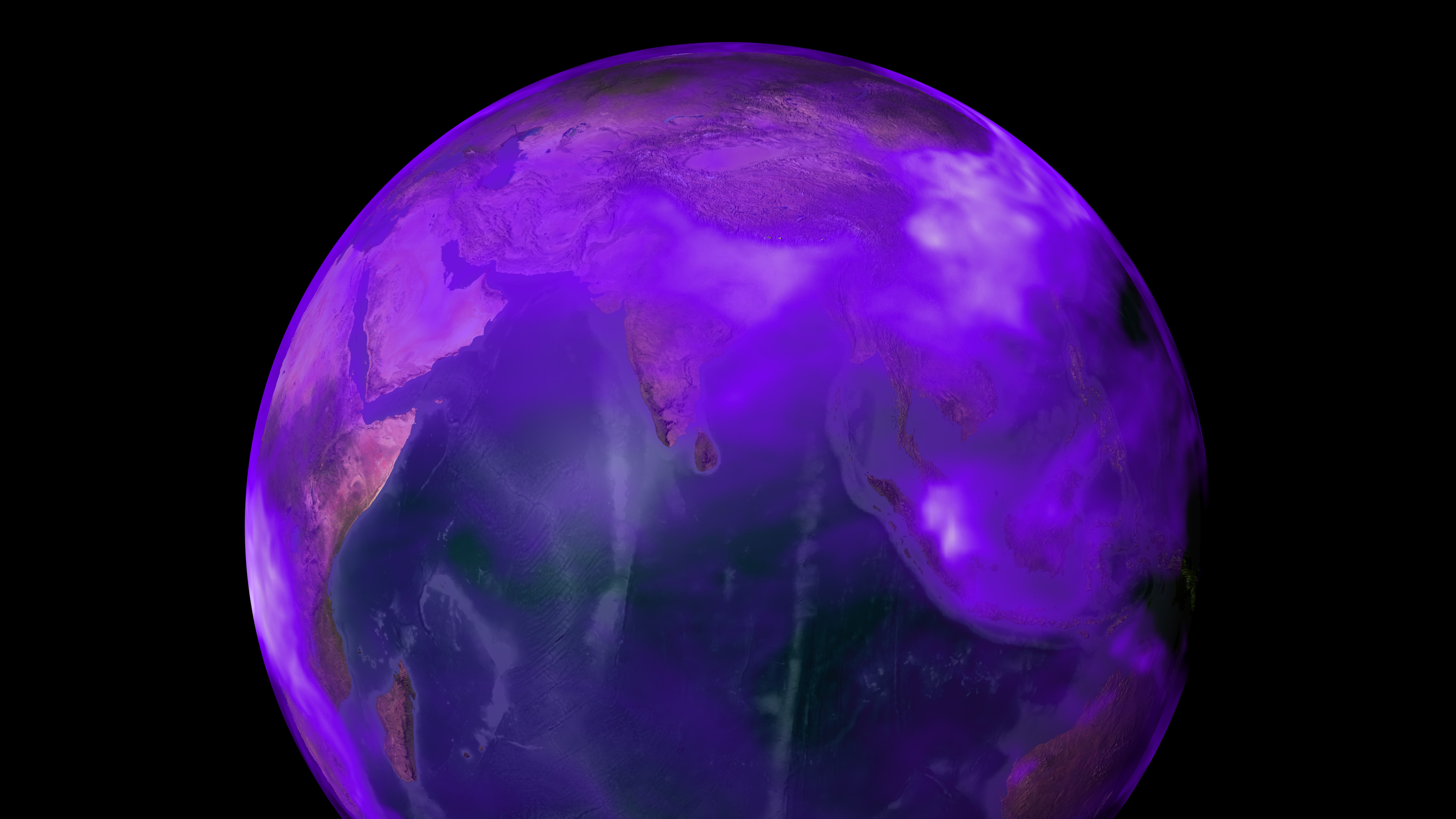
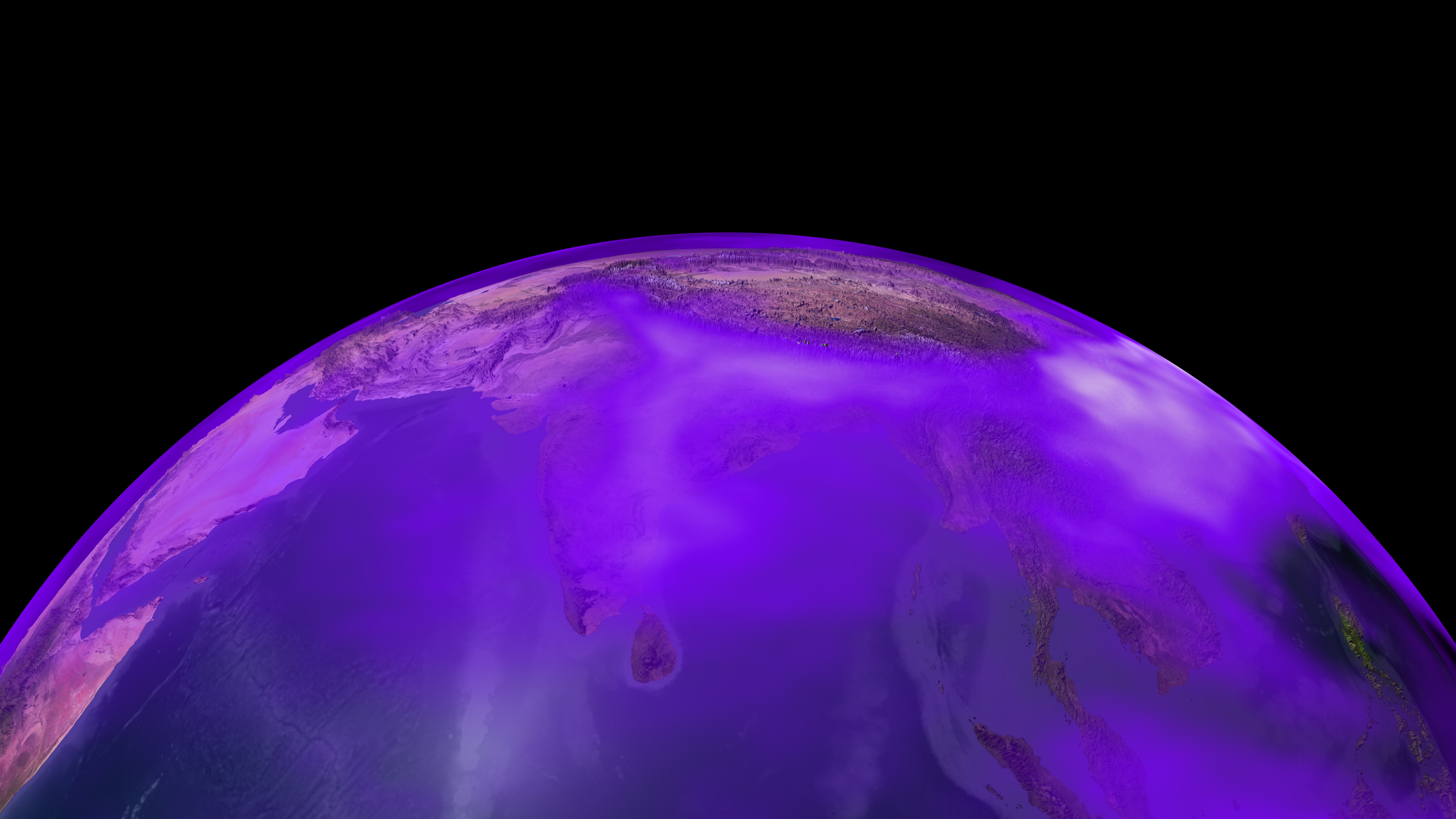
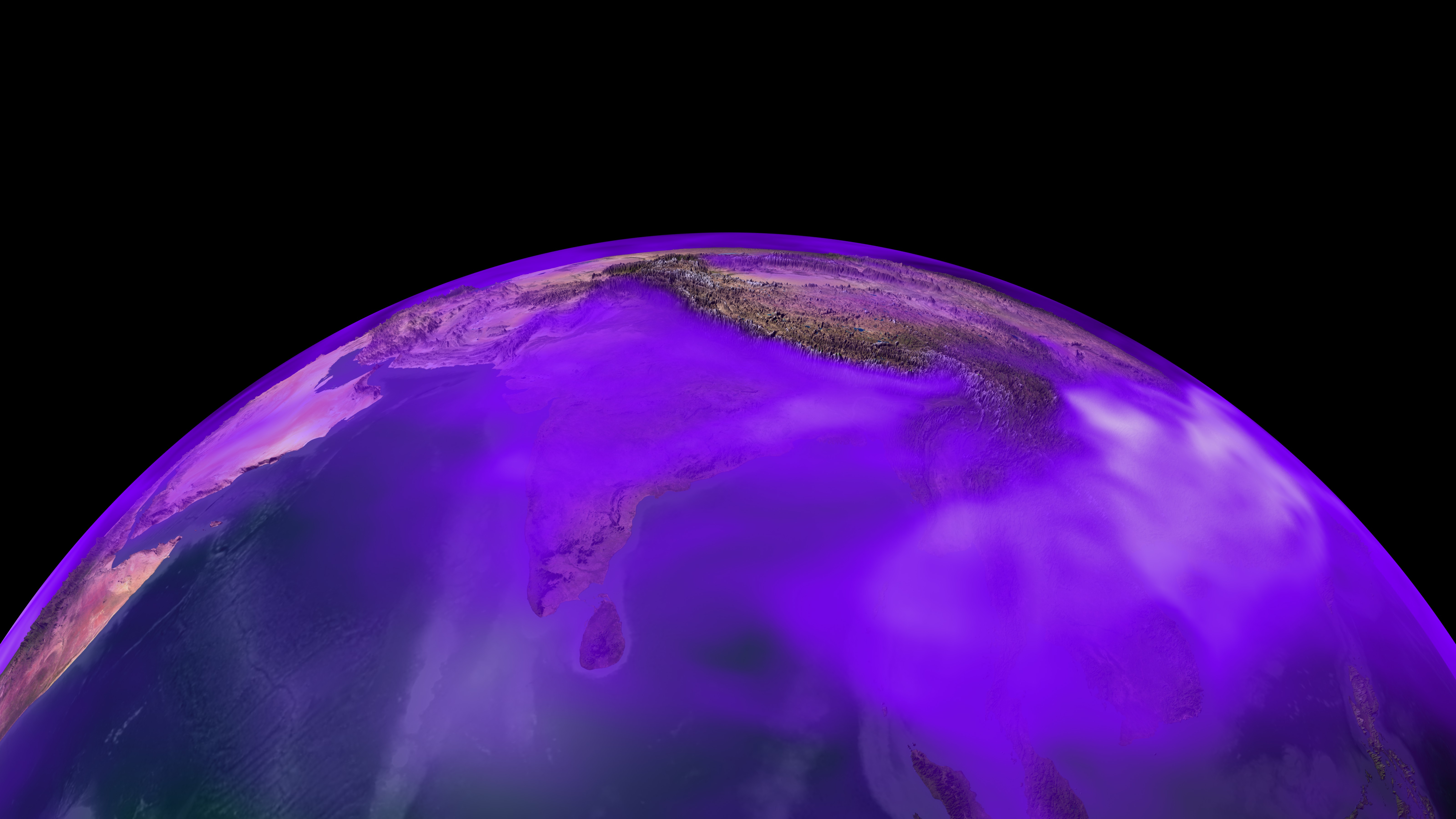
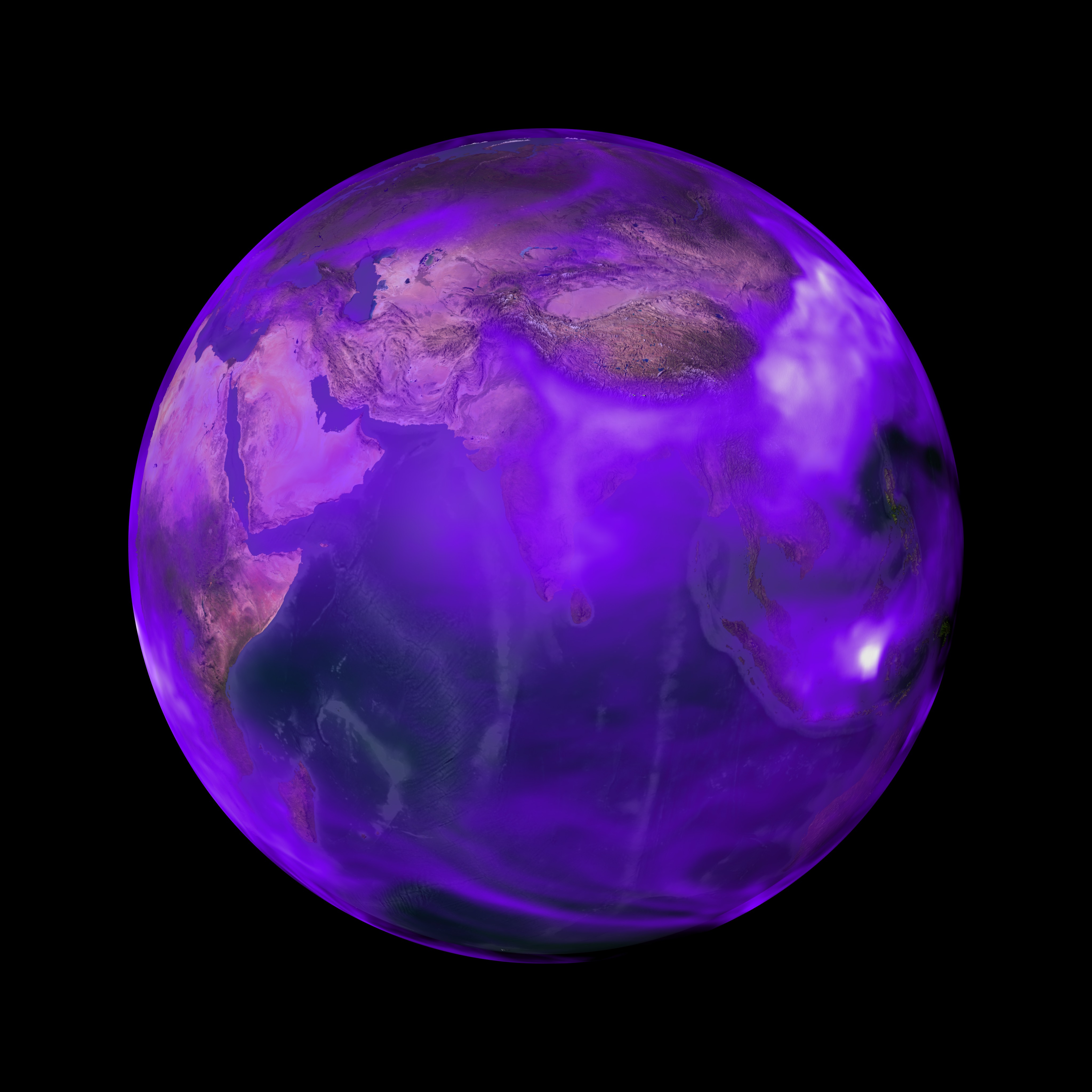
Global Transport of Black Carbon
A flat map version of this animation is available.
This visualziation was created in support of a presentation at the Fall 2009 American Geophysical Union (AGU) conference in San Fransisco, CA.
Related
Visualization Credits
Greg Shirah (NASA/GSFC): Lead Animator
Horace Mitchell (NASA/GSFC): Animator
Maria Frostic (UMBC): Producer
William K. Lau (NASA/GSFC): Scientist
Horace Mitchell (NASA/GSFC): Animator
Maria Frostic (UMBC): Producer
William K. Lau (NASA/GSFC): Scientist
Please give credit for this item to:
NASA/Goddard Space Flight Center Scientific Visualization Studio The Blue Marble Next Generation data is courtesy of Reto Stockli (NASA/GSFC) and NASA's Earth Observatory.
NASA/Goddard Space Flight Center Scientific Visualization Studio The Blue Marble Next Generation data is courtesy of Reto Stockli (NASA/GSFC) and NASA's Earth Observatory.
Short URL to share this page:
https://svs.gsfc.nasa.gov/3665
Mission:
Terra
Data Used:
Note: While we identify the data sets used in these visualizations, we do not store any further details nor the data sets themselves on our site.
Keywords:
SVS >> Carbon Release
SVS >> HDTV
SVS >> Hyperwall
SVS >> Climate Change
SVS >> Black Carbon
SVS >> For Educators
SVS >> Atmosphere >> Winds >> Circulation
SVS >> Pollution >> Distribution
SVS >> Fossil Fuels
NASA Science >> Earth
https://svs.gsfc.nasa.gov/3665
Mission:
Terra
Data Used:
Terra and Aqua/MODIS/Blue Marble: Next Generation also referred to as: BMNG
1/1/2004 - 12/31/2004
Credit:
The Blue Marble data is courtesy of Reto Stockli (NASA/GSFC).
The Blue Marble data is courtesy of Reto Stockli (NASA/GSFC).
GEOS Atmospheric Model
Model - NASA GMAO - 08/01/2009 to 11/19/2009Keywords:
SVS >> Carbon Release
SVS >> HDTV
SVS >> Hyperwall
SVS >> Climate Change
SVS >> Black Carbon
SVS >> For Educators
SVS >> Atmosphere >> Winds >> Circulation
SVS >> Pollution >> Distribution
SVS >> Fossil Fuels
NASA Science >> Earth


