Earth
ID: 3322
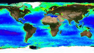
The Aqua satellite orbits the Earth every 99 minutes in a polar, sun-synchronous orbit. The MODIS instrument on Aqua observes reflected light from the Earth in 36 spectral frequencies. These observations can be processed to show many properties of the Earth's surface, from temperature and phytoplankton measurements near the surface of the ocean to fire occurrences and land cover characteristics on the land surface.
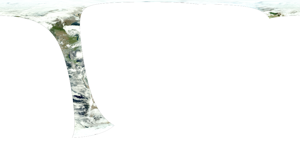
This animation shows about 4 days of MODIS data from individual Aqua orbits processed to look like true-color photographs of the planet's surface.
MODIS True Color Swaths during Hurricane Katrina
This animation shows about 4 days of MODIS data from individual Aqua orbits processed to look like true-color photographs of the planet's surface.
Related
Visualization Credits
Horace Mitchell (NASA/GSFC): Lead Animator
Norman Kuring (NASA/GSFC): Scientist
Gene Feldman (NASA/GSFC): Scientist
Norman Kuring (NASA/GSFC): Scientist
Gene Feldman (NASA/GSFC): Scientist
Please give credit for this item to:
NASA/Goddard Space Flight Center Scientific Visualization Studio
NASA/Goddard Space Flight Center Scientific Visualization Studio
Short URL to share this page:
https://svs.gsfc.nasa.gov/3322
Data Used:
Note: While we identify the data sets used in these visualizations, we do not store any further details nor the data sets themselves on our site.
Dates of Data Used:
2005/08/26T23:17:35 - 2005/08/30T21:52:34
Keywords:
GCMD >> Earth Science >> Spectral/Engineering >> Platform Characteristics >> Orbital Characteristics
GCMD >> Earth Science >> Spectral/Engineering >> Sensor Characteristics >> Viewing Geometry
GCMD >> Earth Science >> Spectral/Engineering >> Visible Wavelengths >> Visible Imagery
SVS >> Hyperwall
NASA Science >> Earth
GCMD keywords can be found on the Internet with the following citation: Olsen, L.M., G. Major, K. Shein, J. Scialdone, S. Ritz, T. Stevens, M. Morahan, A. Aleman, R. Vogel, S. Leicester, H. Weir, M. Meaux, S. Grebas, C.Solomon, M. Holland, T. Northcutt, R. A. Restrepo, R. Bilodeau, 2013. NASA/Global Change Master Directory (GCMD) Earth Science Keywords. Version 8.0.0.0.0
https://svs.gsfc.nasa.gov/3322
Data Used:
Aqua/MODIS/True Color
2005/08/26T23:17:35 - 2005/08/30T21:52:34Dates of Data Used:
2005/08/26T23:17:35 - 2005/08/30T21:52:34
Keywords:
GCMD >> Earth Science >> Spectral/Engineering >> Platform Characteristics >> Orbital Characteristics
GCMD >> Earth Science >> Spectral/Engineering >> Sensor Characteristics >> Viewing Geometry
GCMD >> Earth Science >> Spectral/Engineering >> Visible Wavelengths >> Visible Imagery
SVS >> Hyperwall
NASA Science >> Earth
GCMD keywords can be found on the Internet with the following citation: Olsen, L.M., G. Major, K. Shein, J. Scialdone, S. Ritz, T. Stevens, M. Morahan, A. Aleman, R. Vogel, S. Leicester, H. Weir, M. Meaux, S. Grebas, C.Solomon, M. Holland, T. Northcutt, R. A. Restrepo, R. Bilodeau, 2013. NASA/Global Change Master Directory (GCMD) Earth Science Keywords. Version 8.0.0.0.0


