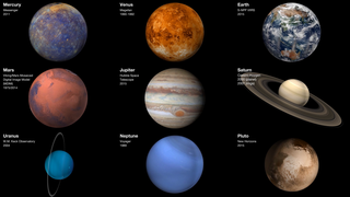
Earth
ID: 31110
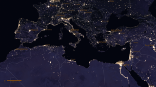
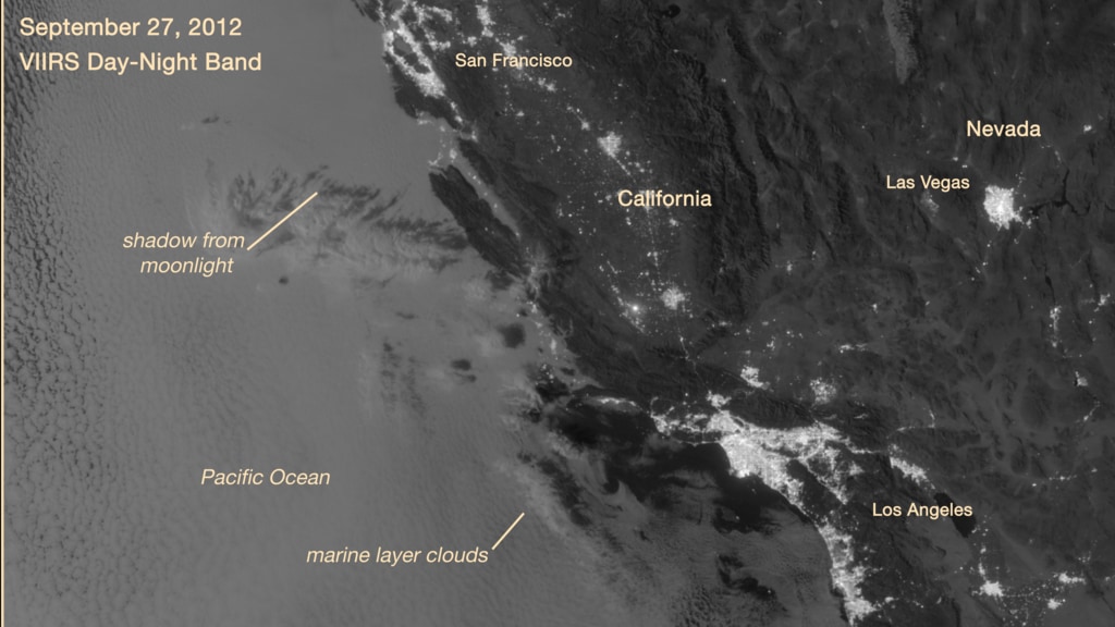
On September 27, 2012, the VIIRS DNB on the Suomi NPP satellite captured a nighttime view of low-lying marine layer clouds along the coast of California. An irregularly shaped patch of high clouds hovered off the coast of California, and moonlight caused the high clouds to cast distinct shadows on the marine layer clouds below. VIIRS acquired the image when the Moon was in its waxing gibbous phase.
Low clouds can pose serious hazards for air and ship traffic, and satellites have had difficulty detecting them in the past. To illustrate this, the second image shows the same scene as viewed by the VIIRS thermal infrared band used by meteorologists to monitor clouds at night. Only high clouds are visible; the low clouds do not show up at all because they are roughly the same temperature as the ground.
Marine Layer Clouds in California
Low clouds can pose serious hazards for air and ship traffic, and satellites have had difficulty detecting them in the past. To illustrate this, the second image shows the same scene as viewed by the VIIRS thermal infrared band used by meteorologists to monitor clouds at night. Only high clouds are visible; the low clouds do not show up at all because they are roughly the same temperature as the ground.
For More Information
Credits
Amy Moran (Global Science and Technology, Inc.): Lead Animator
Jesse Allen (SSAI): Lead Data Visualizer
Robert Simmon (Sigma Space Corporation): Lead Data Visualizer
Adam P. Voiland (SSAI): Lead Writer
Jesse Allen (SSAI): Lead Data Visualizer
Robert Simmon (Sigma Space Corporation): Lead Data Visualizer
Adam P. Voiland (SSAI): Lead Writer
Please give credit for this item to:
NASA, Earth at Night book
NASA, Earth at Night book
Short URL to share this page:
https://svs.gsfc.nasa.gov/31110
Keywords:
SVS >> Clouds
SVS >> Night lights
GCMD >> Location >> California
SVS >> Hyperwall
SVS >> VIIRS
NASA Science >> Earth
GCMD keywords can be found on the Internet with the following citation: Olsen, L.M., G. Major, K. Shein, J. Scialdone, S. Ritz, T. Stevens, M. Morahan, A. Aleman, R. Vogel, S. Leicester, H. Weir, M. Meaux, S. Grebas, C.Solomon, M. Holland, T. Northcutt, R. A. Restrepo, R. Bilodeau, 2013. NASA/Global Change Master Directory (GCMD) Earth Science Keywords. Version 8.0.0.0.0


