Planets and Moons
ID: 30820
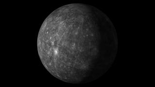
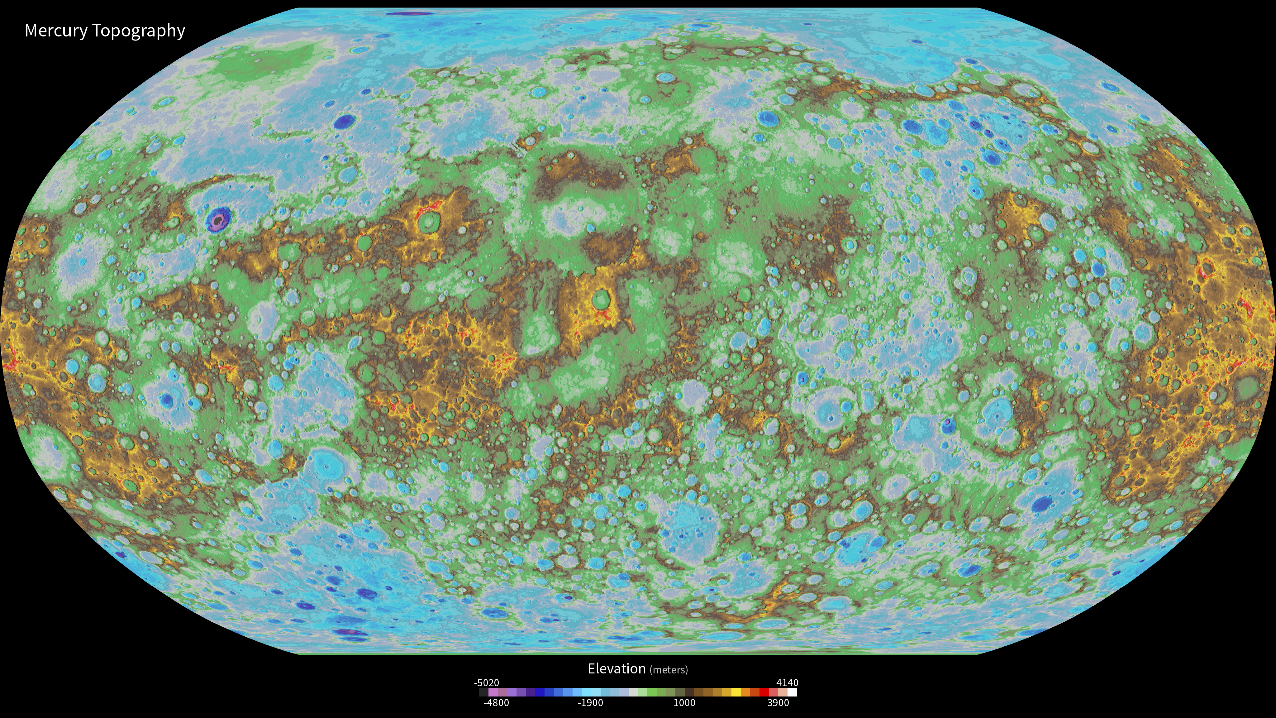
NASA’s MErcury Surface, Space ENvironment, GEochemistry, and Ranging (MESSENGER) mission has unveiled the first global digital elevation model (DEM) of Mercury, revealing in stunning detail the topography across the entire innermost planet and paving the way for scientists to fully characterize Mercury’s geologic history.
In the colorized map, purple and blue colors indicate lower elevations while yellows and red show high elevations.

First Global Topographic Model of Mercury
In the colorized map, purple and blue colors indicate lower elevations while yellows and red show high elevations.
Related
For More Information
http://astrogeology.usgs.gov/maps/mercury-messenger-global-digital-elevation-model
https://www.nasa.gov/feature/first-global-topographic-model-of-mercury
Credits
Marit Jentoft-Nilsen: Graphic Designer
Please give credit for this item to:
NASA/U.S. Geological Survey/Arizona State University/Carnegie Institution of Washington/JHUAPL
NASA/U.S. Geological Survey/Arizona State University/Carnegie Institution of Washington/JHUAPL
Science Paper:
Becker, K.J. et al. (2016) LPS 47, Abstract 2959.
Short URL to share this page:
https://svs.gsfc.nasa.gov/30820
Mission:
MESSENGER: Mercury, Surface, Space Environment, Geochemistry and Ranging
Data Used:
Note: While we identify the data sets used in these visualizations, we do not store any further details nor the data sets themselves on our site.
Keywords:
SVS >> Mercury
SVS >> Hyperwall
NASA Science >> Planets and Moons
SVS >> Mercury Topography
Becker, K.J. et al. (2016) LPS 47, Abstract 2959.
Short URL to share this page:
https://svs.gsfc.nasa.gov/30820
Mission:
MESSENGER: Mercury, Surface, Space Environment, Geochemistry and Ranging
Data Used:
MESSENGER/Global DEM 665m
Using observations from Mercury Dual Imaging System (MDIS) narrow-angle camera (NAC) and multispectral wide-angle camera (WAC), we derived a global digital elevation model (DEM) of Mercury.
Credit:
NASA/U.S. Geological Survey/Arizona State University/Carnegie Institution of Washington/JHUAPL
NASA/U.S. Geological Survey/Arizona State University/Carnegie Institution of Washington/JHUAPL
Keywords:
SVS >> Mercury
SVS >> Hyperwall
NASA Science >> Planets and Moons
SVS >> Mercury Topography


