Earth
ID: 30763
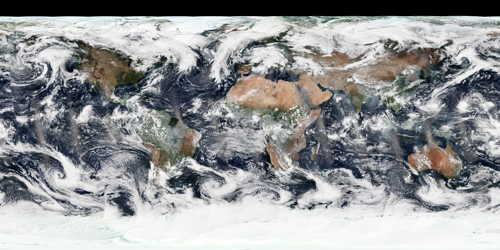
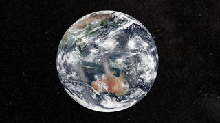
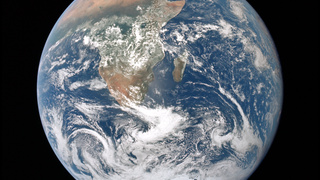
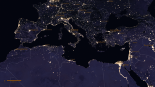
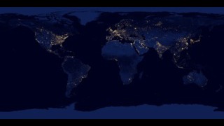
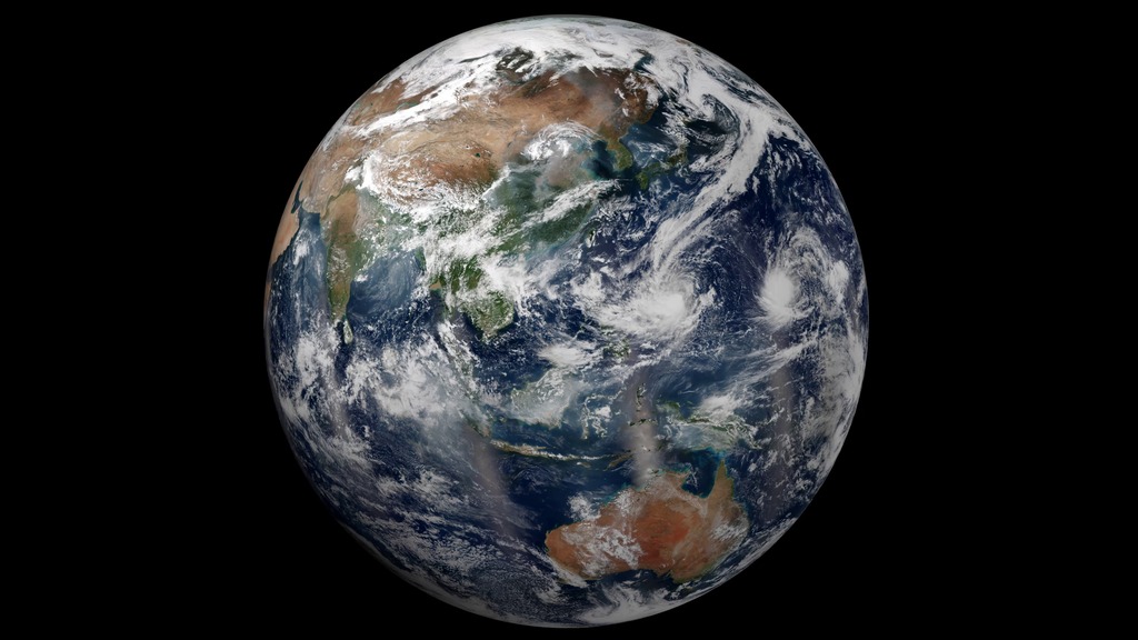
Satellites like Suomi National Polar-orbiting Partnership (NPP) get a complete view of our planet each day, which allows us to create beautiful images of Earth like the one shown here. While it might seem simple, it is actually a rather complex process. Multiple, adjacent swaths of satellite data are pieced together like a quilt to make one global image. Suomi NPP was placed in a unique polar-orbit around the planet that takes the satellite over the equator at the same local (ground) time every orbit. The satellite passes are generally separated by 90 minutes and the instruments image the Earth’s surface in long wedges, called swaths. The swaths from each successive orbit overlap one another, so that at the end of the day, the satellite has a complete view of the world.
This composite image, captured by Suomi NPP’s Visible Infrared Imaging Radiometer Suite (VIIRS), shows how the Earth looked from space on October 14, 2015—a day the contiguous United States had mostly clear skies. The movement of clouds is not easily visible between consecutive swaths of data; however, by the end of the day, the cumulative movement of clouds can be seen at the vertical seam located near the center of the Pacific Ocean. The vertical lines of haze near the equator are caused by sunglint, the reflection of sunlight off the ocean.
Blue Marble 2015
Used Elsewhere In

Related
Credits
Please give credit for this item to:
NASA's Goddard Space Flight Center
NASA's Goddard Space Flight Center
Short URL to share this page:
https://svs.gsfc.nasa.gov/30763
Missions:
NPP
Suomi NPP
Data Used:
Note: While we identify the data sets used in these visualizations, we do not store any further details nor the data sets themselves on our site.
Keywords:
SVS >> HDTV
SVS >> Hyperwall
SVS >> VIIRS
NASA Science >> Earth
https://svs.gsfc.nasa.gov/30763
Missions:
NPP
Suomi NPP
Data Used:
Suomi NPP/VIIRS also referred to as: VIIRS
Keywords:
SVS >> HDTV
SVS >> Hyperwall
SVS >> VIIRS
NASA Science >> Earth


