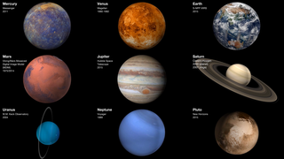
Earth
ID: 30614
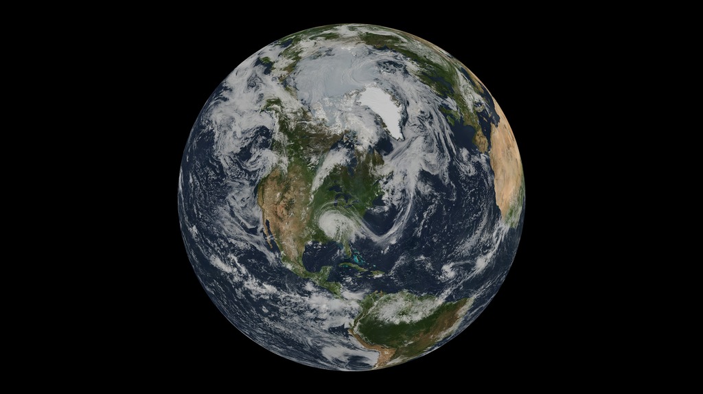
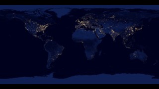
This spectacular blue marble image was the most detailed true-color image of the entire Earth to date in 2002. Using a collection of satellite-based observations, scientists and visualizers stitched together months of observations of the land surface, oceans, sea ice, and clouds into a seamless, true-color mosaic of every square kilometer (.386 square mile) of our planet. The full resolution version of the image is 21,600 pixels across.
Much of the information contained in this image came from a single remote-sensing device-NASA’s Moderate Resolution Imaging Spectroradiometer, or MODIS. Flying over 700 km above the Earth onboard the Terra satellite, MODIS provides an integrated tool for observing a variety of terrestrial, oceanic, and atmospheric features of the Earth.
The land and coastal ocean portions of the image are based on cloud-free surface observations collected from June through September 2001. Two different types of ocean data were used: shallow water true color data, and global ocean color (or chlorophyll) data. Topographic shading is based on an elevation dataset compiled by the U.S. Geological Survey’s EROS Data Center. MODIS observations of polar sea ice were combined with observations from NOAA’s Advanced Very High Resolution Radiometer. The cloud image is a composite of two days of MODIS imagery.
Blue Marble 2002
Much of the information contained in this image came from a single remote-sensing device-NASA’s Moderate Resolution Imaging Spectroradiometer, or MODIS. Flying over 700 km above the Earth onboard the Terra satellite, MODIS provides an integrated tool for observing a variety of terrestrial, oceanic, and atmospheric features of the Earth.
The land and coastal ocean portions of the image are based on cloud-free surface observations collected from June through September 2001. Two different types of ocean data were used: shallow water true color data, and global ocean color (or chlorophyll) data. Topographic shading is based on an elevation dataset compiled by the U.S. Geological Survey’s EROS Data Center. MODIS observations of polar sea ice were combined with observations from NOAA’s Advanced Very High Resolution Radiometer. The cloud image is a composite of two days of MODIS imagery.
Related
For More Information
Credits
Heather Hanson (GST): Writer
Mark Malanoski (GST): Project Support
Marit Jentoft-Nilsen: Project Support
Ishon Prescott (GST): Project Support
Mark Malanoski (GST): Project Support
Marit Jentoft-Nilsen: Project Support
Ishon Prescott (GST): Project Support
Please give credit for this item to:
NASA's Goddard Space Flight Center
NASA's Goddard Space Flight Center
Short URL to share this page:
https://svs.gsfc.nasa.gov/30614
Mission:
Terra
Keywords:
SVS >> Hyperwall
NASA Science >> Earth
SVS >> Presentation
https://svs.gsfc.nasa.gov/30614
Mission:
Terra
Keywords:
SVS >> Hyperwall
NASA Science >> Earth
SVS >> Presentation