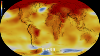
Earth
ID: 13652
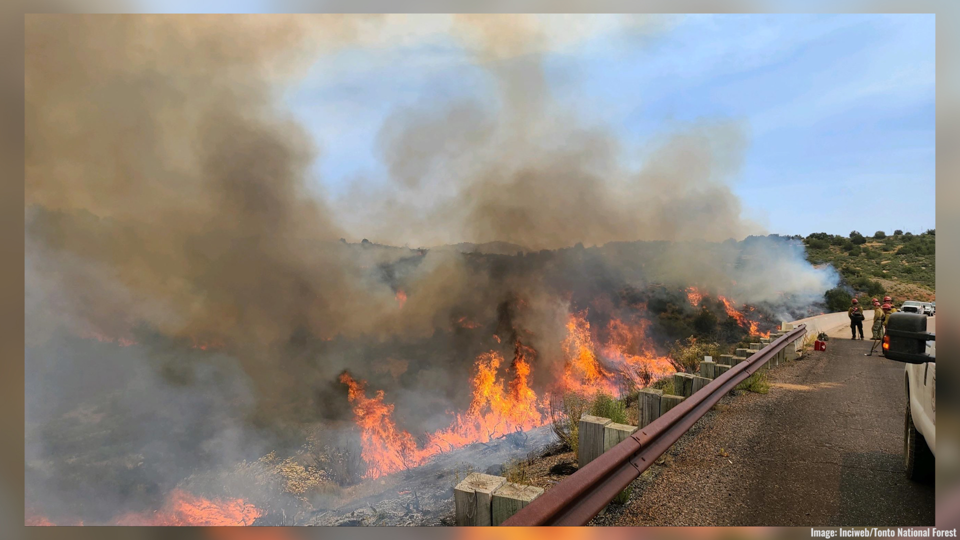
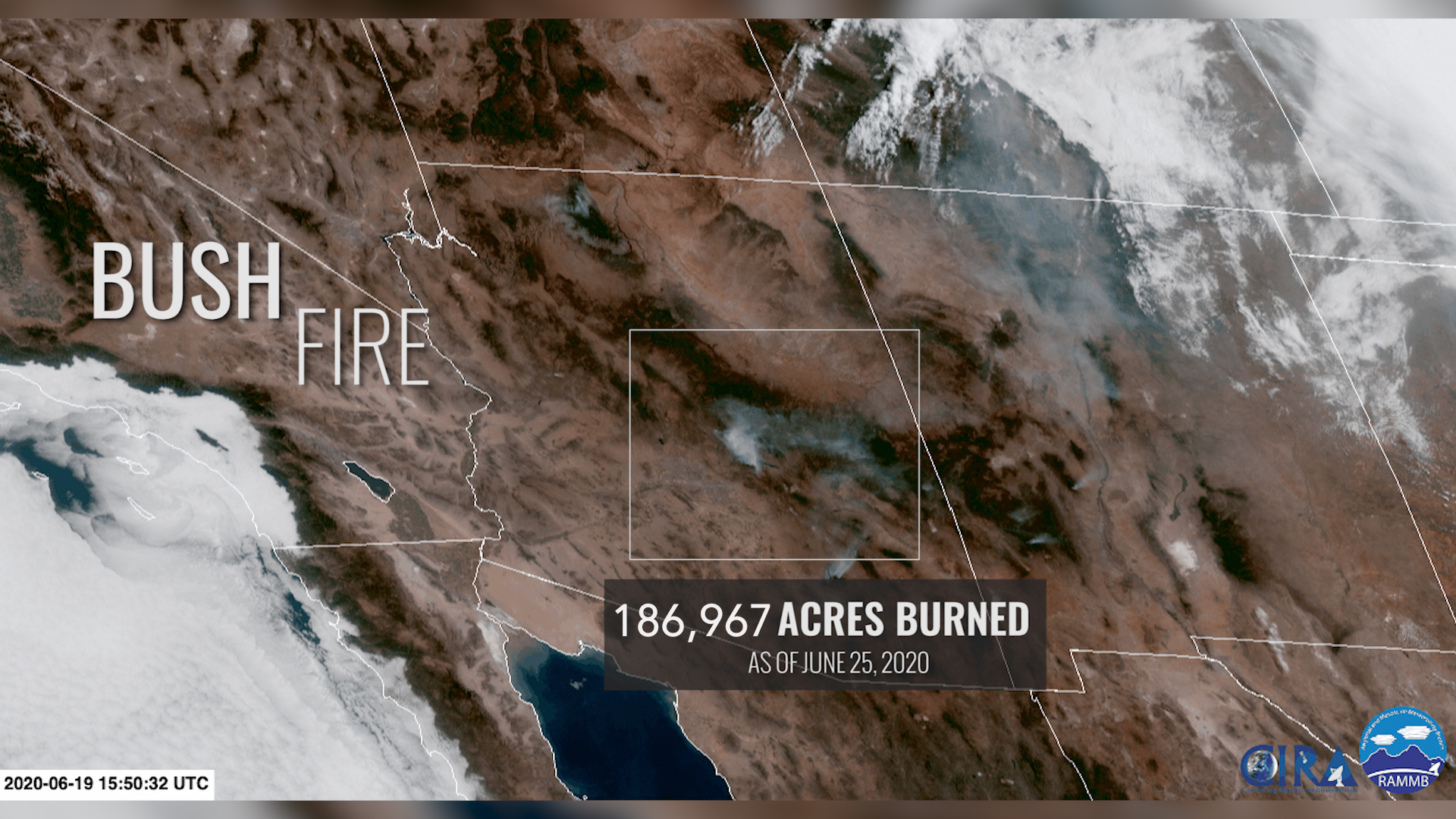
On the afternoon of June 13, 2020, a vehicle fire near the intersection of Bush Highway and State Route 87 ignited the brush and grass nearby. As of June 25, 2020, the Bush Fire is one of the five largest fires in Arizona's history.
NASA’s satellite instruments are often the first to detect wildfires burning in remote regions, and the locations of new fires are sent directly to land managers worldwide within hours of the satellite overpass. Together, NASA instruments detect actively burning fires, track the transport of smoke from fires, provide information for fire management, and map the extent of changes to ecosystems, based on the extent and severity of burn scars. NASA has a fleet of Earth-observing instruments, many of which contribute to our understanding of fire in the Earth system.
NASA Tracks the Arizona Bush Fire
NASA’s satellite instruments are often the first to detect wildfires burning in remote regions, and the locations of new fires are sent directly to land managers worldwide within hours of the satellite overpass. Together, NASA instruments detect actively burning fires, track the transport of smoke from fires, provide information for fire management, and map the extent of changes to ecosystems, based on the extent and severity of burn scars. NASA has a fleet of Earth-observing instruments, many of which contribute to our understanding of fire in the Earth system.
Source Material

For More Information
Credits
Amber Soja (NASA/LaRC): Scientist
Katie Jepson (USRA): Lead Producer
Trent L. Schindler (USRA): Visualizer
Lori Perkins (NASA/GSFC): Visualizer
Greg Shirah (NASA/GSFC): Visualizer
Aaron E. Lepsch (ADNET Systems, Inc.): Technical Support
Katie Jepson (USRA): Lead Producer
Trent L. Schindler (USRA): Visualizer
Lori Perkins (NASA/GSFC): Visualizer
Greg Shirah (NASA/GSFC): Visualizer
Aaron E. Lepsch (ADNET Systems, Inc.): Technical Support
Please give credit for this item to:
NASA's Goddard Space Flight Center
NASA's Goddard Space Flight Center
Short URL to share this page:
https://svs.gsfc.nasa.gov/13652
This item is part of this series:
Narrated Movies
Keywords:
DLESE >> Human geography
DLESE >> Natural hazards
GCMD >> Earth Science >> Human Dimensions >> Natural Hazards >> Fires
NASA Science >> Earth
GCMD keywords can be found on the Internet with the following citation: Olsen, L.M., G. Major, K. Shein, J. Scialdone, S. Ritz, T. Stevens, M. Morahan, A. Aleman, R. Vogel, S. Leicester, H. Weir, M. Meaux, S. Grebas, C.Solomon, M. Holland, T. Northcutt, R. A. Restrepo, R. Bilodeau, 2013. NASA/Global Change Master Directory (GCMD) Earth Science Keywords. Version 8.0.0.0.0


