Earth
ID: 13574
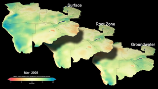
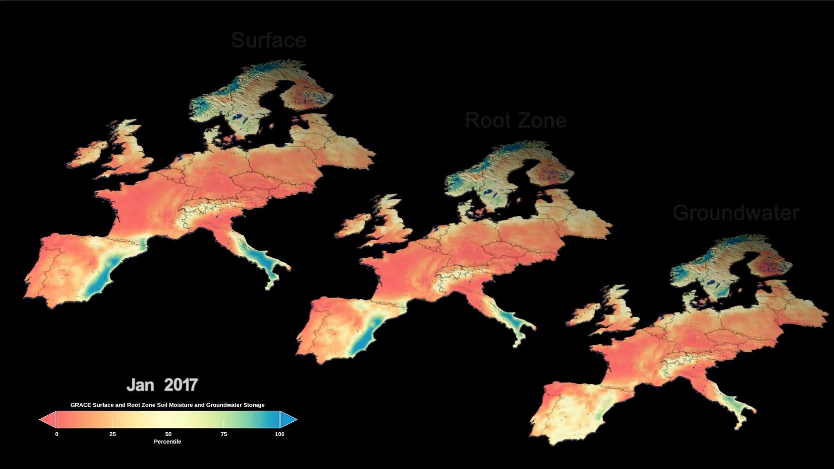
Using measurements from two satellite missions assimilated into a computer model, researchers have created global maps of terrestrial water around the planet. In addition, they can forecast water availability in the United States up to three months out.
Global Maps of Dryness Help Prepare for Water Use around the Globe
Used Elsewhere In
Source Material
Credits
Kathryn Mersmann (USRA): Lead Producer
Ellen T. Gray (ADNET Systems, Inc.): Lead Writer
Trent L. Schindler (USRA): Lead Visualizer
Matthew Rodell (NASA/GSFC): Lead Scientist
Aaron E. Lepsch (ADNET Systems, Inc.): Technical Support
Ellen T. Gray (ADNET Systems, Inc.): Lead Writer
Trent L. Schindler (USRA): Lead Visualizer
Matthew Rodell (NASA/GSFC): Lead Scientist
Aaron E. Lepsch (ADNET Systems, Inc.): Technical Support
Please give credit for this item to:
NASA's Goddard Space Flight Center
NASA's Goddard Space Flight Center
Short URL to share this page:
https://svs.gsfc.nasa.gov/13574
This item is part of this series:
Narrated Movies
Keywords:
SVS >> Drought
DLESE >> Hydrology
DLESE >> Natural hazards
SVS >> Water
GCMD >> Earth Science >> Hydrosphere >> Surface Water
GCMD >> Earth Science >> Hydrosphere >> Surface Water >> Floods
SVS >> GRACE
NASA Science >> Earth
GCMD >> Earth Science >> Terrestrial Hydrosphere >> Ground Water >> Groundwater Chemistry
SVS >> GRACE-FO
GCMD keywords can be found on the Internet with the following citation: Olsen, L.M., G. Major, K. Shein, J. Scialdone, S. Ritz, T. Stevens, M. Morahan, A. Aleman, R. Vogel, S. Leicester, H. Weir, M. Meaux, S. Grebas, C.Solomon, M. Holland, T. Northcutt, R. A. Restrepo, R. Bilodeau, 2013. NASA/Global Change Master Directory (GCMD) Earth Science Keywords. Version 8.0.0.0.0


