Earth
ID: 12984

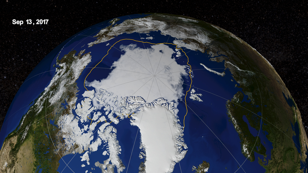
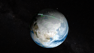
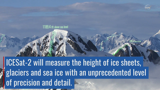
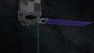
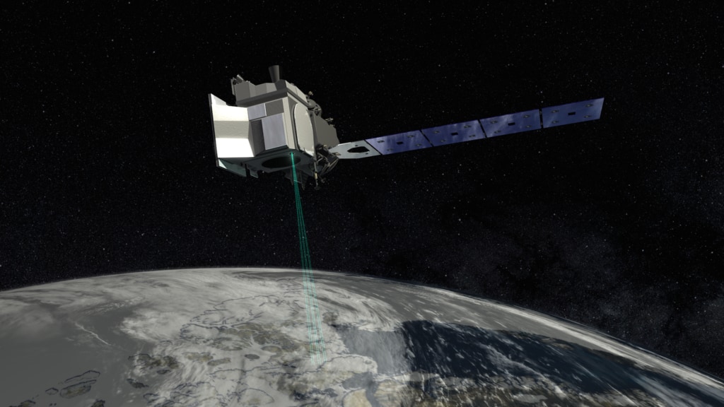
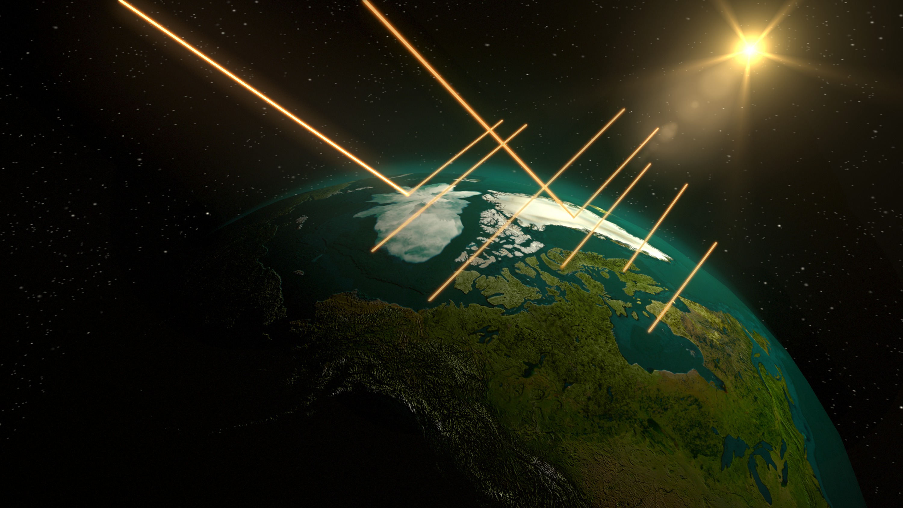
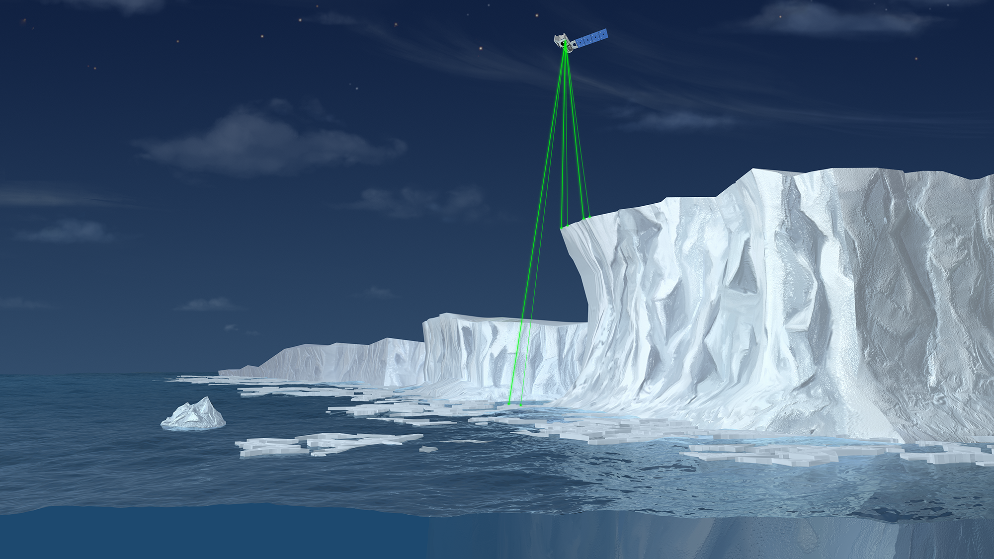
Ice is being lost across the globe, especially in the polar regions. The continental ice sheets of Greenland and Antarctica are shedding ice to the oceans and raising sea level. Arctic sea ice is less than half its 1980s volume. Fundamentally changing the Arctic, this ice loss may also be affecting North American and global weather. In September 2018, NASA is launching the Ice, Cloud and land Elevation Satellite-2 (ICESat-2) to measure changes in Earth’s ice and improve forecasts of the global impacts of these changes. With its fast-firing laser, the satellite will collect information enabling scientists to calculate—to within fractions of an inch—how much the vast ice sheets of Antarctica and Greenland rise or fall each year. ICESat-2 will take measurements across the globe and provide an incredibly precise height map of our planet in unprecedented detail. Its focus will be on Earth’s poles, including the Arctic region where temperatures are rising faster than at other latitudes. Watch the videos to learn more.


ICESat-2's Eye on Ice
Related Material
Source Material

For More Information
Story Credits
Lead Visualizers/Animators:
Greg Shirah (NASA/GSFC)
Adriana Manrique Gutierrez (USRA)
Lead Producer:
Ryan Fitzgibbons (USRA)
Lead Scientists:
Thorsten Markus (NASA/GSFC)
Thomas A. Neumann Ph.D. (NASA/GSFC)
Kelly Brunt (Earth System Science Interdisciplinary Center/University of Maryland)
Lead Writer:
Kate Ramsayer (Telophase)
Greg Shirah (NASA/GSFC)
Adriana Manrique Gutierrez (USRA)
Lead Producer:
Ryan Fitzgibbons (USRA)
Lead Scientists:
Thorsten Markus (NASA/GSFC)
Thomas A. Neumann Ph.D. (NASA/GSFC)
Kelly Brunt (Earth System Science Interdisciplinary Center/University of Maryland)
Lead Writer:
Kate Ramsayer (Telophase)
Please give credit for this item to:
NASA's Scientific Visualization Studio
Non-NASA images listed here with copyright permissions. All photos from government agencies are public domain and only need a credit. For those that require asking the source (i.e. Universities), send copy of email granting permission to ellen.t.gray@nasa.gov
NASA's Scientific Visualization Studio
Non-NASA images listed here with copyright permissions. All photos from government agencies are public domain and only need a credit. For those that require asking the source (i.e. Universities), send copy of email granting permission to ellen.t.gray@nasa.gov
Short URL to share this page:
https://svs.gsfc.nasa.gov/12984
Mission:
Ice, Cloud, and land Elevation Satellite-2 (ICESat-2)
Keywords:
SVS >> HDTV
SVS >> App
NASA Science >> Earth
https://svs.gsfc.nasa.gov/12984
Mission:
Ice, Cloud, and land Elevation Satellite-2 (ICESat-2)
Keywords:
SVS >> HDTV
SVS >> App
NASA Science >> Earth


