Earth
ID: 12948

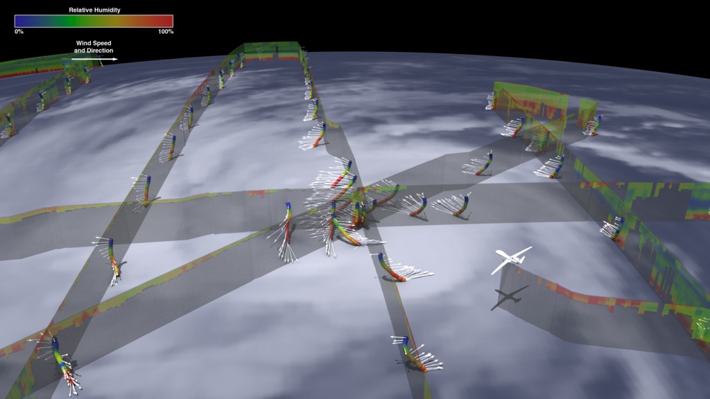
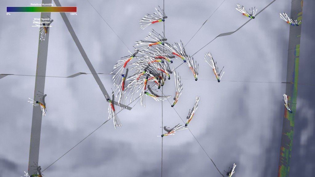
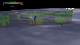
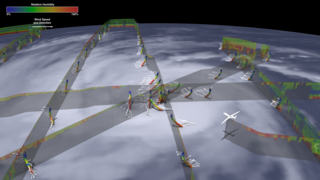
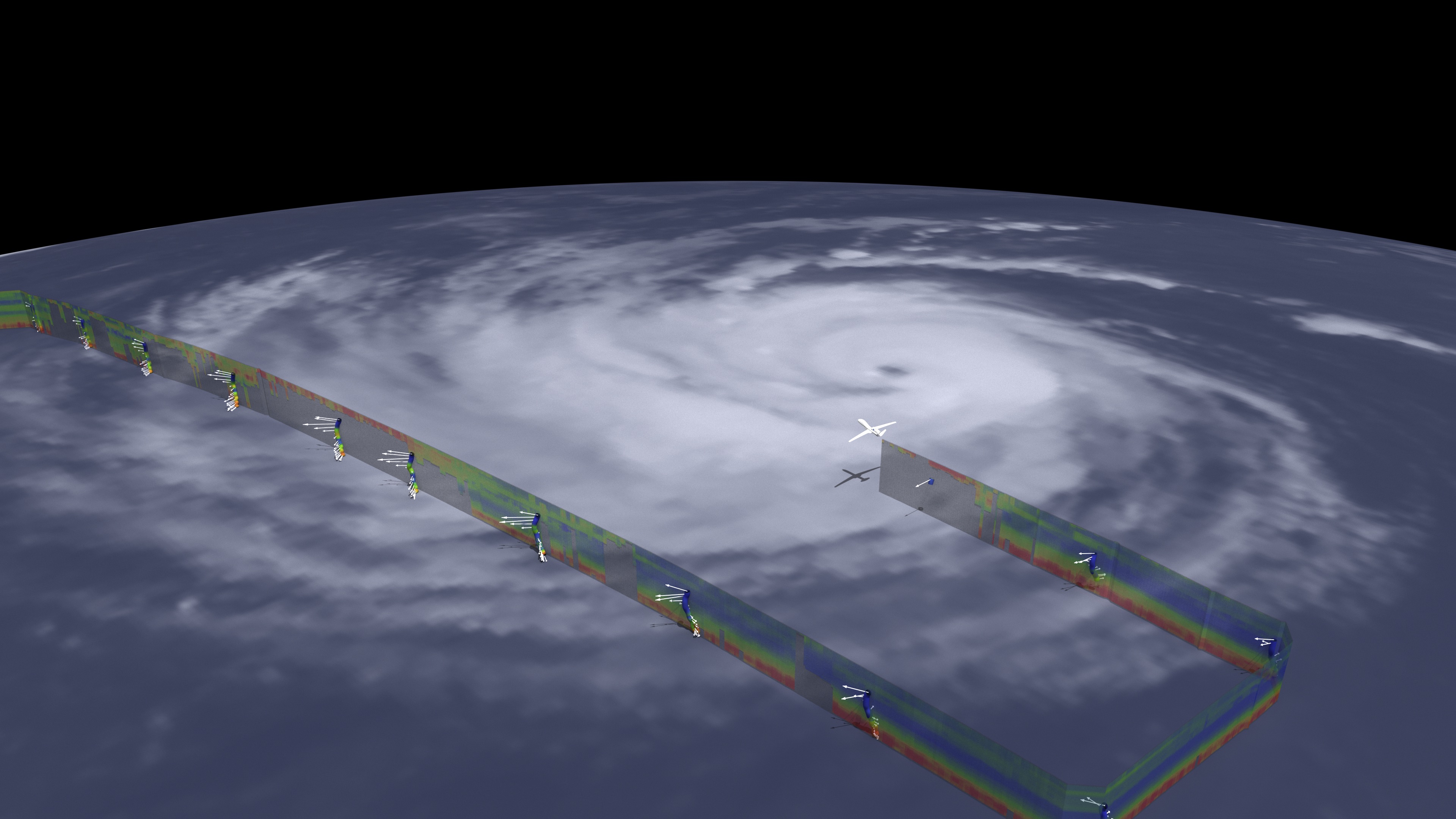
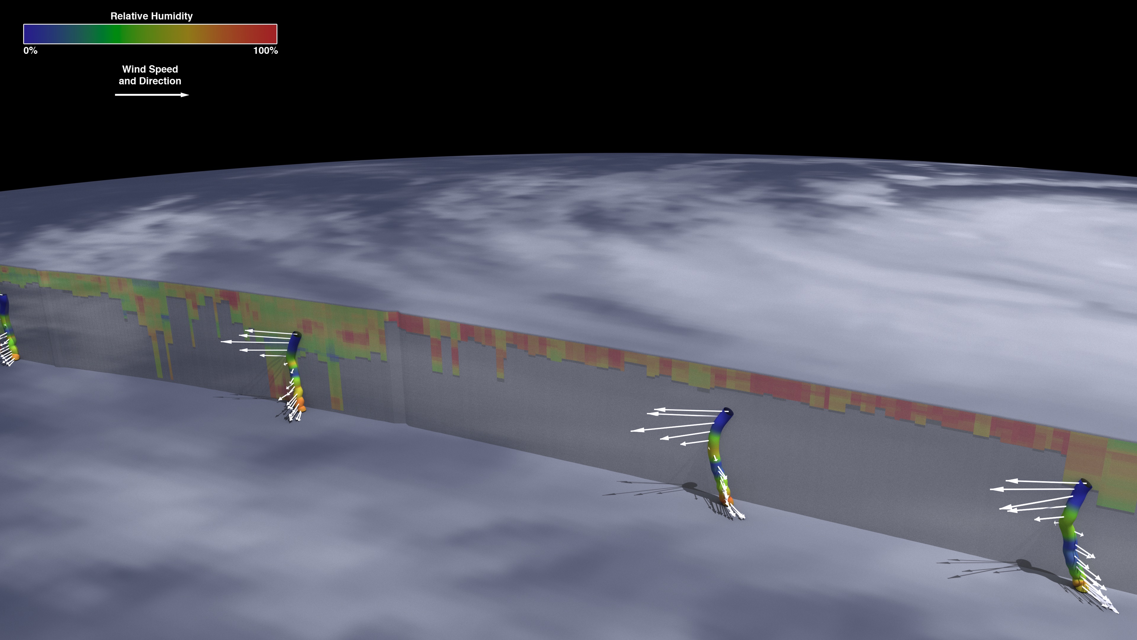
The swirling vortex of hurricane clouds are a familiar sight in satellite imagery, but in order to better understand these storms, scientists need to look inside them. In 2014, NASA's remotely piloted Global Hawk aircraft overflew Hurricane Edouard in the Atlantic Ocean to understand what makes hurricanes intensify into fiercer storms. During the 24-hour flight, a sounder instrument measured the relative humidity of the storm from above, where the cloud cover was thin. Where clouds were too thick, including around the eye of the hurricane, the Global Hawk released dropsondes, foot-long sensors that dropped from the aircraft down through the storm to the ocean's surface – sending humidity, temperature and wind speed data back the whole way down. Warm moist air gives hurricanes their strength, and near the eye, the red colors show high humidity powering the storm. Scientists use these and other data collected from these flights to better understand the environmental signals inside and outside of the hurricane that lead to rapid intensification where wind speeds dramatically increase in a 24-hour period – vital information for anyone in the storm's path. Watch the video to learn more.


Dropped into a Hurricane
Source Material
Story Credits
Lead Visualizer/Animator:
Kel Elkins (USRA)
Lead Producer:
Matthew R. Radcliff (USRA)
Lead Scientist:
Scott Braun (NASA/GSFC)
Lead Writer:
Ellen T. Gray (ADNET Systems, Inc.)
Kel Elkins (USRA)
Lead Producer:
Matthew R. Radcliff (USRA)
Lead Scientist:
Scott Braun (NASA/GSFC)
Lead Writer:
Ellen T. Gray (ADNET Systems, Inc.)
Please give credit for this item to:
NASA's Scientific Visualization Studio
NASA's Scientific Visualization Studio
Short URL to share this page:
https://svs.gsfc.nasa.gov/12948
Keywords:
SVS >> HDTV
SVS >> App
NASA Science >> Earth
https://svs.gsfc.nasa.gov/12948
Keywords:
SVS >> HDTV
SVS >> App
NASA Science >> Earth


