Earth
ID: 12772
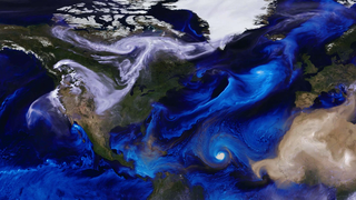
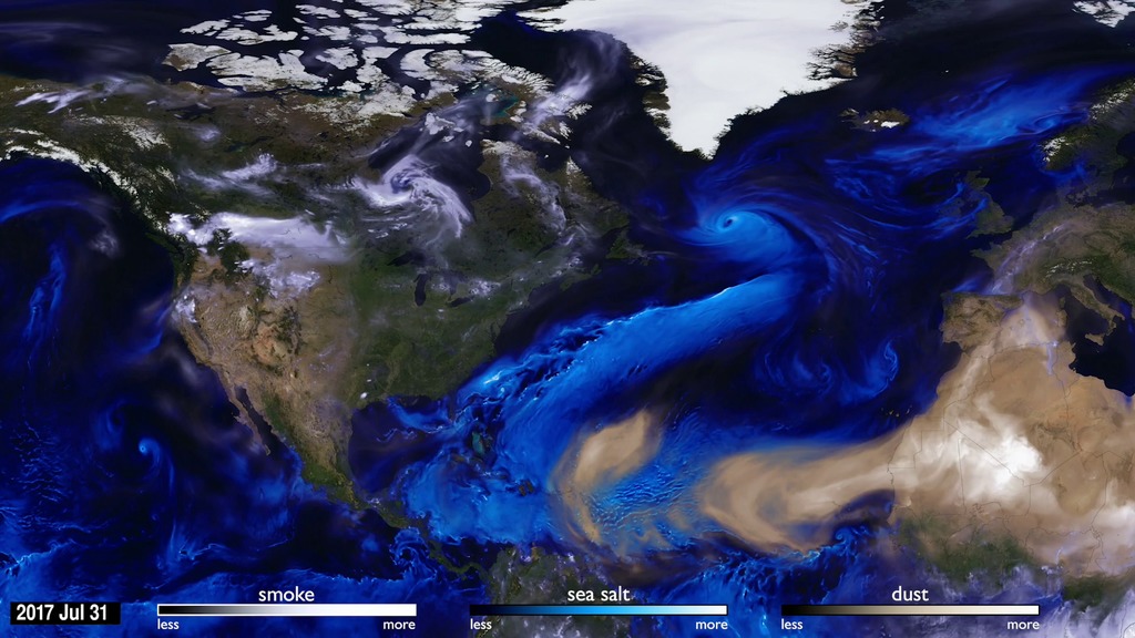
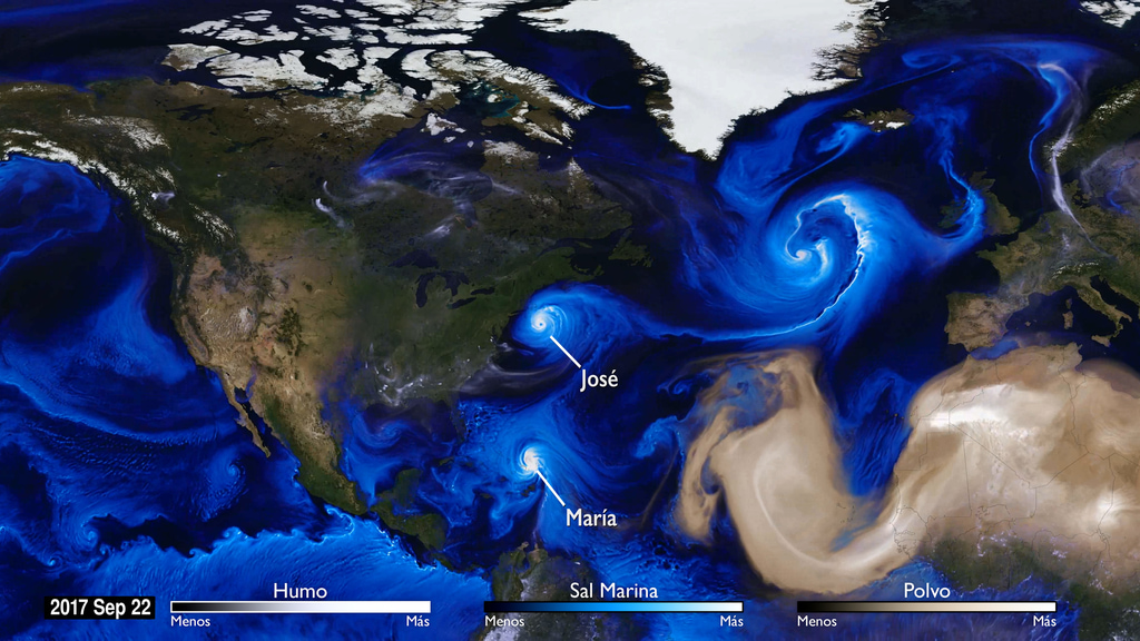
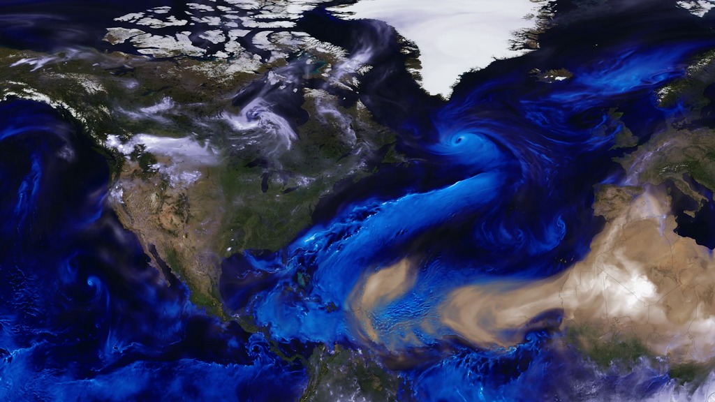
Tracking the aerosols carried on the winds let scientists see the currents in our atmosphere. This visualization follows sea salt, dust, and smoke from July 31 to November 1, 2017, to reveal how these particles are transported across the map.
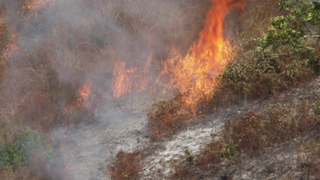
The first thing that is noticeable is how far the particles can travel. Smoke from fires in the Pacific Northwest gets caught in a weather pattern and pulled all the way across the US and over to Europe. Hurricanes form off the coast of Africa and travel across the Atlantic to make landfall in the United States. Dust from the Sahara is blown into the Gulf of Mexico. To understand the impacts of aerosols, scientists need to study the process as a global system.
The Global Modeling and Assimilation Office (GMAO) at NASA's Goddard Space Flight Center has developed the Goddard Earth Observing System (GEOS), a family of mathematical models. Combined with data from NASA's Earth observing satellites, the supercomputer simulations enhance our scientific understanding of specific chemical, physical, and biological processes.
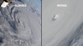
During the 2017 hurricane season, the storms are visible because of the sea salt that is captured by the storms. Strong winds at the surface lift the sea salt into the atmosphere and the particles are incorporated into the storm. Hurricane Irma is the first big storm that spawns off the coast of Africa. As the storm spins up, the Saharan dust is absorbed in cloud droplets and washed out of the storm as rain. This process happens with most of the storms, except for Hurricane Ophelia. Forming more northward than most storms, Ophelia traveled to the east picking up dust from the Sahara and smoke from large fires in Portugal. Retaining its tropical storm state farther northward than any system in the Atlantic, Ophelia carried the smoke and dust into Ireland and the UK.
Computer simulations using the GEOS models allow scientists to see how different processes fit together and evolve as a system. By using mathematical models to represent nature we can separate the system into component parts and better understand the underlying physics of each.
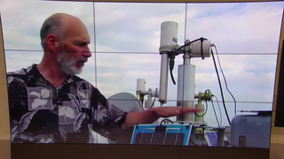
GEOS runs on the Discover supercomputer at the NASA Center for Climate Simulation (NCCS)
For more information: NASA@SC17: Glimpse at the Future of Global Weather Prediction and Analysis at NASA

2017 Hurricanes and Aerosols Simulation
GEOS runs on the Discover supercomputer at the NASA Center for Climate Simulation (NCCS)
For more information: NASA@SC17: Glimpse at the Future of Global Weather Prediction and Analysis at NASA
Used Elsewhere In
Credits
Matthew R. Radcliff (USRA): Lead Producer
Aaron E. Lepsch (ADNET Systems, Inc.): Technical Support
William Putman (NASA/GSFC): Lead Scientist
Anton S. Darmenov (NASA/GSFC): Scientist
Ellen T. Gray (ADNET Systems, Inc.): Narrator
Cristina Porras (GBH): Translator
Cristina Porras (GBH): Narrator
Aaron E. Lepsch (ADNET Systems, Inc.): Technical Support
William Putman (NASA/GSFC): Lead Scientist
Anton S. Darmenov (NASA/GSFC): Scientist
Ellen T. Gray (ADNET Systems, Inc.): Narrator
Cristina Porras (GBH): Translator
Cristina Porras (GBH): Narrator
Please give credit for this item to:
NASA's Goddard Space Flight Center
NASA's Goddard Space Flight Center
Short URL to share this page:
https://svs.gsfc.nasa.gov/12772
This item is part of these series:
GEOS-DAS
Hurricanes
Narrated Movies
Keywords:
DLESE >> Atmospheric science
SVS >> HDTV
DLESE >> Natural hazards
SVS >> Supercomputing Conference
GCMD >> Earth Science >> Atmosphere >> Aerosols
GCMD >> Earth Science >> Atmosphere >> Atmospheric Phenomena >> Hurricanes
SVS >> Hyperwall
SVS >> Supercomputer
SVS >> GEOS
NASA Science >> Earth
SVS >> Hurricane Harvey
NASA Earth Science Focus Areas >> Atmospheric Composition
GCMD keywords can be found on the Internet with the following citation: Olsen, L.M., G. Major, K. Shein, J. Scialdone, S. Ritz, T. Stevens, M. Morahan, A. Aleman, R. Vogel, S. Leicester, H. Weir, M. Meaux, S. Grebas, C.Solomon, M. Holland, T. Northcutt, R. A. Restrepo, R. Bilodeau, 2013. NASA/Global Change Master Directory (GCMD) Earth Science Keywords. Version 8.0.0.0.0


