Earth
ID: 12770
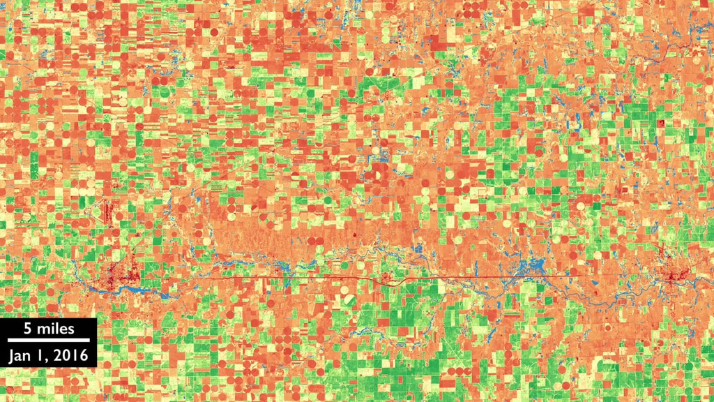
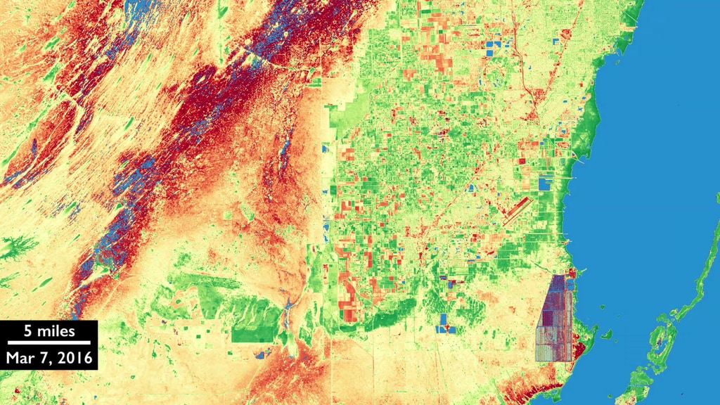
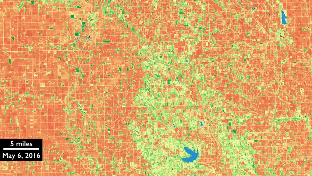
Landsat 8 and Sentinel-2 satellites have spectral and spatial similarities that make using their data together possible. When the data are used together observations can be more timely and accurate.
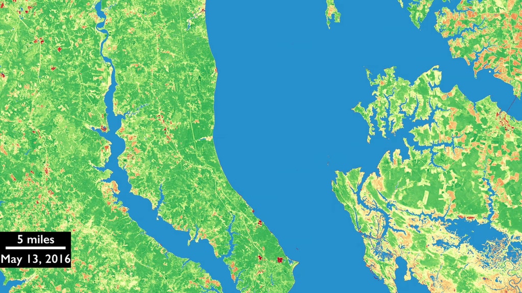
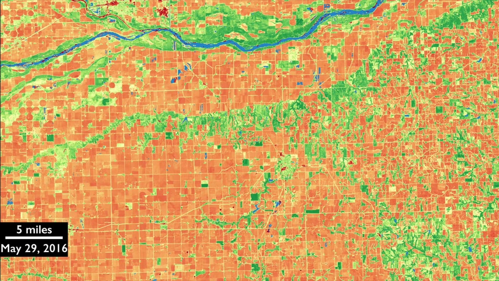
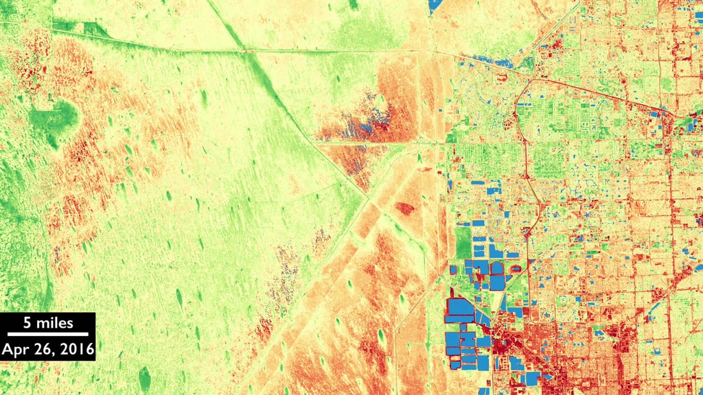
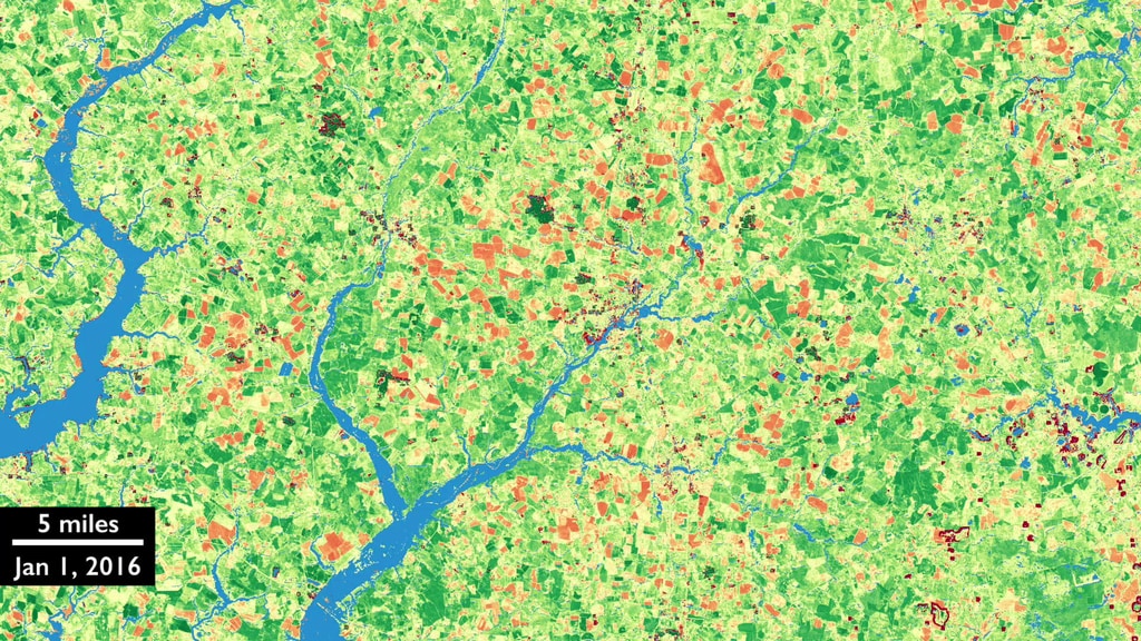
The HLS project is an effort to "harmonize" the data of the two satellite programs so that they can be more easily used in unison. The ultimate goal is to obtain seamless 2-3 day global surface reflectance coverage at 30 meters that removes residual differences between the sensors due to spectral bandpass and view geometry. Currently the v1.3 HLS data set encompasses 82 global test sites that cover about 7% of the global land area.
Using the processing power of the NASA Earth Exchange (NEX) computer cluster at NASA Ames, the HLS workflow atmospherically corrects data from the satellites, geographically tiles the Landsat data in a manor matching the Sentinel-2 tiling, and then corrects for different sensor view angles (Bidirectional Reflectance Distribution Function, or BRDF) and does a slight band pass adjustment for the Sentinel-2 data to create the harmonized 30-meter product.
The HLS team includes researchers from NASA Goddard Space Flight Center, the University of Maryland, and NASA Ames Research Center.
Harmonized Landsat 8 and Sentinel-2 Data
The HLS project is an effort to "harmonize" the data of the two satellite programs so that they can be more easily used in unison. The ultimate goal is to obtain seamless 2-3 day global surface reflectance coverage at 30 meters that removes residual differences between the sensors due to spectral bandpass and view geometry. Currently the v1.3 HLS data set encompasses 82 global test sites that cover about 7% of the global land area.
Using the processing power of the NASA Earth Exchange (NEX) computer cluster at NASA Ames, the HLS workflow atmospherically corrects data from the satellites, geographically tiles the Landsat data in a manor matching the Sentinel-2 tiling, and then corrects for different sensor view angles (Bidirectional Reflectance Distribution Function, or BRDF) and does a slight band pass adjustment for the Sentinel-2 data to create the harmonized 30-meter product.
The HLS team includes researchers from NASA Goddard Space Flight Center, the University of Maryland, and NASA Ames Research Center.
For More Information
Credits
Mike Taylor (SSAI): Animator
Matthew R. Radcliff (USRA): Producer
Jeffrey Masek (NASA/GSFC): Scientist
Laura Rocchio (SSAI): Writer
Matthew R. Radcliff (USRA): Producer
Jeffrey Masek (NASA/GSFC): Scientist
Laura Rocchio (SSAI): Writer
Please give credit for this item to:
NASA's Goddard Space Flight Center
NASA's Goddard Space Flight Center
Short URL to share this page:
https://svs.gsfc.nasa.gov/12770
Missions:
Landsat
LDCM: Landsat Data Continuity Mission
This item is part of these series:
Landsat
LDCM
Keywords:
DLESE >> Agricultural science
SVS >> HDTV
SVS >> Landsat
SVS >> NDVI
SVS >> Seasons
GCMD >> Earth Science >> Agriculture
GCMD >> Earth Science >> Biosphere >> Vegetation
SVS >> Hyperwall
SVS >> Biosphere >> Agriculture
SVS >> Weather >> Seasons >> Vegetation Growth
NASA Science >> Earth
GCMD keywords can be found on the Internet with the following citation: Olsen, L.M., G. Major, K. Shein, J. Scialdone, S. Ritz, T. Stevens, M. Morahan, A. Aleman, R. Vogel, S. Leicester, H. Weir, M. Meaux, S. Grebas, C.Solomon, M. Holland, T. Northcutt, R. A. Restrepo, R. Bilodeau, 2013. NASA/Global Change Master Directory (GCMD) Earth Science Keywords. Version 8.0.0.0.0


