Earth
ID: 12701
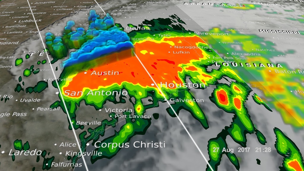
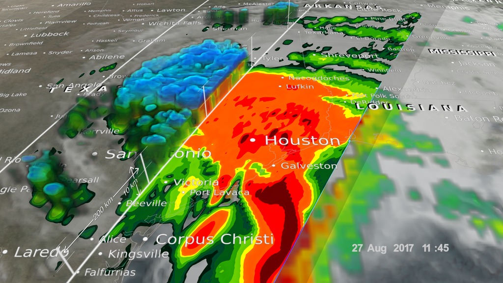
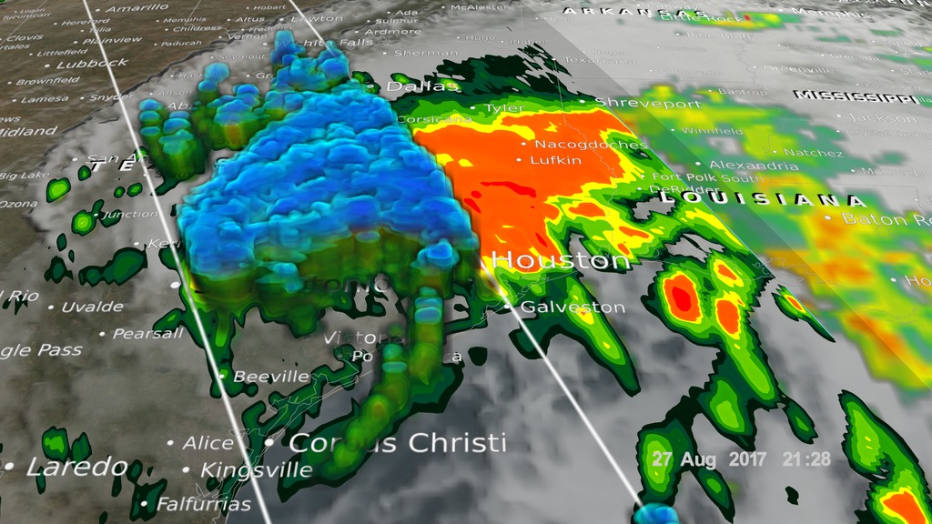
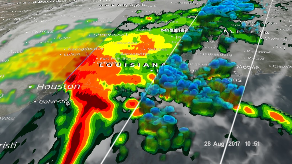
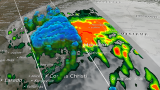
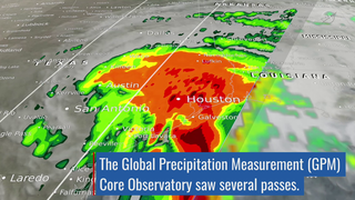
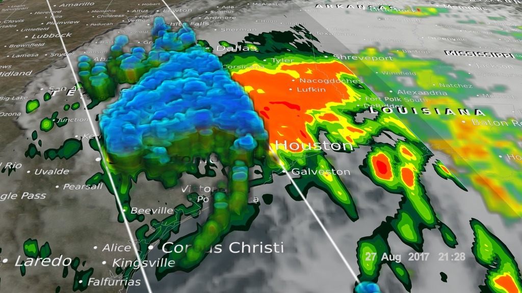
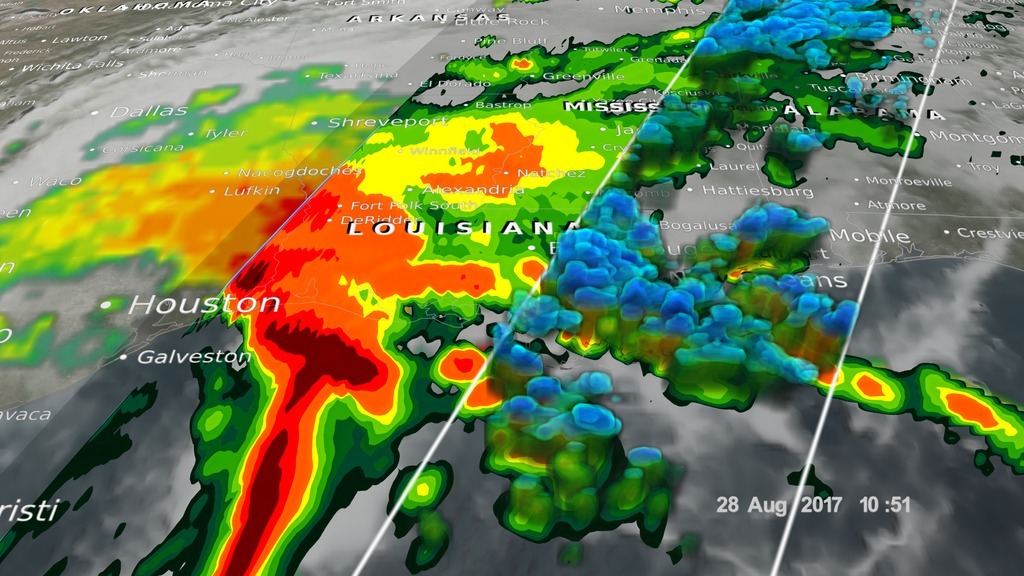
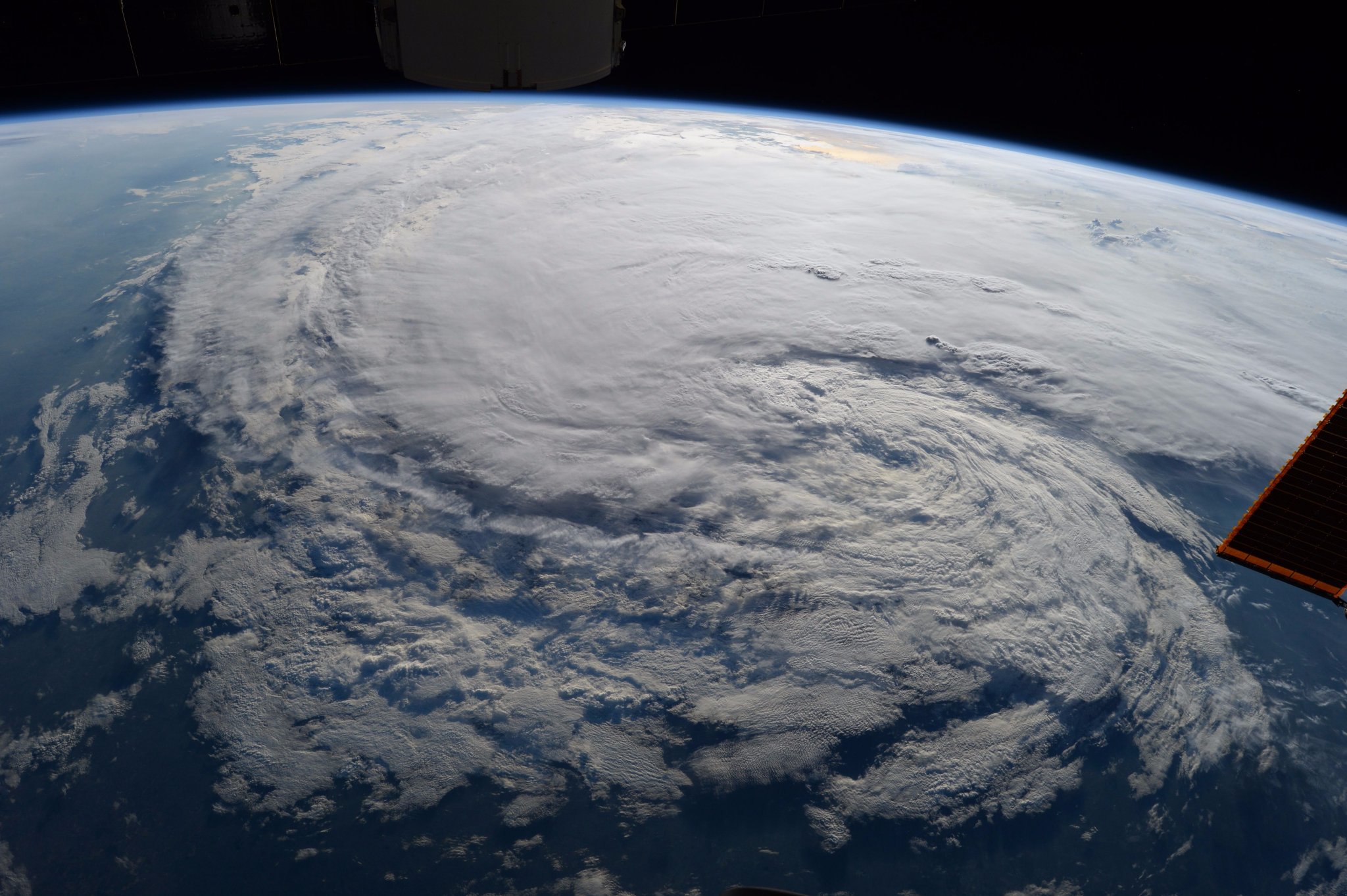
Hurricane Harvey made landfall in southeast Texas at Rockport on Aug. 25 as a Category 4 storm with winds at 130 mph. The hurricane quickly lost its power, downgrading to a tropical storm that lingered as it slowly inched up the coast. The result was a record-shattering amount of rainfall, topping 50 inches – 4 feet – in some areas, that led to catastrophic flooding of Houston and other nearby communities. NASA and the Japan Aerospace Exploration Agency's Global Precipitation Measurement mission's Core satellite passed over the region several times, capturing the scope of the water dropped from the sky. After returning to sea, Harvey made a second landfall in Louisiana, bringing heavy rains. Moving inland, Harvey dissipated as a tropical storm, but its associated clouds moved north and eastward, bringing rain to Arkansas, Tennessee and Kentucky and the East Coast in early September. Watch the videos to learn more.

Hurricane Harvey
Source Material
For More Information
Story Credits
Lead Visualizer/Animator:
Alex Kekesi (Global Science and Technology, Inc.)
Lead Producer:
Ryan Fitzgibbons (USRA)
Scientist:
Gail Skofronick Jackson (NASA/GSFC)
Lead Scientist:
George Huffman (NASA/GSFC)
Lead Writer:
Ellen T. Gray (ADNET Systems, Inc.)
Alex Kekesi (Global Science and Technology, Inc.)
Lead Producer:
Ryan Fitzgibbons (USRA)
Scientist:
Gail Skofronick Jackson (NASA/GSFC)
Lead Scientist:
George Huffman (NASA/GSFC)
Lead Writer:
Ellen T. Gray (ADNET Systems, Inc.)
Please give credit for this item to:
NASA's Scientific Visualization Studio.
Astronaut photo courtesy of NASA's Johnson Space Center.
NASA's Scientific Visualization Studio.
Astronaut photo courtesy of NASA's Johnson Space Center.
Short URL to share this page:
https://svs.gsfc.nasa.gov/12701
Keywords:
SVS >> HDTV
SVS >> App
NASA Science >> Earth
https://svs.gsfc.nasa.gov/12701
Keywords:
SVS >> HDTV
SVS >> App
NASA Science >> Earth


